- Oregon 450
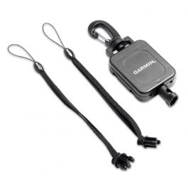
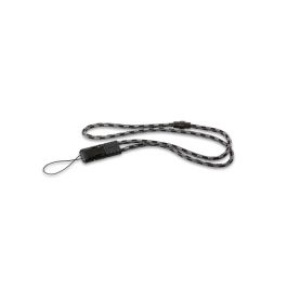
- Carabiner clip
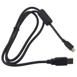
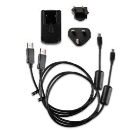
- USB cable
- Manual

Garmin Oregon 450 GPS - Factory Refurbished
Model Number: 010-N0697-40
$179.00  ($4.00
) ($4.00
)
($4.00
) ($4.00
)
($4.00
) $249.99 28% off
$179.00 ($4.00
) Availability: Out of stock
Condition: Garmin Certified Refurbished  A Garmin Certified Refurbished device is a device that was returned to Garmin USA. The device is certified by Garmin only after undergoing a complete rebuild, and extensive testing to bring the unit up to the same strict cosmetic and functional standards as a new Garmin device. Only after meeting the highest quality standards is the device then released back to the market. All units include brand new original Garmin accessories, and a full one-year Garmin warranty, as well as our free extended warranty when purchased from GPS Nation. Your purchase extends the lifetime of this product and reduces electronic waste. That's good news for the environment and your wallet
- 3" sunlight-readable touchscreen display
- Worldwide basemap with shaded relief
- 3-axis compass with accelerometer and barometric altimeter sensors
- microSD card slot
Write Your Own Review
In the Box
Manual and Warranty
✓
Your request has been successfully sent!
* Required Fields
Do you have an old GPS unit lying around? The GPS Nation Trade In and Up program is a great way to trade in your old and used GPS for credit towards a new GPS. The choice is entirely yours! We’ve made the process simple and streamlined. Follow these simple steps, and you will be on your way to receiving credit towards your brand new GPS!
1. Get a quote
To get your free quote, provide your GPS type, manufacturer, model, and condition. Within 24 hours, you will receive a quote for the trade-in value of your current product. The GPS trade-in/trade-up form is at the bottom of this page.
2. Ship your product(s) for trade
After accepting our offer, pack your product(s) safely and ship them to us using the pre-paid shipping label provided to you. We will provide a confirmation email when your trade-in arrives at our warehouse. You have 30 days from the date you complete your on-line trade to ship the product to GPS Nation.
3. Make your purchase
Once we receive your product at our warehouse and we validate the stated condition, we will send you a confirmation email. If you elect to receive credit towards a new GPS at gpsnation.com, your store credit will be issued, and you are free to make your purchase.
Overview
Touch and Go
Oregon 450 leads the way with a tough, 3-inch diagonal, sunlight-readable, color, touchscreen display that offers crystal clear enhanced colors and high-resolution images. Its easy-to-use interface means you’ll spend more time enjoying the outdoors and less time searching for information. Customize the display with an array of dashboards. Both durable and waterproof, Oregon 450 is built to withstand the elements. Bumps, dust, dirt, humidity and water are no match for this rugged navigator.
Explore More
Oregon 450 comes with a built-in worldwide basemap with shaded contours. Simply touch the color screen to navigate. Its digital elevation maps show you shaded contours at higher zoom levels, giving you a big picture of the surrounding terrain.
Get Your Bearings
Oregon 450 has a built-in 3-axis tilt-compensated electronic compass, which shows your heading even when you’re standing still, without holding it level. Its barometric altimeter tracks changes in pressure to pinpoint your precise altitude, and you can even use it to plot barometric pressure over time, which can help you keep an eye on changing weather conditions. See changes in your elevation ahead of you and where you've been with enhanced track navigation. With its high-sensitivity, WAAS-enabled GPS receiver and HotFix® satellite prediction, Oregon 450 locates your position quickly and precisely and maintains its GPS location even in heavy cover and deep canyons.
Share Wirelessly
With Oregon 450 you can share your waypoints, tracks, routes and geocaches wirelessly with other compatible Oregon, Colorado and Dakota devices. Send your favorite hike to your friend to enjoy or the location of a cache to find. Just touch “send” to transfer your information.
Add Maps
Adding more maps to Oregon is easy. Load TOPO U.S. 24K maps and hit the trail, plug in BlueChart® g2 preloaded cards for a great day on the water or load City Navigator map data for turn-by-turn routing on roads (see maps tab for compatible maps). Add satellite images to your maps with BirdsEye Satellite Imagery (subscription required).
Find Fun
Oregon 450 supports OpenCaching.com GPX files for downloading geocaches and details straight to your unit. By going paperless, you're not only helping the environment but also improving efficiency. Oregon stores and displays key information, including location, terrain, difficulty, hints and descriptions, which means no more manually entering coordinates and paper print outs! Simply upload the GPX file to your unit and start hunting for caches. Show off photos of your excursions with Oregon’s picture viewer. Slim and lightweight, Oregon is the perfect companion for all your outdoor pursuits.
Plan Your Next Trip
Take charge of your next adventure with BaseCamp™, software that lets you view and organize maps, waypoints, routes, and tracks. This free trip-planning software even allows you to create Garmin Adventures that you can share with friends, family or fellow explorers. BaseCamp displays topographic map data in 2-D or 3-D on your computer screen, including contour lines and elevation profiles. It also can transfer an unlimited amount of satellite images to your device when paired with a BirdsEye Satellite Imagery subscription.
Other Products You May Like