


Garmin ECHOMAP CHIRP 74sv w/o Transducer (010-01576-00)
Garmin ECHOMAP CHIRP 74sv w/o Transducer (010-01576-00)
Model Number: 010-01576-00
Out of stock
 View full details
 WhatsApp
 SMS - Text us!
 Email Us!
 Help Desk

Tech Specs
Experience Precision with the Garmin ECHOMAP CHIRP 74sv w/o Transducer (010-01576-00)
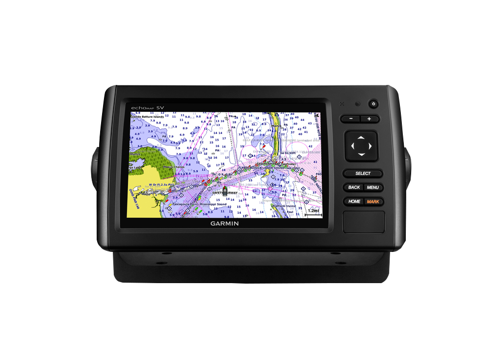
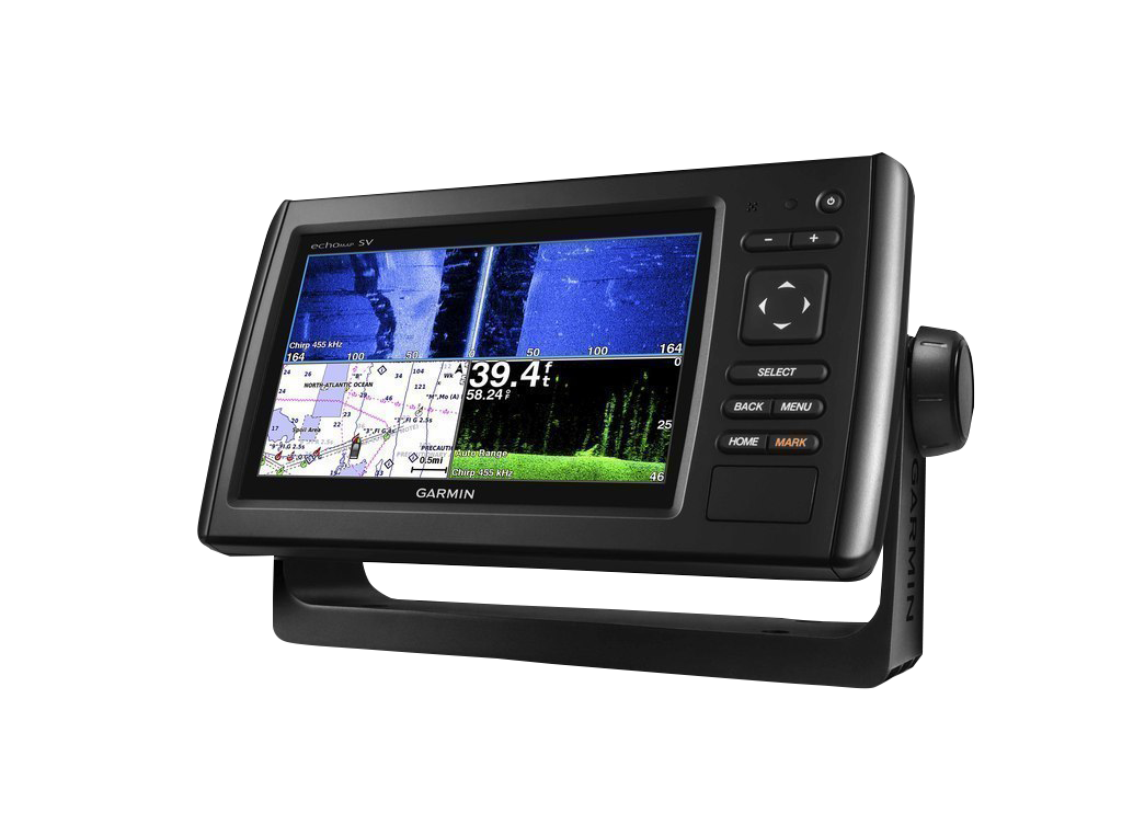
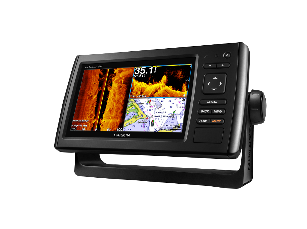
Elevate your fishing adventures with the Garmin ECHOMAP CHIRP 74sv, designed for serious anglers seeking unmatched clarity and performance. This advanced sonar device features a 7-inch display, delivering exceptional detail through its CHIRP technology. Whether you're locating fish or navigating underwater structures, this device empowers you to fish smarter and more efficiently.
Key Features
- CHIRP Sonar Technology: Experience superior target separation and definition with high wide CHIRP sonar, enhancing your ability to see fish and structures.
- Quickdraw Contours: Instantly generate personalized HD fishing maps with 1-foot contours, perfect for customizing your fishing experience.
- Fast GPS Refresh Rate: The internal 5 Hz GPS updates your position and heading five times per second for accuracy in navigation and waypoint dropping.
- User-Friendly Design: Effortlessly install and remove your device with cords that plug directly into the mount; both transom and trolling motor mounts are included.
- Enhanced Mapping: Comes preloaded with BlueChart g2 maps, offering comprehensive coastal U.S. coverage, including NOAA chart data.
- Panoptix Compatibility: Upgrade with Panoptix LiveVü Forward Sonar for real-time views of underwater activity, enhancing your fishing strategy.
Data Insights
The Garmin ECHOMAP CHIRP 74sv sets the standard for sonar devices with its advanced CHIRP technology, offering up to 70% better target separation compared to traditional sonar. This precision allows anglers to distinguish between various fish species and submerged structures, significantly improving your chances of success on the water.
Usage Instructions
To maximize your experience with the Garmin ECHOMAP CHIRP 74sv, ensure proper installation using the included mounts. Power on the device, select your preferred sonar mode, and adjust the settings according to your fishing environment. Utilize the Quickdraw feature to create and customize your maps while you fish.
Design & Material
Crafted with both functionality and aesthetics in mind, the Garmin ECHOMAP CHIRP 74sv exhibits a sleek, modern design that integrates seamlessly into any boating environment.
- Durable Construction: Designed to withstand the rigors of marine environments.
- High-Resolution Display: 7-inch screen with vibrant colors for easy visibility in various lighting conditions.
- Intuitive Interface: User-friendly controls for quick access to essential features.
- Compact Design: Space-saving dimensions make it easy to mount in any boat.
- Responsive Touchscreen: Allows for easy navigation through menus and settings.
- Water-Resistant Housing: Designed to resist water damage and maintain functionality in wet conditions.
Final Verdict
The Garmin ECHOMAP CHIRP 74sv is not just a gadget; it is an essential fishing companion that enhances your fishing success through advanced technology. Its unmatched features, user-friendly design, and durable construction make it a must-have for serious anglers. Transform your fishing experience today with the Garmin ECHOMAP CHIRP 74sv!
In The Box
- echoMAP CHIRP 74sv with U.S. BlueChart® g2
- Power/data cable
- Tilt mount
- Quick-release cradle
- Protective cover
- Flush mount kit
- Hardware
- Documentation
Manual & Warranty
 Garmin Warranty
Do you have an old GPS unit lying around? The GPS Nation Trade In and Up program is a great way to trade in your old and used GPS for credit towards a new GPS. The choice is entirely yours! We’ve made the process simple and streamlined. Follow these simple steps, and you will be on your way to receiving credit towards your brand new GPS!
1. Get a quote
To get your free quote, provide your GPS type, manufacturer, model, and condition. Within 24 hours, you will receive a quote for the trade-in value of your current product. The GPS trade-in/trade-up form is at the bottom of this page.
2. Ship your product(s) for trade
After accepting our offer, pack your product(s) safely and ship them to us using the pre-paid shipping label provided to you. We will provide a confirmation email when your trade-in arrives at our warehouse. You have 30 days from the date you complete your on-line trade to ship the product to GPS Nation.
3. Make your purchase
Once we receive your product at our warehouse and we validate the stated condition, we will send you a confirmation email. If you elect to receive credit towards a new GPS at gpsnation.com, your store credit will be issued, and you are free to make your purchase.
Reviews
Ask a Question
Tech Specs
Experience Precision with the Garmin ECHOMAP CHIRP 74sv w/o Transducer (010-01576-00)
Elevate your fishing adventures with the Garmin ECHOMAP CHIRP 74sv, designed for serious anglers seeking unmatched clarity and performance. This advanced sonar device features a 7-inch display, delivering exceptional detail through its CHIRP technology. Whether you're locating fish or navigating underwater structures, this device empowers you to fish smarter and more efficiently.
Key Features
- CHIRP Sonar Technology: Experience superior target separation and definition with high wide CHIRP sonar, enhancing your ability to see fish and structures.
- Quickdraw Contours: Instantly generate personalized HD fishing maps with 1-foot contours, perfect for customizing your fishing experience.
- Fast GPS Refresh Rate: The internal 5 Hz GPS updates your position and heading five times per second for accuracy in navigation and waypoint dropping.
- User-Friendly Design: Effortlessly install and remove your device with cords that plug directly into the mount; both transom and trolling motor mounts are included.
- Enhanced Mapping: Comes preloaded with BlueChart g2 maps, offering comprehensive coastal U.S. coverage, including NOAA chart data.
- Panoptix Compatibility: Upgrade with Panoptix LiveVü Forward Sonar for real-time views of underwater activity, enhancing your fishing strategy.
Data Insights
The Garmin ECHOMAP CHIRP 74sv sets the standard for sonar devices with its advanced CHIRP technology, offering up to 70% better target separation compared to traditional sonar. This precision allows anglers to distinguish between various fish species and submerged structures, significantly improving your chances of success on the water.
Usage Instructions
To maximize your experience with the Garmin ECHOMAP CHIRP 74sv, ensure proper installation using the included mounts. Power on the device, select your preferred sonar mode, and adjust the settings according to your fishing environment. Utilize the Quickdraw feature to create and customize your maps while you fish.
Design & Material
Crafted with both functionality and aesthetics in mind, the Garmin ECHOMAP CHIRP 74sv exhibits a sleek, modern design that integrates seamlessly into any boating environment.
- Durable Construction: Designed to withstand the rigors of marine environments.
- High-Resolution Display: 7-inch screen with vibrant colors for easy visibility in various lighting conditions.
- Intuitive Interface: User-friendly controls for quick access to essential features.
- Compact Design: Space-saving dimensions make it easy to mount in any boat.
- Responsive Touchscreen: Allows for easy navigation through menus and settings.
- Water-Resistant Housing: Designed to resist water damage and maintain functionality in wet conditions.
Final Verdict
The Garmin ECHOMAP CHIRP 74sv is not just a gadget; it is an essential fishing companion that enhances your fishing success through advanced technology. Its unmatched features, user-friendly design, and durable construction make it a must-have for serious anglers. Transform your fishing experience today with the Garmin ECHOMAP CHIRP 74sv!
In The Box
- echoMAP CHIRP 74sv with U.S. BlueChart® g2
- Power/data cable
- Tilt mount
- Quick-release cradle
- Protective cover
- Flush mount kit
- Hardware
- Documentation
Manual & Warranty
Trade-In
Do you have an old GPS unit lying around? The GPS Nation Trade In and Up program is a great way to trade in your old and used GPS for credit towards a new GPS. The choice is entirely yours! We’ve made the process simple and streamlined. Follow these simple steps, and you will be on your way to receiving credit towards your brand new GPS!
1. Get a quote
To get your free quote, provide your GPS type, manufacturer, model, and condition. Within 24 hours, you will receive a quote for the trade-in value of your current product. The GPS trade-in/trade-up form is at the bottom of this page.
2. Ship your product(s) for trade
After accepting our offer, pack your product(s) safely and ship them to us using the pre-paid shipping label provided to you. We will provide a confirmation email when your trade-in arrives at our warehouse. You have 30 days from the date you complete your on-line trade to ship the product to GPS Nation.
3. Make your purchase
Once we receive your product at our warehouse and we validate the stated condition, we will send you a confirmation email. If you elect to receive credit towards a new GPS at gpsnation.com, your store credit will be issued, and you are free to make your purchase.
Overview
Experience Precision with the Garmin ECHOMAP CHIRP 74sv w/o Transducer (010-01576-00)
Elevate your fishing adventures with the Garmin ECHOMAP CHIRP 74sv, designed for serious anglers seeking unmatched clarity and performance. This advanced sonar device features a 7-inch display, delivering exceptional detail through its CHIRP technology. Whether you're locating fish or navigating underwater structures, this device empowers you to fish smarter and more efficiently.
Key Features
- CHIRP Sonar Technology: Experience superior target separation and definition with high wide CHIRP sonar, enhancing your ability to see fish and structures.
- Quickdraw Contours: Instantly generate personalized HD fishing maps with 1-foot contours, perfect for customizing your fishing experience.
- Fast GPS Refresh Rate: The internal 5 Hz GPS updates your position and heading five times per second for accuracy in navigation and waypoint dropping.
- User-Friendly Design: Effortlessly install and remove your device with cords that plug directly into the mount; both transom and trolling motor mounts are included.
- Enhanced Mapping: Comes preloaded with BlueChart g2 maps, offering comprehensive coastal U.S. coverage, including NOAA chart data.
- Panoptix Compatibility: Upgrade with Panoptix LiveVü Forward Sonar for real-time views of underwater activity, enhancing your fishing strategy.
Data Insights
The Garmin ECHOMAP CHIRP 74sv sets the standard for sonar devices with its advanced CHIRP technology, offering up to 70% better target separation compared to traditional sonar. This precision allows anglers to distinguish between various fish species and submerged structures, significantly improving your chances of success on the water.
Usage Instructions
To maximize your experience with the Garmin ECHOMAP CHIRP 74sv, ensure proper installation using the included mounts. Power on the device, select your preferred sonar mode, and adjust the settings according to your fishing environment. Utilize the Quickdraw feature to create and customize your maps while you fish.
Design & Material
Crafted with both functionality and aesthetics in mind, the Garmin ECHOMAP CHIRP 74sv exhibits a sleek, modern design that integrates seamlessly into any boating environment.
- Durable Construction: Designed to withstand the rigors of marine environments.
- High-Resolution Display: 7-inch screen with vibrant colors for easy visibility in various lighting conditions.
- Intuitive Interface: User-friendly controls for quick access to essential features.
- Compact Design: Space-saving dimensions make it easy to mount in any boat.
- Responsive Touchscreen: Allows for easy navigation through menus and settings.
- Water-Resistant Housing: Designed to resist water damage and maintain functionality in wet conditions.
Final Verdict
The Garmin ECHOMAP CHIRP 74sv is not just a gadget; it is an essential fishing companion that enhances your fishing success through advanced technology. Its unmatched features, user-friendly design, and durable construction make it a must-have for serious anglers. Transform your fishing experience today with the Garmin ECHOMAP CHIRP 74sv!


