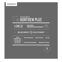
Garmin LakeVü HD - All LUS100F
 ($3.00
) $149.99 ($3.00
)
($3.00
) $149.99 ($3.00
) Order within 05 Hours 04 Minutes and your Garmin LakeVü HD - All LUS100F will ship today1 with Free Shipping
![]() Place your order by 4:00 PM PST and your order will ship the same day, weekends and holidays excluded. Orders placed after 4:00 PM PST will ship the following business day. All orders are subject to verification. International orders subject to shipping charges. For further details see delivery estimates in cart.
Place your order by 4:00 PM PST and your order will ship the same day, weekends and holidays excluded. Orders placed after 4:00 PM PST will ship the following business day. All orders are subject to verification. International orders subject to shipping charges. For further details see delivery estimates in cart.
Condition: New  A brand-new, unused, unopened item in its original retail packaging, with all original packaging materials included. Original manufacturer's warranty is included.
With maps of more than 17,000 U.S. lakes many with 1' contours throughout this HD-mapping product brings new levels of detail to your chartplotter.
* Required Fields
Do you have an old GPS unit lying around? The GPS Nation Trade In and Up program is a great way to trade in your old and used GPS for credit towards a new GPS. The choice is entirely yours! We’ve made the process simple and streamlined. Follow these simple steps, and you will be on your way to receiving credit towards your brand new GPS!
1. Get a quote
To get your free quote, provide your GPS type, manufacturer, model, and condition. Within 24 hours, you will receive a quote for the trade-in value of your current product. The GPS trade-in/trade-up form is at the bottom of this page.
2. Ship your product(s) for trade
After accepting our offer, pack your product(s) safely and ship them to us using the pre-paid shipping label provided to you. We will provide a confirmation email when your trade-in arrives at our warehouse. You have 30 days from the date you complete your on-line trade to ship the product to GPS Nation.
3. Make your purchase
Once we receive your product at our warehouse and we validate the stated condition, we will send you a confirmation email. If you elect to receive credit towards a new GPS at gpsnation.com, your store credit will be issued, and you are free to make your purchase.
- Contains more than 400 HD lakes with 1' contours throughout to help you pinpoint the best places to find fish.
- Displays points of interests, including docks, designated fishing areas, campgrounds, boat ramps, marinas and bridges.
- Shows interstates, highways and general roads.
- Shows underwater features, such as riverbeds, bridges, roads, fish attractors and potential hazards.
- Offers Safety Shading, which lets you input and shade a minimum depth to help you avoid running aground.
![]()
Coverage:
Features detailed coverage of more than 17,000 freshwater lakes, reservoirs and rivers throughout the continental U.S.