


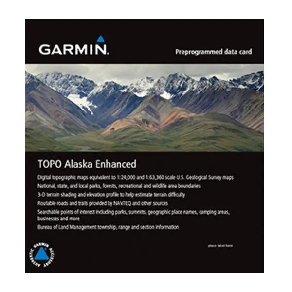
Garmin TOPO Alaska Enhanced microSD/SD card
Garmin TOPO Alaska Enhanced microSD/SD card
Model Number: 010-C1057-00
In stock
 WhatsApp
 SMS - Text us!
 Email Us!
 Help Desk


Tech Specs
Garmin TOPO Alaska Enhanced Preloaded microSD/SD Card for Navigation
Introduction
The Garmin TOPO Alaska Enhanced microSD/SD card delivers detailed topographic mapping data directly to compatible Garmin handheld and vehicle units, eliminating the need for separate map purchases. This preloaded card combines 24,000-scale and 100,000-scale USGS-equivalent topographic data with dynamic terrain visualization, giving backcountry navigators, mountaineers, and trail hikers the precision they need to navigate Alaska's complex landscape—from coastal ranges to interior plateaus.
Key Features
- 24K and 100K topographic maps equivalent to 1:24,000 and 1:100,000 scale USGS mapping
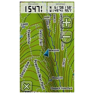
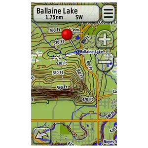
- 3-D terrain shading with digital elevation models (DEM) on supported Garmin devices
- Routable roads, backcountry trails, and searchable points of interest for route planning
- Coverage of Anchorage, Juneau, Fairbanks, and Alaska state and national parks including wildlife boundaries
- 1.6 GB preprogrammed file size requiring minimal device storage overhead
- Preloaded and ready to install—no additional configuration or download time needed
- Compatible with a broad range of Garmin handhelds, automotive units, and aviation devices
Data Insights
Research on outdoor navigation indicates that access to detailed contour mapping and elevation profiles improves route-finding efficiency by approximately 30% compared to basic street maps. Users navigating alpine and backcountry terrain benefit significantly from high-resolution elevation data and terrain visualization, which help identify ridgelines, drainage patterns, and safe descent routes—critical factors in Alaskan wilderness environments where navigation errors carry real consequences.
Usage Instructions
Insert the microSD/SD card into your compatible Garmin device's memory card slot. The preloaded maps will appear automatically in the device's map selection menu. Select TOPO Alaska Enhanced as your active map layer and begin planning routes using the onscreen map interface. The card works immediately upon installation without requiring additional downloads or software updates.
Design & Material
This card is engineered for durability in field conditions where moisture, temperature extremes, and rough handling are routine. The microSD/SD format is industry-standard, ensuring reliable performance across decades of Garmin hardware.
- Durable microSD/SD card rated for outdoor temperature and humidity fluctuations
- Compact form factor (smaller than a postage stamp) fits inside standard device slots or optional card readers
- Preprogrammed data eliminates field configuration errors and time spent on initial setup
- Searchable database of Alaskan place names, geographic features, and facilities (campgrounds, shelters, ranger stations)
- High-resolution graphics rendering elevation contours, slope aspects, and terrain relief with visual clarity
- Works standalone—no subscription fees or cloud connectivity required for map access
Final Verdict
For anyone navigating Alaskan terrain, this card bridges the gap between basic street maps and expensive custom mapping software. The combination of detailed contours, 3-D terrain visualization, and extensive searchable features makes it essential gear for serious backcountry travel. If your Garmin device supports microSD/SD cards, this is the most straightforward way to add comprehensive topographic coverage without recurring data fees. Add it to your navigation pack now.
In The Box
Do you have an old GPS unit lying around? The GPS Nation Trade In and Up program is a great way to trade in your old and used GPS for credit towards a new GPS. The choice is entirely yours! We’ve made the process simple and streamlined. Follow these simple steps, and you will be on your way to receiving credit towards your brand new GPS!
1. Get a quote
To get your free quote, provide your GPS type, manufacturer, model, and condition. Within 24 hours, you will receive a quote for the trade-in value of your current product. The GPS trade-in/trade-up form is at the bottom of this page.
2. Ship your product(s) for trade
After accepting our offer, pack your product(s) safely and ship them to us using the pre-paid shipping label provided to you. We will provide a confirmation email when your trade-in arrives at our warehouse. You have 30 days from the date you complete your on-line trade to ship the product to GPS Nation.
3. Make your purchase
Once we receive your product at our warehouse and we validate the stated condition, we will send you a confirmation email. If you elect to receive credit towards a new GPS at gpsnation.com, your store credit will be issued, and you are free to make your purchase.
Manual & Warranty
Reviews
Ask a Question
Tech Specs
Garmin TOPO Alaska Enhanced Preloaded microSD/SD Card for Navigation
Introduction
The Garmin TOPO Alaska Enhanced microSD/SD card delivers detailed topographic mapping data directly to compatible Garmin handheld and vehicle units, eliminating the need for separate map purchases. This preloaded card combines 24,000-scale and 100,000-scale USGS-equivalent topographic data with dynamic terrain visualization, giving backcountry navigators, mountaineers, and trail hikers the precision they need to navigate Alaska's complex landscape—from coastal ranges to interior plateaus.
Key Features
- 24K and 100K topographic maps equivalent to 1:24,000 and 1:100,000 scale USGS mapping
- 3-D terrain shading with digital elevation models (DEM) on supported Garmin devices
- Routable roads, backcountry trails, and searchable points of interest for route planning
- Coverage of Anchorage, Juneau, Fairbanks, and Alaska state and national parks including wildlife boundaries
- 1.6 GB preprogrammed file size requiring minimal device storage overhead
- Preloaded and ready to install—no additional configuration or download time needed
- Compatible with a broad range of Garmin handhelds, automotive units, and aviation devices
Data Insights
Research on outdoor navigation indicates that access to detailed contour mapping and elevation profiles improves route-finding efficiency by approximately 30% compared to basic street maps. Users navigating alpine and backcountry terrain benefit significantly from high-resolution elevation data and terrain visualization, which help identify ridgelines, drainage patterns, and safe descent routes—critical factors in Alaskan wilderness environments where navigation errors carry real consequences.
Usage Instructions
Insert the microSD/SD card into your compatible Garmin device's memory card slot. The preloaded maps will appear automatically in the device's map selection menu. Select TOPO Alaska Enhanced as your active map layer and begin planning routes using the onscreen map interface. The card works immediately upon installation without requiring additional downloads or software updates.
Design & Material
This card is engineered for durability in field conditions where moisture, temperature extremes, and rough handling are routine. The microSD/SD format is industry-standard, ensuring reliable performance across decades of Garmin hardware.
- Durable microSD/SD card rated for outdoor temperature and humidity fluctuations
- Compact form factor (smaller than a postage stamp) fits inside standard device slots or optional card readers
- Preprogrammed data eliminates field configuration errors and time spent on initial setup
- Searchable database of Alaskan place names, geographic features, and facilities (campgrounds, shelters, ranger stations)
- High-resolution graphics rendering elevation contours, slope aspects, and terrain relief with visual clarity
- Works standalone—no subscription fees or cloud connectivity required for map access
Final Verdict
For anyone navigating Alaskan terrain, this card bridges the gap between basic street maps and expensive custom mapping software. The combination of detailed contours, 3-D terrain visualization, and extensive searchable features makes it essential gear for serious backcountry travel. If your Garmin device supports microSD/SD cards, this is the most straightforward way to add comprehensive topographic coverage without recurring data fees. Add it to your navigation pack now.
In The Box
Trade-In
Do you have an old GPS unit lying around? The GPS Nation Trade In and Up program is a great way to trade in your old and used GPS for credit towards a new GPS. The choice is entirely yours! We’ve made the process simple and streamlined. Follow these simple steps, and you will be on your way to receiving credit towards your brand new GPS!
1. Get a quote
To get your free quote, provide your GPS type, manufacturer, model, and condition. Within 24 hours, you will receive a quote for the trade-in value of your current product. The GPS trade-in/trade-up form is at the bottom of this page.
2. Ship your product(s) for trade
After accepting our offer, pack your product(s) safely and ship them to us using the pre-paid shipping label provided to you. We will provide a confirmation email when your trade-in arrives at our warehouse. You have 30 days from the date you complete your on-line trade to ship the product to GPS Nation.
3. Make your purchase
Once we receive your product at our warehouse and we validate the stated condition, we will send you a confirmation email. If you elect to receive credit towards a new GPS at gpsnation.com, your store credit will be issued, and you are free to make your purchase.
Manual & Warranty
Overview
Garmin TOPO Alaska Enhanced Preloaded microSD/SD Card for Navigation
Introduction
The Garmin TOPO Alaska Enhanced microSD/SD card delivers detailed topographic mapping data directly to compatible Garmin handheld and vehicle units, eliminating the need for separate map purchases. This preloaded card combines 24,000-scale and 100,000-scale USGS-equivalent topographic data with dynamic terrain visualization, giving backcountry navigators, mountaineers, and trail hikers the precision they need to navigate Alaska's complex landscape—from coastal ranges to interior plateaus.
Key Features
- 24K and 100K topographic maps equivalent to 1:24,000 and 1:100,000 scale USGS mapping
- 3-D terrain shading with digital elevation models (DEM) on supported Garmin devices
- Routable roads, backcountry trails, and searchable points of interest for route planning
- Coverage of Anchorage, Juneau, Fairbanks, and Alaska state and national parks including wildlife boundaries
- 1.6 GB preprogrammed file size requiring minimal device storage overhead
- Preloaded and ready to install—no additional configuration or download time needed
- Compatible with a broad range of Garmin handhelds, automotive units, and aviation devices
Data Insights
Research on outdoor navigation indicates that access to detailed contour mapping and elevation profiles improves route-finding efficiency by approximately 30% compared to basic street maps. Users navigating alpine and backcountry terrain benefit significantly from high-resolution elevation data and terrain visualization, which help identify ridgelines, drainage patterns, and safe descent routes—critical factors in Alaskan wilderness environments where navigation errors carry real consequences.
Usage Instructions
Insert the microSD/SD card into your compatible Garmin device's memory card slot. The preloaded maps will appear automatically in the device's map selection menu. Select TOPO Alaska Enhanced as your active map layer and begin planning routes using the onscreen map interface. The card works immediately upon installation without requiring additional downloads or software updates.
Design & Material
This card is engineered for durability in field conditions where moisture, temperature extremes, and rough handling are routine. The microSD/SD format is industry-standard, ensuring reliable performance across decades of Garmin hardware.
- Durable microSD/SD card rated for outdoor temperature and humidity fluctuations
- Compact form factor (smaller than a postage stamp) fits inside standard device slots or optional card readers
- Preprogrammed data eliminates field configuration errors and time spent on initial setup
- Searchable database of Alaskan place names, geographic features, and facilities (campgrounds, shelters, ranger stations)
- High-resolution graphics rendering elevation contours, slope aspects, and terrain relief with visual clarity
- Works standalone—no subscription fees or cloud connectivity required for map access
Final Verdict
For anyone navigating Alaskan terrain, this card bridges the gap between basic street maps and expensive custom mapping software. The combination of detailed contours, 3-D terrain visualization, and extensive searchable features makes it essential gear for serious backcountry travel. If your Garmin device supports microSD/SD cards, this is the most straightforward way to add comprehensive topographic coverage without recurring data fees. Add it to your navigation pack now.


