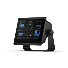
U.S. Inland Maps LakeVü g3 | LUS100F | Download
 ($3.00
) $149.99 ($3.00
)
($3.00
) $149.99 ($3.00
) Estimated Ship Date : January, 01 1970
Condition: New  A brand-new, unused, unopened item in its original retail packaging, with all original packaging materials included. Original manufacturer's warranty is included.
* Required Fields
Do you have an old GPS unit lying around? The GPS Nation Trade In and Up program is a great way to trade in your old and used GPS for credit towards a new GPS. The choice is entirely yours! We’ve made the process simple and streamlined. Follow these simple steps, and you will be on your way to receiving credit towards your brand new GPS!
1. Get a quote
To get your free quote, provide your GPS type, manufacturer, model, and condition. Within 24 hours, you will receive a quote for the trade-in value of your current product. The GPS trade-in/trade-up form is at the bottom of this page.
2. Ship your product(s) for trade
After accepting our offer, pack your product(s) safely and ship them to us using the pre-paid shipping label provided to you. We will provide a confirmation email when your trade-in arrives at our warehouse. You have 30 days from the date you complete your on-line trade to ship the product to GPS Nation.
3. Make your purchase
Once we receive your product at our warehouse and we validate the stated condition, we will send you a confirmation email. If you elect to receive credit towards a new GPS at gpsnation.com, your store credit will be issued, and you are free to make your purchase.
The Advanced Freshwater Fishing Map
- Provides exceptional coverage, clarity and detail for more than 18,000 lakes with up to 1’ contours that feature integrated Garmin and Navionics data
- Auto Guidance1 technology uses your desired depth and overhead clearance to calculate routes and show a suggested path to follow
- Depth range shading for up to 10 depth ranges, enables you to view your target depth at a glance
- Shallow water shading allows for shading at a user-defined depth to give a clear picture of shallow areas
- Displays points of interest, campgrounds, highways and roads as well as underwater features such as riverbeds, fish attractors and potential hazards
Experience unparalleled coverage and brilliant detail when you’re on the water. LakeVü g3 inland charts provide exceptional coverage, clarity and detail with integrated Garmin and Navionics content on more than 18,000 lakes — including more than 160 Garmin Elite surveyed lakes.
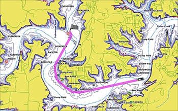
Auto Guidance Technology
The Auto Guidance feature1 uses your desired depth and overhead clearance to calculate a route and suggest a path to follow.
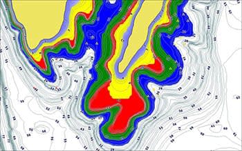
Depth Range Shading
This feature displays high-resolution depth range shading for up to 10 depth ranges so you can view your designated target depth.
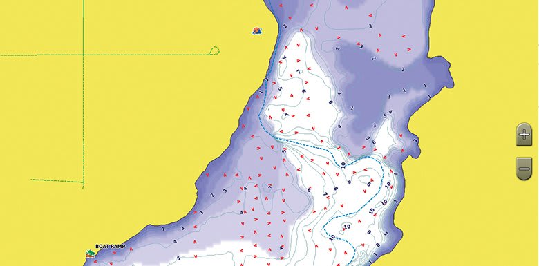
Shallow Water Shading
To give a clear picture of shallow waters to avoid, this feature allows for shading at a user-defined depth.
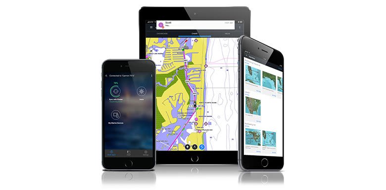
Access Your Charts and Maps
Download the ActiveCaptain app to use OneChart, which gives you access to all your charts and maps from your mobile device and even lets you purchase new ones.