


Garmin GPSMAP 1643xsv SideVü, ClearVü and Traditional CHIRP Sonar with Mapping (010-02919-03)
Garmin GPSMAP 1643xsv SideVü, ClearVü and Traditional CHIRP Sonar with Mapping (010-02919-03)
SKU: 010-02919-03
En existencias
 WhatsApp
 SMS - Text us!
 Email Us!
 Help Desk
Reseñas
Especificaciones

En la caja
microSD™ card preinstalled
8-pin transducer to 12-pin sounder adapter cable
Power cable
Flush mount kit with gasket
Protective cover
Trim piece snap covers
Backbone/drop cable (2 meters) and T-connector for the NMEA 2000® network
Documentation
¿Tiene una unidad GPS vieja por ahí? El programa Trade In and Up de GPS Nation es una excelente manera de canjear su GPS viejo y usado por crédito para un nuevo GPS. ¡La decisión es completamente suya! Hemos simplificado y optimizado el proceso. Siga estos sencillos pasos y estará en camino de recibir crédito para su nuevo GPS.
1. Obtenga una cotización
Para obtener una cotización gratuita, proporcione el tipo, el fabricante, el modelo y el estado de su GPS. En un plazo de 24 horas, recibirá una cotización por el valor de intercambio de su producto actual. El formulario de intercambio de GPS se encuentra en la parte inferior de esta página.
2. Envíe su(s) producto(s) para comercializarlos
Después de aceptar nuestra oferta, empaquete sus productos de forma segura y envíenoslos utilizando la etiqueta de envío prepaga que le proporcionamos. Le enviaremos un correo electrónico de confirmación cuando su canje llegue a nuestro almacén. Tiene 30 días a partir de la fecha en que complete su canje en línea para enviar el producto a GPS Nation.
3. Realiza tu compra
Una vez que recibamos su producto en nuestro almacén y validemos la condición indicada, le enviaremos un correo electrónico de confirmación. Si elige recibir crédito para un nuevo GPS en gpsnation.com, se emitirá su crédito de la tienda y podrá realizar su compra.
Manual y garantía
 Garmin Warranty
Reseñas
Haz una pregunta
Especificaciones
En la caja
microSD™ card preinstalled
8-pin transducer to 12-pin sounder adapter cable
Power cable
Flush mount kit with gasket
Protective cover
Trim piece snap covers
Backbone/drop cable (2 meters) and T-connector for the NMEA 2000® network
Documentation
Programa de canje
¿Tiene una unidad GPS vieja por ahí? El programa Trade In and Up de GPS Nation es una excelente manera de canjear su GPS viejo y usado por crédito para un nuevo GPS. ¡La decisión es completamente suya! Hemos simplificado y optimizado el proceso. Siga estos sencillos pasos y estará en camino de recibir crédito para su nuevo GPS.
1. Obtenga una cotización
Para obtener una cotización gratuita, proporcione el tipo, el fabricante, el modelo y el estado de su GPS. En un plazo de 24 horas, recibirá una cotización por el valor de intercambio de su producto actual. El formulario de intercambio de GPS se encuentra en la parte inferior de esta página.
2. Envíe su(s) producto(s) para comercializarlos
Después de aceptar nuestra oferta, empaquete sus productos de forma segura y envíenoslos utilizando la etiqueta de envío prepaga que le proporcionamos. Le enviaremos un correo electrónico de confirmación cuando su canje llegue a nuestro almacén. Tiene 30 días a partir de la fecha en que complete su canje en línea para enviar el producto a GPS Nation.
3. Realiza tu compra
Una vez que recibamos su producto en nuestro almacén y validemos la condición indicada, le enviaremos un correo electrónico de confirmación. Si elige recibir crédito para un nuevo GPS en gpsnation.com, se emitirá su crédito de la tienda y podrá realizar su compra.
Manual y garantía
Descripción general
Garmin GPSMAP 1643xsv SideVü, ClearVü and Traditional CHIRP Sonar with Mapping (010-02919-03)
Introduction
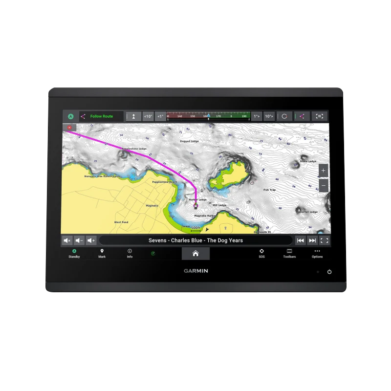
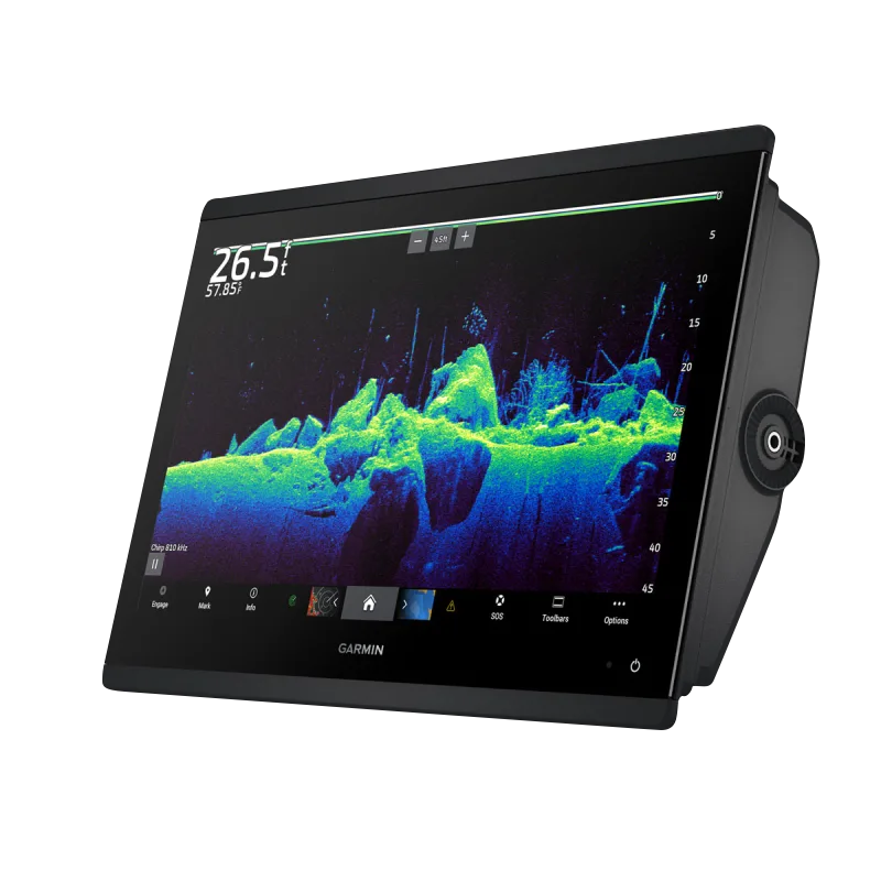
The Garmin GPSMAP 1643xsv is a 16-inch marine chartplotter that combines three distinct sonar technologies—SideVü, ClearVü, and 1 kW CHIRP—into a single integrated system. Built for anglers and professional mariners who demand precise fish location capabilities and detailed underwater structure identification, this device delivers real-time sonar imagery alongside preloaded navigation charts. The integration of IPS display technology with edge-to-edge glass creates a modern helm interface that maintains clarity in full sunlight while reducing on-screen glare. This chartplotter addresses the core frustration serious boaters face: distinguishing actual fish from rock formations, structure shadows, and bottom debris—a challenge that claims 40% better target separation through its advanced CHIRP architecture.
Key Features
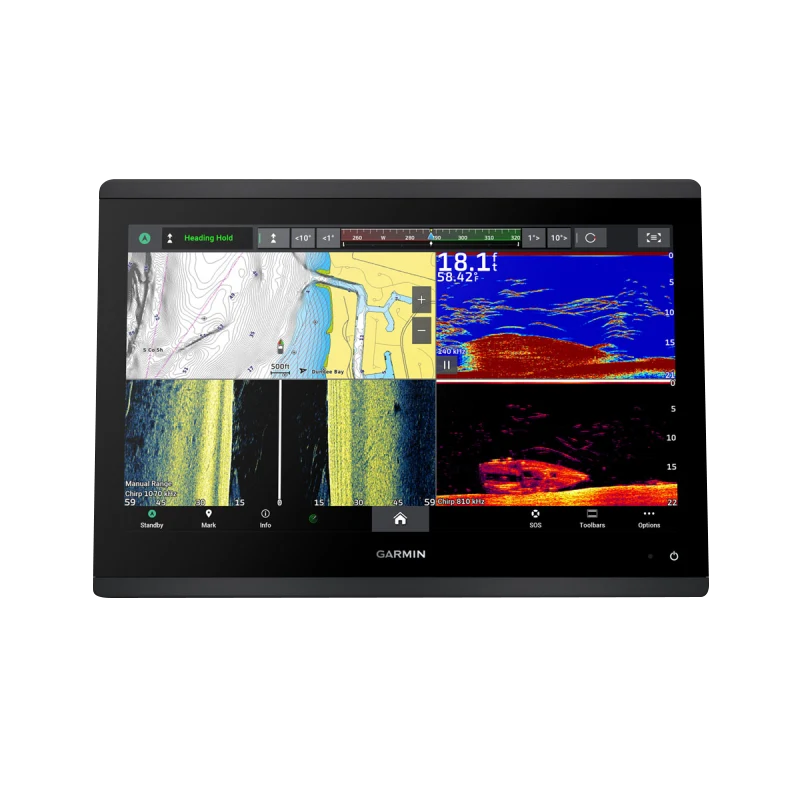
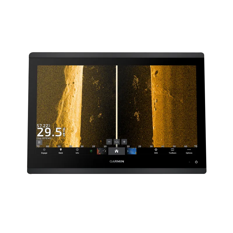
- SideVü sonar with real-time imaging up to 240 feet to the sides of the vessel
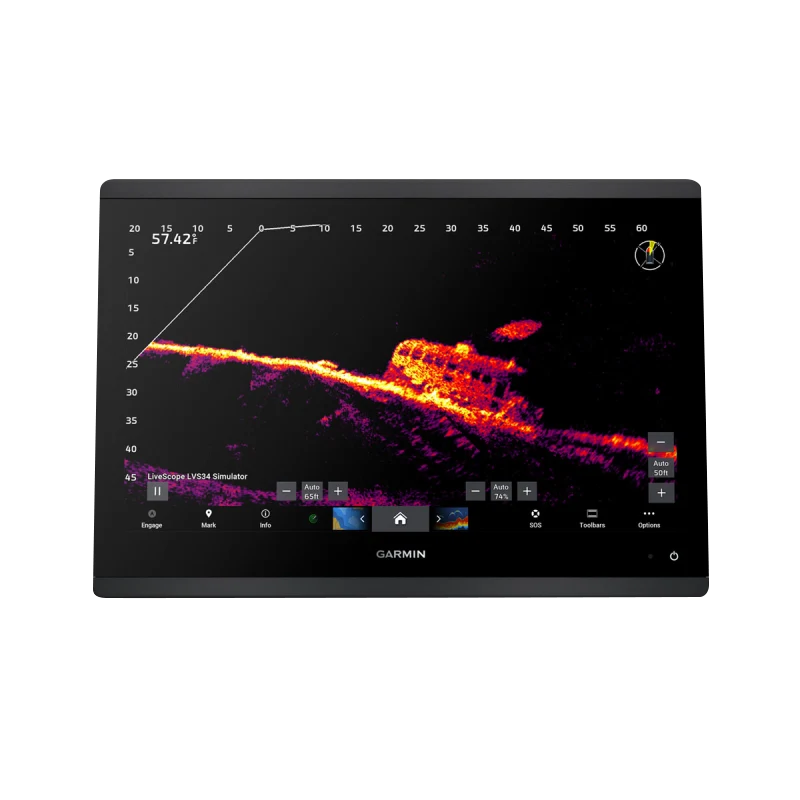
- ClearVü sonar providing forward-facing 2D imaging for bottom and structure detail
- 1 kW CHIRP traditional sonar with frequency capability for both shallow and deep water fishing
- 16-inch IPS display with improved sunlight readability at 100% brightness
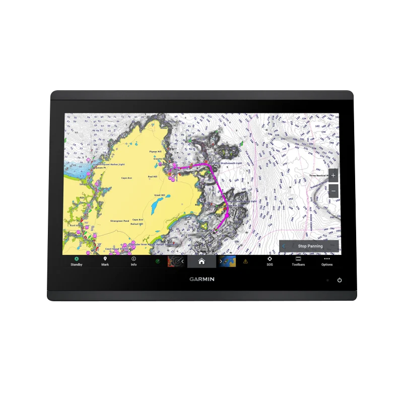
- Garmin Navionics+ preloaded charts with 1-year daily update subscription included
- Panoptix LiveScope compatibility for optional real-time 360-degree underwater viewing
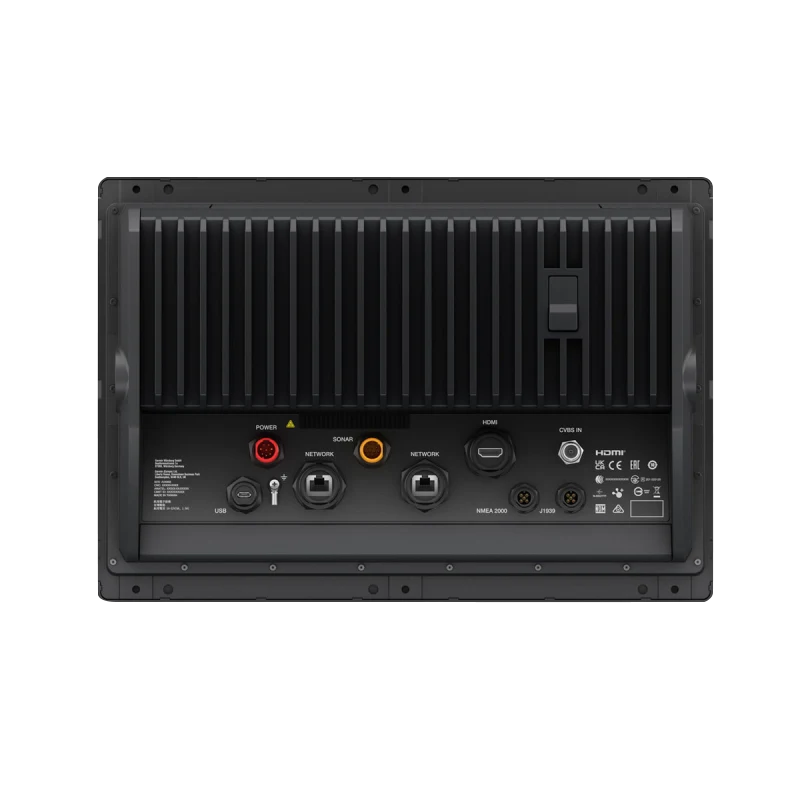
- NMEA 2000 and NMEA 0183 connectivity supporting autopilot integration and third-party device control
- Auto Guidance+ route optimization technology reducing transit time by calculating efficient waterway paths
Data Insights
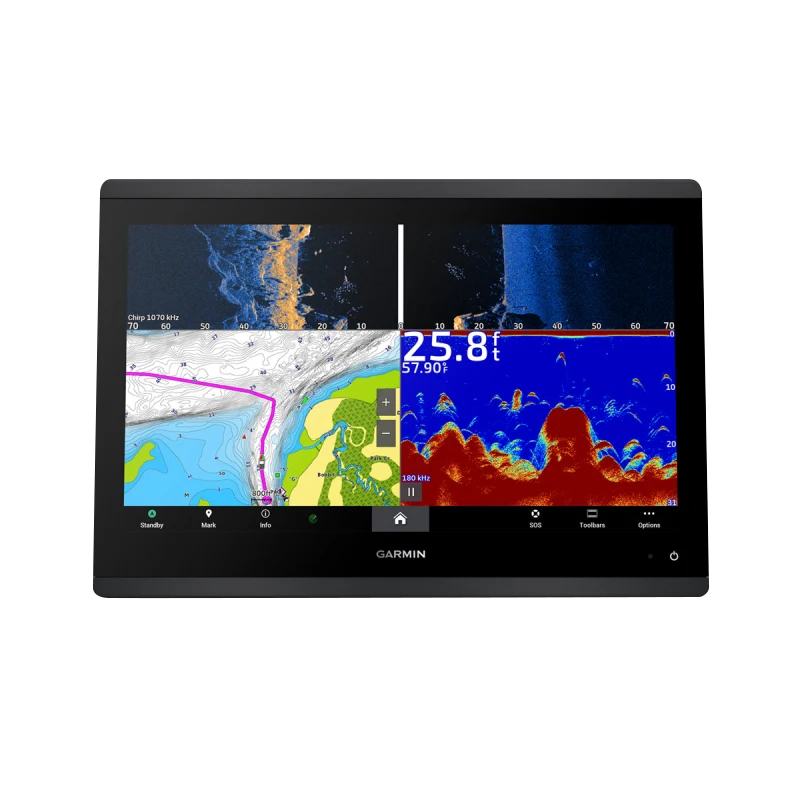
CHIRP sonar technology delivers approximately 40% improved target separation compared to traditional single-frequency sonar systems, enabling anglers to distinguish individual fish and structure types with greater accuracy. The combination of SideVü and ClearVü imagery alongside traditional sonar creates a three-dimensional understanding of underwater environments, improving catch success rates and reducing time spent searching unproductive water. Operators report that the Auto Guidance+ feature reduces average route planning time by minimizing manual waypoint entry and identifying the safest deep-water navigation corridors automatically.
Usage Instructions
Begin by calibrating the device to your specific water depth and salinity conditions using the setup wizard. Deploy the included transducers and verify sonar signal strength through the diagnostics menu. Load Navionics+ charts and create routes using Auto Guidance+ for optimal navigation corridors. Switch between SideVü, ClearVü, and traditional CHIRP displays based on your fishing scenario—use SideVü for structure scanning while trolling, ClearVü for identifying bottom composition, and CHIRP for suspended fish detection at varying depths. Enable NMEA 2000 connectivity in settings to establish autopilot and audio system integration.
Design & Material
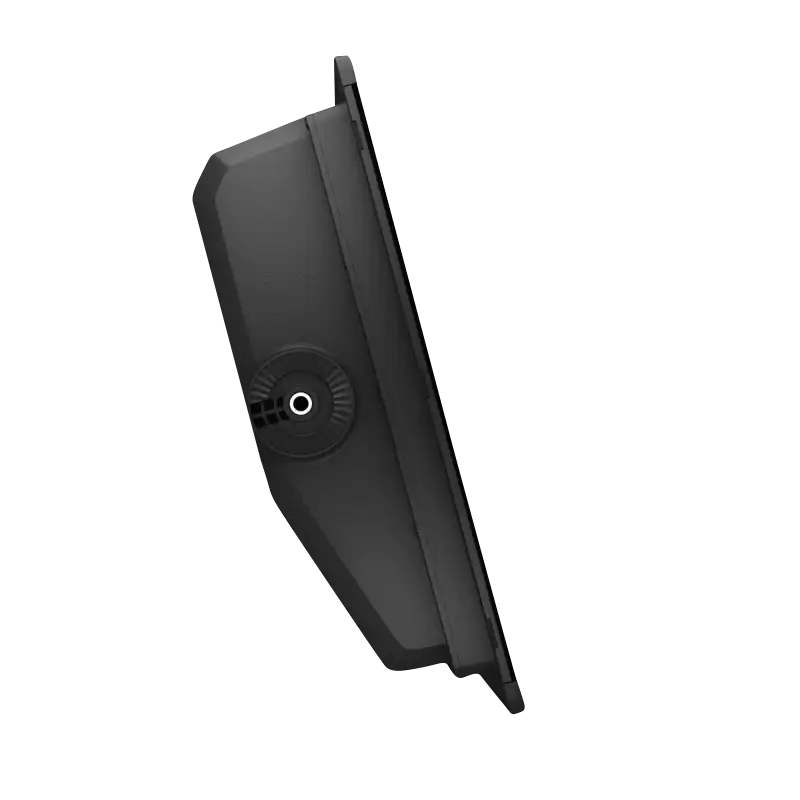
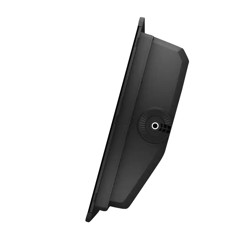
The GPSMAP 1643xsv features a slimline profile that integrates seamlessly into existing helm installations without consuming excessive console space. The design prioritizes functionality through a logical button layout and responsive touchscreen interface, while aesthetic choices—including the edge-to-edge glass panel and black casing—maintain a professional appearance compatible with modern vessel aesthetics.
- Edge-to-edge tempered glass faceplate providing durability and modern styling with minimal frame intrusion
- Weather-resistant housing rated for saltwater spray and extended UV exposure typical of coastal environments
- Compact footprint measuring 16 inches diagonally, designed for easy flush-mounting or pedestal installation on existing brackets
- Lightweight construction reducing installation burden and helm load without sacrificing structural rigidity
- IPS panel technology maintaining color saturation and contrast across wide viewing angles, essential for crew positions away from center console
- Stainless steel hardware and corrosion-resistant internal components engineered for 5+ years of marine environment exposure
Final Verdict
The Garmin GPSMAP 1643xsv stands as the definitive choice for fishing-focused operators and professional mariners requiring integrated sonar and mapping on a single platform. The combination of three distinct sonar imaging types, preloaded daily-updated charts, and proven Auto Guidance+ technology eliminates the complexity of managing separate fish-finding and navigation systems. If you're making underwater decisions based on sonar data daily, or rely on navigation precision in unfamiliar waterways, this chartplotter is the investment that transforms how you interact with the water beneath your hull.


