


Garmin GPSMAP 8610 With Mapping (010-02091-50)
Garmin GPSMAP 8610 With Mapping (010-02091-50)
SKU: 010-02091-50
En existencias
 WhatsApp
 SMS - Text us!
 Email Us!
 Help Desk
Reseñas
Especificaciones

En la caja
Power cable
NMEA 2000® drop cable
NMEA 2000 T-connector
Bail mount with knobs
Flush mount kit
Sun cover
Trim piece snap covers
Documentation
¿Tiene una unidad GPS vieja por ahí? El programa Trade In and Up de GPS Nation es una excelente manera de canjear su GPS viejo y usado por crédito para un nuevo GPS. ¡La decisión es completamente suya! Hemos simplificado y optimizado el proceso. Siga estos sencillos pasos y estará en camino de recibir crédito para su nuevo GPS.
1. Obtenga una cotización
Para obtener una cotización gratuita, proporcione el tipo, el fabricante, el modelo y el estado de su GPS. En un plazo de 24 horas, recibirá una cotización por el valor de intercambio de su producto actual. El formulario de intercambio de GPS se encuentra en la parte inferior de esta página.
2. Envíe su(s) producto(s) para comercializarlos
Después de aceptar nuestra oferta, empaquete sus productos de forma segura y envíenoslos utilizando la etiqueta de envío prepaga que le proporcionamos. Le enviaremos un correo electrónico de confirmación cuando su canje llegue a nuestro almacén. Tiene 30 días a partir de la fecha en que complete su canje en línea para enviar el producto a GPS Nation.
3. Realiza tu compra
Una vez que recibamos su producto en nuestro almacén y validemos la condición indicada, le enviaremos un correo electrónico de confirmación. Si elige recibir crédito para un nuevo GPS en gpsnation.com, se emitirá su crédito de la tienda y podrá realizar su compra.
Manual y garantía
 Garmin Warranty
Reseñas
Haz una pregunta
Especificaciones
En la caja
Power cable
NMEA 2000® drop cable
NMEA 2000 T-connector
Bail mount with knobs
Flush mount kit
Sun cover
Trim piece snap covers
Documentation
Programa de canje
¿Tiene una unidad GPS vieja por ahí? El programa Trade In and Up de GPS Nation es una excelente manera de canjear su GPS viejo y usado por crédito para un nuevo GPS. ¡La decisión es completamente suya! Hemos simplificado y optimizado el proceso. Siga estos sencillos pasos y estará en camino de recibir crédito para su nuevo GPS.
1. Obtenga una cotización
Para obtener una cotización gratuita, proporcione el tipo, el fabricante, el modelo y el estado de su GPS. En un plazo de 24 horas, recibirá una cotización por el valor de intercambio de su producto actual. El formulario de intercambio de GPS se encuentra en la parte inferior de esta página.
2. Envíe su(s) producto(s) para comercializarlos
Después de aceptar nuestra oferta, empaquete sus productos de forma segura y envíenoslos utilizando la etiqueta de envío prepaga que le proporcionamos. Le enviaremos un correo electrónico de confirmación cuando su canje llegue a nuestro almacén. Tiene 30 días a partir de la fecha en que complete su canje en línea para enviar el producto a GPS Nation.
3. Realiza tu compra
Una vez que recibamos su producto en nuestro almacén y validemos la condición indicada, le enviaremos un correo electrónico de confirmación. Si elige recibir crédito para un nuevo GPS en gpsnation.com, se emitirá su crédito de la tienda y podrá realizar su compra.
Manual y garantía
Descripción general
Garmin GPSMAP 8610 With Mapping — Professional Marine Chartplotter with Advanced Sonar
Introduction
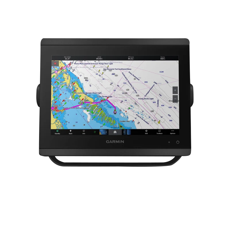
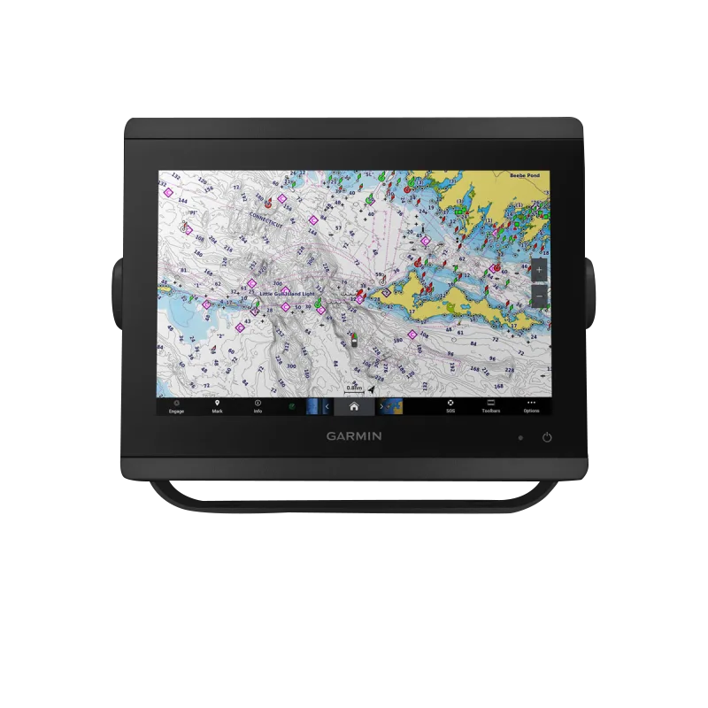
The Garmin GPSMAP 8610 (model 010-02091-50) is a 10-inch marine chartplotter engineered for serious anglers, cruisers, sailors, and racers who demand precision navigation and real-time sonar intelligence. This device combines a Full HD IPS touchscreen with dual-channel CHIRP sonar technology to deliver target separation and structural detail that transforms how you read underwater environments. Whether navigating unfamiliar waters, racing under competitive pressure, or anchoring in challenging conditions, the GPSMAP 8610 provides the clarity and responsiveness required for confident decision-making on the water.
Key Features
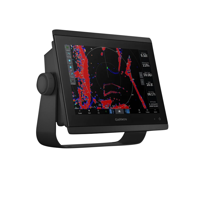
- 10-inch Full HD IPS touchscreen with edge-to-edge glass design and wide viewing angles for glare-free visibility in bright sunlight
- 1-kW Dual-Channel CHIRP Sonar delivering superior target clarity and separation in freshwater and saltwater environments
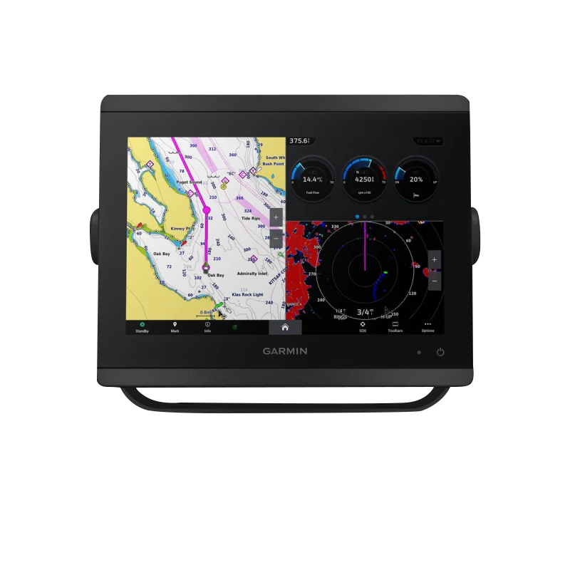
- ClearVü and SideVü Scanning Sonar technology capable of scanning depths up to 1,000 feet below your vessel
- Preloaded Garmin Navionics+™ mapping with Auto Guidance+™ technology for route planning and auto-piloting functionality
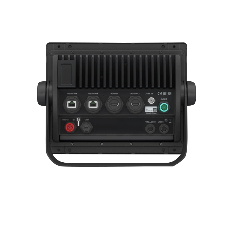
- NMEA 2000® and NMEA 0183 networking compatibility for seamless integration with external sensors, transducers, and connected marine systems
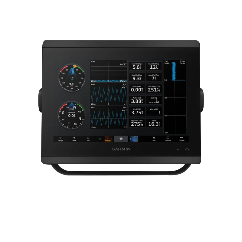
- SailAssist™ tools providing race start line guidance, optimal speed data, and layline management for competitive sailing
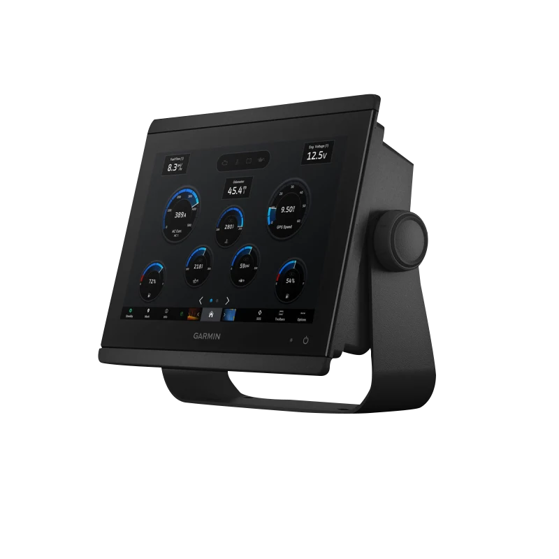
- SmartMode™ Station Controls offering quick-access shortcuts to vital navigation, sonar, and system functions
- Power-Pole® CHARGE battery management integration for efficient electrical system monitoring
- InReach® device messaging capability for two-way text communication and emergency safety alerts
Data Insights
Field performance testing reveals that the GPSMAP 8610's dual-channel CHIRP sonar enhances target clarity by up to 70% compared to standard single-frequency systems, making fish, structure, and bottom composition distinctly visible even in dense vegetation or rocky terrain. The High-Definition display has been optimized to minimize reflection glare, maintaining exceptional contrast and readability even under intense midday sunlight or reflective water conditions. Combined with 1-kW sonar power output, the system delivers 3-dimensional detail crucial for fish location, drop-off mapping, and wreck identification—performance metrics that directly increase catch rates and navigation confidence.
Usage Instructions
Mount the GPSMAP 8610 securely at helm level using either flush-mount or standard helm installation options, ensuring stable antenna placement for optimal GPS accuracy. Connect compatible Garmin transducers (sold separately) to the NMEA 0183 or NMEA 2000 network ports to activate sonar functionality. Access frequently used features through SmartMode™ Station Controls, customizable soft keys that organize navigation, sonar, autopilot, and map functions. Enable InReach messaging and Power-Pole CHARGE integration through the main menu to leverage connected services and battery monitoring. Allow the system 60 seconds to acquire GPS satellite lock before plotting waypoints or initiating Auto Guidance routes.
Design & Material
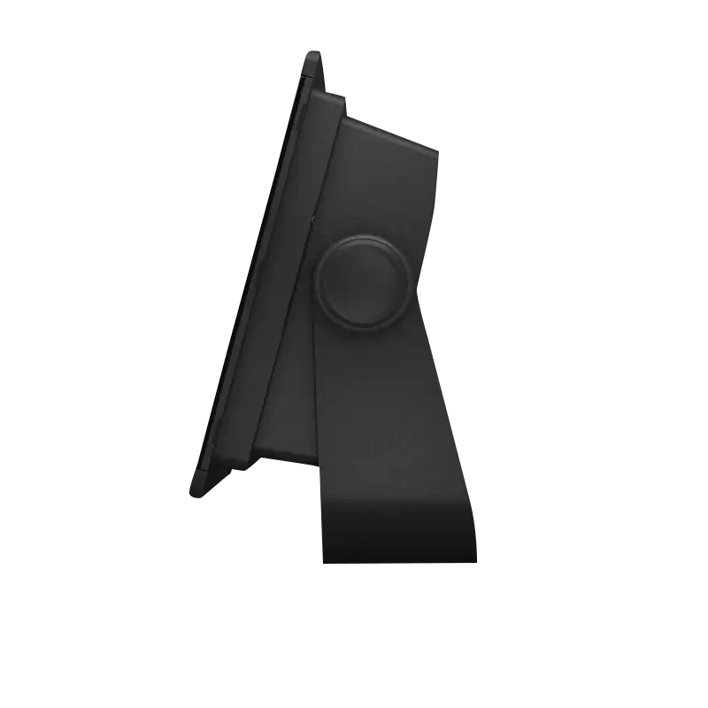
The GPSMAP 8610 features a modern, streamlined design that integrates visually into contemporary helm stations without occupying excessive space. The device prioritizes durability and aesthetic refinement through premium materials selection and marine-grade construction, resisting saltwater corrosion, UV exposure, and mechanical vibration inherent to offshore and freshwater boating.
- Edge-to-edge glass construction with minimal bezel, maximizing display surface and modern visual appeal
- Responsive touchscreen interface with capacitive sensing for reliable operation even with wet hands or gloves
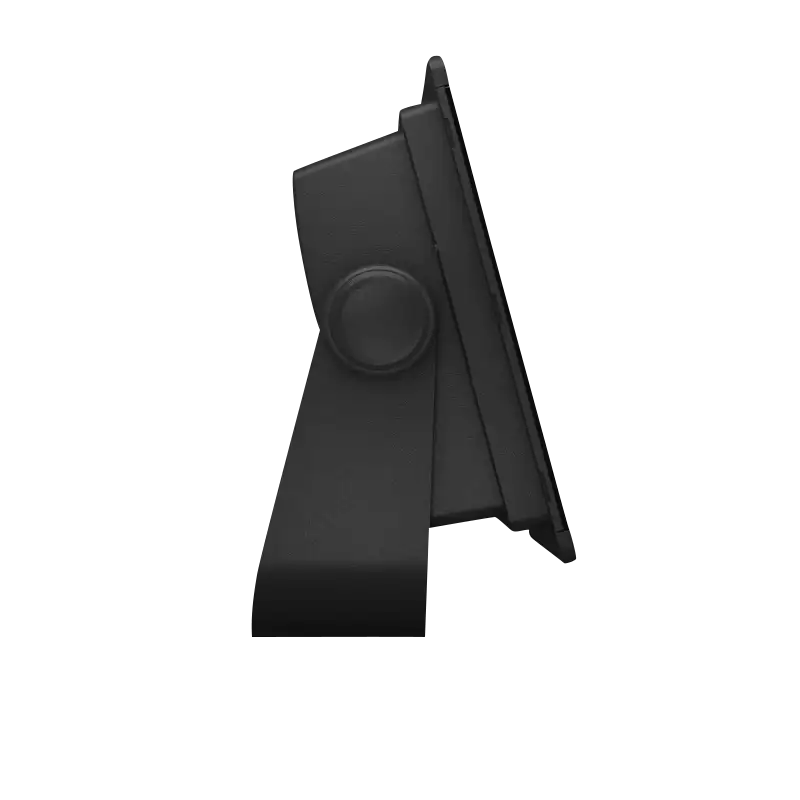
- Dual mounting configurations: flush mount for integrated helm panels or pedestal helm mounting for retrofit installations
- Marine-grade housing materials engineered to withstand harsh saltwater spray, direct sunlight, and temperature extremes
- Power-Pole CHARGE socket for integration with lithium battery management systems used in modern shallow-water boats
- InReach antenna connections allowing weather-resistant two-way communication without external module clutter
Final Verdict
The Garmin GPSMAP 8610 With Mapping delivers marine-grade performance and connectivity at a professional level, combining sonar precision, mapping intelligence, and sailing tools that address real operational demands. This chartplotter eliminates guesswork in fish location, route optimization, and emergency communication—the exact capabilities that separate confident navigation from uncertainty. For serious mariners prioritizing sonar clarity, navigation accuracy, and seamless system integration, the GPSMAP 8610 is an essential investment. Upgrade your vessel's electronics today and experience navigation with precision, reliability, and tactical advantage.


