


Garmin ECHOMAP Ultra 2 10" Chartplotters 106sv without Transducer; Includes Garmin Navionics+ U.S. Inland & Coastal Mapping (010-02880-00)
Garmin ECHOMAP Ultra 2 10" Chartplotters 106sv without Transducer; Includes Garmin Navionics+ U.S. Inland & Coastal Mapping (010-02880-00)
SKU: 010-02880-00
Stock bas
 WhatsApp
 SMS - Text us!
 Email Us!
 Help Desk
Avis
Spécifications

Dans la boîte
Power/data cable
Bail mount with quick release cradle
Protective sun cover
8-pin transducer to 12-pin sounder adapter cable Hardware
Documentation
Vous avez un vieux GPS qui traîne ? Le programme Trade In and Up de GPS Nation est un excellent moyen d'échanger votre ancien GPS usagé contre un crédit pour l'achat d'un nouveau GPS. Le choix vous appartient entièrement ! Nous avons simplifié et rationalisé le processus. Suivez ces étapes simples et vous serez sur la bonne voie pour recevoir un crédit pour votre tout nouveau GPS !
1. Obtenez un devis
Pour obtenir votre devis gratuit, indiquez le type, le fabricant, le modèle et l'état de votre GPS. Dans les 24 heures, vous recevrez un devis correspondant à la valeur de reprise de votre produit actuel. Le formulaire de reprise/d'échange de GPS se trouve au bas de cette page.
2. Expédiez votre/vos produit(s) pour le commerce
Après avoir accepté notre offre, emballez votre ou vos produits en toute sécurité et expédiez-les-nous à l'aide de l'étiquette d'expédition prépayée qui vous a été fournie. Nous vous enverrons un e-mail de confirmation lorsque votre échange arrivera à notre entrepôt. Vous disposez de 30 jours à compter de la date à laquelle vous avez terminé votre échange en ligne pour expédier le produit à GPS Nation.
3. Effectuez votre achat
Une fois que nous aurons reçu votre produit à notre entrepôt et que nous aurons validé l'état indiqué, nous vous enverrons un e-mail de confirmation. Si vous choisissez de recevoir un crédit pour un nouveau GPS sur gpsnation.com, votre crédit de magasin sera émis et vous serez libre de procéder à votre achat.
Manuel et garantie
 Garmin Warranty
Avis
Poser une question
Spécifications
Dans la boîte
Power/data cable
Bail mount with quick release cradle
Protective sun cover
8-pin transducer to 12-pin sounder adapter cable Hardware
Documentation
Programme d'échange
Vous avez un vieux GPS qui traîne ? Le programme Trade In and Up de GPS Nation est un excellent moyen d'échanger votre ancien GPS usagé contre un crédit pour l'achat d'un nouveau GPS. Le choix vous appartient entièrement ! Nous avons simplifié et rationalisé le processus. Suivez ces étapes simples et vous serez sur la bonne voie pour recevoir un crédit pour votre tout nouveau GPS !
1. Obtenez un devis
Pour obtenir votre devis gratuit, indiquez le type, le fabricant, le modèle et l'état de votre GPS. Dans les 24 heures, vous recevrez un devis correspondant à la valeur de reprise de votre produit actuel. Le formulaire de reprise/d'échange de GPS se trouve au bas de cette page.
2. Expédiez votre/vos produit(s) pour le commerce
Après avoir accepté notre offre, emballez votre ou vos produits en toute sécurité et expédiez-les-nous à l'aide de l'étiquette d'expédition prépayée qui vous a été fournie. Nous vous enverrons un e-mail de confirmation lorsque votre échange arrivera à notre entrepôt. Vous disposez de 30 jours à compter de la date à laquelle vous avez terminé votre échange en ligne pour expédier le produit à GPS Nation.
3. Effectuez votre achat
Une fois que nous aurons reçu votre produit à notre entrepôt et que nous aurons validé l'état indiqué, nous vous enverrons un e-mail de confirmation. Si vous choisissez de recevoir un crédit pour un nouveau GPS sur gpsnation.com, votre crédit de magasin sera émis et vous serez libre de procéder à votre achat.
Manuel et garantie
Aperçu
Garmin ECHOMAP Ultra 2 10" Chartplotter 106sv with Navionics+ Inland and Coastal Maps
Introduction
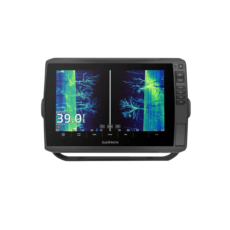
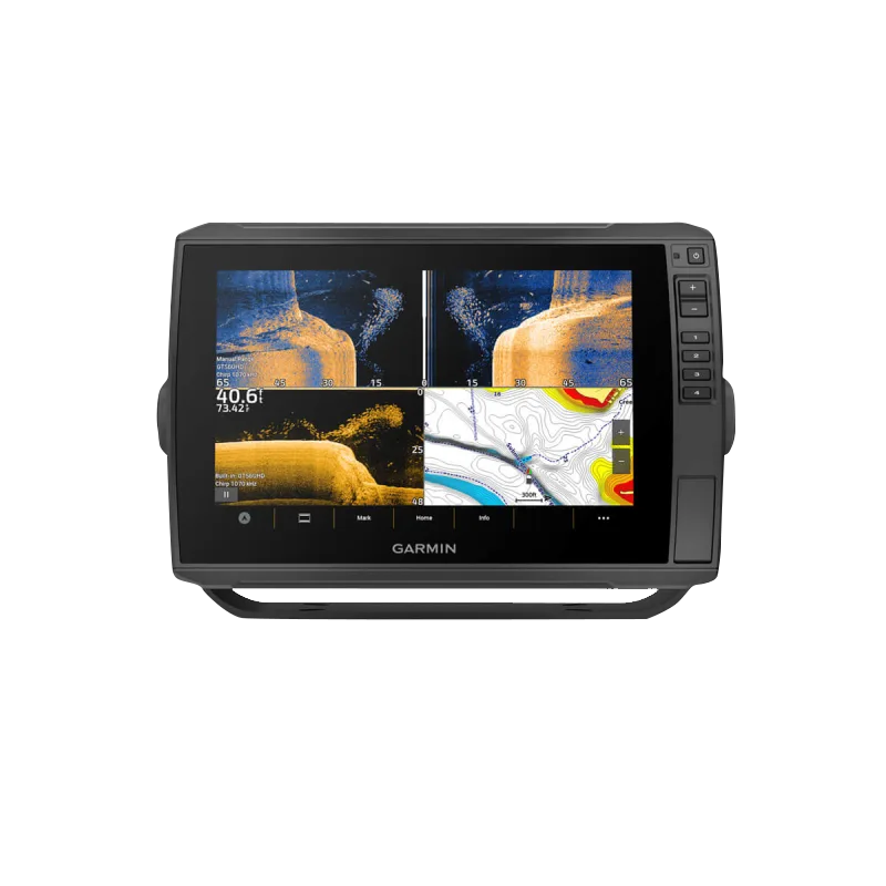
The Garmin ECHOMAP Ultra 2 106sv is a 10-inch dual-screen chartplotter engineered for serious anglers and recreational boaters who demand precision navigation and advanced underwater imaging on the water. Without requiring a transducer purchase, this unit ships ready to integrate with compatible sonar systems and delivers real-time fishfinding data, detailed mapping, and reliable positioning in freshwater and saltwater environments. The combination of a sunlight-readable touchscreen display and preloaded Navionics+ U.S. inland and coastal cartography creates a complete navigation platform that responds to how you actually fish and navigate.
Key Features
- 10-inch high-resolution dual touchscreen display with sunlight-readable technology for visibility in bright outdoor conditions
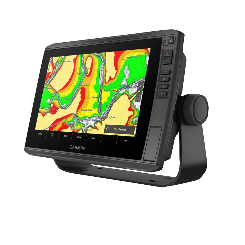
- Preloaded Garmin Navionics+ mapping with 1-foot depth contours for detailed underwater structure identification across U.S. inland lakes and coastal regions
- Multi-band GPS technology delivers positioning accuracy improvements up to 10 centimeters for reliable waypoint placement and route navigation
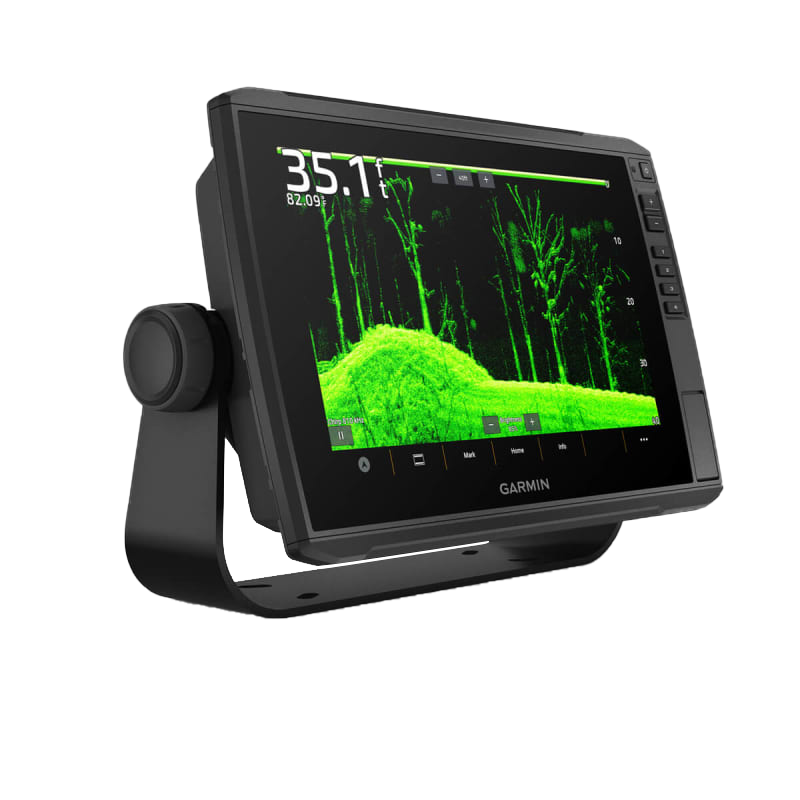
- Full compatibility with LiveScope real-time scanning sonar for live underwater views and fish tracking
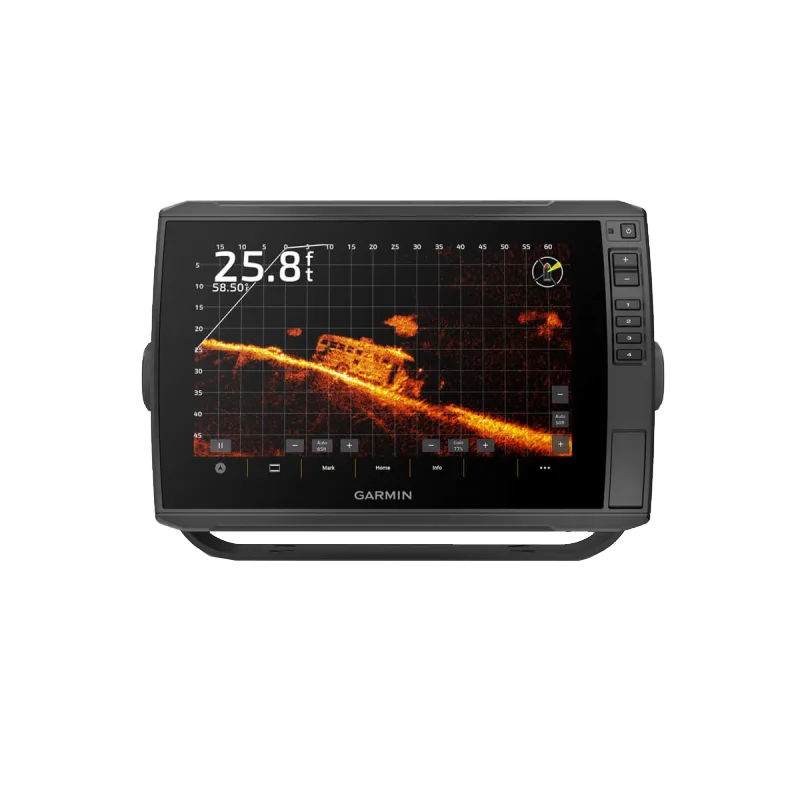
- Support for Ultra High-Definition ClearVü and SideVü scanning sonar alongside traditional CHIRP sonar technologies
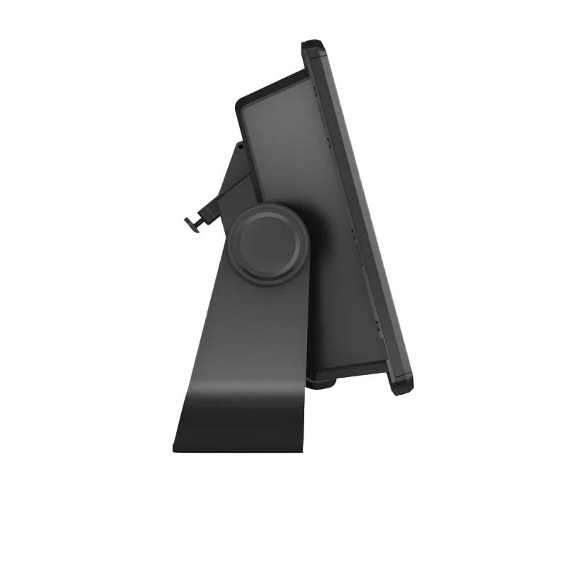
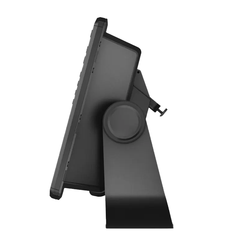
- Quick-disconnect bail mounting system rated for repeated removal and secure installation across multiple vessels
- ActiveCaptain app integration enables wireless map updates and user-generated content sharing without computer transfer
- Scratch-resistant touchscreen coating rated for extended durability in marine salt spray and abrasive environments
Data Insights
The ECHOMAP Ultra 2 106sv's multi-band GPS positioning accuracy of up to 10 centimeters represents a measurable improvement over single-frequency systems, particularly critical when marking precise structure in deep water or navigating narrow channels. The preloaded Navionics+ mapping database includes 1-foot contour intervals, which is essential for distinguishing between shallow shelves (8-12 feet) and deeper basins where fish often suspend. Users accessing the ActiveCaptain community contribute real-time waypoint data and depth verification, creating a continuously refined mapping layer that improves over time through crowdsourced field testing.
Usage Instructions
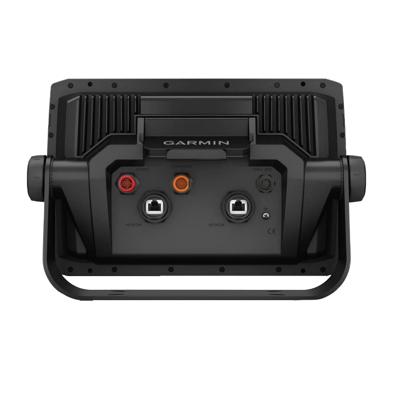
Begin by mounting the unit using the included quick-disconnect bail mount, securing it at an angle that minimizes glare and water splash while keeping the screen within arm's reach. Power on the device and access the mapping interface to load your fishing destination or navigation route. To enable sonar functionality, connect a compatible transducer via the appropriate cable port and calibrate the water temperature and bottom hardness settings within the sonar menu. Activate the ActiveCaptain app on your mobile device to sync mapping updates wirelessly; the unit downloads the latest chart corrections and community waypoints when docked on your home network. For LiveScope real-time sonar, install the compatible transducer according to Garmin's installation guide and pair it via the sonar configuration menu.
Design & Material
The ECHOMAP Ultra 2 106sv combines functional marine engineering with a compact footprint designed for center console, cabin cruiser, and even portable tournament setups. The unit's black composite housing resists fading from UV exposure and corrosion from salt spray, while the physical layout prioritizes quick access to critical controls during active fishing sessions.
- Durable composite housing engineered to withstand continuous marine salt spray exposure and temperature fluctuations from freezing to 140°F operating range
- Sunlight-readable IPS touchscreen with anti-glare coating and 1000-nit brightness for visibility in direct sunlight without sunshade accessories
- Scratch-resistant glass panel overlay protects the display from fishing line contact, fish handling, and abrasive water conditions
- Ergonomic side-mounted control buttons remain fully functional when wet and designed for operation while wearing gloves or using rod grips
- Compact 10-inch footprint (approximately 14 inches wide with bezel) fits standard helm spaces on center consoles and smaller cabin cruisers
- Quick-disconnect bail mount allows secure installation and removal in under 30 seconds without tools, enabling single-unit ownership across multiple vessels
Final Verdict
The Garmin ECHOMAP Ultra 2 106sv delivers a complete navigation and fishfinding solution without forcing you to purchase a transducer bundle you may not need. The combination of dual-screen architecture, multi-band GPS accuracy, and Navionics+ mapping creates immediate advantage on unfamiliar water, while LiveScope and advanced sonar compatibility ensure you're future-proofed as your skills advance. Whether you're tracking walleye on inland reservoirs or navigating coastal flats, this chartplotter handles both roles with the durability and precision that tournament anglers and weekend boaters depend on. Invest in the ECHOMAP Ultra 2 and gain the situational awareness that transforms fishing days into consistent, successful outings.


