


Garmin ECHOMAP Ultra 2 12" Chartplotters 126sv without Transducer; Includes Garmin Navionics+ U.S. Inland & Coastal Mapping (010-02882-00)
Garmin ECHOMAP Ultra 2 12" Chartplotters 126sv without Transducer; Includes Garmin Navionics+ U.S. Inland & Coastal Mapping (010-02882-00)
SKU: 010-02882-00
Stock bas
 WhatsApp
 SMS - Text us!
 Email Us!
 Help Desk

Avis
Spécifications

Dans la boîte
Power/data cable
Bail mount with quick release cradle
Protective sun cover
8-pin transducer to 12-pin sounder adapter cable Hardware
Documentation
Vous avez un vieux GPS qui traîne ? Le programme Trade In and Up de GPS Nation est un excellent moyen d'échanger votre ancien GPS usagé contre un crédit pour l'achat d'un nouveau GPS. Le choix vous appartient entièrement ! Nous avons simplifié et rationalisé le processus. Suivez ces étapes simples et vous serez sur la bonne voie pour recevoir un crédit pour votre tout nouveau GPS !
1. Obtenez un devis
Pour obtenir votre devis gratuit, indiquez le type, le fabricant, le modèle et l'état de votre GPS. Dans les 24 heures, vous recevrez un devis correspondant à la valeur de reprise de votre produit actuel. Le formulaire de reprise/d'échange de GPS se trouve au bas de cette page.
2. Expédiez votre/vos produit(s) pour le commerce
Après avoir accepté notre offre, emballez votre ou vos produits en toute sécurité et expédiez-les-nous à l'aide de l'étiquette d'expédition prépayée qui vous a été fournie. Nous vous enverrons un e-mail de confirmation lorsque votre échange arrivera à notre entrepôt. Vous disposez de 30 jours à compter de la date à laquelle vous avez terminé votre échange en ligne pour expédier le produit à GPS Nation.
3. Effectuez votre achat
Une fois que nous aurons reçu votre produit à notre entrepôt et que nous aurons validé l'état indiqué, nous vous enverrons un e-mail de confirmation. Si vous choisissez de recevoir un crédit pour un nouveau GPS sur gpsnation.com, votre crédit de magasin sera émis et vous serez libre de procéder à votre achat.
Manuel et garantie
 Garmin Warranty
Avis
Poser une question
Spécifications
Dans la boîte
Power/data cable
Bail mount with quick release cradle
Protective sun cover
8-pin transducer to 12-pin sounder adapter cable Hardware
Documentation
Programme d'échange
Vous avez un vieux GPS qui traîne ? Le programme Trade In and Up de GPS Nation est un excellent moyen d'échanger votre ancien GPS usagé contre un crédit pour l'achat d'un nouveau GPS. Le choix vous appartient entièrement ! Nous avons simplifié et rationalisé le processus. Suivez ces étapes simples et vous serez sur la bonne voie pour recevoir un crédit pour votre tout nouveau GPS !
1. Obtenez un devis
Pour obtenir votre devis gratuit, indiquez le type, le fabricant, le modèle et l'état de votre GPS. Dans les 24 heures, vous recevrez un devis correspondant à la valeur de reprise de votre produit actuel. Le formulaire de reprise/d'échange de GPS se trouve au bas de cette page.
2. Expédiez votre/vos produit(s) pour le commerce
Après avoir accepté notre offre, emballez votre ou vos produits en toute sécurité et expédiez-les-nous à l'aide de l'étiquette d'expédition prépayée qui vous a été fournie. Nous vous enverrons un e-mail de confirmation lorsque votre échange arrivera à notre entrepôt. Vous disposez de 30 jours à compter de la date à laquelle vous avez terminé votre échange en ligne pour expédier le produit à GPS Nation.
3. Effectuez votre achat
Une fois que nous aurons reçu votre produit à notre entrepôt et que nous aurons validé l'état indiqué, nous vous enverrons un e-mail de confirmation. Si vous choisissez de recevoir un crédit pour un nouveau GPS sur gpsnation.com, votre crédit de magasin sera émis et vous serez libre de procéder à votre achat.
Manuel et garantie
Aperçu
Garmin ECHOMAP Ultra 2 12" Chartplotter 126sv — Multi-Band GPS and UHD Sonar-Ready Navigation for Inland and Coastal Waters
Introduction
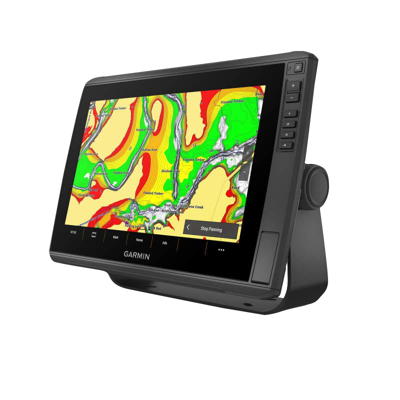
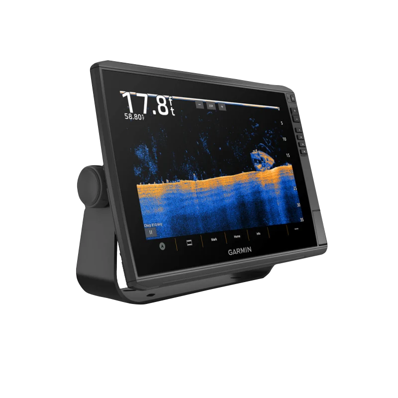
The Garmin ECHOMAP Ultra 2 126sv delivers professional-grade navigation and fish-finding capability in a 12-inch touchscreen platform built for anglers and boaters who demand precision. This chartplotter combines sunlight-readable display technology with preloaded Garmin Navionics+ mapping coverage across U.S. inland and coastal regions, offering depth range shading and 1-foot contours for detailed structure identification. The unit operates as a standalone GPS and chart system or integrates with advanced sonar technology for real-time underwater visualization when paired with compatible transducers.
Key Features
- 12-inch sunlight-readable touchscreen display with responsive controls and high-contrast color palettes for visibility in full daylight conditions
- Multi-band GPS technology delivering enhanced positioning accuracy and faster signal acquisition in challenging environments
- Preloaded Garmin Navionics+ mapping featuring U.S. inland and coastal waters with 1-foot contour depth intervals
- 1-year chart update subscription via the ActiveCaptain app with daily map refresh capability
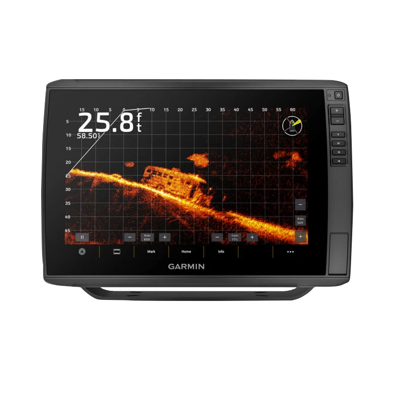
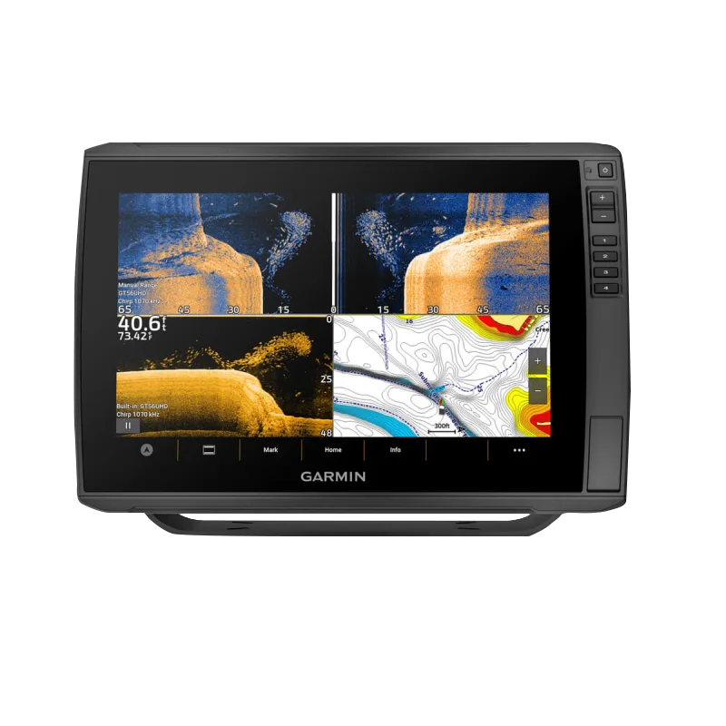
- LiveScope sonar compatibility enabling real-time underwater imaging when connected to compatible transducers (sold separately)
- Wireless networking capability for seamless information sharing between ECHOMAP Ultra 2 and UHD2 devices on the same network
- UHD sonar architecture supporting up to 50% improvement in target separation and fish identification accuracy with paired transducers
Data Insights
The ECHOMAP Ultra 2's UHD sonar processing delivers measurable performance gains in underwater target clarity. Anglers using compatible transducers report approximately 50% better target separation capabilities compared to standard sonar imaging, translating to improved ability to distinguish fish, vegetation, rocks, and bottom composition. The integrated Garmin Navionics+ mapping provides comprehensive bathymetric detail with 1-foot contour intervals, enabling precise location of structural changes that concentrate fish.
Usage Instructions
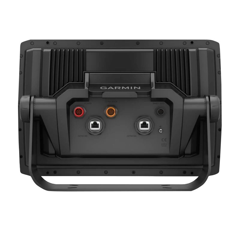
Mount the chartplotter securely using the quick-disconnect bail mount and connect to a 12-volt power source. Access the preloaded Garmin Navionics+ maps via the 12-inch touchscreen interface to locate fishing areas and plan navigation routes. For sonar functionality, connect a compatible LiveScope transducer or other Garmin sonar source using the device's networking ports. Maintain current charts and software features by updating regularly through the ActiveCaptain app, which delivers daily chart revisions throughout your 1-year subscription period.
Design and Material
The ECHOMAP Ultra 2 combines a compact, low-profile construction with marine-grade engineering. The unit integrates flush into console mounting systems with minimal footprint while maintaining full touchscreen accessibility. The water-resistant housing protects internal electronics from splashes and salt-spray exposure common in marine environments.
- Durable marine-grade housing engineered for salt and freshwater resistance
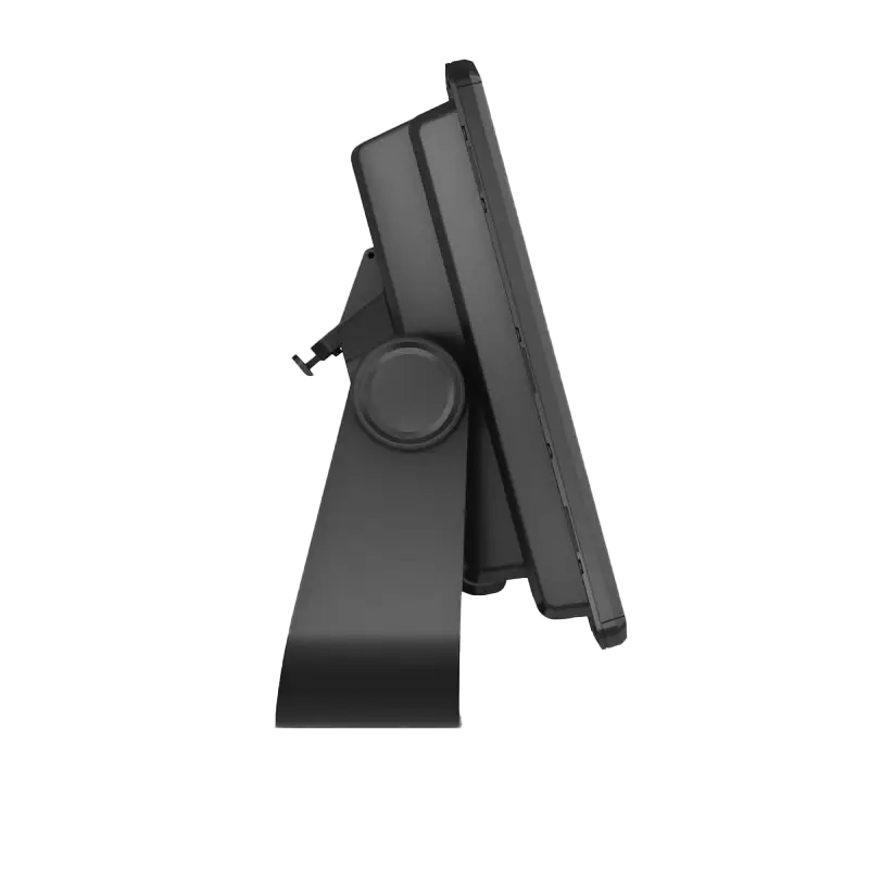
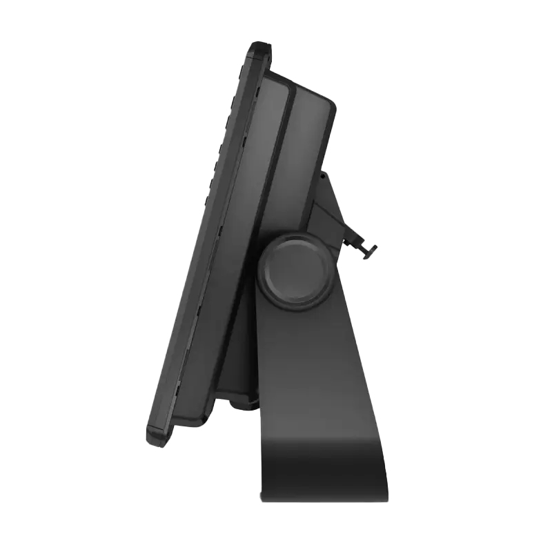
- Lightweight composite construction enabling straightforward installation and removal via quick-disconnect bail mount
- High-resolution 12-inch display with anti-glare technology and high-contrast color rendering for structure and target distinction
- Ergonomic side-mounted physical button panel for intuitive navigation and quick adjustments without relying solely on touchscreen
- Sleek profile designed to integrate seamlessly into modern and traditional boat console layouts
- Water-resistant gaskets and sealed connections protecting against moisture ingress and corrosion in harsh marine conditions
Final Verdict
The Garmin ECHOMAP Ultra 2 126sv stands as a complete navigation and mapping solution for serious anglers targeting inland reservoirs and coastal fisheries. Its combination of multi-band GPS positioning, 1-foot depth contour mapping, wireless networking, and LiveScope sonar compatibility addresses the core demands of modern fishing and boating without compromise. Whether navigating complex structure in lakes or verifying waypoints across coastal regions, this chartplotter delivers the accuracy and processing power that separates successful trips from frustrating ones. Choose the ECHOMAP Ultra 2 to gain a competitive advantage on the water.


