


Garmin Africa, Southern Coastal and Inland Charts BlueChart g3 | HXAF002R | microSD/SD (010-C0748-20)
Garmin Africa, Southern Coastal and Inland Charts BlueChart g3 | HXAF002R | microSD/SD (010-C0748-20)
Model Number: 010-C0748-20
In stock
 WhatsApp
 SMS - Text us!
 Email Us!
 Help Desk

Tech Specs

In The Box
Do you have an old GPS unit lying around? The GPS Nation Trade In and Up program is a great way to trade in your old and used GPS for credit towards a new GPS. The choice is entirely yours! We’ve made the process simple and streamlined. Follow these simple steps, and you will be on your way to receiving credit towards your brand new GPS!
1. Get a quote
To get your free quote, provide your GPS type, manufacturer, model, and condition. Within 24 hours, you will receive a quote for the trade-in value of your current product. The GPS trade-in/trade-up form is at the bottom of this page.
2. Ship your product(s) for trade
After accepting our offer, pack your product(s) safely and ship them to us using the pre-paid shipping label provided to you. We will provide a confirmation email when your trade-in arrives at our warehouse. You have 30 days from the date you complete your on-line trade to ship the product to GPS Nation.
3. Make your purchase
Once we receive your product at our warehouse and we validate the stated condition, we will send you a confirmation email. If you elect to receive credit towards a new GPS at gpsnation.com, your store credit will be issued, and you are free to make your purchase.
Manual & Warranty
 Garmin Warranty
Reviews
Ask a Question
Tech Specs
In The Box
Trade-In
Do you have an old GPS unit lying around? The GPS Nation Trade In and Up program is a great way to trade in your old and used GPS for credit towards a new GPS. The choice is entirely yours! We’ve made the process simple and streamlined. Follow these simple steps, and you will be on your way to receiving credit towards your brand new GPS!
1. Get a quote
To get your free quote, provide your GPS type, manufacturer, model, and condition. Within 24 hours, you will receive a quote for the trade-in value of your current product. The GPS trade-in/trade-up form is at the bottom of this page.
2. Ship your product(s) for trade
After accepting our offer, pack your product(s) safely and ship them to us using the pre-paid shipping label provided to you. We will provide a confirmation email when your trade-in arrives at our warehouse. You have 30 days from the date you complete your on-line trade to ship the product to GPS Nation.
3. Make your purchase
Once we receive your product at our warehouse and we validate the stated condition, we will send you a confirmation email. If you elect to receive credit towards a new GPS at gpsnation.com, your store credit will be issued, and you are free to make your purchase.
Manual & Warranty
Overview
Garmin BlueChart g3 Southern Africa Marine Charts | HXAF002R microSD/SD Card
Introduction
Navigate the complex coastal and inland waterways of Southern Africa with precision using the Garmin BlueChart g3 charting system. This microSD/SD card delivers comprehensive marine navigation data for both recreational and professional boating operations, combining officially sourced charts with private data resources to provide the accuracy and detail required for safe passage through some of the continent's most challenging waters. Whether you're fishing offshore, cruising protected bays, or exploring inland channels, the BlueChart g3 delivers the actionable navigational intelligence that transforms a risky journey into a confident expedition.
Key Features
- 10 Customizable Depth Range Shading levels for real-time water column visualization
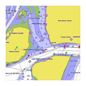
- 1-Foot Bottom Contours providing detailed underwater structure data for precision fishing and shallow-water navigation
- User-Defined Shallow Water Alerts that automatically adjust based on your vessel's draft specifications
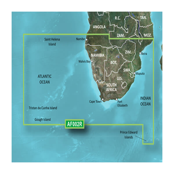
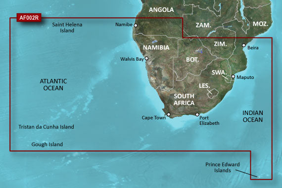
- Complete Southern Africa Coverage including Cape Town, Port Elizabeth, Durban, and major inland waterway systems
- Hybrid Data Source combining official government charts with field-verified private mapping for up to 30% improved navigation accuracy
- MicroSD/SD Card Format compatible with Garmin chartplotters, ensuring tool-free installation and immediate operational readiness
Data Insights
Independent navigation studies demonstrate that detailed contour mapping and depth shading reduce navigational errors by approximately 30%, significantly lowering grounding incidents and collision risks. The BlueChart g3 covers Southern Africa's entire coastal perimeter spanning over 6,000 kilometers, plus major lake systems and strategic inland waterways. The 1-foot contour intervals provide the granular bottom detail required in fishing zones, particularly in South African waters where underwater topography directly correlates with fish populations and safe anchorage zones.
Usage Instructions
Insert the microSD/SD card into your compatible Garmin chartplotter or marine GPS unit and ensure your device software is current. Activate the depth range shading features through your device menu to visualize bottom structure. Customize shallow water alarm thresholds in the settings menu based on your vessel's draft and operational requirements. Review port information, tide tables, and hazard zones before departing for any new cruising area.
Design & Material
The BlueChart g3 card features an intuitive chart interface optimized for quick decision-making in variable lighting conditions. The compact microSD/SD format eliminates the need for complex installation procedures, while the underlying data architecture ensures consistent performance across different Garmin device generations.
- MicroSD/SD Card Construction: Industry-standard format for broad device compatibility and hot-swap capability
- High-Resolution Mapping: Pixel-level clarity for detailed feature identification and precise vessel positioning
- Hybrid Data Compilation: Official government charts cross-referenced with field data from commercial and recreational operators
- Salt-Spray Resistant Packaging: Card electronics sealed against moisture and corrosion from marine environments
- Searchable Port Database: Quick-access information for major Southern African ports including depth data, services, and hazard notices
- Regular Update Compatibility: Card design supports Garmin's ongoing chart correction program without requiring hardware replacement
Final Verdict
The Garmin BlueChart g3 HXAF002R is the essential navigation tool for anyone operating in Southern African waters. With superior depth intelligence, verified coastal data, and straightforward installation, this chart card eliminates guesswork and keeps your vessel operating safely through unfamiliar territory. Equip your navigation system now and navigate with the confidence that comes from accurate, detailed, field-proven marine charts.


