


Garmin Australia and New Zealand Coastal Charts BlueChart g3 | HXPC024R | microSD/SD (010-C1020-20)
Garmin Australia and New Zealand Coastal Charts BlueChart g3 | HXPC024R | microSD/SD (010-C1020-20)
Model Number: 010-C1020-20
In stock
 WhatsApp
 SMS - Text us!
 Email Us!
 Help Desk

Tech Specs

In The Box
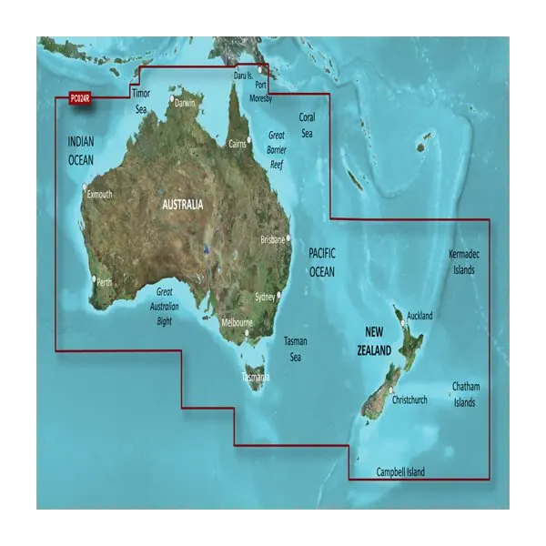
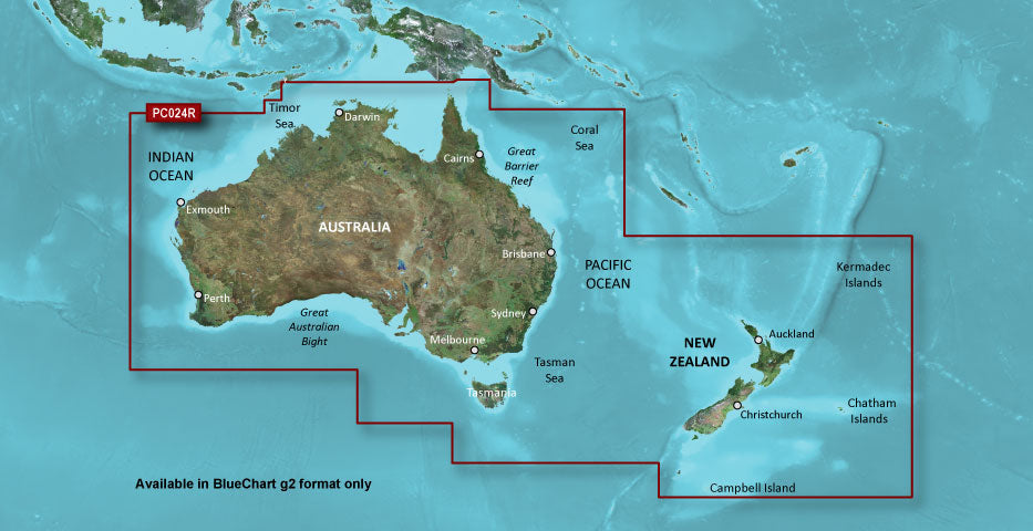
Australia and New Zealand Coastal Charts
Do you have an old GPS unit lying around? The GPS Nation Trade In and Up program is a great way to trade in your old and used GPS for credit towards a new GPS. The choice is entirely yours! We’ve made the process simple and streamlined. Follow these simple steps, and you will be on your way to receiving credit towards your brand new GPS!
1. Get a quote
To get your free quote, provide your GPS type, manufacturer, model, and condition. Within 24 hours, you will receive a quote for the trade-in value of your current product. The GPS trade-in/trade-up form is at the bottom of this page.
2. Ship your product(s) for trade
After accepting our offer, pack your product(s) safely and ship them to us using the pre-paid shipping label provided to you. We will provide a confirmation email when your trade-in arrives at our warehouse. You have 30 days from the date you complete your on-line trade to ship the product to GPS Nation.
3. Make your purchase
Once we receive your product at our warehouse and we validate the stated condition, we will send you a confirmation email. If you elect to receive credit towards a new GPS at gpsnation.com, your store credit will be issued, and you are free to make your purchase.
Manual & Warranty
 Garmin Warranty
Reviews
Ask a Question
Tech Specs
In The Box
Australia and New Zealand Coastal Charts
Trade-In
Do you have an old GPS unit lying around? The GPS Nation Trade In and Up program is a great way to trade in your old and used GPS for credit towards a new GPS. The choice is entirely yours! We’ve made the process simple and streamlined. Follow these simple steps, and you will be on your way to receiving credit towards your brand new GPS!
1. Get a quote
To get your free quote, provide your GPS type, manufacturer, model, and condition. Within 24 hours, you will receive a quote for the trade-in value of your current product. The GPS trade-in/trade-up form is at the bottom of this page.
2. Ship your product(s) for trade
After accepting our offer, pack your product(s) safely and ship them to us using the pre-paid shipping label provided to you. We will provide a confirmation email when your trade-in arrives at our warehouse. You have 30 days from the date you complete your on-line trade to ship the product to GPS Nation.
3. Make your purchase
Once we receive your product at our warehouse and we validate the stated condition, we will send you a confirmation email. If you elect to receive credit towards a new GPS at gpsnation.com, your store credit will be issued, and you are free to make your purchase.
Manual & Warranty
Overview
Garmin Australia and New Zealand Coastal Charts BlueChart g3 – Precision Maritime Navigation for HXPC024R Devices
Introduction
The Garmin Australia and New Zealand Coastal Charts BlueChart g3 (010-C1020-20) delivers precise, real-time navigational data across thousands of kilometers of coastline, enabling mariners to navigate Australia's extensive reef systems, New Zealand's fjords, and surrounding territorial waters with confidence. This microSD/SD card integrates Garmin and Navionics hydrographic data to provide the clarity and underwater detail needed for safe passage through shallow channels, port approaches, and open ocean routes.
Key Features
- Coverage spanning Australia, New Zealand, Tasmania, and major surrounding islands including the Great Barrier Reef and Kermadec Islands
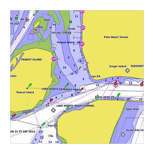
- Up to 10 distinct depth-range shading categories for intuitive underwater hazard identification
- 1-foot depth contours for precise understanding of underwater topography and structure
- Auto Guidance Technology that highlights safe passages and identifies obstacles, reducing route-planning time by up to 30 percent
- Shallow water shading with user-defined depth thresholds for customized navigation in coastal zones
- Over 24,000 nautical charts covering the entire region with major port coverage including Sydney, Melbourne, and Auckland
- High-resolution graphics optimized for readability on marine GPS displays
- Continuous automatic updates to reflect chart corrections and new navigational data
- microSD/SD card format compatible with Garmin chartplotters, fish finders, and handheld GPS units
Data Insights
Navigation routes planned using Auto Guidance technology reduce average travel time by approximately 30 percent through optimized waypoint sequencing and real-time obstacle avoidance. The integration of combined Garmin and Navionics source data delivers higher confidence in depth readings, reef delineation, and tidal corrections across the Australia-New Zealand region. Continuous depth shading visibility prevents unintended shallow-water encounters, a critical safety metric for vessels operating in regions where uncharted reefs and sandbanks pose navigational hazards.
Usage Instructions
Insert the microSD/SD card directly into your compatible Garmin device's memory slot. Once recognized, the chart card automatically loads regional charts and Auto Guidance data into your chartplotter's navigation menu. Select your destination using the device interface, then engage Auto Guidance to receive a highlighted safe-passage route with real-time depth and structure updates. User-defined shallow water depth thresholds can be adjusted through the device settings menu to match your vessel's draft and intended operating zone.
Design & Material
The BlueChart g3 card combines a compact microSD/SD form factor with marine-grade data encoding designed to survive saltwater environments. Its architecture prioritizes performance across Garmin's existing ecosystem of chartplotters and multifunction displays without requiring hardware upgrades or compatibility workarounds.
- Rugged microSD/SD card housing rated for temperature extremes and moisture exposure typical of marine environments
- Intuitive chart interface with customizable layers for depth shading, shallow water alerts, and hazard overlays
- Waterproof data encoding ensuring chart integrity after accidental water immersion
- Seamless compatibility with Garmin GPSMAP, echoMAP, and other compatible chartplotter platforms
- User-configurable waypoint storage, route presets, and depth alarm thresholds specific to individual vessel requirements
- Automatic update capability via Garmin's update infrastructure for chart corrections, revised depth data, and new navigational publications
Final Verdict
For mariners navigating the complex reef systems, narrow channels, and deep-water passages of Australia and New Zealand, the Garmin BlueChart g3 represents a critical investment in situational awareness and passage safety. The combination of comprehensive coverage, precise depth data, and Auto Guidance efficiency eliminates the guesswork from route planning while providing the granular detail required for coastal and offshore confidence. Purchase this chart card today to unlock faster routes, safer passages, and complete peace of mind across the entire Australasian maritime region.


