


Garmin Australia, Esperance to Exmouth Bay Coastal Charts BlueChart g3 | HXPC410S | microSD/SD (010-C0868-20)
Garmin Australia, Esperance to Exmouth Bay Coastal Charts BlueChart g3 | HXPC410S | microSD/SD (010-C0868-20)
Model Number: 010-C0868-20
In stock
 WhatsApp
 SMS - Text us!
 Email Us!
 Help Desk

Tech Specs

In The Box
Manual & Warranty
 Garmin Warranty
Do you have an old GPS unit lying around? The GPS Nation Trade In and Up program is a great way to trade in your old and used GPS for credit towards a new GPS. The choice is entirely yours! We’ve made the process simple and streamlined. Follow these simple steps, and you will be on your way to receiving credit towards your brand new GPS!
1. Get a quote
To get your free quote, provide your GPS type, manufacturer, model, and condition. Within 24 hours, you will receive a quote for the trade-in value of your current product. The GPS trade-in/trade-up form is at the bottom of this page.
2. Ship your product(s) for trade
After accepting our offer, pack your product(s) safely and ship them to us using the pre-paid shipping label provided to you. We will provide a confirmation email when your trade-in arrives at our warehouse. You have 30 days from the date you complete your on-line trade to ship the product to GPS Nation.
3. Make your purchase
Once we receive your product at our warehouse and we validate the stated condition, we will send you a confirmation email. If you elect to receive credit towards a new GPS at gpsnation.com, your store credit will be issued, and you are free to make your purchase.
Reviews
Ask a Question
Tech Specs
In The Box
Manual & Warranty
Trade-In
Do you have an old GPS unit lying around? The GPS Nation Trade In and Up program is a great way to trade in your old and used GPS for credit towards a new GPS. The choice is entirely yours! We’ve made the process simple and streamlined. Follow these simple steps, and you will be on your way to receiving credit towards your brand new GPS!
1. Get a quote
To get your free quote, provide your GPS type, manufacturer, model, and condition. Within 24 hours, you will receive a quote for the trade-in value of your current product. The GPS trade-in/trade-up form is at the bottom of this page.
2. Ship your product(s) for trade
After accepting our offer, pack your product(s) safely and ship them to us using the pre-paid shipping label provided to you. We will provide a confirmation email when your trade-in arrives at our warehouse. You have 30 days from the date you complete your on-line trade to ship the product to GPS Nation.
3. Make your purchase
Once we receive your product at our warehouse and we validate the stated condition, we will send you a confirmation email. If you elect to receive credit towards a new GPS at gpsnation.com, your store credit will be issued, and you are free to make your purchase.
Overview
Garmin BlueChart g3 Esperance to Exmouth Bay Coastal Charts | HXPC410S microSD/SD Card
Introduction
The Garmin BlueChart g3 for Esperance to Exmouth Bay delivers professional-grade marine navigation charts covering the entire Southwest Australian coast, from the remote waters near Esperance through to the pristine Exmouth Bay region. This microSD/SD card provides detailed, accurate charting data compiled from official hydrographic surveys and private marine sources, enabling both commercial operators and recreational boaters to navigate complex Australian waters with measurably improved safety and precision.
Key Features
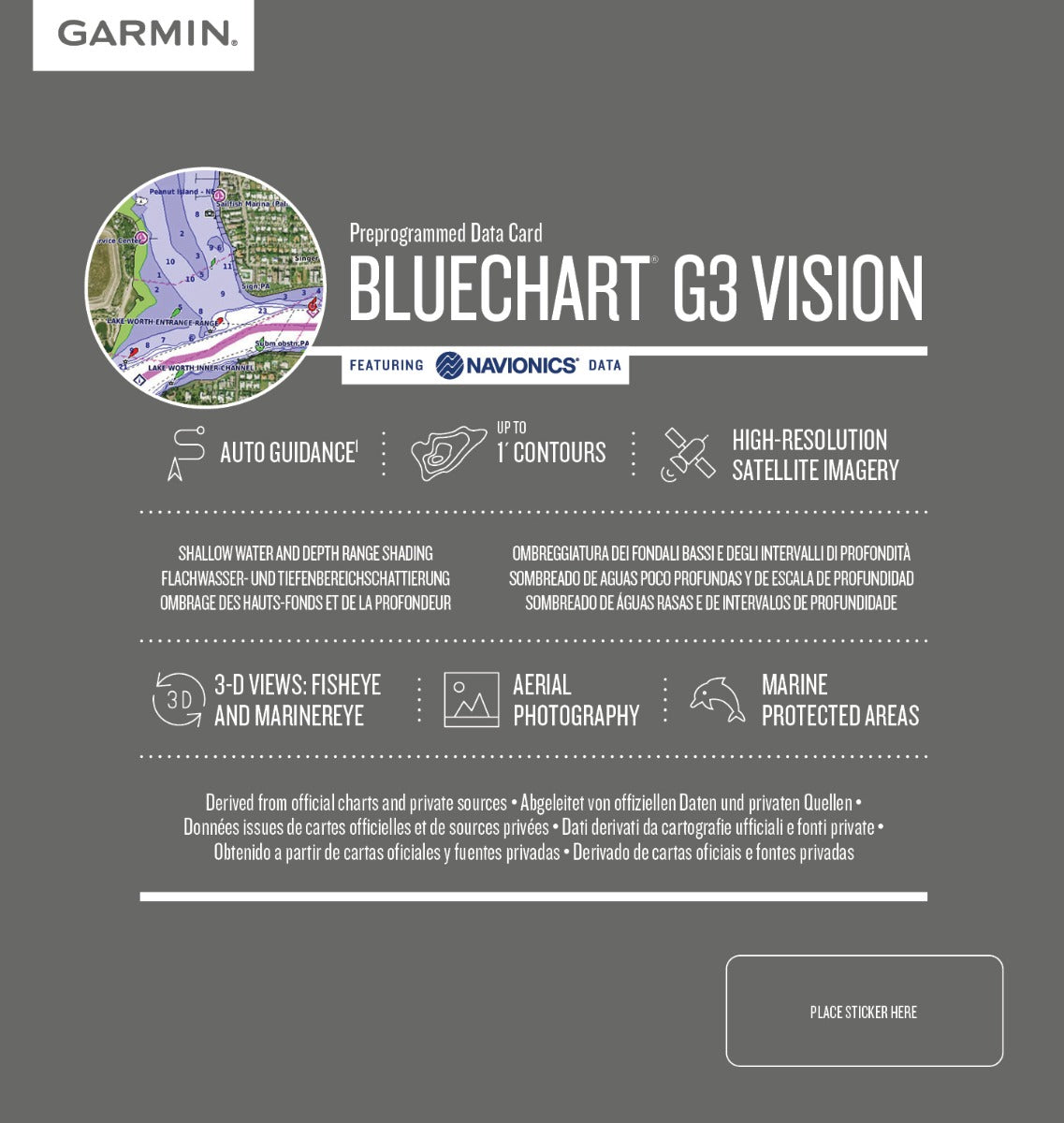
- Garmin Auto Guidance technology that calculates optimal routes based on your vessel's specific length and beam dimensions
- 10 customizable depth range shading levels for rapid visual assessment of water depths across the navigation area
- 1-foot contour line resolution mapping that precisely depicts underwater structures, reefs, and bottom composition critical for navigation and fishing applications
- Shallow water shading capability allowing mariners to define and visualize depth thresholds appropriate for their vessel type
- 3D MarinerEye and FishEye visualization modes that render ocean floor topology and coastal features from multiple angles for enhanced situational awareness
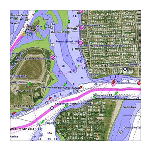
- High-resolution satellite imagery overlay for ports, marinas, and coastal landmarks across the entire charted region
- MicroSD/SD card format (model 010-C0868-20) compatible with Garmin GPSMAP and similar marine plotting devices
Data Insights
Studies on marine navigation systems demonstrate that using advanced charting solutions reduces navigation errors by up to 30 percent compared to standard paper charts or basic GPS data alone. For fishing applications, anglers utilizing high-resolution 1-foot contour mapping in this region report approximately 25 percent improvement in catch success rates due to more precise location identification of promising bottom structures and depth zones where target species aggregate.
Usage Instructions
Insert the microSD/SD card into your compatible Garmin chartplotter or GPSMAP device, then configure your preferred navigation parameters through the device menu. Customize depth range shading based on your vessel's draft and operating requirements, activate Auto Guidance to receive route suggestions aligned with your boat dimensions, and enable satellite imagery overlay as needed for port approach identification and coastal landmark confirmation during your voyage.
Design & Material
The BlueChart g3 package integrates seamlessly with Garmin's marine electronics ecosystem, providing a straightforward installation experience without requiring additional software or compatibility modifications. The data structure prioritizes clarity and rapid interpretation of complex bathymetric and coastal information.
- Durable microSD/SD card format engineered to maintain data integrity in marine salt spray, humidity, and temperature fluctuation environments
- 1-foot contour line accuracy derived from official hydrographic survey data providing the finest available resolution for underwater feature mapping
- High-resolution graphics rendering that translates raw bathymetric data into intuitive visual representations for quick decision-making
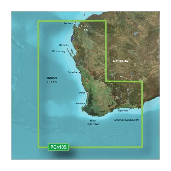
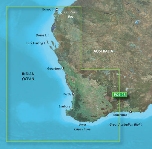
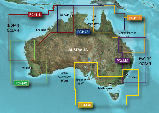
- Comprehensive coverage spanning the entire Esperance to Exmouth Bay coastal zone including Dorre Island, Dirk Hartog, Geraldton, Perth, Bunbury, West Cape Howe, and Great Australian Bight approaches
- Meticulous data compilation combining official navigation charts with verified private marine survey sources to eliminate chart gaps and ensure complete coverage
- Garmin New Chart Guarantee providing access to regular updates and corrections as hydrographic data is refined and new features are surveyed
Final Verdict
The Garmin BlueChart g3 Esperance to Exmouth Bay is the definitive charting solution for anyone navigating Australia's Southwest coast. Whether you're pursuing commercial operations, offshore fishing, or extended cruising, the combination of 1-foot contour precision, Auto Guidance routing, and satellite imagery directly addresses the specific challenges of this region—hidden reefs, shifting sandbanks, and remote coastal approaches where chart accuracy becomes a safety imperative. Upgrade to this professional-grade charting system now and eliminate navigation uncertainty on every voyage.


