


Garmin Bluechart G2 English Channel (010-C0760-20)
Garmin Bluechart G2 English Channel (010-C0760-20)
Model Number: 010-C0760-20
In stock
 WhatsApp
 SMS - Text us!
 Email Us!
 Help Desk


Tech Specs

In The Box
Garmin Bluechart G2 English Channel
Do you have an old GPS unit lying around? The GPS Nation Trade In and Up program is a great way to trade in your old and used GPS for credit towards a new GPS. The choice is entirely yours! We’ve made the process simple and streamlined. Follow these simple steps, and you will be on your way to receiving credit towards your brand new GPS!
1. Get a quote
To get your free quote, provide your GPS type, manufacturer, model, and condition. Within 24 hours, you will receive a quote for the trade-in value of your current product. The GPS trade-in/trade-up form is at the bottom of this page.
2. Ship your product(s) for trade
After accepting our offer, pack your product(s) safely and ship them to us using the pre-paid shipping label provided to you. We will provide a confirmation email when your trade-in arrives at our warehouse. You have 30 days from the date you complete your on-line trade to ship the product to GPS Nation.
3. Make your purchase
Once we receive your product at our warehouse and we validate the stated condition, we will send you a confirmation email. If you elect to receive credit towards a new GPS at gpsnation.com, your store credit will be issued, and you are free to make your purchase.
Manual & Warranty
 Garmin Warranty
Reviews
Ask a Question
Tech Specs
In The Box
Garmin Bluechart G2 English Channel
Trade-In
Do you have an old GPS unit lying around? The GPS Nation Trade In and Up program is a great way to trade in your old and used GPS for credit towards a new GPS. The choice is entirely yours! We’ve made the process simple and streamlined. Follow these simple steps, and you will be on your way to receiving credit towards your brand new GPS!
1. Get a quote
To get your free quote, provide your GPS type, manufacturer, model, and condition. Within 24 hours, you will receive a quote for the trade-in value of your current product. The GPS trade-in/trade-up form is at the bottom of this page.
2. Ship your product(s) for trade
After accepting our offer, pack your product(s) safely and ship them to us using the pre-paid shipping label provided to you. We will provide a confirmation email when your trade-in arrives at our warehouse. You have 30 days from the date you complete your on-line trade to ship the product to GPS Nation.
3. Make your purchase
Once we receive your product at our warehouse and we validate the stated condition, we will send you a confirmation email. If you elect to receive credit towards a new GPS at gpsnation.com, your store credit will be issued, and you are free to make your purchase.
Manual & Warranty
Overview
Garmin Bluechart G2 English Channel (010-C0760-20) Preprogrammed Marine Navigation Card
Introduction
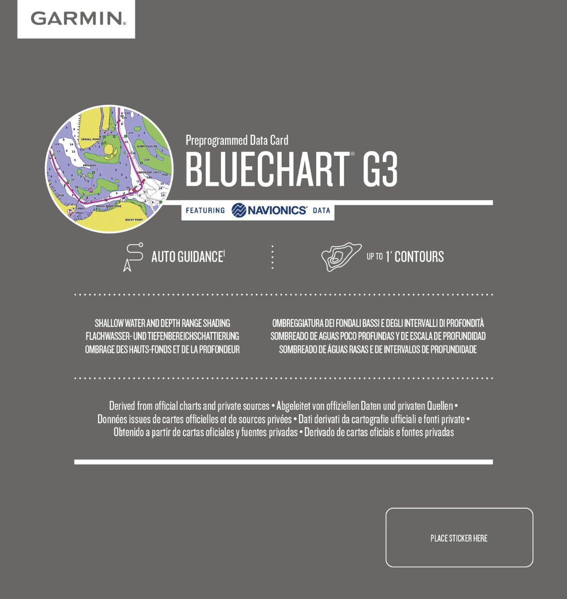
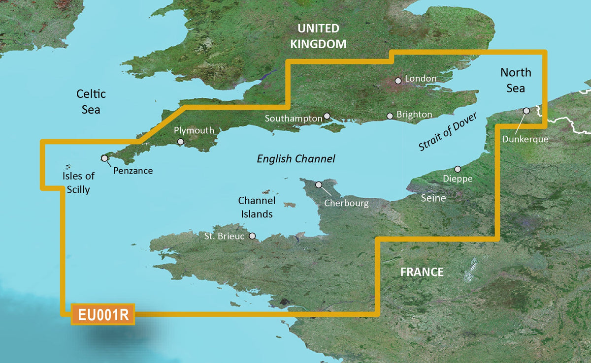
The Garmin Bluechart G2 English Channel is a preprogrammed marine chart data card that delivers real-time navigational intelligence for one of Europe's busiest and most complex waterways. This chart provides the precise bathymetric data and hazard identification needed to navigate confidently through the English Channel's tidal currents, shipping lanes, and rocky obstacles, whether you're piloting a sailboat, cruiser, or fishing vessel. Coverage extends from Felixstowe to the Isles of Scilly on the British coast and from Dunkerque to L'Aber Wrac'h on the French side, ensuring uninterrupted navigation across this critical maritime corridor.
Key Features
- Shaded depth contours for all water depths shallower than your personally defined safe depth thresholds, with visual highlighting to prevent grounding risks
- Detailed obstruction mapping including wrecks, submerged hazards, intertidal zones, and restricted shipping areas specific to Channel traffic regulations
- Spot soundings and 1-foot contour intervals for precise bottom characterization in shallow and variable-depth zones
- Complete navaids coverage including buoys, lighthouses, fog signals, and radio beacon frequencies aligned with official UK and French hydrographic data
- Port plans for major harbors and anchorages with approach routes, depth ranges, and mooring information
- Seamless 2-D and 3-D chart perspectives with zoom-level continuity and no chart boundary transitions
- Specialized fishing bottom-contour mode displaying depth soundings and seabed composition with reduced visual clutter
Data Insights
The Bluechart G2 dataset draws from official UK and French hydrographic surveys combined with Navionics private source verification, representing the most current publicly available chart data for this region. Garmin's cartography is derived from surveys and source material that account for over 65% of the world's published nautical charts, ensuring that obstacles, depth changes, and regulatory zones reflect recent updates rather than outdated paper chart editions.
Usage Instructions
Insert the 010-C0760-20 data card into a compatible Garmin marine GPS device (echoMAP or GPSMAP series). Verify your unit has the latest software version installed. Use HomePort planning software on your computer to preload waypoints, routes, and alerts before departure. In-device, toggle between 2-D overhead view for chart overview and 3-D "over the bow" view for approach navigation. Configure depth shading thresholds based on your vessel's draft before entering shallow water.
Design and Material
The Bluechart G2 English Channel combines high-resolution raster and vector cartography optimized for clarity on small marine display screens. Data processing prioritizes readability of shallow-water detail without overwhelming the user during active navigation.
- MicroSD data card format compatible with Garmin echoMAP, GPSMAP, and inReach devices
- High-resolution bathymetric rendering with distinct color coding for depth ranges and bottom type
- Overlay-capable chart layers allowing selective display of fishing contours, hazards, or traffic separation schemes
- Auto-guidance steering feature compatible with supported Garmin plotters for preset route following
- Periodic data updates available through Garmin's chart update service for corrections and new surveys
- Integrated regulatory and seasonal information including fishing closure areas and tidal stream diamonds
Final Verdict
The Garmin Bluechart G2 English Channel (010-C0760-20) is essential equipment for any skipper regularly transiting the Channel. Its depth contour detail, hazard identification, and regulatory overlays reduce navigation risk in one of Europe's highest-traffic maritime zones. Whether you're planning a day passage or establishing waypoints for seasonal cruising, this chart delivers the accuracy and detail that professional mariners and serious boaters demand. Order the 010-C0760-20 today and add verified chart data to your Garmin navigation system.


