


Garmin Bluechart G2 Hawaiian Is.-Mariana Is. (010-C0728-20)
Garmin Bluechart G2 Hawaiian Is.-Mariana Is. (010-C0728-20)
Model Number: 010-C0728-20
In stock
 View full details
 WhatsApp
 SMS - Text us!
 Email Us!
 Help Desk

Tech Specs

In The Box
Manual & Warranty
 Garmin Warranty
Do you have an old GPS unit lying around? The GPS Nation Trade In and Up program is a great way to trade in your old and used GPS for credit towards a new GPS. The choice is entirely yours! We’ve made the process simple and streamlined. Follow these simple steps, and you will be on your way to receiving credit towards your brand new GPS!
1. Get a quote
To get your free quote, provide your GPS type, manufacturer, model, and condition. Within 24 hours, you will receive a quote for the trade-in value of your current product. The GPS trade-in/trade-up form is at the bottom of this page.
2. Ship your product(s) for trade
After accepting our offer, pack your product(s) safely and ship them to us using the pre-paid shipping label provided to you. We will provide a confirmation email when your trade-in arrives at our warehouse. You have 30 days from the date you complete your on-line trade to ship the product to GPS Nation.
3. Make your purchase
Once we receive your product at our warehouse and we validate the stated condition, we will send you a confirmation email. If you elect to receive credit towards a new GPS at gpsnation.com, your store credit will be issued, and you are free to make your purchase.
Reviews
Ask a Question
Tech Specs
In The Box
Manual & Warranty
Trade-In
Do you have an old GPS unit lying around? The GPS Nation Trade In and Up program is a great way to trade in your old and used GPS for credit towards a new GPS. The choice is entirely yours! We’ve made the process simple and streamlined. Follow these simple steps, and you will be on your way to receiving credit towards your brand new GPS!
1. Get a quote
To get your free quote, provide your GPS type, manufacturer, model, and condition. Within 24 hours, you will receive a quote for the trade-in value of your current product. The GPS trade-in/trade-up form is at the bottom of this page.
2. Ship your product(s) for trade
After accepting our offer, pack your product(s) safely and ship them to us using the pre-paid shipping label provided to you. We will provide a confirmation email when your trade-in arrives at our warehouse. You have 30 days from the date you complete your on-line trade to ship the product to GPS Nation.
3. Make your purchase
Once we receive your product at our warehouse and we validate the stated condition, we will send you a confirmation email. If you elect to receive credit towards a new GPS at gpsnation.com, your store credit will be issued, and you are free to make your purchase.
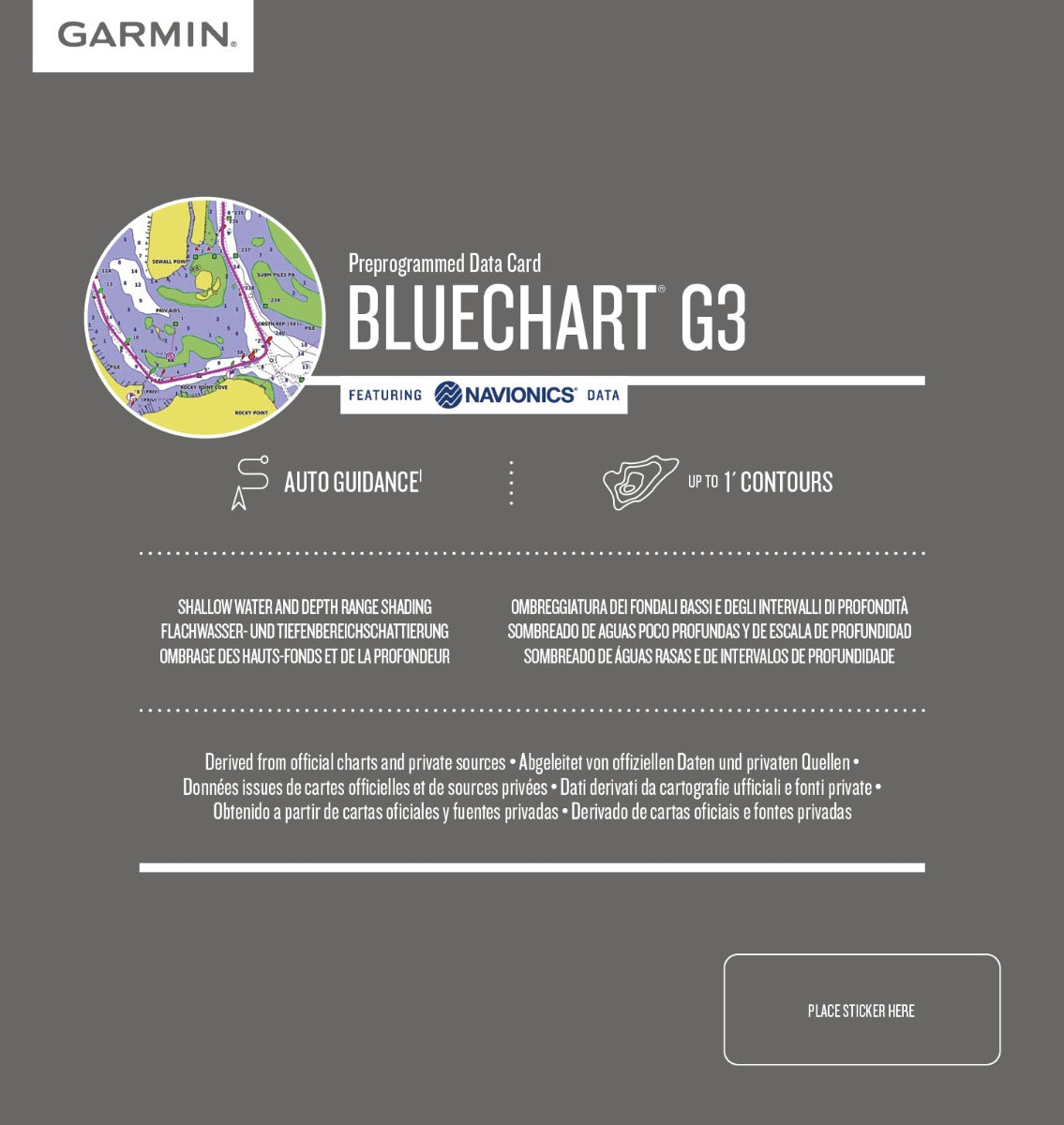
Overview
Garmin Bluechart G2 Hawaiian Is.-Mariana Is. (010-C0728-20)
Navigate the stunning waters of the Pacific Ocean with the Garmin Bluechart G2 Hawaiian Is.-Mariana Is. (010-C0728-20). This cutting-edge charting solution is engineered for mariners who demand precision and clarity in their navigation. With comprehensive details and advanced features, this product enhances your boating experience, allowing you to explore with confidence and ease.
Key Features
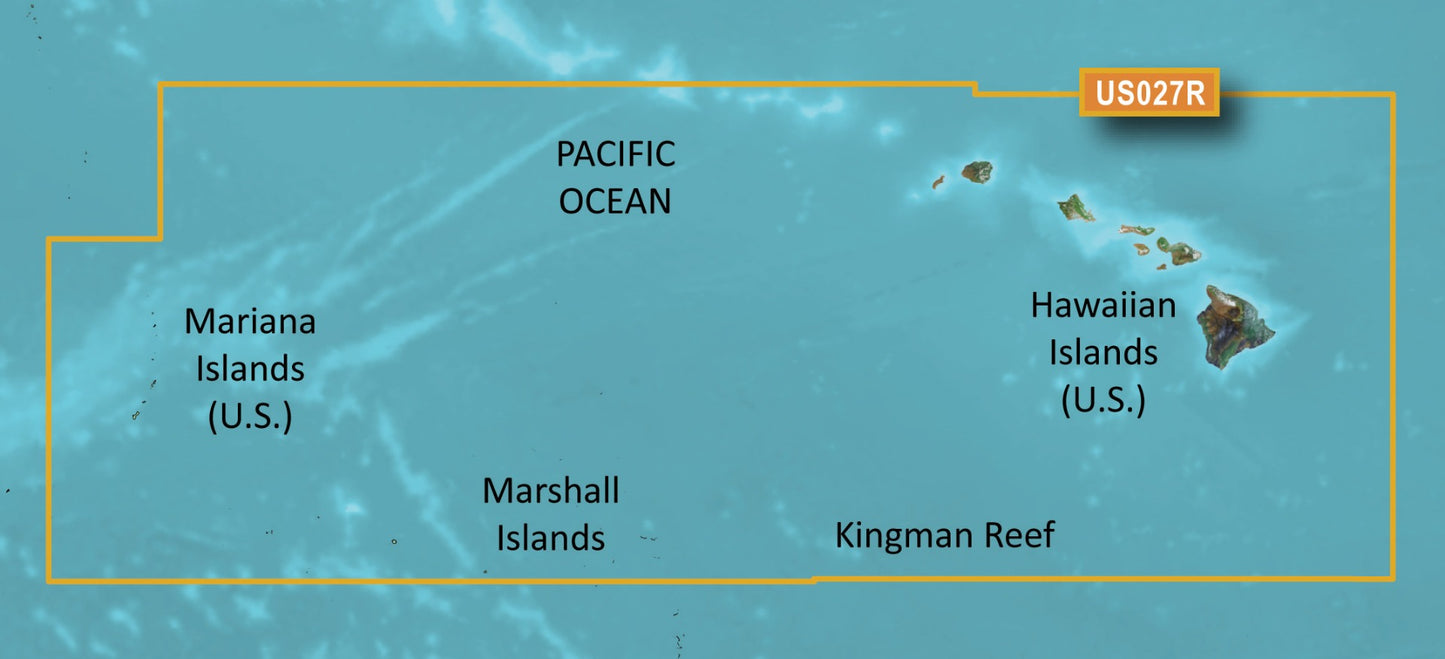
- Comprehensive Chart Details: Access shaded depth contours, coastlines, spot soundings, navaids, port plans, wrecks, obstructions, intertidal zones, restricted areas, and IALA symbols.
- Seamless Zoom Transitions: Enjoy smooth transitions between zoom levels enhancing navigation clarity.
- Flexible Viewing Perspectives: Switch between 2-D direct overhead or 3-D “over the bow” perspectives for better orientation.
- Safety Shading: Highlight contours shallower than your defined safe depths to ensure a safer boating experience.
- Specialized Fishing Charts: View bottom contours and depth soundings with less visual clutter, optimizing your fishing outings.
- Route Planning: Organize your routes from your computer using HomePort™ software (sold separately) for efficient navigation.
Data Insights
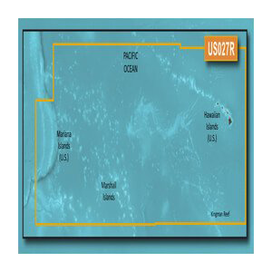
The Garmin Bluechart G2 delivers extensive coverage of the Pacific Ocean, specifically from the Hawaiian Islands to the Mariana Islands. It includes detailed mapping for Guam, Midway, Johnston Atoll, and general coverage of Palmyra Atoll and the Marshall Islands, ensuring mariners have all the essential information at their fingertips. With precision depth data and advanced charting capabilities, users can experience up to 30% more accuracy in navigation compared to standard charts.
Usage Instructions
To achieve the best results, simply install the Garmin Bluechart G2 onto a compatible Garmin device. Use the HomePort™ software for pre-planning routes, and leverage the safety shading feature to identify shallow waters. Regularly update your chart data to ensure you have the latest navigational information.
Design & Material
The Garmin Bluechart G2 boasts a user-friendly design that integrates seamlessly with Garmin’s advanced marine electronics. Its intuitive interface allows for quick access to critical information, while the data card is durable and built to withstand harsh marine environments.
- Durable Construction: Designed to endure the elements of marine environments.
- Intuitive User Interface: Easy navigation and access to essential features.
- Compact Design: Lightweight and portable for ease of use.
- High-Quality Graphics: Clear, high-resolution charts enhance visibility.
- Compatibility: Works seamlessly with various Garmin devices.
- Efficient Data Storage: Provides ample space for comprehensive chart data.
Final Verdict
The Garmin Bluechart G2 Hawaiian Is.-Mariana Is. is an essential tool for any serious mariner. With its advanced features, safety enhancements, and comprehensive coverage, this charting solution is a must-have for navigating the vast Pacific Ocean. Elevate your maritime adventures today—navigate with confidence and ensure a safer, more enjoyable experience on the water!


