


Garmin Bluechart G2 Vision East Coast Australia (010-C0756-00)
Garmin Bluechart G2 Vision East Coast Australia (010-C0756-00)
Model Number: 010-C0756-00
In stock
 WhatsApp
 SMS - Text us!
 Email Us!
 Help Desk

Tech Specs

In The Box
Do you have an old GPS unit lying around? The GPS Nation Trade In and Up program is a great way to trade in your old and used GPS for credit towards a new GPS. The choice is entirely yours! We’ve made the process simple and streamlined. Follow these simple steps, and you will be on your way to receiving credit towards your brand new GPS!
1. Get a quote
To get your free quote, provide your GPS type, manufacturer, model, and condition. Within 24 hours, you will receive a quote for the trade-in value of your current product. The GPS trade-in/trade-up form is at the bottom of this page.
2. Ship your product(s) for trade
After accepting our offer, pack your product(s) safely and ship them to us using the pre-paid shipping label provided to you. We will provide a confirmation email when your trade-in arrives at our warehouse. You have 30 days from the date you complete your on-line trade to ship the product to GPS Nation.
3. Make your purchase
Once we receive your product at our warehouse and we validate the stated condition, we will send you a confirmation email. If you elect to receive credit towards a new GPS at gpsnation.com, your store credit will be issued, and you are free to make your purchase.
Manual & Warranty
 Garmin Warranty
Reviews
Ask a Question
Tech Specs
In The Box
Trade-In
Do you have an old GPS unit lying around? The GPS Nation Trade In and Up program is a great way to trade in your old and used GPS for credit towards a new GPS. The choice is entirely yours! We’ve made the process simple and streamlined. Follow these simple steps, and you will be on your way to receiving credit towards your brand new GPS!
1. Get a quote
To get your free quote, provide your GPS type, manufacturer, model, and condition. Within 24 hours, you will receive a quote for the trade-in value of your current product. The GPS trade-in/trade-up form is at the bottom of this page.
2. Ship your product(s) for trade
After accepting our offer, pack your product(s) safely and ship them to us using the pre-paid shipping label provided to you. We will provide a confirmation email when your trade-in arrives at our warehouse. You have 30 days from the date you complete your on-line trade to ship the product to GPS Nation.
3. Make your purchase
Once we receive your product at our warehouse and we validate the stated condition, we will send you a confirmation email. If you elect to receive credit towards a new GPS at gpsnation.com, your store credit will be issued, and you are free to make your purchase.
Manual & Warranty
Overview
Garmin Bluechart G2 Vision East Coast Australia Preprogrammed Map Card
Introduction
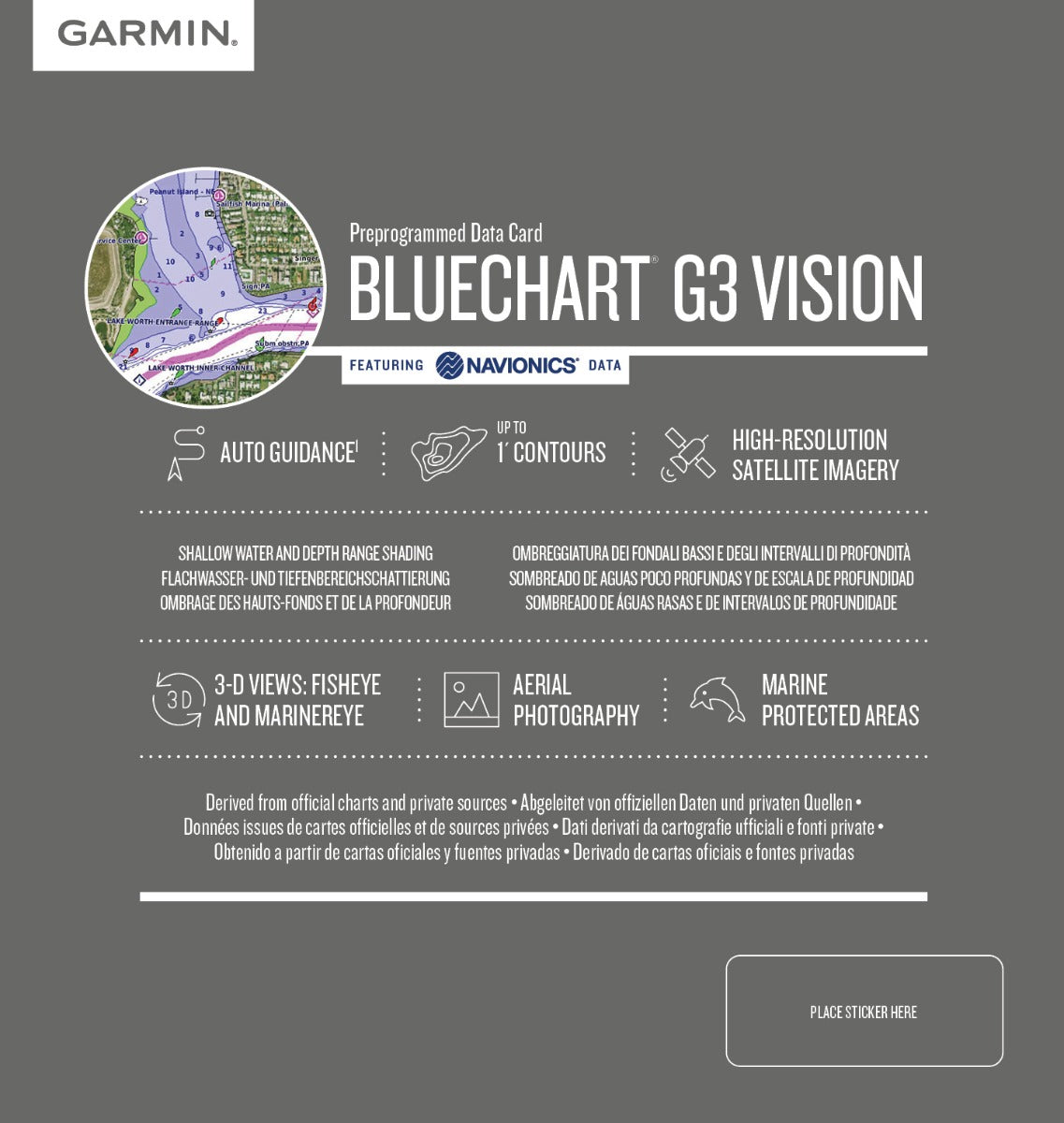
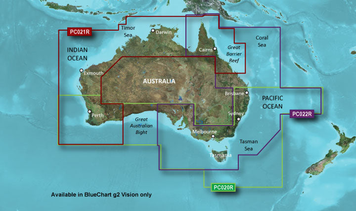
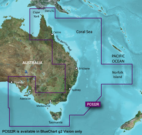
The Garmin Bluechart G2 Vision East Coast Australia (010-C0756-00) is a preprogrammed data card that transforms your Garmin chartplotter into a comprehensive marine navigation system for Australia's eastern coastline. This microSD card combines detailed bathymetric data, high-resolution satellite imagery, and advanced vessel guidance tools to reduce navigation uncertainty and improve decision-making in coastal and offshore waters. Whether you're planning routes around reef systems, entering unfamiliar harbors, or navigating complex tidal areas, this card delivers the information density and clarity professional and recreational boaters need for safer passage.
Key Features
- Up to 97% coverage of navigational aids, including buoys, lights, and markers along the East Coast
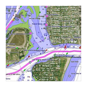
- Shaded depth contours with spot soundings for shallow-water identification and depth-range visualization
- 1-foot contour intervals in critical coastal zones for precise depth awareness
- High-resolution satellite imagery providing photorealistic coastal reference and landmark identification
- Aerial photography of key ports and navigational landmarks for enhanced situational awareness
- Auto Guidance technology that analyzes chart data to suggest optimal vessel passages and clearance routes
- 3-D FishEye and MarinerEye viewing modes offering immersive underwater and vessel-perspective visualization
- Marine protected area overlays for regulatory compliance and conservation-zone awareness
Data Insights
Garmin Bluechart G2 Vision data derives from official navigational charts and Navionics private sources, ensuring accuracy critical for coastal operations. The integration of bathymetric depth data with 1-foot contour intervals in shallow-water zones—where most navigation hazards concentrate—provides the granularity needed to identify underwater obstructions and safe anchorages. Users navigating the complex reef systems, bays, and estuaries of Australia's east coast benefit from contour-based depth shading that immediately highlights water too shallow for safe passage, a feature that reduces pilot workload during high-traffic or challenging conditions.
Usage Instructions
Insert the Bluechart G2 Vision microSD card into your compatible Garmin marine chartplotter or GPS device. Upon installation, the preprogrammed data loads automatically. Enable Auto Guidance on your route-planning screen to receive suggested passages based on your vessel's draft and charting preferences. Activate the Safety Shading feature to automatically shade water shallower than your defined safe depth. Periodically check for chart updates through Garmin's website to ensure your navigational data remains current, particularly before transitioning to new cruising grounds. Use the 3-D viewing modes to preview approach routes and understand bottom topology before arrival.
Design & Material
The Garmin Bluechart G2 Vision is a compact microSD card optimized for durability and seamless integration into Garmin's ecosystem of marine electronics. Its physical design minimizes footprint while maximizing data density, allowing full regional coverage on a single card without requiring supplementary storage or complex setup procedures.
- MicroSD card format compatible with Garmin chartplotters, tactile handhelds, and multifunction displays
- Preprogrammed regional coverage eliminating manual chart selection or data layering
- Robust data encryption and error-correction protocols ensure reliability in saltwater marine environments
- Seamless integration with Garmin's ecosystem—works with echosounder, autopilot, and radar systems on compatible units
- Professional-grade cartography sourced from official hydrographic surveys and private maritime databases
- Compact form factor fits standard microSD card slots without adapters or external housings
Final Verdict
If you navigate Australia's eastern waters regularly—whether fishing, cruising, or conducting commercial operations—the Garmin Bluechart G2 Vision East Coast Australia (010-C0756-00) is a critical navigation tool that bridges the gap between chart awareness and real-time decision-making. The combination of 97% navigational aid coverage, 1-foot depth contours, satellite imagery overlays, and Auto Guidance analysis gives you information parity with professional mariners and eliminates the uncertainty of outdated or incomplete charting. Equip your Garmin device today and navigate with the confidence that comes from comprehensive, accurate, and continuously updated coastal data.


