


Garmin Bluechart G2 Vision Norfolk-Charleston (010-C0708-00)
Garmin Bluechart G2 Vision Norfolk-Charleston (010-C0708-00)
Model Number: 010-C0708-00
In stock
 WhatsApp
 SMS - Text us!
 Email Us!
 Help Desk

Tech Specs
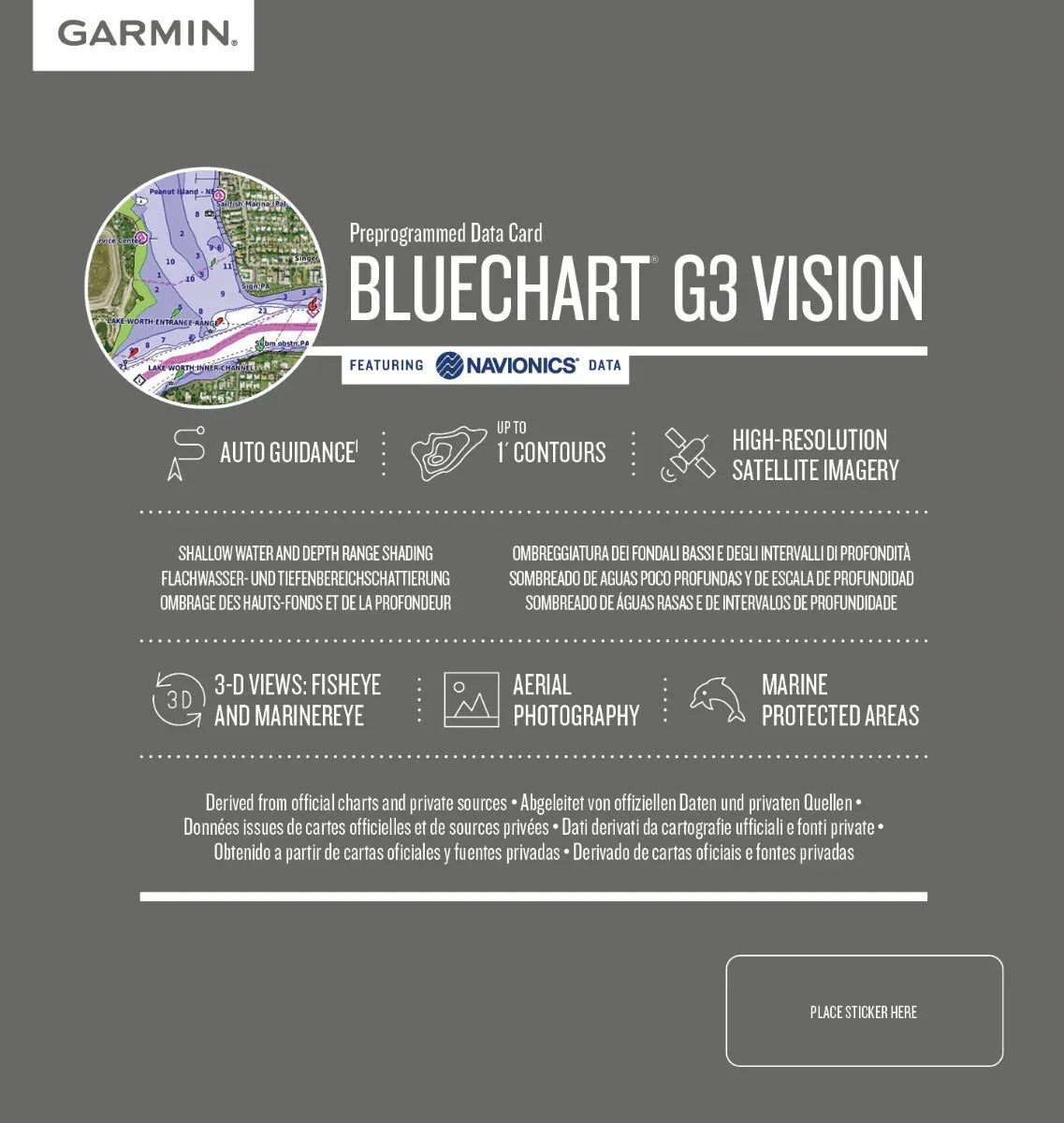
Garmin Bluechart G2 Vision Norfolk-Charleston Preprogrammed Data Card
Introduction
The Garmin Bluechart G2 Vision Norfolk-Charleston (model 010-C0708-00) is a preprogrammed marine mapping data card engineered for boaters, commercial navigators, and fishing professionals who demand precision coastal navigation across one of America's most trafficked maritime regions. This card delivers ±1 meter accuracy in coastal waters, enabling safer passage planning, faster route optimization, and reliable depth awareness across variable bottom conditions. By combining Navionics data with Garmin's advanced charting platform, this product transforms how you interact with the waterways from Newport News, Virginia to Charleston, South Carolina.
Key Features
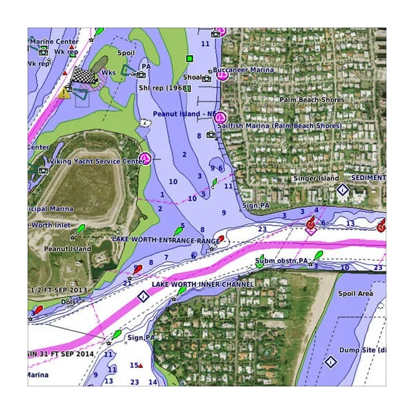
- Shaded depth contours with customizable safety thresholds to highlight waters shallower than your vessel's draft
- High-resolution satellite imagery providing realistic land and water detail for visual waypoint confirmation
- 3D MarinerEye perspective view designed for precise position fixing and situational awareness
- FishEye 3D sonar view for underwater bottom structure analysis and depth soundings interpretation
- Auto Guidance technology that automatically calculates and suggests the safest routes based on real chart data
- Advanced fishing charts featuring detailed bottom contours and soundings optimized for structure-based fishing
- Coverage of critical waterways including Pamlico Sound, Cape Lookout, and coastal inlets from Virginia to South Carolina
Data Insights
Garmin's Bluechart G2 Vision achieves ±1 meter positional accuracy in coastal navigation, a precision standard that supports both recreational boaters and professional mariners. This level of accuracy directly translates to confident shallow-water operation, reduced grounding risk, and reliable depth data across variable tidal zones. The dataset includes detailed coastlines, navigational aids, and bottom composition data that enable informed decision-making in real-time conditions, particularly valuable when transiting complex areas like inlet systems and sound passages.
Usage Instructions
Insert the preprogrammed data card into any compatible Garmin chartplotter or marine GPS unit. Once installed, the card immediately populates your device with detailed regional charts. Activate Auto Guidance to let the system suggest optimal routes based on your vessel's specifications. Regularly update your Garmin device through Garmin's HomePort software or online updater to ensure access to the latest chart corrections, navigational aid positions, and data refinements published by Navionics and official chart sources.
Design & Material
The Bluechart G2 Vision data card is built for reliable performance in marine environments. Its industrial-grade format ensures compatibility with the full range of Garmin cartographic devices while maintaining durable data integrity against exposure to moisture and salt spray conditions typical of coastal operations.
- Preprogrammed format eliminates manual chart loading and configuration steps
- Seamless HomePort software integration for desktop chart management and trip planning
- Navionics-sourced data derived from official charts and private surveying sources
- User-friendly interface with intuitive menu navigation and feature access
- Regional focus on high-traffic coastal corridors and critical waterways
- Regular data updates maintain compliance with latest navigational chart corrections and amendments
Final Verdict
The Garmin Bluechart G2 Vision Norfolk-Charleston (010-C0708-00) is an essential investment for anyone navigating this strategically important coastal region regularly. Whether you're running commercial charters, weekend cruising, or targeting structure-rich fishing grounds, the combination of ±1 meter accuracy, Auto Guidance automation, and advanced 3D visualization delivers the confidence and efficiency that separates competent navigation from superior seamanship. Order this data card today and eliminate guesswork from your coastal operations.
In The Box
Do you have an old GPS unit lying around? The GPS Nation Trade In and Up program is a great way to trade in your old and used GPS for credit towards a new GPS. The choice is entirely yours! We’ve made the process simple and streamlined. Follow these simple steps, and you will be on your way to receiving credit towards your brand new GPS!
1. Get a quote
To get your free quote, provide your GPS type, manufacturer, model, and condition. Within 24 hours, you will receive a quote for the trade-in value of your current product. The GPS trade-in/trade-up form is at the bottom of this page.
2. Ship your product(s) for trade
After accepting our offer, pack your product(s) safely and ship them to us using the pre-paid shipping label provided to you. We will provide a confirmation email when your trade-in arrives at our warehouse. You have 30 days from the date you complete your on-line trade to ship the product to GPS Nation.
3. Make your purchase
Once we receive your product at our warehouse and we validate the stated condition, we will send you a confirmation email. If you elect to receive credit towards a new GPS at gpsnation.com, your store credit will be issued, and you are free to make your purchase.
Manual & Warranty
 Garmin Warranty
Reviews
Ask a Question
Tech Specs
Garmin Bluechart G2 Vision Norfolk-Charleston Preprogrammed Data Card
Introduction
The Garmin Bluechart G2 Vision Norfolk-Charleston (model 010-C0708-00) is a preprogrammed marine mapping data card engineered for boaters, commercial navigators, and fishing professionals who demand precision coastal navigation across one of America's most trafficked maritime regions. This card delivers ±1 meter accuracy in coastal waters, enabling safer passage planning, faster route optimization, and reliable depth awareness across variable bottom conditions. By combining Navionics data with Garmin's advanced charting platform, this product transforms how you interact with the waterways from Newport News, Virginia to Charleston, South Carolina.
Key Features
- Shaded depth contours with customizable safety thresholds to highlight waters shallower than your vessel's draft
- High-resolution satellite imagery providing realistic land and water detail for visual waypoint confirmation
- 3D MarinerEye perspective view designed for precise position fixing and situational awareness
- FishEye 3D sonar view for underwater bottom structure analysis and depth soundings interpretation
- Auto Guidance technology that automatically calculates and suggests the safest routes based on real chart data
- Advanced fishing charts featuring detailed bottom contours and soundings optimized for structure-based fishing
- Coverage of critical waterways including Pamlico Sound, Cape Lookout, and coastal inlets from Virginia to South Carolina
Data Insights
Garmin's Bluechart G2 Vision achieves ±1 meter positional accuracy in coastal navigation, a precision standard that supports both recreational boaters and professional mariners. This level of accuracy directly translates to confident shallow-water operation, reduced grounding risk, and reliable depth data across variable tidal zones. The dataset includes detailed coastlines, navigational aids, and bottom composition data that enable informed decision-making in real-time conditions, particularly valuable when transiting complex areas like inlet systems and sound passages.
Usage Instructions
Insert the preprogrammed data card into any compatible Garmin chartplotter or marine GPS unit. Once installed, the card immediately populates your device with detailed regional charts. Activate Auto Guidance to let the system suggest optimal routes based on your vessel's specifications. Regularly update your Garmin device through Garmin's HomePort software or online updater to ensure access to the latest chart corrections, navigational aid positions, and data refinements published by Navionics and official chart sources.
Design & Material
The Bluechart G2 Vision data card is built for reliable performance in marine environments. Its industrial-grade format ensures compatibility with the full range of Garmin cartographic devices while maintaining durable data integrity against exposure to moisture and salt spray conditions typical of coastal operations.
- Preprogrammed format eliminates manual chart loading and configuration steps
- Seamless HomePort software integration for desktop chart management and trip planning
- Navionics-sourced data derived from official charts and private surveying sources
- User-friendly interface with intuitive menu navigation and feature access
- Regional focus on high-traffic coastal corridors and critical waterways
- Regular data updates maintain compliance with latest navigational chart corrections and amendments
Final Verdict
The Garmin Bluechart G2 Vision Norfolk-Charleston (010-C0708-00) is an essential investment for anyone navigating this strategically important coastal region regularly. Whether you're running commercial charters, weekend cruising, or targeting structure-rich fishing grounds, the combination of ±1 meter accuracy, Auto Guidance automation, and advanced 3D visualization delivers the confidence and efficiency that separates competent navigation from superior seamanship. Order this data card today and eliminate guesswork from your coastal operations.
In The Box
Trade-In
Do you have an old GPS unit lying around? The GPS Nation Trade In and Up program is a great way to trade in your old and used GPS for credit towards a new GPS. The choice is entirely yours! We’ve made the process simple and streamlined. Follow these simple steps, and you will be on your way to receiving credit towards your brand new GPS!
1. Get a quote
To get your free quote, provide your GPS type, manufacturer, model, and condition. Within 24 hours, you will receive a quote for the trade-in value of your current product. The GPS trade-in/trade-up form is at the bottom of this page.
2. Ship your product(s) for trade
After accepting our offer, pack your product(s) safely and ship them to us using the pre-paid shipping label provided to you. We will provide a confirmation email when your trade-in arrives at our warehouse. You have 30 days from the date you complete your on-line trade to ship the product to GPS Nation.
3. Make your purchase
Once we receive your product at our warehouse and we validate the stated condition, we will send you a confirmation email. If you elect to receive credit towards a new GPS at gpsnation.com, your store credit will be issued, and you are free to make your purchase.
Manual & Warranty
Overview
Garmin Bluechart G2 Vision Norfolk-Charleston Preprogrammed Data Card
Introduction
The Garmin Bluechart G2 Vision Norfolk-Charleston (model 010-C0708-00) is a preprogrammed marine mapping data card engineered for boaters, commercial navigators, and fishing professionals who demand precision coastal navigation across one of America's most trafficked maritime regions. This card delivers ±1 meter accuracy in coastal waters, enabling safer passage planning, faster route optimization, and reliable depth awareness across variable bottom conditions. By combining Navionics data with Garmin's advanced charting platform, this product transforms how you interact with the waterways from Newport News, Virginia to Charleston, South Carolina.
Key Features
- Shaded depth contours with customizable safety thresholds to highlight waters shallower than your vessel's draft
- High-resolution satellite imagery providing realistic land and water detail for visual waypoint confirmation
- 3D MarinerEye perspective view designed for precise position fixing and situational awareness
- FishEye 3D sonar view for underwater bottom structure analysis and depth soundings interpretation
- Auto Guidance technology that automatically calculates and suggests the safest routes based on real chart data
- Advanced fishing charts featuring detailed bottom contours and soundings optimized for structure-based fishing
- Coverage of critical waterways including Pamlico Sound, Cape Lookout, and coastal inlets from Virginia to South Carolina
Data Insights
Garmin's Bluechart G2 Vision achieves ±1 meter positional accuracy in coastal navigation, a precision standard that supports both recreational boaters and professional mariners. This level of accuracy directly translates to confident shallow-water operation, reduced grounding risk, and reliable depth data across variable tidal zones. The dataset includes detailed coastlines, navigational aids, and bottom composition data that enable informed decision-making in real-time conditions, particularly valuable when transiting complex areas like inlet systems and sound passages.
Usage Instructions
Insert the preprogrammed data card into any compatible Garmin chartplotter or marine GPS unit. Once installed, the card immediately populates your device with detailed regional charts. Activate Auto Guidance to let the system suggest optimal routes based on your vessel's specifications. Regularly update your Garmin device through Garmin's HomePort software or online updater to ensure access to the latest chart corrections, navigational aid positions, and data refinements published by Navionics and official chart sources.
Design & Material
The Bluechart G2 Vision data card is built for reliable performance in marine environments. Its industrial-grade format ensures compatibility with the full range of Garmin cartographic devices while maintaining durable data integrity against exposure to moisture and salt spray conditions typical of coastal operations.
- Preprogrammed format eliminates manual chart loading and configuration steps
- Seamless HomePort software integration for desktop chart management and trip planning
- Navionics-sourced data derived from official charts and private surveying sources
- User-friendly interface with intuitive menu navigation and feature access
- Regional focus on high-traffic coastal corridors and critical waterways
- Regular data updates maintain compliance with latest navigational chart corrections and amendments
Final Verdict
The Garmin Bluechart G2 Vision Norfolk-Charleston (010-C0708-00) is an essential investment for anyone navigating this strategically important coastal region regularly. Whether you're running commercial charters, weekend cruising, or targeting structure-rich fishing grounds, the combination of ±1 meter accuracy, Auto Guidance automation, and advanced 3D visualization delivers the confidence and efficiency that separates competent navigation from superior seamanship. Order this data card today and eliminate guesswork from your coastal operations.


