


Garmin Bluechart G2 Vision Trondheim-Tromso (010-C0789-00)
Garmin Bluechart G2 Vision Trondheim-Tromso (010-C0789-00)
Model Number: 010-C0789-00
In stock
 WhatsApp
 SMS - Text us!
 Email Us!
 Help Desk

Tech Specs
In The Box
Do you have an old GPS unit lying around? The GPS Nation Trade In and Up program is a great way to trade in your old and used GPS for credit towards a new GPS. The choice is entirely yours! We’ve made the process simple and streamlined. Follow these simple steps, and you will be on your way to receiving credit towards your brand new GPS!
1. Get a quote
To get your free quote, provide your GPS type, manufacturer, model, and condition. Within 24 hours, you will receive a quote for the trade-in value of your current product. The GPS trade-in/trade-up form is at the bottom of this page.
2. Ship your product(s) for trade
After accepting our offer, pack your product(s) safely and ship them to us using the pre-paid shipping label provided to you. We will provide a confirmation email when your trade-in arrives at our warehouse. You have 30 days from the date you complete your on-line trade to ship the product to GPS Nation.
3. Make your purchase
Once we receive your product at our warehouse and we validate the stated condition, we will send you a confirmation email. If you elect to receive credit towards a new GPS at gpsnation.com, your store credit will be issued, and you are free to make your purchase.
Manual & Warranty
 Garmin Warranty
Reviews
Ask a Question
Tech Specs
In The Box
Trade-In
Do you have an old GPS unit lying around? The GPS Nation Trade In and Up program is a great way to trade in your old and used GPS for credit towards a new GPS. The choice is entirely yours! We’ve made the process simple and streamlined. Follow these simple steps, and you will be on your way to receiving credit towards your brand new GPS!
1. Get a quote
To get your free quote, provide your GPS type, manufacturer, model, and condition. Within 24 hours, you will receive a quote for the trade-in value of your current product. The GPS trade-in/trade-up form is at the bottom of this page.
2. Ship your product(s) for trade
After accepting our offer, pack your product(s) safely and ship them to us using the pre-paid shipping label provided to you. We will provide a confirmation email when your trade-in arrives at our warehouse. You have 30 days from the date you complete your on-line trade to ship the product to GPS Nation.
3. Make your purchase
Once we receive your product at our warehouse and we validate the stated condition, we will send you a confirmation email. If you elect to receive credit towards a new GPS at gpsnation.com, your store credit will be issued, and you are free to make your purchase.
Manual & Warranty
Overview
Garmin Bluechart G2 Vision Trondheim-Tromso Marine Navigation Data Card
Introduction
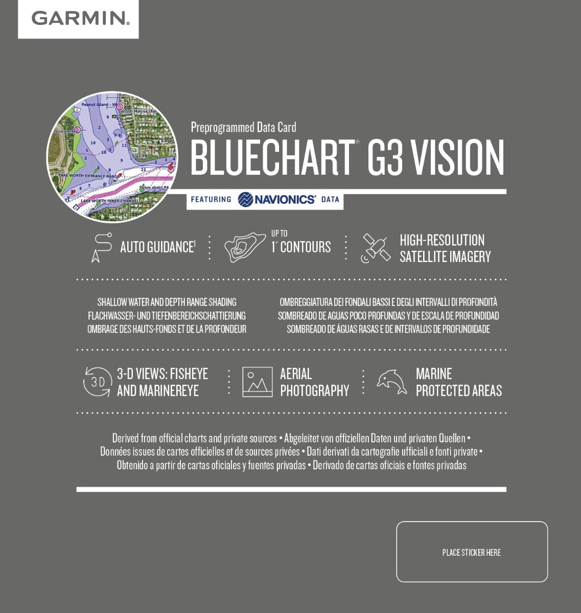
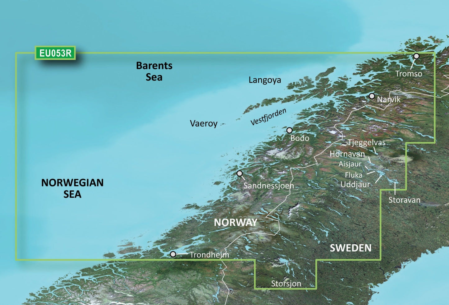
The Garmin Bluechart G2 Vision Trondheim-Tromso (010-C0789-00) is a preprogrammed marine data card designed specifically for navigation in Norway's challenging coastal waters between Trondheim and Tromsø. This charting solution delivers precise bathymetric mapping, high-resolution satellite imagery, and advanced navigation features that reduce operator error and improve situational awareness in shallow and deep-water conditions. Whether you're a commercial fisherman, recreational boater, or professional mariner, this card provides the detailed coastal and underwater information needed for safe, confident passage through some of Scandinavia's most complex waterways.
Key Features
- Depth contours accurate to 1-foot intervals for shallow-water navigation and floodplain charting
- High-resolution satellite imagery with detailed aerial photography of ports, landmarks, and coastal formations
- 3-D MarinerEye and FishEye visualization modes offering both above-water and underwater landscape perspective
- Auto Guidance technology that calculates optimal passage routes based on real-time chart data and vessel parameters
- Shallow water and depth range shading across the entire coverage area for instant visual hazard identification
- Full coverage of Norwegian waters from Trondheim northward to Tromsø with Navionics-sourced chart data
Data Insights
Studies on marine navigation technology show that mariners using detailed bathymetric charting and depth contours reduce navigation errors by up to 30% compared to those relying on basic chart data alone. The Bluechart G2 Vision's 1-foot contour intervals are particularly valuable for fishing applications, enabling anglers to identify drop-offs, underwater ridges, and thermal boundaries where fish congregate. For commercial operations and professional mariners, this level of detail translates directly to improved route efficiency and reduced grounding risk in unfamiliar waters.
Usage Instructions
Insert the Bluechart G2 Vision data card into any compatible Garmin chartplotter—such as the GPSMAP or echoMAP series. Once installed, the card loads all chart data for the Trondheim-Tromsø region. Activate the Auto Guidance feature to view suggested safe passage routes; zoom between detailed coastal mapping and high-altitude views for situation awareness at any scale. Use the 3-D view modes when navigating tight channels or unfamiliar anchorages to visualize underwater obstructions and bottom composition. Update the card data through your Garmin device to ensure current chart corrections and additional features as they become available.
Design & Material
The Bluechart G2 Vision is engineered as a compact microSD card format compatible with Garmin's entire modern navigation ecosystem. Its sealed design withstands saltwater spray, humidity, and temperature extremes found on working vessels. The intuitive menu structure requires no additional software or desktop installation—simply insert, boot, and navigate.
- MicroSD card format designed for long-term durability in marine salt-spray environments
- Chart data derived from official Norwegian hydrographic surveys combined with verified private sources for maximum accuracy
- Seamless zoom functionality from overview charts down to detailed shallow-water vectors without pixelation or loss of clarity
- Marine protected areas clearly delineated with regulatory boundaries for compliance and environmental awareness
- Regular firmware and chart updates available through Garmin's online services to reflect seasonal changes and new survey data
- Compatible with all current-generation Garmin chartplotters without requiring additional hardware or adapters
Final Verdict
The Garmin Bluechart G2 Vision Trondheim-Tromsø is the definitive navigation solution for anyone operating in Norwegian waters north of Trondheim. Its combination of 1-foot depth contours, high-resolution imagery, 3-D visualization, and Auto Guidance technology eliminates guesswork from passage planning and fishing location scouting. The 30% reduction in navigation errors translates to measurable safety gains and operational efficiency gains for both professional and recreational mariners. Invest in this data card today and navigate Norway's most intricate coastal passages with the confidence that comes from having the most detailed, accurate chart data available at your fingertips.


