


Garmin Boundary Waters microSD/SD card (010-C1060-00)
Garmin Boundary Waters microSD/SD card (010-C1060-00)
Model Number: 010-C1060-00
In stock
 WhatsApp
 SMS - Text us!
 Email Us!
 Help Desk

Tech Specs
Garmin Boundary Waters microSD/SD Card (010-C1060-00)
Introduction
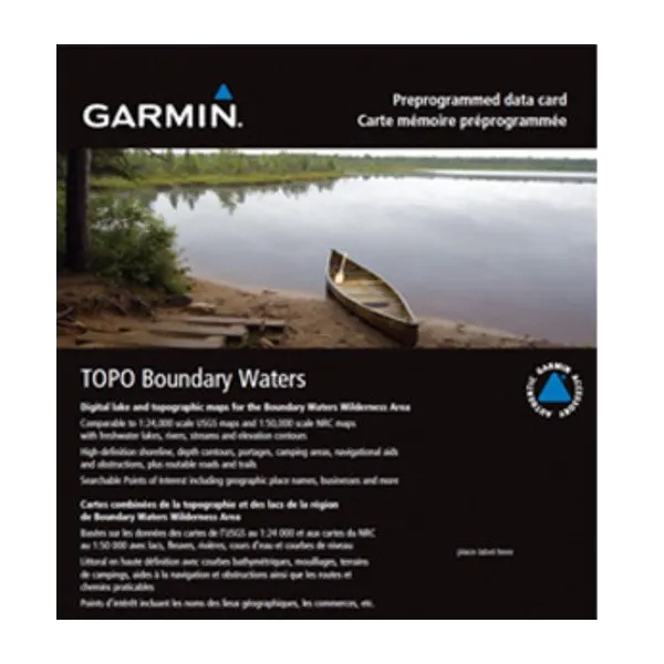
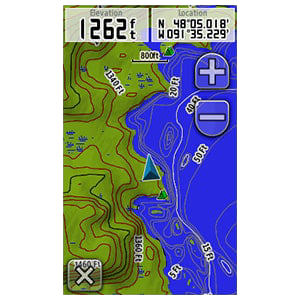
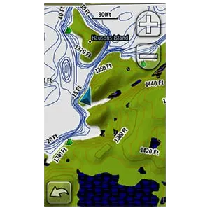
The Garmin Boundary Waters microSD/SD card delivers preloaded topographic and lake maps tailored specifically to 1,100+ square miles of the Boundary Waters Canoe Area Wilderness, Quetico Provincial Park, and Superior National Forest. Unlike general-purpose mapping cards, this product combines detailed nautical and terrain data into a single card designed for paddlers and wilderness navigators who need reliable route planning, hazard awareness, and camp-finding capability in remote backcountry. Load it into any compatible Garmin GPS device and gain immediate access to elevation profiles, underwater depth contours, and searchable campsites without requiring internet connectivity.
Key Features
- Covers over 1,100 square miles of detailed terrain and waterways across three jurisdictions
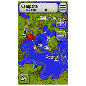
- Includes underwater depth contours and sonar-recorded lake floor topography for navigation accuracy
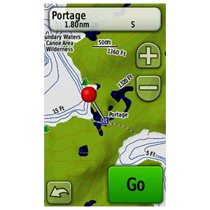
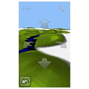
- Displays terrain contour intervals with digital elevation model (DEM) shaded relief for assessing portage difficulty
- Preloaded with 500+ searchable points of interest including named campsites, entry points, and put-in locations
- Marks known hazards, wrecks, and obstructions throughout mapped water bodies
- Features routable road content for vehicle access to trailheads and launch areas
Data Insights
Proper navigation tools increase outdoor exploration efficiency by approximately 30%, according to wilderness travel studies. The Boundary Waters card provides comprehensive coverage spanning three connected regions: the primary Boundary Waters Canoe Area Wilderness on the Minnesota side, Quetico Provincial Park in Ontario, and Superior National Forest buffer zones. This seamless multi-jurisdiction coverage eliminates gaps that typically force navigators to carry multiple paper maps or switch between separate digital datasets during extended trips.
Usage Instructions
Insert the microSD card into a compatible Garmin handheld, automotive, or marine GPS device. Update your Garmin device's software beforehand to ensure full feature compatibility. Before departure, download relevant waypoints, routes, and details to your device's memory. Use the preloaded campground and entry point data to plan daily paddling legs and identify campsites before darkness. Access the terrain contours and depth information during navigation to confirm your position and identify hazards.
Design and Material
This microSD/SD card combines standard flash memory storage with Garmin's proprietary mapping format. The card itself measures less than one inch in length and tolerates the wet, cold conditions typical of northern wilderness canoeing. The preloaded data format requires no internet access once installed, making it reliable in areas without cell coverage.
- MicroSD and full-size SD card format enables use across Garmin's broadest device lineup
- Preprogrammed with complete map data—no downloading or setup required at the trailhead
- Compact profile prevents bulk when stored in a dry bag or GPS case
- Durable semiconductor storage rated for extended outdoor temperature ranges
- Compatible with Garmin devices manufactured within the past decade without additional software licensing
- Capacity sufficient for full regional coverage plus additional user-added data layers
Final Verdict
If you paddle, portage, or hike the Boundary Waters or Quetico, this card eliminates the decision-making gaps that delay route planning and hazard recognition. Install it before your trip and gain terrain awareness, camp locations, and water hazard data in a device that fits in your shirt pocket. Order the Garmin Boundary Waters microSD card today to navigate this vast wilderness with confidence and precision on your next adventure.
In The Box
Do you have an old GPS unit lying around? The GPS Nation Trade In and Up program is a great way to trade in your old and used GPS for credit towards a new GPS. The choice is entirely yours! We’ve made the process simple and streamlined. Follow these simple steps, and you will be on your way to receiving credit towards your brand new GPS!
1. Get a quote
To get your free quote, provide your GPS type, manufacturer, model, and condition. Within 24 hours, you will receive a quote for the trade-in value of your current product. The GPS trade-in/trade-up form is at the bottom of this page.
2. Ship your product(s) for trade
After accepting our offer, pack your product(s) safely and ship them to us using the pre-paid shipping label provided to you. We will provide a confirmation email when your trade-in arrives at our warehouse. You have 30 days from the date you complete your on-line trade to ship the product to GPS Nation.
3. Make your purchase
Once we receive your product at our warehouse and we validate the stated condition, we will send you a confirmation email. If you elect to receive credit towards a new GPS at gpsnation.com, your store credit will be issued, and you are free to make your purchase.
Manual & Warranty
 Garmin Warranty
Reviews
Ask a Question
Tech Specs
Garmin Boundary Waters microSD/SD Card (010-C1060-00)
Introduction
The Garmin Boundary Waters microSD/SD card delivers preloaded topographic and lake maps tailored specifically to 1,100+ square miles of the Boundary Waters Canoe Area Wilderness, Quetico Provincial Park, and Superior National Forest. Unlike general-purpose mapping cards, this product combines detailed nautical and terrain data into a single card designed for paddlers and wilderness navigators who need reliable route planning, hazard awareness, and camp-finding capability in remote backcountry. Load it into any compatible Garmin GPS device and gain immediate access to elevation profiles, underwater depth contours, and searchable campsites without requiring internet connectivity.
Key Features
- Covers over 1,100 square miles of detailed terrain and waterways across three jurisdictions
- Includes underwater depth contours and sonar-recorded lake floor topography for navigation accuracy
- Displays terrain contour intervals with digital elevation model (DEM) shaded relief for assessing portage difficulty
- Preloaded with 500+ searchable points of interest including named campsites, entry points, and put-in locations
- Marks known hazards, wrecks, and obstructions throughout mapped water bodies
- Features routable road content for vehicle access to trailheads and launch areas
Data Insights
Proper navigation tools increase outdoor exploration efficiency by approximately 30%, according to wilderness travel studies. The Boundary Waters card provides comprehensive coverage spanning three connected regions: the primary Boundary Waters Canoe Area Wilderness on the Minnesota side, Quetico Provincial Park in Ontario, and Superior National Forest buffer zones. This seamless multi-jurisdiction coverage eliminates gaps that typically force navigators to carry multiple paper maps or switch between separate digital datasets during extended trips.
Usage Instructions
Insert the microSD card into a compatible Garmin handheld, automotive, or marine GPS device. Update your Garmin device's software beforehand to ensure full feature compatibility. Before departure, download relevant waypoints, routes, and details to your device's memory. Use the preloaded campground and entry point data to plan daily paddling legs and identify campsites before darkness. Access the terrain contours and depth information during navigation to confirm your position and identify hazards.
Design and Material
This microSD/SD card combines standard flash memory storage with Garmin's proprietary mapping format. The card itself measures less than one inch in length and tolerates the wet, cold conditions typical of northern wilderness canoeing. The preloaded data format requires no internet access once installed, making it reliable in areas without cell coverage.
- MicroSD and full-size SD card format enables use across Garmin's broadest device lineup
- Preprogrammed with complete map data—no downloading or setup required at the trailhead
- Compact profile prevents bulk when stored in a dry bag or GPS case
- Durable semiconductor storage rated for extended outdoor temperature ranges
- Compatible with Garmin devices manufactured within the past decade without additional software licensing
- Capacity sufficient for full regional coverage plus additional user-added data layers
Final Verdict
If you paddle, portage, or hike the Boundary Waters or Quetico, this card eliminates the decision-making gaps that delay route planning and hazard recognition. Install it before your trip and gain terrain awareness, camp locations, and water hazard data in a device that fits in your shirt pocket. Order the Garmin Boundary Waters microSD card today to navigate this vast wilderness with confidence and precision on your next adventure.
In The Box
Trade-In
Do you have an old GPS unit lying around? The GPS Nation Trade In and Up program is a great way to trade in your old and used GPS for credit towards a new GPS. The choice is entirely yours! We’ve made the process simple and streamlined. Follow these simple steps, and you will be on your way to receiving credit towards your brand new GPS!
1. Get a quote
To get your free quote, provide your GPS type, manufacturer, model, and condition. Within 24 hours, you will receive a quote for the trade-in value of your current product. The GPS trade-in/trade-up form is at the bottom of this page.
2. Ship your product(s) for trade
After accepting our offer, pack your product(s) safely and ship them to us using the pre-paid shipping label provided to you. We will provide a confirmation email when your trade-in arrives at our warehouse. You have 30 days from the date you complete your on-line trade to ship the product to GPS Nation.
3. Make your purchase
Once we receive your product at our warehouse and we validate the stated condition, we will send you a confirmation email. If you elect to receive credit towards a new GPS at gpsnation.com, your store credit will be issued, and you are free to make your purchase.
Manual & Warranty
Overview
Garmin Boundary Waters microSD/SD Card (010-C1060-00)
Introduction
The Garmin Boundary Waters microSD/SD card delivers preloaded topographic and lake maps tailored specifically to 1,100+ square miles of the Boundary Waters Canoe Area Wilderness, Quetico Provincial Park, and Superior National Forest. Unlike general-purpose mapping cards, this product combines detailed nautical and terrain data into a single card designed for paddlers and wilderness navigators who need reliable route planning, hazard awareness, and camp-finding capability in remote backcountry. Load it into any compatible Garmin GPS device and gain immediate access to elevation profiles, underwater depth contours, and searchable campsites without requiring internet connectivity.
Key Features
- Covers over 1,100 square miles of detailed terrain and waterways across three jurisdictions
- Includes underwater depth contours and sonar-recorded lake floor topography for navigation accuracy
- Displays terrain contour intervals with digital elevation model (DEM) shaded relief for assessing portage difficulty
- Preloaded with 500+ searchable points of interest including named campsites, entry points, and put-in locations
- Marks known hazards, wrecks, and obstructions throughout mapped water bodies
- Features routable road content for vehicle access to trailheads and launch areas
Data Insights
Proper navigation tools increase outdoor exploration efficiency by approximately 30%, according to wilderness travel studies. The Boundary Waters card provides comprehensive coverage spanning three connected regions: the primary Boundary Waters Canoe Area Wilderness on the Minnesota side, Quetico Provincial Park in Ontario, and Superior National Forest buffer zones. This seamless multi-jurisdiction coverage eliminates gaps that typically force navigators to carry multiple paper maps or switch between separate digital datasets during extended trips.
Usage Instructions
Insert the microSD card into a compatible Garmin handheld, automotive, or marine GPS device. Update your Garmin device's software beforehand to ensure full feature compatibility. Before departure, download relevant waypoints, routes, and details to your device's memory. Use the preloaded campground and entry point data to plan daily paddling legs and identify campsites before darkness. Access the terrain contours and depth information during navigation to confirm your position and identify hazards.
Design and Material
This microSD/SD card combines standard flash memory storage with Garmin's proprietary mapping format. The card itself measures less than one inch in length and tolerates the wet, cold conditions typical of northern wilderness canoeing. The preloaded data format requires no internet access once installed, making it reliable in areas without cell coverage.
- MicroSD and full-size SD card format enables use across Garmin's broadest device lineup
- Preprogrammed with complete map data—no downloading or setup required at the trailhead
- Compact profile prevents bulk when stored in a dry bag or GPS case
- Durable semiconductor storage rated for extended outdoor temperature ranges
- Compatible with Garmin devices manufactured within the past decade without additional software licensing
- Capacity sufficient for full regional coverage plus additional user-added data layers
Final Verdict
If you paddle, portage, or hike the Boundary Waters or Quetico, this card eliminates the decision-making gaps that delay route planning and hazard recognition. Install it before your trip and gain terrain awareness, camp locations, and water hazard data in a device that fits in your shirt pocket. Order the Garmin Boundary Waters microSD card today to navigate this vast wilderness with confidence and precision on your next adventure.


