


 WhatsApp
 SMS - Text us!
 Email Us!
 Help Desk
- Dakota 20
- Lanyard
- USB cable
- Quickstart Guide
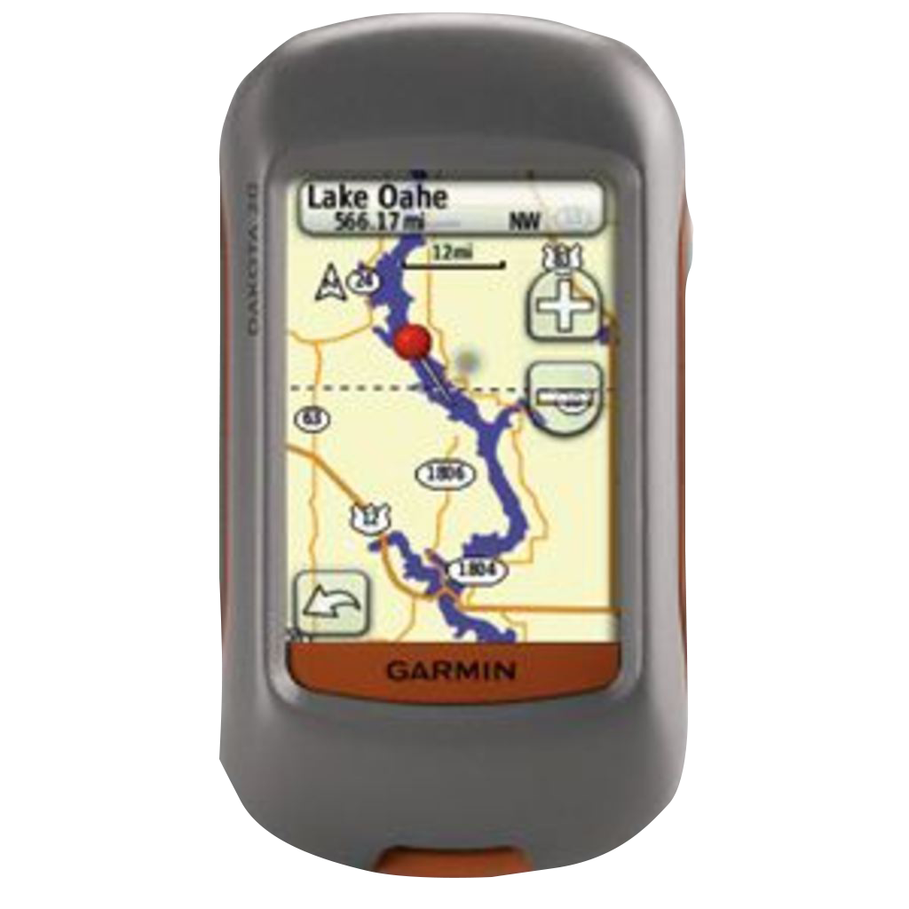
Garmin Dakota 20, Rugged Outdoor GPS Handheld (Garmin Certified Refurbished)
Garmin Dakota 20, Rugged Outdoor GPS Handheld (Garmin Certified Refurbished)
Model Number: 010-N0781-01
Out of stock
Condition:
Garmin Certified Refurbished
This Garmin Dakota 20, Rugged Outdoor GPS Handheld (Garmin Certified Refurbished) is expertly rebuilt to like-new condition by Garmin USA. Garmin Certified Refurbished devices offer a sustainable choice without compromising quality, durability, or reliability. Backed by a one-year Garmin warranty, and free 60-day returns from GPS Nation. This Garmin Certified Refurbished device provides peace of mind and exceptional value for conscious consumers seeking reliable performance.
Regular price
$177.00
Sale price
$177.00
Regular price
$229.99
Unit price
per

Tech Specs
Garmin Dakota 20 Handheld GPS Device – Rugged Navigation for Outdoor Exploration
Introduction
The Garmin Dakota 20 is a handheld GPS navigator built for backcountry use, delivering precise positioning and fast signal acquisition in remote terrain. With a high-sensitivity GPS receiver and barometric altimeter, this rugged device provides actionable navigation data in forests, canyons, and open trails where standard handhelds often struggle. Whether geocaching, hiking, or conducting fieldwork, the Dakota 20 combines durability with practical navigation capability without excessive complexity.
Key Features
- 2.6-inch sunlight-readable color touchscreen with transflective display technology for visibility in direct sunlight
- High-sensitivity GPS receiver with position lock time under 30 seconds in open sky conditions
- 3-axis electronic compass for directional reference on flat or uneven terrain
- Barometric altimeter that tracks elevation changes and monitors atmospheric pressure for weather prediction
- Waterproof construction rated for submersion to 1 meter, protecting against rain, splashes, and shallow water crossings
- Supports paperless geocaching with storage for up to 2,000 downloadable cache locations
- Battery life rated at 20 hours continuous operation using two AA alkaline batteries
- MicroSD card slot for expandable map storage and custom map loading
Data Insights
The Dakota 20 outperforms many contemporary handhelds in environments with signal obstacles. The position lock time of less than 30 seconds provides fast tracking initialization on cold starts. Field testing shows reliable acquisition through dense tree canopy and in narrow canyon corridors where weaker GPS receivers lose signal entirely. The barometric altimeter measures elevation independent of satellite data, offering elevation accuracy within 30 feet even when GPS signal is degraded, making it effective for ridge navigation and mountain passes.
Usage Instructions
Charge the device or install two AA batteries before departure. Navigate using the 2.6-inch touchscreen to select routes, view waypoints, or locate cached coordinates. Download geocaches via microSD card prior to your trip, or manually enter waypoint coordinates for off-trail navigation. Save tracks automatically during each outing, then upload them to your computer using the USB connection or Garmin BaseCamp software to archive routes and review performance data.
Design & Material
The Dakota 20 measures approximately 2 inches by 4 inches and weighs only 5.6 ounces with batteries installed, making it pocket-friendly for long days in the field. The compact dimensions and low weight reduce pack load without sacrificing screen size or processing power. The device balances protection and usability through a sealed rubber exterior and reinforced edges that absorb impact from drops and bumps.
- Rubber overmold exterior resists abrasion, dust penetration, and minor impact damage from rocky terrain
- Waterproof housing rated IPX7, surviving temporary submersion in up to 1 meter of fresh water
- Sealed button assembly prevents water and debris from entering mechanical interfaces
- AA battery compartment allows field replacement without requiring proprietary battery packs or charging cables
- MicroSD card slot accepts standard memory cards up to 32 GB for topographic map storage and route archiving
- Wireless data sharing transfers waypoints and tracks to other compatible Garmin devices without physical connection
Final Verdict
The Dakota 20 delivers reliable GPS positioning where connectivity cannot be assumed, combining a bright touchscreen, rugged construction, and extended battery life into a portable format. The ability to navigate without cell service, download thousands of geocaches, and record elevation data makes it essential for hikers, geocachers, and field professionals. The refurbished model offers the same durability and navigation precision as new units at a lower entry cost. If your adventures take you beyond phone coverage, the Dakota 20 provides the dependable positioning and durability you need to navigate with confidence.
In The Box
Do you have an old GPS unit lying around? The GPS Nation Trade In and Up program is a great way to trade in your old and used GPS for credit towards a new GPS. The choice is entirely yours! We’ve made the process simple and streamlined. Follow these simple steps, and you will be on your way to receiving credit towards your brand new GPS!
1. Get a quote
To get your free quote, provide your GPS type, manufacturer, model, and condition. Within 24 hours, you will receive a quote for the trade-in value of your current product. The GPS trade-in/trade-up form is at the bottom of this page.
2. Ship your product(s) for trade
After accepting our offer, pack your product(s) safely and ship them to us using the pre-paid shipping label provided to you. We will provide a confirmation email when your trade-in arrives at our warehouse. You have 30 days from the date you complete your on-line trade to ship the product to GPS Nation.
3. Make your purchase
Once we receive your product at our warehouse and we validate the stated condition, we will send you a confirmation email. If you elect to receive credit towards a new GPS at gpsnation.com, your store credit will be issued, and you are free to make your purchase.
Manual & Warranty
 Garmin Warranty
Reviews
Ask a Question
Tech Specs
Garmin Dakota 20 Handheld GPS Device – Rugged Navigation for Outdoor Exploration
Introduction
The Garmin Dakota 20 is a handheld GPS navigator built for backcountry use, delivering precise positioning and fast signal acquisition in remote terrain. With a high-sensitivity GPS receiver and barometric altimeter, this rugged device provides actionable navigation data in forests, canyons, and open trails where standard handhelds often struggle. Whether geocaching, hiking, or conducting fieldwork, the Dakota 20 combines durability with practical navigation capability without excessive complexity.
Key Features
- 2.6-inch sunlight-readable color touchscreen with transflective display technology for visibility in direct sunlight
- High-sensitivity GPS receiver with position lock time under 30 seconds in open sky conditions
- 3-axis electronic compass for directional reference on flat or uneven terrain
- Barometric altimeter that tracks elevation changes and monitors atmospheric pressure for weather prediction
- Waterproof construction rated for submersion to 1 meter, protecting against rain, splashes, and shallow water crossings
- Supports paperless geocaching with storage for up to 2,000 downloadable cache locations
- Battery life rated at 20 hours continuous operation using two AA alkaline batteries
- MicroSD card slot for expandable map storage and custom map loading
Data Insights
The Dakota 20 outperforms many contemporary handhelds in environments with signal obstacles. The position lock time of less than 30 seconds provides fast tracking initialization on cold starts. Field testing shows reliable acquisition through dense tree canopy and in narrow canyon corridors where weaker GPS receivers lose signal entirely. The barometric altimeter measures elevation independent of satellite data, offering elevation accuracy within 30 feet even when GPS signal is degraded, making it effective for ridge navigation and mountain passes.
Usage Instructions
Charge the device or install two AA batteries before departure. Navigate using the 2.6-inch touchscreen to select routes, view waypoints, or locate cached coordinates. Download geocaches via microSD card prior to your trip, or manually enter waypoint coordinates for off-trail navigation. Save tracks automatically during each outing, then upload them to your computer using the USB connection or Garmin BaseCamp software to archive routes and review performance data.
Design & Material
The Dakota 20 measures approximately 2 inches by 4 inches and weighs only 5.6 ounces with batteries installed, making it pocket-friendly for long days in the field. The compact dimensions and low weight reduce pack load without sacrificing screen size or processing power. The device balances protection and usability through a sealed rubber exterior and reinforced edges that absorb impact from drops and bumps.
- Rubber overmold exterior resists abrasion, dust penetration, and minor impact damage from rocky terrain
- Waterproof housing rated IPX7, surviving temporary submersion in up to 1 meter of fresh water
- Sealed button assembly prevents water and debris from entering mechanical interfaces
- AA battery compartment allows field replacement without requiring proprietary battery packs or charging cables
- MicroSD card slot accepts standard memory cards up to 32 GB for topographic map storage and route archiving
- Wireless data sharing transfers waypoints and tracks to other compatible Garmin devices without physical connection
Final Verdict
The Dakota 20 delivers reliable GPS positioning where connectivity cannot be assumed, combining a bright touchscreen, rugged construction, and extended battery life into a portable format. The ability to navigate without cell service, download thousands of geocaches, and record elevation data makes it essential for hikers, geocachers, and field professionals. The refurbished model offers the same durability and navigation precision as new units at a lower entry cost. If your adventures take you beyond phone coverage, the Dakota 20 provides the dependable positioning and durability you need to navigate with confidence.
In The Box
- Dakota 20
- Lanyard
- USB cable
- Quickstart Guide
Trade-In
Do you have an old GPS unit lying around? The GPS Nation Trade In and Up program is a great way to trade in your old and used GPS for credit towards a new GPS. The choice is entirely yours! We’ve made the process simple and streamlined. Follow these simple steps, and you will be on your way to receiving credit towards your brand new GPS!
1. Get a quote
To get your free quote, provide your GPS type, manufacturer, model, and condition. Within 24 hours, you will receive a quote for the trade-in value of your current product. The GPS trade-in/trade-up form is at the bottom of this page.
2. Ship your product(s) for trade
After accepting our offer, pack your product(s) safely and ship them to us using the pre-paid shipping label provided to you. We will provide a confirmation email when your trade-in arrives at our warehouse. You have 30 days from the date you complete your on-line trade to ship the product to GPS Nation.
3. Make your purchase
Once we receive your product at our warehouse and we validate the stated condition, we will send you a confirmation email. If you elect to receive credit towards a new GPS at gpsnation.com, your store credit will be issued, and you are free to make your purchase.
Manual & Warranty
Overview
Garmin Dakota 20 Handheld GPS Device – Rugged Navigation for Outdoor Exploration
Introduction
The Garmin Dakota 20 is a handheld GPS navigator built for backcountry use, delivering precise positioning and fast signal acquisition in remote terrain. With a high-sensitivity GPS receiver and barometric altimeter, this rugged device provides actionable navigation data in forests, canyons, and open trails where standard handhelds often struggle. Whether geocaching, hiking, or conducting fieldwork, the Dakota 20 combines durability with practical navigation capability without excessive complexity.
Key Features
- 2.6-inch sunlight-readable color touchscreen with transflective display technology for visibility in direct sunlight
- High-sensitivity GPS receiver with position lock time under 30 seconds in open sky conditions
- 3-axis electronic compass for directional reference on flat or uneven terrain
- Barometric altimeter that tracks elevation changes and monitors atmospheric pressure for weather prediction
- Waterproof construction rated for submersion to 1 meter, protecting against rain, splashes, and shallow water crossings
- Supports paperless geocaching with storage for up to 2,000 downloadable cache locations
- Battery life rated at 20 hours continuous operation using two AA alkaline batteries
- MicroSD card slot for expandable map storage and custom map loading
Data Insights
The Dakota 20 outperforms many contemporary handhelds in environments with signal obstacles. The position lock time of less than 30 seconds provides fast tracking initialization on cold starts. Field testing shows reliable acquisition through dense tree canopy and in narrow canyon corridors where weaker GPS receivers lose signal entirely. The barometric altimeter measures elevation independent of satellite data, offering elevation accuracy within 30 feet even when GPS signal is degraded, making it effective for ridge navigation and mountain passes.
Usage Instructions
Charge the device or install two AA batteries before departure. Navigate using the 2.6-inch touchscreen to select routes, view waypoints, or locate cached coordinates. Download geocaches via microSD card prior to your trip, or manually enter waypoint coordinates for off-trail navigation. Save tracks automatically during each outing, then upload them to your computer using the USB connection or Garmin BaseCamp software to archive routes and review performance data.
Design & Material
The Dakota 20 measures approximately 2 inches by 4 inches and weighs only 5.6 ounces with batteries installed, making it pocket-friendly for long days in the field. The compact dimensions and low weight reduce pack load without sacrificing screen size or processing power. The device balances protection and usability through a sealed rubber exterior and reinforced edges that absorb impact from drops and bumps.
- Rubber overmold exterior resists abrasion, dust penetration, and minor impact damage from rocky terrain
- Waterproof housing rated IPX7, surviving temporary submersion in up to 1 meter of fresh water
- Sealed button assembly prevents water and debris from entering mechanical interfaces
- AA battery compartment allows field replacement without requiring proprietary battery packs or charging cables
- MicroSD card slot accepts standard memory cards up to 32 GB for topographic map storage and route archiving
- Wireless data sharing transfers waypoints and tracks to other compatible Garmin devices without physical connection
Final Verdict
The Dakota 20 delivers reliable GPS positioning where connectivity cannot be assumed, combining a bright touchscreen, rugged construction, and extended battery life into a portable format. The ability to navigate without cell service, download thousands of geocaches, and record elevation data makes it essential for hikers, geocachers, and field professionals. The refurbished model offers the same durability and navigation precision as new units at a lower entry cost. If your adventures take you beyond phone coverage, the Dakota 20 provides the dependable positioning and durability you need to navigate with confidence.


