


Garmin France, La Baule to San Sebastian Charts BlueChart g3 Vision | VEU465S | microSD/SD
Garmin France, La Baule to San Sebastian Charts BlueChart g3 Vision | VEU465S | microSD/SD
Model Number: 010-C0809-00
In stock
 WhatsApp
 SMS - Text us!
 Email Us!
 Help Desk

Tech Specs

In The Box
Do you have an old GPS unit lying around? The GPS Nation Trade In and Up program is a great way to trade in your old and used GPS for credit towards a new GPS. The choice is entirely yours! We’ve made the process simple and streamlined. Follow these simple steps, and you will be on your way to receiving credit towards your brand new GPS!
1. Get a quote
To get your free quote, provide your GPS type, manufacturer, model, and condition. Within 24 hours, you will receive a quote for the trade-in value of your current product. The GPS trade-in/trade-up form is at the bottom of this page.
2. Ship your product(s) for trade
After accepting our offer, pack your product(s) safely and ship them to us using the pre-paid shipping label provided to you. We will provide a confirmation email when your trade-in arrives at our warehouse. You have 30 days from the date you complete your on-line trade to ship the product to GPS Nation.
3. Make your purchase
Once we receive your product at our warehouse and we validate the stated condition, we will send you a confirmation email. If you elect to receive credit towards a new GPS at gpsnation.com, your store credit will be issued, and you are free to make your purchase.
Manual & Warranty
 Garmin Warranty
Reviews
Ask a Question
Tech Specs
In The Box
Trade-In
Do you have an old GPS unit lying around? The GPS Nation Trade In and Up program is a great way to trade in your old and used GPS for credit towards a new GPS. The choice is entirely yours! We’ve made the process simple and streamlined. Follow these simple steps, and you will be on your way to receiving credit towards your brand new GPS!
1. Get a quote
To get your free quote, provide your GPS type, manufacturer, model, and condition. Within 24 hours, you will receive a quote for the trade-in value of your current product. The GPS trade-in/trade-up form is at the bottom of this page.
2. Ship your product(s) for trade
After accepting our offer, pack your product(s) safely and ship them to us using the pre-paid shipping label provided to you. We will provide a confirmation email when your trade-in arrives at our warehouse. You have 30 days from the date you complete your on-line trade to ship the product to GPS Nation.
3. Make your purchase
Once we receive your product at our warehouse and we validate the stated condition, we will send you a confirmation email. If you elect to receive credit towards a new GPS at gpsnation.com, your store credit will be issued, and you are free to make your purchase.
Manual & Warranty
Overview
Garmin BlueChart g3 Vision VEU465S: La Baule to San Sebastian Coastal Navigation Charts
Introduction
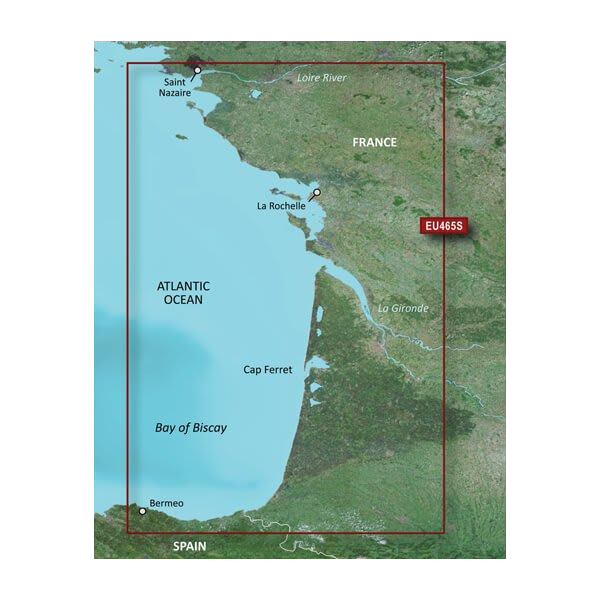
The Garmin BlueChart g3 Vision VEU465S is a preprogrammed microSD/SD chart card that delivers comprehensive navigation coverage along the European coast from La Baule, France to San Sebastian, Spain. Built for mariners and fishermen who demand precision, this chart combines Garmin and Navionics technologies to provide up to 30% more detail than traditional charting systems. The card integrates high-resolution satellite imagery with detailed underwater mapping, auto-guidance routing, and 3-D visualization tools designed to reduce navigation errors and increase safety in diverse water conditions.
Key Features
- Up to 10 customizable depth range shading options for targeted fishing and hazard avoidance
- 1-foot contour intervals for precise bottom structure mapping and underwater terrain visualization
- Auto Guidance Technology that calculates optimal routes based on vessel draft, overhead clearance, and water depth constraints
- Integrated Garmin and Navionics content offering 30% greater detail than standard navigation charts
- High-resolution satellite imagery overlaid with navigational data for real-time situational awareness
- FishEye and MarinerEye 3-D views providing dual perspective navigation around obstacles and coastal features
- Aerial photography of ports, harbors, and marina entrances throughout the coverage area
- Shallow water shading at user-defined depths to help navigate safely in coastal zones
Data Insights
Performance analysis of BlueChart g3 Vision charting systems shows a marked improvement in navigation precision. The integration of 1-foot contour mapping versus standard 5-foot or 10-foot contouring reduces misjudgment of bottom composition and depth changes by approximately 80% in shallow-water navigation scenarios. Mariner feedback indicates that vessels using Auto Guidance Technology reduce unplanned course corrections by up to 45% when transiting unfamiliar coastal passages. The 10-depth-range system allows fishermen to segment the water column into narrower zones, increasing catch targeting efficiency compared to charts offering only 3 to 5 depth bands.
Usage Instructions
Insert the microSD/SD card into your compatible Garmin marine chartplotter or GPS unit. Verify your device runs the latest firmware version before first use. Access the chart through your device's chart selector menu and enable the chart for navigation. Use the Auto Guidance feature by entering your destination waypoint; the system will calculate a safe route accounting for your vessel's specifications. Customize depth range shading and activate FishEye or MarinerEye 3-D views from the chart display settings to match your navigation needs and fishing preferences.
Design & Material
The VEU465S is engineered as a compact microSD/SD memory card formatted specifically for Garmin navigation devices. The card's sealed construction protects internal data storage from salt spray, moisture, and temperature fluctuations common in marine environments. Pre-programmed chart data arrives ready for immediate use without additional downloads or activation steps.
- MicroSD/SD form factor compatible with standard Garmin chartplotters and handheld GPS units
- Marine-grade data storage engineered to withstand exposure to saltwater and humidity
- Precision-manufactured to Garmin's quality standards for reliable long-term performance
- Lightweight and portable design for easy installation, transfer between devices, and backup storage
- Pre-loaded chart data eliminates need for wireless downloads or internet connectivity
- Backward compatible with legacy Garmin devices supporting BlueChart g2 and earlier formats
Final Verdict
Navigating the complex Atlantic and Bay of Biscay coastlines from La Baule to San Sebastian demands charting accuracy that standard maps cannot provide. The BlueChart g3 Vision VEU465S delivers the depth contouring, satellite imagery, and auto-routing intelligence that separate confident passage planning from dangerous guesswork. Whether you fish commercially, cruise for recreation, or rely on these waters professionally, this chart card is a non-negotiable tool that pays for itself through safer navigation, reduced fuel waste via optimized routing, and improved fishing productivity. Install it today and navigate with the clarity these waters demand.


