


Garmin GPSMAP 1222xsv Touch (010-01917-12)
Garmin GPSMAP 1222xsv Touch (010-01917-12)
Model Number: 010-01917-12
Out of stock
 WhatsApp
 SMS - Text us!
 Email Us!
 Help Desk

Tech Specs
Garmin GPSMAP 1222xsv Touch: 12-Inch Marine Chartplotter with Integrated CHIRP Sonar and SideVü Technology
Introduction
The Garmin GPSMAP 1222xsv Touch combines a 12-inch touchscreen chartplotter with integrated sonar scanning capabilities designed for anglers and mariners who need real-time seafloor visualization and precise navigation. The 1 kW CHIRP sonar with ClearVü and SideVü modes delivers the detection clarity and range required for identifying fish, structure, and bottom composition in coastal and nearshore environments. This all-in-one system consolidates navigation, sonar, and network connectivity in a single marine-grade display, reducing console clutter while expanding capability.
Key Features
- 12-inch high-resolution touchscreen display with wide viewing angles for daylight visibility and intuitive navigation control
- 1 kW single-channel CHIRP sonar transducer with up to 60% greater clarity compared to legacy sonar systems
- ClearVü scanning sonar for traditional down-looking detailed imaging of bottom structure and fish signatures
- SideVü sonar technology providing side-scan imaging up to 500 feet laterally on each side of the vessel
- 10 Hz GPS and GLONASS receiver refreshing position updates 10 times per second for accurate heading and drift tracking
- Quickdraw Contours feature enabling custom HD bathymetric mapping by tracing depth contours during operation
- Full networking integration supporting radar systems, autopilots, additional sonar modules, and compatible sensors through standard NMEA 2000 and Ethernet connections
- Built-in Wi-Fi for remote device monitoring and access to the ActiveCaptain™ community-driven app ecosystem
- SailAssist functionality including virtual starting lines, wind data overlay, and apparent wind angle calculations for racing and cruising
Data Insights
The CHIRP sonar technology integrated into this system delivers significantly higher resolution than traditional single-frequency transducers, with users experiencing up to 60% improvement in sonar clarity when distinguishing fish, thermoclines, and hard bottom from soft mud or sand. The 10 Hz GPS update rate means your vessel's position refreshes one-tenth of a second apart—critical for anchoring precision, trolling pattern accuracy, and staying on tight fishing marks. The dual-band GLONASS receiver integration provides redundancy and improved fix acquisition in challenging marine environments where standard GPS alone may struggle with signal obstruction from bridges or dense coastal terrain.
Usage Instructions
Mount the chartplotter securely to your vessel's console using the included versatile mounting hardware, ensuring cables route away from high-traffic areas. Connect to a dedicated marine battery circuit via the power connector, then power on and allow the GPS receiver to acquire initial satellite lock—typically 1 to 3 minutes. Use the touchscreen to navigate the main menu and access sonar, charting, and navigation functions. Before heading out, verify your transducer is properly installed through-hull or on the transom and that sonar appears active in the system settings. Update your charts and fishing map data regularly via the ActiveCaptain™ app over Wi-Fi to access the latest community-contributed contours and waypoints.
Design & Material
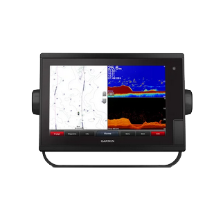
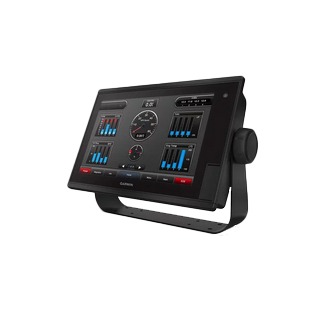
The GPSMAP 1222xsv Touch features a modern multi-pane display layout that consolidates sonar, chart, and instrumentation views simultaneously. The bezel design incorporates ergonomic side handles, making it easy to adjust viewing angles. The unit is engineered for sustained exposure to saltwater spray, moisture, and vibration typical of working fishing vessels and offshore cruisers.
- Stainless steel and polycarbonate housing rated for continuous saltwater and UV exposure
- Sealed front bezel preventing water ingress into the touchscreen assembly
- Glare-resistant display coating optimized for bright sunlight and reflections off water
- Multi-function keys and control options providing redundancy independent of the touchscreen interface
- Integrated antenna housing for Wi-Fi and optional external GPS/compass sensor connections
- Multiple network port options including NMEA 2000, Ethernet, and USB for comprehensive system integration with autopilots, radar, and other marine electronics
Final Verdict
The Garmin GPSMAP 1222xsv Touch represents a full-featured marine electronics platform for fishermen, cruisers, and racers who demand integrated sonar, navigation, and network capability without installing multiple devices. Its real-time sonar clarity, customizable mapping through Quickdraw, and seamless integration with compatible systems make it a practical upgrade over standalone chartplotters or aging sonar units. Serious mariners benefit from the dual-band GPS, touchscreen efficiency, and community-driven map updates via ActiveCaptain. Whether chasing offshore pelagics, navigating complex inshore structure, or racing competitively, this all-in-one system delivers the situational awareness and reliability needed for confident navigation and productive fishing. Invest in the GPSMAP 1222xsv Touch to consolidate your marine electronics suite and gain a powerful sonar and navigation advantage on the water.
In The Box
- GPSMAP 1222xsv Touch chartplotter
- Power/data cable
- NMEA 2000® T-connector
- NMEA 2000 drop cable (2 meters)
- Bail mount kit with knobs
- Flush mount kit with gasket
- 8-pin transducer to 12-pin sounder adapter cable
- Protective cover
- Trim piece snap covers
- Documentation
Do you have an old GPS unit lying around? The GPS Nation Trade In and Up program is a great way to trade in your old and used GPS for credit towards a new GPS. The choice is entirely yours! We’ve made the process simple and streamlined. Follow these simple steps, and you will be on your way to receiving credit towards your brand new GPS!
1. Get a quote
To get your free quote, provide your GPS type, manufacturer, model, and condition. Within 24 hours, you will receive a quote for the trade-in value of your current product. The GPS trade-in/trade-up form is at the bottom of this page.
2. Ship your product(s) for trade
After accepting our offer, pack your product(s) safely and ship them to us using the pre-paid shipping label provided to you. We will provide a confirmation email when your trade-in arrives at our warehouse. You have 30 days from the date you complete your on-line trade to ship the product to GPS Nation.
3. Make your purchase
Once we receive your product at our warehouse and we validate the stated condition, we will send you a confirmation email. If you elect to receive credit towards a new GPS at gpsnation.com, your store credit will be issued, and you are free to make your purchase.
Manual & Warranty
 Garmin Warranty
Reviews
Ask a Question
Tech Specs
Garmin GPSMAP 1222xsv Touch: 12-Inch Marine Chartplotter with Integrated CHIRP Sonar and SideVü Technology
Introduction
The Garmin GPSMAP 1222xsv Touch combines a 12-inch touchscreen chartplotter with integrated sonar scanning capabilities designed for anglers and mariners who need real-time seafloor visualization and precise navigation. The 1 kW CHIRP sonar with ClearVü and SideVü modes delivers the detection clarity and range required for identifying fish, structure, and bottom composition in coastal and nearshore environments. This all-in-one system consolidates navigation, sonar, and network connectivity in a single marine-grade display, reducing console clutter while expanding capability.
Key Features
- 12-inch high-resolution touchscreen display with wide viewing angles for daylight visibility and intuitive navigation control
- 1 kW single-channel CHIRP sonar transducer with up to 60% greater clarity compared to legacy sonar systems
- ClearVü scanning sonar for traditional down-looking detailed imaging of bottom structure and fish signatures
- SideVü sonar technology providing side-scan imaging up to 500 feet laterally on each side of the vessel
- 10 Hz GPS and GLONASS receiver refreshing position updates 10 times per second for accurate heading and drift tracking
- Quickdraw Contours feature enabling custom HD bathymetric mapping by tracing depth contours during operation
- Full networking integration supporting radar systems, autopilots, additional sonar modules, and compatible sensors through standard NMEA 2000 and Ethernet connections
- Built-in Wi-Fi for remote device monitoring and access to the ActiveCaptain™ community-driven app ecosystem
- SailAssist functionality including virtual starting lines, wind data overlay, and apparent wind angle calculations for racing and cruising
Data Insights
The CHIRP sonar technology integrated into this system delivers significantly higher resolution than traditional single-frequency transducers, with users experiencing up to 60% improvement in sonar clarity when distinguishing fish, thermoclines, and hard bottom from soft mud or sand. The 10 Hz GPS update rate means your vessel's position refreshes one-tenth of a second apart—critical for anchoring precision, trolling pattern accuracy, and staying on tight fishing marks. The dual-band GLONASS receiver integration provides redundancy and improved fix acquisition in challenging marine environments where standard GPS alone may struggle with signal obstruction from bridges or dense coastal terrain.
Usage Instructions
Mount the chartplotter securely to your vessel's console using the included versatile mounting hardware, ensuring cables route away from high-traffic areas. Connect to a dedicated marine battery circuit via the power connector, then power on and allow the GPS receiver to acquire initial satellite lock—typically 1 to 3 minutes. Use the touchscreen to navigate the main menu and access sonar, charting, and navigation functions. Before heading out, verify your transducer is properly installed through-hull or on the transom and that sonar appears active in the system settings. Update your charts and fishing map data regularly via the ActiveCaptain™ app over Wi-Fi to access the latest community-contributed contours and waypoints.
Design & Material
The GPSMAP 1222xsv Touch features a modern multi-pane display layout that consolidates sonar, chart, and instrumentation views simultaneously. The bezel design incorporates ergonomic side handles, making it easy to adjust viewing angles. The unit is engineered for sustained exposure to saltwater spray, moisture, and vibration typical of working fishing vessels and offshore cruisers.
- Stainless steel and polycarbonate housing rated for continuous saltwater and UV exposure
- Sealed front bezel preventing water ingress into the touchscreen assembly
- Glare-resistant display coating optimized for bright sunlight and reflections off water
- Multi-function keys and control options providing redundancy independent of the touchscreen interface
- Integrated antenna housing for Wi-Fi and optional external GPS/compass sensor connections
- Multiple network port options including NMEA 2000, Ethernet, and USB for comprehensive system integration with autopilots, radar, and other marine electronics
Final Verdict
The Garmin GPSMAP 1222xsv Touch represents a full-featured marine electronics platform for fishermen, cruisers, and racers who demand integrated sonar, navigation, and network capability without installing multiple devices. Its real-time sonar clarity, customizable mapping through Quickdraw, and seamless integration with compatible systems make it a practical upgrade over standalone chartplotters or aging sonar units. Serious mariners benefit from the dual-band GPS, touchscreen efficiency, and community-driven map updates via ActiveCaptain. Whether chasing offshore pelagics, navigating complex inshore structure, or racing competitively, this all-in-one system delivers the situational awareness and reliability needed for confident navigation and productive fishing. Invest in the GPSMAP 1222xsv Touch to consolidate your marine electronics suite and gain a powerful sonar and navigation advantage on the water.
In The Box
- GPSMAP 1222xsv Touch chartplotter
- Power/data cable
- NMEA 2000® T-connector
- NMEA 2000 drop cable (2 meters)
- Bail mount kit with knobs
- Flush mount kit with gasket
- 8-pin transducer to 12-pin sounder adapter cable
- Protective cover
- Trim piece snap covers
- Documentation
Trade-In
Do you have an old GPS unit lying around? The GPS Nation Trade In and Up program is a great way to trade in your old and used GPS for credit towards a new GPS. The choice is entirely yours! We’ve made the process simple and streamlined. Follow these simple steps, and you will be on your way to receiving credit towards your brand new GPS!
1. Get a quote
To get your free quote, provide your GPS type, manufacturer, model, and condition. Within 24 hours, you will receive a quote for the trade-in value of your current product. The GPS trade-in/trade-up form is at the bottom of this page.
2. Ship your product(s) for trade
After accepting our offer, pack your product(s) safely and ship them to us using the pre-paid shipping label provided to you. We will provide a confirmation email when your trade-in arrives at our warehouse. You have 30 days from the date you complete your on-line trade to ship the product to GPS Nation.
3. Make your purchase
Once we receive your product at our warehouse and we validate the stated condition, we will send you a confirmation email. If you elect to receive credit towards a new GPS at gpsnation.com, your store credit will be issued, and you are free to make your purchase.
Manual & Warranty
Overview
Garmin GPSMAP 1222xsv Touch: 12-Inch Marine Chartplotter with Integrated CHIRP Sonar and SideVü Technology
Introduction
The Garmin GPSMAP 1222xsv Touch combines a 12-inch touchscreen chartplotter with integrated sonar scanning capabilities designed for anglers and mariners who need real-time seafloor visualization and precise navigation. The 1 kW CHIRP sonar with ClearVü and SideVü modes delivers the detection clarity and range required for identifying fish, structure, and bottom composition in coastal and nearshore environments. This all-in-one system consolidates navigation, sonar, and network connectivity in a single marine-grade display, reducing console clutter while expanding capability.
Key Features
- 12-inch high-resolution touchscreen display with wide viewing angles for daylight visibility and intuitive navigation control
- 1 kW single-channel CHIRP sonar transducer with up to 60% greater clarity compared to legacy sonar systems
- ClearVü scanning sonar for traditional down-looking detailed imaging of bottom structure and fish signatures
- SideVü sonar technology providing side-scan imaging up to 500 feet laterally on each side of the vessel
- 10 Hz GPS and GLONASS receiver refreshing position updates 10 times per second for accurate heading and drift tracking
- Quickdraw Contours feature enabling custom HD bathymetric mapping by tracing depth contours during operation
- Full networking integration supporting radar systems, autopilots, additional sonar modules, and compatible sensors through standard NMEA 2000 and Ethernet connections
- Built-in Wi-Fi for remote device monitoring and access to the ActiveCaptain™ community-driven app ecosystem
- SailAssist functionality including virtual starting lines, wind data overlay, and apparent wind angle calculations for racing and cruising
Data Insights
The CHIRP sonar technology integrated into this system delivers significantly higher resolution than traditional single-frequency transducers, with users experiencing up to 60% improvement in sonar clarity when distinguishing fish, thermoclines, and hard bottom from soft mud or sand. The 10 Hz GPS update rate means your vessel's position refreshes one-tenth of a second apart—critical for anchoring precision, trolling pattern accuracy, and staying on tight fishing marks. The dual-band GLONASS receiver integration provides redundancy and improved fix acquisition in challenging marine environments where standard GPS alone may struggle with signal obstruction from bridges or dense coastal terrain.
Usage Instructions
Mount the chartplotter securely to your vessel's console using the included versatile mounting hardware, ensuring cables route away from high-traffic areas. Connect to a dedicated marine battery circuit via the power connector, then power on and allow the GPS receiver to acquire initial satellite lock—typically 1 to 3 minutes. Use the touchscreen to navigate the main menu and access sonar, charting, and navigation functions. Before heading out, verify your transducer is properly installed through-hull or on the transom and that sonar appears active in the system settings. Update your charts and fishing map data regularly via the ActiveCaptain™ app over Wi-Fi to access the latest community-contributed contours and waypoints.
Design & Material
The GPSMAP 1222xsv Touch features a modern multi-pane display layout that consolidates sonar, chart, and instrumentation views simultaneously. The bezel design incorporates ergonomic side handles, making it easy to adjust viewing angles. The unit is engineered for sustained exposure to saltwater spray, moisture, and vibration typical of working fishing vessels and offshore cruisers.
- Stainless steel and polycarbonate housing rated for continuous saltwater and UV exposure
- Sealed front bezel preventing water ingress into the touchscreen assembly
- Glare-resistant display coating optimized for bright sunlight and reflections off water
- Multi-function keys and control options providing redundancy independent of the touchscreen interface
- Integrated antenna housing for Wi-Fi and optional external GPS/compass sensor connections
- Multiple network port options including NMEA 2000, Ethernet, and USB for comprehensive system integration with autopilots, radar, and other marine electronics
Final Verdict
The Garmin GPSMAP 1222xsv Touch represents a full-featured marine electronics platform for fishermen, cruisers, and racers who demand integrated sonar, navigation, and network capability without installing multiple devices. Its real-time sonar clarity, customizable mapping through Quickdraw, and seamless integration with compatible systems make it a practical upgrade over standalone chartplotters or aging sonar units. Serious mariners benefit from the dual-band GPS, touchscreen efficiency, and community-driven map updates via ActiveCaptain. Whether chasing offshore pelagics, navigating complex inshore structure, or racing competitively, this all-in-one system delivers the situational awareness and reliability needed for confident navigation and productive fishing. Invest in the GPSMAP 1222xsv Touch to consolidate your marine electronics suite and gain a powerful sonar and navigation advantage on the water.


