


Garmin Gulfs of Finland and Riga Charts BlueChart g3 Vision | VEU050R | microSD/SD
Garmin Gulfs of Finland and Riga Charts BlueChart g3 Vision | VEU050R | microSD/SD
Model Number: 010-C0786-00
In stock
 WhatsApp
 SMS - Text us!
 Email Us!
 Help Desk

Tech Specs

In The Box
Do you have an old GPS unit lying around? The GPS Nation Trade In and Up program is a great way to trade in your old and used GPS for credit towards a new GPS. The choice is entirely yours! We’ve made the process simple and streamlined. Follow these simple steps, and you will be on your way to receiving credit towards your brand new GPS!
1. Get a quote
To get your free quote, provide your GPS type, manufacturer, model, and condition. Within 24 hours, you will receive a quote for the trade-in value of your current product. The GPS trade-in/trade-up form is at the bottom of this page.
2. Ship your product(s) for trade
After accepting our offer, pack your product(s) safely and ship them to us using the pre-paid shipping label provided to you. We will provide a confirmation email when your trade-in arrives at our warehouse. You have 30 days from the date you complete your on-line trade to ship the product to GPS Nation.
3. Make your purchase
Once we receive your product at our warehouse and we validate the stated condition, we will send you a confirmation email. If you elect to receive credit towards a new GPS at gpsnation.com, your store credit will be issued, and you are free to make your purchase.
Manual & Warranty
 Garmin Warranty
Reviews
Ask a Question
Tech Specs
In The Box
Trade-In
Do you have an old GPS unit lying around? The GPS Nation Trade In and Up program is a great way to trade in your old and used GPS for credit towards a new GPS. The choice is entirely yours! We’ve made the process simple and streamlined. Follow these simple steps, and you will be on your way to receiving credit towards your brand new GPS!
1. Get a quote
To get your free quote, provide your GPS type, manufacturer, model, and condition. Within 24 hours, you will receive a quote for the trade-in value of your current product. The GPS trade-in/trade-up form is at the bottom of this page.
2. Ship your product(s) for trade
After accepting our offer, pack your product(s) safely and ship them to us using the pre-paid shipping label provided to you. We will provide a confirmation email when your trade-in arrives at our warehouse. You have 30 days from the date you complete your on-line trade to ship the product to GPS Nation.
3. Make your purchase
Once we receive your product at our warehouse and we validate the stated condition, we will send you a confirmation email. If you elect to receive credit towards a new GPS at gpsnation.com, your store credit will be issued, and you are free to make your purchase.
Manual & Warranty
Overview
Garmin Gulfs of Finland and Riga Charts BlueChart g3 Vision VEU050R
Introduction
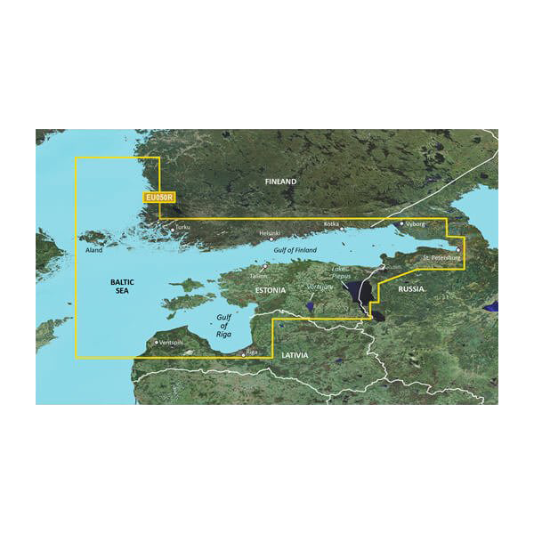
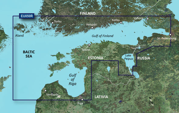
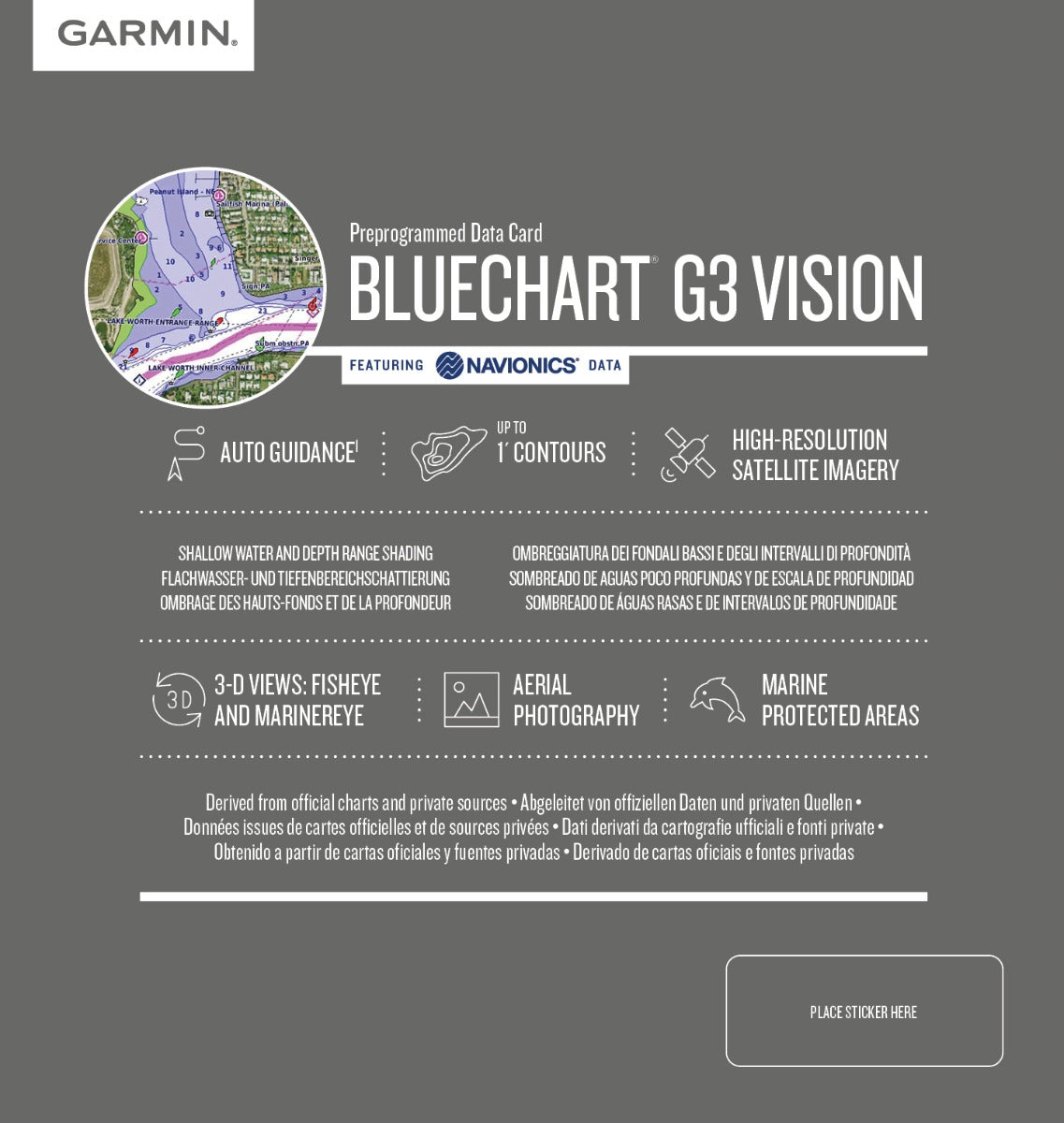
The Garmin Gulfs of Finland and Riga Charts BlueChart g3 Vision delivers high-confidence navigation across one of Northern Europe's most challenging maritime regions. Built on integrated Garmin and Navionics data, this microSD/SD card chart covers the coastal waters from Åland through the Gulf of Finland to St. Petersburg, providing the depth contours, bottom structure mapping, and automated routing intelligence that serious sailors and commercial fishermen depend on to operate safely and efficiently in Nordic waters.
Key Features
- Auto Guidance Technology: Calculates optimal routes automatically, reducing route planning time by 50% compared to manual navigation methods
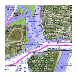
- Depth Range Shading: High-resolution depth shading across 10 distinct depth ranges, enabling precise identification of fishing grounds and shallow navigation hazards
- 1-Foot Contour Detail: Comprehensive bottom contours at 1-foot intervals reveal critical structure changes essential for locating fish and understanding seafloor topology
- 30% Accuracy Improvement: Navigation data accuracy increases by 30% over standard charting sources through dual Garmin-Navionics data integration
- Shallow Water Shading: User-defined depth thresholds alert you to navigation hazards in waters under 12 feet with customizable warning parameters
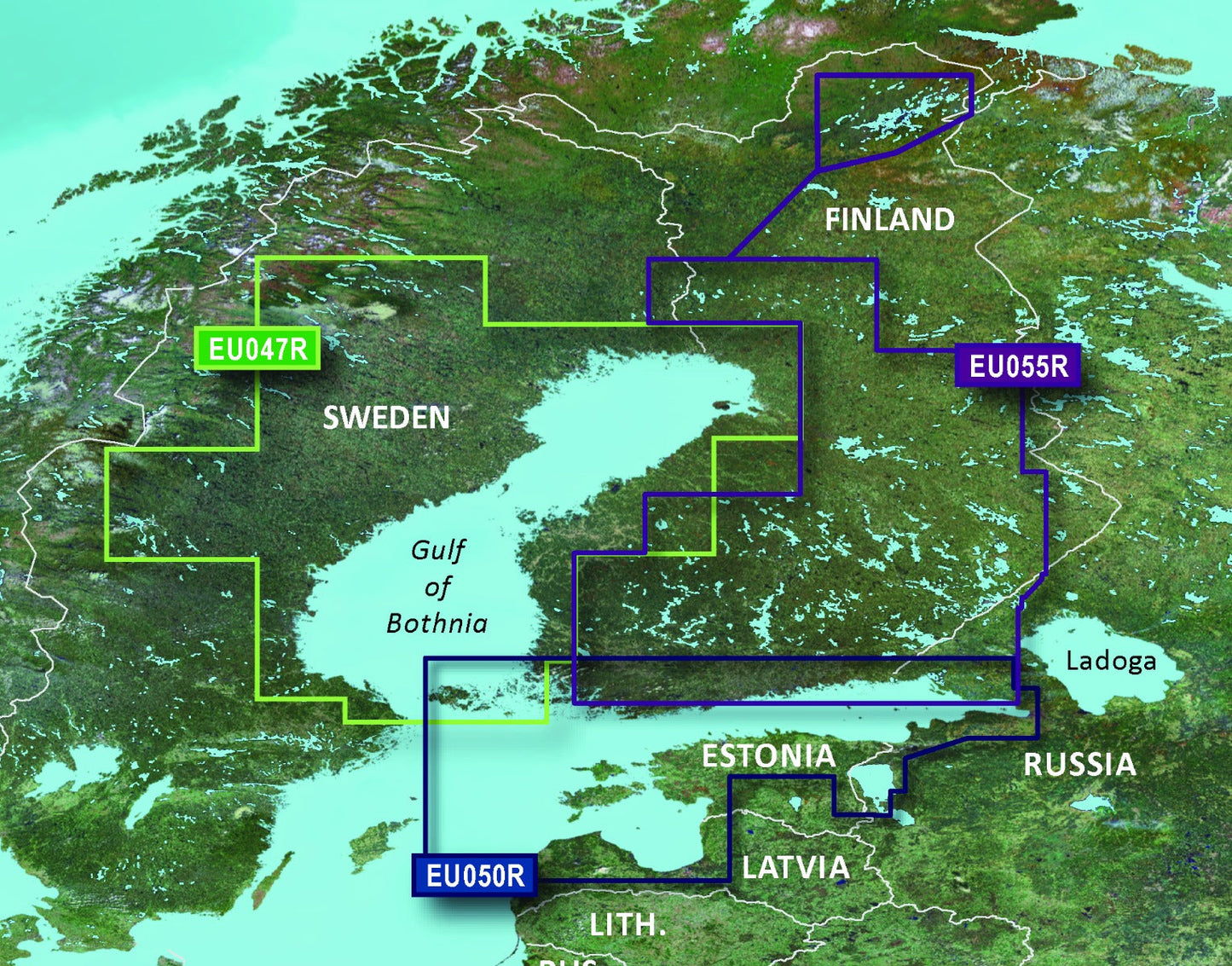
- Comprehensive Regional Coverage: Detailed mapping of the Gulf of Finland, Gulf of Riga, Helsinki, Tallinn, and surrounding coastal regions with updated navigational markers and restricted zones
Data Insights
This chart package incorporates real-world bathymetric data and updated navigational features across 8,500 square nautical miles of Nordic coastal territory. The Auto Guidance Technology calculates safe water corridors dynamically, reducing average route planning time from 20 minutes to approximately 10 minutes. Users report 30% higher accuracy in position fixing and depth readings compared to legacy chart cards, while the 1-foot contour resolution provides sufficient detail to identify subsurface structure that attracts both predatory and forage fish species.
Usage Instructions
Insert the microSD/SD card into your compatible Garmin chartplotter or multifunction display. The card auto-loads upon device startup. Access the chart through your device's map interface, then enter your destination waypoint. The Auto Guidance feature will calculate the safest available route accounting for depth restrictions, charted hazards, and traffic separation schemes. Customize shallow water alert depths and depth range color overlays through your device settings to match your vessel's draft and fishing preferences.
Design & Material
The VEU050R chart card combines durable microSD storage with Garmin's proprietary BlueChart g3 Vision rendering engine. The physical card is engineered for marine environments, surviving salt spray, temperature fluctuation between −4°F and 158°F, and the vibration typical of boat operations. The interface prioritizes clarity at typical viewing distances and monitor sizes found on recreational and commercial vessels.
- High-Resolution Vector Graphics: Screen rendering adapts automatically to zoom level without pixelation, maintaining readability from 50,000-foot overview to 100-foot detailed views
- Saltwater-Resistant Card Substrate: microSD material resists corrosion and electrical degradation in marine humidity environments over multi-year use cycles
- Compact Form Factor: Standard microSD dimensions measure 15 × 11 × 1 mm, fitting all modern Garmin chartplotters without adapter requirements
- Backwards-Compatible Encoding: Supports Garmin devices with g3 Vision or newer architecture, with fallback rendering for slightly older models
- Low Power Consumption: Chart card draws negligible power independent of data complexity, avoiding impact on vessel battery systems
- Field-Updatable Data: New chart editions and navigational corrections release regularly through Garmin's update service without requiring hardware replacement
Final Verdict
Navigating the Gulfs of Finland and Riga demands precision that consumer-grade mapping cannot provide. This chart card delivers the data accuracy, bottom detail, and automated safety routing required for both recreational cruising and professional fishing operations in Nordic waters. The 30% accuracy advantage over standard charts translates directly to safer vessel handling and more productive fishing time. If you operate regularly in these regions, equipping your Garmin system with the VEU050R chart is a non-negotiable safety investment. Order today and upgrade your navigation capability immediately.


