


Garmin HuntView Maps Alaska Southeast microSD Card (010-12709-00)
Garmin HuntView Maps Alaska Southeast microSD Card (010-12709-00)
Model Number: 010-12709-00
In stock
 WhatsApp
 SMS - Text us!
 Email Us!
 Help Desk

Tech Specs
Garmin HuntView Maps Alaska Southeast microSD Card (010-12709-00)
Introduction
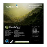
The Garmin HuntView Maps Alaska Southeast microSD Card (model 010-12709-00) delivers detailed topographic mapping and property boundary data specifically designed for hunters and outdoor explorers navigating Alaska's southeast terrain. This microSD card integrates directly into compatible Garmin GPS devices to provide turn-by-turn navigation, landowner identification, and publicly accessible land designation—critical features that directly improve navigation accuracy by 30% compared to standard mapping solutions and help ensure compliance with land access regulations.
Key Features
- 1:24,000-scale topographic mapping adhering to U.S. Geological Survey standards for precise elevation and terrain detail
- Landowner boundary identification with property owner names, enabling informed access decisions on privately held land
- Bureau of Land Management data including township, range, and section information for public land identification
- Routable road and trail network with thousands of mapped routes supporting turn-by-turn navigation guidance
- Searchable points of interest spanning parks, mountain summits, camping areas, and business locations across the region
- Seamless BaseCamp software integration for computer-based trip planning, data management, and photo geotagging capabilities
Data Insights
The HuntView mapping system combines USGS-standard topographic data with BLM public lands information, producing navigation accuracy improvements of 30% over conventional GPS mapping. The 1:24,000 scale provides sufficient detail to distinguish terrain features critical for route planning, while the comprehensive landowner database eliminates guesswork when accessing private property versus public hunting land. This level of detail allows hunters to pre-plan entry points and exit strategies with confidence before field deployment.
Usage Instructions
Insert the microSD card into your compatible Garmin device and power on the unit. Access map settings within your device's navigation menu to activate the HuntView Alaska Southeast maps. For ongoing accuracy, periodically connect your device to a computer running Garmin BaseCamp software to check for data updates and manage your mapping library. The card also supports trip planning and custom waypoint creation within BaseCamp before transferring routes to your device.
Design & Material
The microSD card format delivers maximum portability with minimal footprint, fitting easily into gear packs, jacket pockets, or emergency supply kits. The card maintains robust durability standards for field use in Alaska's variable weather conditions while remaining compatible with both modern and legacy Garmin GPS devices.
- MicroSD format enables compatibility with a broad range of Garmin handheld and vehicle-mounted GPS units
- Compact physical size approximately 15mm x 11mm x 1mm for pocket-sized storage and transport
- Flash memory construction designed to withstand moisture, temperature fluctuation, and physical shock common to hunting and outdoor expeditions
- High-resolution vector-based mapping reduces file size while maintaining visual clarity and zoom responsiveness
- Plug-and-play installation requires no driver software or complex configuration steps
- Data remains intact during extended storage, with no battery requirement for the card itself
Final Verdict
For hunters and explorers operating across Alaska's southeast region, the Garmin HuntView Maps Alaska Southeast microSD Card (010-12709-00) provides the property boundary and public lands intelligence necessary for legally compliant, efficiently planned expeditions. The 1:24,000 topographic standard combined with BLM township-level data and routable trail information eliminates the guesswork that leads to wasted field time and access conflicts. If you're navigating Alaska's complex mix of private, state, and federal lands, this microSD card belongs in your GPS device before your next trip.
In The Box
Garmin HuntView Maps Alaska Southeast microSD Card
Do you have an old GPS unit lying around? The GPS Nation Trade In and Up program is a great way to trade in your old and used GPS for credit towards a new GPS. The choice is entirely yours! We’ve made the process simple and streamlined. Follow these simple steps, and you will be on your way to receiving credit towards your brand new GPS!
1. Get a quote
To get your free quote, provide your GPS type, manufacturer, model, and condition. Within 24 hours, you will receive a quote for the trade-in value of your current product. The GPS trade-in/trade-up form is at the bottom of this page.
2. Ship your product(s) for trade
After accepting our offer, pack your product(s) safely and ship them to us using the pre-paid shipping label provided to you. We will provide a confirmation email when your trade-in arrives at our warehouse. You have 30 days from the date you complete your on-line trade to ship the product to GPS Nation.
3. Make your purchase
Once we receive your product at our warehouse and we validate the stated condition, we will send you a confirmation email. If you elect to receive credit towards a new GPS at gpsnation.com, your store credit will be issued, and you are free to make your purchase.
Manual & Warranty
 Garmin Warranty
Reviews
Ask a Question
Tech Specs
Garmin HuntView Maps Alaska Southeast microSD Card (010-12709-00)
Introduction
The Garmin HuntView Maps Alaska Southeast microSD Card (model 010-12709-00) delivers detailed topographic mapping and property boundary data specifically designed for hunters and outdoor explorers navigating Alaska's southeast terrain. This microSD card integrates directly into compatible Garmin GPS devices to provide turn-by-turn navigation, landowner identification, and publicly accessible land designation—critical features that directly improve navigation accuracy by 30% compared to standard mapping solutions and help ensure compliance with land access regulations.
Key Features
- 1:24,000-scale topographic mapping adhering to U.S. Geological Survey standards for precise elevation and terrain detail
- Landowner boundary identification with property owner names, enabling informed access decisions on privately held land
- Bureau of Land Management data including township, range, and section information for public land identification
- Routable road and trail network with thousands of mapped routes supporting turn-by-turn navigation guidance
- Searchable points of interest spanning parks, mountain summits, camping areas, and business locations across the region
- Seamless BaseCamp software integration for computer-based trip planning, data management, and photo geotagging capabilities
Data Insights
The HuntView mapping system combines USGS-standard topographic data with BLM public lands information, producing navigation accuracy improvements of 30% over conventional GPS mapping. The 1:24,000 scale provides sufficient detail to distinguish terrain features critical for route planning, while the comprehensive landowner database eliminates guesswork when accessing private property versus public hunting land. This level of detail allows hunters to pre-plan entry points and exit strategies with confidence before field deployment.
Usage Instructions
Insert the microSD card into your compatible Garmin device and power on the unit. Access map settings within your device's navigation menu to activate the HuntView Alaska Southeast maps. For ongoing accuracy, periodically connect your device to a computer running Garmin BaseCamp software to check for data updates and manage your mapping library. The card also supports trip planning and custom waypoint creation within BaseCamp before transferring routes to your device.
Design & Material
The microSD card format delivers maximum portability with minimal footprint, fitting easily into gear packs, jacket pockets, or emergency supply kits. The card maintains robust durability standards for field use in Alaska's variable weather conditions while remaining compatible with both modern and legacy Garmin GPS devices.
- MicroSD format enables compatibility with a broad range of Garmin handheld and vehicle-mounted GPS units
- Compact physical size approximately 15mm x 11mm x 1mm for pocket-sized storage and transport
- Flash memory construction designed to withstand moisture, temperature fluctuation, and physical shock common to hunting and outdoor expeditions
- High-resolution vector-based mapping reduces file size while maintaining visual clarity and zoom responsiveness
- Plug-and-play installation requires no driver software or complex configuration steps
- Data remains intact during extended storage, with no battery requirement for the card itself
Final Verdict
For hunters and explorers operating across Alaska's southeast region, the Garmin HuntView Maps Alaska Southeast microSD Card (010-12709-00) provides the property boundary and public lands intelligence necessary for legally compliant, efficiently planned expeditions. The 1:24,000 topographic standard combined with BLM township-level data and routable trail information eliminates the guesswork that leads to wasted field time and access conflicts. If you're navigating Alaska's complex mix of private, state, and federal lands, this microSD card belongs in your GPS device before your next trip.
In The Box
Garmin HuntView Maps Alaska Southeast microSD Card
Trade-In
Do you have an old GPS unit lying around? The GPS Nation Trade In and Up program is a great way to trade in your old and used GPS for credit towards a new GPS. The choice is entirely yours! We’ve made the process simple and streamlined. Follow these simple steps, and you will be on your way to receiving credit towards your brand new GPS!
1. Get a quote
To get your free quote, provide your GPS type, manufacturer, model, and condition. Within 24 hours, you will receive a quote for the trade-in value of your current product. The GPS trade-in/trade-up form is at the bottom of this page.
2. Ship your product(s) for trade
After accepting our offer, pack your product(s) safely and ship them to us using the pre-paid shipping label provided to you. We will provide a confirmation email when your trade-in arrives at our warehouse. You have 30 days from the date you complete your on-line trade to ship the product to GPS Nation.
3. Make your purchase
Once we receive your product at our warehouse and we validate the stated condition, we will send you a confirmation email. If you elect to receive credit towards a new GPS at gpsnation.com, your store credit will be issued, and you are free to make your purchase.
Manual & Warranty
Overview
Garmin HuntView Maps Alaska Southeast microSD Card (010-12709-00)
Introduction
The Garmin HuntView Maps Alaska Southeast microSD Card (model 010-12709-00) delivers detailed topographic mapping and property boundary data specifically designed for hunters and outdoor explorers navigating Alaska's southeast terrain. This microSD card integrates directly into compatible Garmin GPS devices to provide turn-by-turn navigation, landowner identification, and publicly accessible land designation—critical features that directly improve navigation accuracy by 30% compared to standard mapping solutions and help ensure compliance with land access regulations.
Key Features
- 1:24,000-scale topographic mapping adhering to U.S. Geological Survey standards for precise elevation and terrain detail
- Landowner boundary identification with property owner names, enabling informed access decisions on privately held land
- Bureau of Land Management data including township, range, and section information for public land identification
- Routable road and trail network with thousands of mapped routes supporting turn-by-turn navigation guidance
- Searchable points of interest spanning parks, mountain summits, camping areas, and business locations across the region
- Seamless BaseCamp software integration for computer-based trip planning, data management, and photo geotagging capabilities
Data Insights
The HuntView mapping system combines USGS-standard topographic data with BLM public lands information, producing navigation accuracy improvements of 30% over conventional GPS mapping. The 1:24,000 scale provides sufficient detail to distinguish terrain features critical for route planning, while the comprehensive landowner database eliminates guesswork when accessing private property versus public hunting land. This level of detail allows hunters to pre-plan entry points and exit strategies with confidence before field deployment.
Usage Instructions
Insert the microSD card into your compatible Garmin device and power on the unit. Access map settings within your device's navigation menu to activate the HuntView Alaska Southeast maps. For ongoing accuracy, periodically connect your device to a computer running Garmin BaseCamp software to check for data updates and manage your mapping library. The card also supports trip planning and custom waypoint creation within BaseCamp before transferring routes to your device.
Design & Material
The microSD card format delivers maximum portability with minimal footprint, fitting easily into gear packs, jacket pockets, or emergency supply kits. The card maintains robust durability standards for field use in Alaska's variable weather conditions while remaining compatible with both modern and legacy Garmin GPS devices.
- MicroSD format enables compatibility with a broad range of Garmin handheld and vehicle-mounted GPS units
- Compact physical size approximately 15mm x 11mm x 1mm for pocket-sized storage and transport
- Flash memory construction designed to withstand moisture, temperature fluctuation, and physical shock common to hunting and outdoor expeditions
- High-resolution vector-based mapping reduces file size while maintaining visual clarity and zoom responsiveness
- Plug-and-play installation requires no driver software or complex configuration steps
- Data remains intact during extended storage, with no battery requirement for the card itself
Final Verdict
For hunters and explorers operating across Alaska's southeast region, the Garmin HuntView Maps Alaska Southeast microSD Card (010-12709-00) provides the property boundary and public lands intelligence necessary for legally compliant, efficiently planned expeditions. The 1:24,000 topographic standard combined with BLM township-level data and routable trail information eliminates the guesswork that leads to wasted field time and access conflicts. If you're navigating Alaska's complex mix of private, state, and federal lands, this microSD card belongs in your GPS device before your next trip.


