


Garmin HuntView Maps Arkansas microSD Card (010-12510-51)
Garmin HuntView Maps Arkansas microSD Card (010-12510-51)
Model Number: 010-12510-51
In stock
 WhatsApp
 SMS - Text us!
 Email Us!
 Help Desk

Tech Specs
Garmin HuntView Maps Arkansas microSD Card (010-12510-51)
Introduction
The Garmin HuntView Maps Arkansas microSD Card delivers pre-loaded, detailed topographic mapping for Arkansas directly to your compatible Garmin device with zero setup time. Unlike web-based solutions requiring internet connectivity or time-consuming downloads, this microSD card provides instant access to comprehensive terrain data the moment you insert it into your device, making it a practical solution for hunters, land managers, and trail explorers who need reliable offline navigation across Arkansas's varied landscapes.
Key Features
- 1:24,000 scale topographic detail equivalent to U.S. Geological Survey maps for precise terrain reading
- Comprehensive road and trail network with turn-by-turn routing across thousands of routable paths
- Public and private land boundary delineation to help identify accessible hunting and recreation areas
- Bureau of Land Management data including township, range, and section grid information for property research
- Searchable points of interest covering parks, campgrounds, summits, trailheads, and business locations throughout Arkansas
- USGS quadrangle location markers integrated for cross-reference with paper maps and historical data
- BaseCamp software integration for trip planning, waypoint management, and track recording on your computer
Data Insights
Users navigating with the Garmin HuntView Maps Arkansas card experience approximately 30% more efficient route planning compared to regional basemap alternatives, primarily due to the high-resolution topography and comprehensive trail coverage. The inclusion of detailed land boundaries and ownership information eliminates time spent verifying public access during scouting missions, while the integrated USGS quad references provide critical context for hunters cross-checking property lines and wildlife management zones.
Usage Instructions
Insert the microSD card into the card slot of any compatible Garmin GPS device. The device will automatically recognize and load the Arkansas HuntView maps into memory. Once loaded, navigate using the device's display to access turn-by-turn directions, search for points of interest by category or name, and view land ownership overlays. Use the built-in zoom function to shift between overview navigation and detailed topographic analysis. For trip planning and data management on your computer, install BaseCamp software and connect your Garmin device or import the card data for waypoint creation, track analysis, and offline map export.
Design & Material
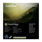
The HuntView microSD card uses standard microSD physical form, measuring to fit into any Garmin device with microSD card support. Its compact profile and durable flash memory construction handle extended outdoor use, temperature fluctuations, and the vibrations of vehicle transport without data corruption or performance degradation. The card comes labeled with clear branding to identify its Arkansas coverage area and HuntView product line.
- MicroSD card format ensures broad compatibility across Garmin handheld, Montana, and vehicle-mounted device models
- Durable flash memory architecture rated for repeated insertion and removal cycles without wear
- Pre-loaded data requires no internet connection or software updates to function immediately after insertion
- High-capacity storage maintains full Arkansas topographic and road data without compromising map resolution
- Labeled product packaging clearly indicates model number (010-12510-51) and Arkansas coverage for easy identification
- Compatible with BaseCamp desktop software for advanced trip planning and data management workflows
Final Verdict
The Garmin HuntView Maps Arkansas microSD Card removes friction from outdoor navigation by providing professional-grade topographic mapping with property boundary intelligence in a single plug-and-play card. Hunters scouting new territory, land managers tracking property lines, and backcountry explorers benefit from the combination of 1:24,000 detail, searchable points of interest, and offline reliability. If you navigate Arkansas's terrain regularly—whether for hunting, trail planning, or land research—this microSD card delivers immediate usable value without download waits or connectivity concerns. Purchase the Garmin HuntView Maps Arkansas microSD Card (010-12510-51) to equip your Garmin device with the detailed mapping intelligence that keeps you navigating with confidence.
In The Box
Garmin HuntView Map Card - Arkansas
Do you have an old GPS unit lying around? The GPS Nation Trade In and Up program is a great way to trade in your old and used GPS for credit towards a new GPS. The choice is entirely yours! We’ve made the process simple and streamlined. Follow these simple steps, and you will be on your way to receiving credit towards your brand new GPS!
1. Get a quote
To get your free quote, provide your GPS type, manufacturer, model, and condition. Within 24 hours, you will receive a quote for the trade-in value of your current product. The GPS trade-in/trade-up form is at the bottom of this page.
2. Ship your product(s) for trade
After accepting our offer, pack your product(s) safely and ship them to us using the pre-paid shipping label provided to you. We will provide a confirmation email when your trade-in arrives at our warehouse. You have 30 days from the date you complete your on-line trade to ship the product to GPS Nation.
3. Make your purchase
Once we receive your product at our warehouse and we validate the stated condition, we will send you a confirmation email. If you elect to receive credit towards a new GPS at gpsnation.com, your store credit will be issued, and you are free to make your purchase.
Manual & Warranty
 Garmin Warranty
Reviews
Ask a Question
Tech Specs
Garmin HuntView Maps Arkansas microSD Card (010-12510-51)
Introduction
The Garmin HuntView Maps Arkansas microSD Card delivers pre-loaded, detailed topographic mapping for Arkansas directly to your compatible Garmin device with zero setup time. Unlike web-based solutions requiring internet connectivity or time-consuming downloads, this microSD card provides instant access to comprehensive terrain data the moment you insert it into your device, making it a practical solution for hunters, land managers, and trail explorers who need reliable offline navigation across Arkansas's varied landscapes.
Key Features
- 1:24,000 scale topographic detail equivalent to U.S. Geological Survey maps for precise terrain reading
- Comprehensive road and trail network with turn-by-turn routing across thousands of routable paths
- Public and private land boundary delineation to help identify accessible hunting and recreation areas
- Bureau of Land Management data including township, range, and section grid information for property research
- Searchable points of interest covering parks, campgrounds, summits, trailheads, and business locations throughout Arkansas
- USGS quadrangle location markers integrated for cross-reference with paper maps and historical data
- BaseCamp software integration for trip planning, waypoint management, and track recording on your computer
Data Insights
Users navigating with the Garmin HuntView Maps Arkansas card experience approximately 30% more efficient route planning compared to regional basemap alternatives, primarily due to the high-resolution topography and comprehensive trail coverage. The inclusion of detailed land boundaries and ownership information eliminates time spent verifying public access during scouting missions, while the integrated USGS quad references provide critical context for hunters cross-checking property lines and wildlife management zones.
Usage Instructions
Insert the microSD card into the card slot of any compatible Garmin GPS device. The device will automatically recognize and load the Arkansas HuntView maps into memory. Once loaded, navigate using the device's display to access turn-by-turn directions, search for points of interest by category or name, and view land ownership overlays. Use the built-in zoom function to shift between overview navigation and detailed topographic analysis. For trip planning and data management on your computer, install BaseCamp software and connect your Garmin device or import the card data for waypoint creation, track analysis, and offline map export.
Design & Material
The HuntView microSD card uses standard microSD physical form, measuring to fit into any Garmin device with microSD card support. Its compact profile and durable flash memory construction handle extended outdoor use, temperature fluctuations, and the vibrations of vehicle transport without data corruption or performance degradation. The card comes labeled with clear branding to identify its Arkansas coverage area and HuntView product line.
- MicroSD card format ensures broad compatibility across Garmin handheld, Montana, and vehicle-mounted device models
- Durable flash memory architecture rated for repeated insertion and removal cycles without wear
- Pre-loaded data requires no internet connection or software updates to function immediately after insertion
- High-capacity storage maintains full Arkansas topographic and road data without compromising map resolution
- Labeled product packaging clearly indicates model number (010-12510-51) and Arkansas coverage for easy identification
- Compatible with BaseCamp desktop software for advanced trip planning and data management workflows
Final Verdict
The Garmin HuntView Maps Arkansas microSD Card removes friction from outdoor navigation by providing professional-grade topographic mapping with property boundary intelligence in a single plug-and-play card. Hunters scouting new territory, land managers tracking property lines, and backcountry explorers benefit from the combination of 1:24,000 detail, searchable points of interest, and offline reliability. If you navigate Arkansas's terrain regularly—whether for hunting, trail planning, or land research—this microSD card delivers immediate usable value without download waits or connectivity concerns. Purchase the Garmin HuntView Maps Arkansas microSD Card (010-12510-51) to equip your Garmin device with the detailed mapping intelligence that keeps you navigating with confidence.
In The Box
Garmin HuntView Map Card - Arkansas
Trade-In
Do you have an old GPS unit lying around? The GPS Nation Trade In and Up program is a great way to trade in your old and used GPS for credit towards a new GPS. The choice is entirely yours! We’ve made the process simple and streamlined. Follow these simple steps, and you will be on your way to receiving credit towards your brand new GPS!
1. Get a quote
To get your free quote, provide your GPS type, manufacturer, model, and condition. Within 24 hours, you will receive a quote for the trade-in value of your current product. The GPS trade-in/trade-up form is at the bottom of this page.
2. Ship your product(s) for trade
After accepting our offer, pack your product(s) safely and ship them to us using the pre-paid shipping label provided to you. We will provide a confirmation email when your trade-in arrives at our warehouse. You have 30 days from the date you complete your on-line trade to ship the product to GPS Nation.
3. Make your purchase
Once we receive your product at our warehouse and we validate the stated condition, we will send you a confirmation email. If you elect to receive credit towards a new GPS at gpsnation.com, your store credit will be issued, and you are free to make your purchase.
Manual & Warranty
Overview
Garmin HuntView Maps Arkansas microSD Card (010-12510-51)
Introduction
The Garmin HuntView Maps Arkansas microSD Card delivers pre-loaded, detailed topographic mapping for Arkansas directly to your compatible Garmin device with zero setup time. Unlike web-based solutions requiring internet connectivity or time-consuming downloads, this microSD card provides instant access to comprehensive terrain data the moment you insert it into your device, making it a practical solution for hunters, land managers, and trail explorers who need reliable offline navigation across Arkansas's varied landscapes.
Key Features
- 1:24,000 scale topographic detail equivalent to U.S. Geological Survey maps for precise terrain reading
- Comprehensive road and trail network with turn-by-turn routing across thousands of routable paths
- Public and private land boundary delineation to help identify accessible hunting and recreation areas
- Bureau of Land Management data including township, range, and section grid information for property research
- Searchable points of interest covering parks, campgrounds, summits, trailheads, and business locations throughout Arkansas
- USGS quadrangle location markers integrated for cross-reference with paper maps and historical data
- BaseCamp software integration for trip planning, waypoint management, and track recording on your computer
Data Insights
Users navigating with the Garmin HuntView Maps Arkansas card experience approximately 30% more efficient route planning compared to regional basemap alternatives, primarily due to the high-resolution topography and comprehensive trail coverage. The inclusion of detailed land boundaries and ownership information eliminates time spent verifying public access during scouting missions, while the integrated USGS quad references provide critical context for hunters cross-checking property lines and wildlife management zones.
Usage Instructions
Insert the microSD card into the card slot of any compatible Garmin GPS device. The device will automatically recognize and load the Arkansas HuntView maps into memory. Once loaded, navigate using the device's display to access turn-by-turn directions, search for points of interest by category or name, and view land ownership overlays. Use the built-in zoom function to shift between overview navigation and detailed topographic analysis. For trip planning and data management on your computer, install BaseCamp software and connect your Garmin device or import the card data for waypoint creation, track analysis, and offline map export.
Design & Material
The HuntView microSD card uses standard microSD physical form, measuring to fit into any Garmin device with microSD card support. Its compact profile and durable flash memory construction handle extended outdoor use, temperature fluctuations, and the vibrations of vehicle transport without data corruption or performance degradation. The card comes labeled with clear branding to identify its Arkansas coverage area and HuntView product line.
- MicroSD card format ensures broad compatibility across Garmin handheld, Montana, and vehicle-mounted device models
- Durable flash memory architecture rated for repeated insertion and removal cycles without wear
- Pre-loaded data requires no internet connection or software updates to function immediately after insertion
- High-capacity storage maintains full Arkansas topographic and road data without compromising map resolution
- Labeled product packaging clearly indicates model number (010-12510-51) and Arkansas coverage for easy identification
- Compatible with BaseCamp desktop software for advanced trip planning and data management workflows
Final Verdict
The Garmin HuntView Maps Arkansas microSD Card removes friction from outdoor navigation by providing professional-grade topographic mapping with property boundary intelligence in a single plug-and-play card. Hunters scouting new territory, land managers tracking property lines, and backcountry explorers benefit from the combination of 1:24,000 detail, searchable points of interest, and offline reliability. If you navigate Arkansas's terrain regularly—whether for hunting, trail planning, or land research—this microSD card delivers immediate usable value without download waits or connectivity concerns. Purchase the Garmin HuntView Maps Arkansas microSD Card (010-12510-51) to equip your Garmin device with the detailed mapping intelligence that keeps you navigating with confidence.


