


Garmin HuntView Maps DE + MD + NJ + DC microSD Card (010-12681-50)
Garmin HuntView Maps DE + MD + NJ + DC microSD Card (010-12681-50)
Model Number: 010-12681-50
In stock
 WhatsApp
 SMS - Text us!
 Email Us!
 Help Desk

Tech Specs
Garmin HuntView Maps DE + MD + NJ + DC microSD Card
Introduction
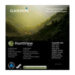
The Garmin HuntView Maps microSD Card (model 010-12681-50) delivers hunting-specific and land ownership data directly to your Garmin GPS device without requiring downloads or complex setup. This card covers 4,000 square miles across Delaware, Maryland, New Jersey, and Washington DC, combining topographic detail with landowner boundary information critical for hunters and land-conscious outdoor navigators.
Key Features
- Topographic mapping at 1:24,000 scale, equivalent to U.S. Geological Survey standard maps for terrain accuracy
- Comprehensive landowner data including names and boundaries for both public and private properties across the four-state region
- Thousands of routable roads and trails with turn-by-turn navigation for continuous path guidance
- BLM township, range, and section information integrated for federal land reference and legal parcel identification
- USGS quad location data for precise map sheet cross-reference
- Searchable point-of-interest database covering parks, summits, camping areas, geographic landmarks, and businesses
Data Insights
This microSD card consolidates data sourced from multiple authoritative databases, providing landowner information and boundary precision comparable to professional-grade mapping solutions. The 1:24,000 topographic scale ensures sufficient detail for identifying terrain features, drainage patterns, and elevation changes essential for hunt planning and navigation across varied landscapes in the Mid-Atlantic region.
Usage Instructions
Insert the microSD card into any compatible Garmin device—including Alpha, Astro, and eTrex series units—and access the maps directly from your device's menu. No software installation is required. Keep your Garmin device firmware updated to ensure full compatibility and access to all map features.
Design & Material
This microSD card balances durability with portability, engineered to function reliably in outdoor hunting and field conditions while maintaining compatibility with Garmin's established device ecosystem.
- Compact microSD format for easy storage in backpacks, vests, or navigation kits
- Durable construction designed to withstand temperature fluctuations and moisture exposure typical in field use
- Cross-compatible with Garmin Alpha, Astro, eTrex, and BaseCamp software platforms
- Plug-and-play installation—no drivers, downloads, or computer configuration required
- High-resolution mapping detail for precise, scannable navigation without zooming limitations
- Data sourced from trusted government and private land records databases for accuracy and legal reliability
Final Verdict
If you hunt, fish, or explore public and private lands across Delaware, Maryland, New Jersey, or DC, the HuntView Maps microSD card eliminates guesswork about landowner boundaries and terrain navigation. Its combination of legal parcel data, routable trails, and topographic detail makes it essential for responsible land access and efficient field planning. Purchase this card to add verified hunting and navigation intelligence directly to your Garmin device.
In The Box
Garmin HuntView Maps DE+MD+NJ+DC microSD Card
Do you have an old GPS unit lying around? The GPS Nation Trade In and Up program is a great way to trade in your old and used GPS for credit towards a new GPS. The choice is entirely yours! We’ve made the process simple and streamlined. Follow these simple steps, and you will be on your way to receiving credit towards your brand new GPS!
1. Get a quote
To get your free quote, provide your GPS type, manufacturer, model, and condition. Within 24 hours, you will receive a quote for the trade-in value of your current product. The GPS trade-in/trade-up form is at the bottom of this page.
2. Ship your product(s) for trade
After accepting our offer, pack your product(s) safely and ship them to us using the pre-paid shipping label provided to you. We will provide a confirmation email when your trade-in arrives at our warehouse. You have 30 days from the date you complete your on-line trade to ship the product to GPS Nation.
3. Make your purchase
Once we receive your product at our warehouse and we validate the stated condition, we will send you a confirmation email. If you elect to receive credit towards a new GPS at gpsnation.com, your store credit will be issued, and you are free to make your purchase.
Manual & Warranty
 Garmin Warranty
Reviews
Ask a Question
Tech Specs
Garmin HuntView Maps DE + MD + NJ + DC microSD Card
Introduction
The Garmin HuntView Maps microSD Card (model 010-12681-50) delivers hunting-specific and land ownership data directly to your Garmin GPS device without requiring downloads or complex setup. This card covers 4,000 square miles across Delaware, Maryland, New Jersey, and Washington DC, combining topographic detail with landowner boundary information critical for hunters and land-conscious outdoor navigators.
Key Features
- Topographic mapping at 1:24,000 scale, equivalent to U.S. Geological Survey standard maps for terrain accuracy
- Comprehensive landowner data including names and boundaries for both public and private properties across the four-state region
- Thousands of routable roads and trails with turn-by-turn navigation for continuous path guidance
- BLM township, range, and section information integrated for federal land reference and legal parcel identification
- USGS quad location data for precise map sheet cross-reference
- Searchable point-of-interest database covering parks, summits, camping areas, geographic landmarks, and businesses
Data Insights
This microSD card consolidates data sourced from multiple authoritative databases, providing landowner information and boundary precision comparable to professional-grade mapping solutions. The 1:24,000 topographic scale ensures sufficient detail for identifying terrain features, drainage patterns, and elevation changes essential for hunt planning and navigation across varied landscapes in the Mid-Atlantic region.
Usage Instructions
Insert the microSD card into any compatible Garmin device—including Alpha, Astro, and eTrex series units—and access the maps directly from your device's menu. No software installation is required. Keep your Garmin device firmware updated to ensure full compatibility and access to all map features.
Design & Material
This microSD card balances durability with portability, engineered to function reliably in outdoor hunting and field conditions while maintaining compatibility with Garmin's established device ecosystem.
- Compact microSD format for easy storage in backpacks, vests, or navigation kits
- Durable construction designed to withstand temperature fluctuations and moisture exposure typical in field use
- Cross-compatible with Garmin Alpha, Astro, eTrex, and BaseCamp software platforms
- Plug-and-play installation—no drivers, downloads, or computer configuration required
- High-resolution mapping detail for precise, scannable navigation without zooming limitations
- Data sourced from trusted government and private land records databases for accuracy and legal reliability
Final Verdict
If you hunt, fish, or explore public and private lands across Delaware, Maryland, New Jersey, or DC, the HuntView Maps microSD card eliminates guesswork about landowner boundaries and terrain navigation. Its combination of legal parcel data, routable trails, and topographic detail makes it essential for responsible land access and efficient field planning. Purchase this card to add verified hunting and navigation intelligence directly to your Garmin device.
In The Box
Garmin HuntView Maps DE+MD+NJ+DC microSD Card
Trade-In
Do you have an old GPS unit lying around? The GPS Nation Trade In and Up program is a great way to trade in your old and used GPS for credit towards a new GPS. The choice is entirely yours! We’ve made the process simple and streamlined. Follow these simple steps, and you will be on your way to receiving credit towards your brand new GPS!
1. Get a quote
To get your free quote, provide your GPS type, manufacturer, model, and condition. Within 24 hours, you will receive a quote for the trade-in value of your current product. The GPS trade-in/trade-up form is at the bottom of this page.
2. Ship your product(s) for trade
After accepting our offer, pack your product(s) safely and ship them to us using the pre-paid shipping label provided to you. We will provide a confirmation email when your trade-in arrives at our warehouse. You have 30 days from the date you complete your on-line trade to ship the product to GPS Nation.
3. Make your purchase
Once we receive your product at our warehouse and we validate the stated condition, we will send you a confirmation email. If you elect to receive credit towards a new GPS at gpsnation.com, your store credit will be issued, and you are free to make your purchase.
Manual & Warranty
Overview
Garmin HuntView Maps DE + MD + NJ + DC microSD Card
Introduction
The Garmin HuntView Maps microSD Card (model 010-12681-50) delivers hunting-specific and land ownership data directly to your Garmin GPS device without requiring downloads or complex setup. This card covers 4,000 square miles across Delaware, Maryland, New Jersey, and Washington DC, combining topographic detail with landowner boundary information critical for hunters and land-conscious outdoor navigators.
Key Features
- Topographic mapping at 1:24,000 scale, equivalent to U.S. Geological Survey standard maps for terrain accuracy
- Comprehensive landowner data including names and boundaries for both public and private properties across the four-state region
- Thousands of routable roads and trails with turn-by-turn navigation for continuous path guidance
- BLM township, range, and section information integrated for federal land reference and legal parcel identification
- USGS quad location data for precise map sheet cross-reference
- Searchable point-of-interest database covering parks, summits, camping areas, geographic landmarks, and businesses
Data Insights
This microSD card consolidates data sourced from multiple authoritative databases, providing landowner information and boundary precision comparable to professional-grade mapping solutions. The 1:24,000 topographic scale ensures sufficient detail for identifying terrain features, drainage patterns, and elevation changes essential for hunt planning and navigation across varied landscapes in the Mid-Atlantic region.
Usage Instructions
Insert the microSD card into any compatible Garmin device—including Alpha, Astro, and eTrex series units—and access the maps directly from your device's menu. No software installation is required. Keep your Garmin device firmware updated to ensure full compatibility and access to all map features.
Design & Material
This microSD card balances durability with portability, engineered to function reliably in outdoor hunting and field conditions while maintaining compatibility with Garmin's established device ecosystem.
- Compact microSD format for easy storage in backpacks, vests, or navigation kits
- Durable construction designed to withstand temperature fluctuations and moisture exposure typical in field use
- Cross-compatible with Garmin Alpha, Astro, eTrex, and BaseCamp software platforms
- Plug-and-play installation—no drivers, downloads, or computer configuration required
- High-resolution mapping detail for precise, scannable navigation without zooming limitations
- Data sourced from trusted government and private land records databases for accuracy and legal reliability
Final Verdict
If you hunt, fish, or explore public and private lands across Delaware, Maryland, New Jersey, or DC, the HuntView Maps microSD card eliminates guesswork about landowner boundaries and terrain navigation. Its combination of legal parcel data, routable trails, and topographic detail makes it essential for responsible land access and efficient field planning. Purchase this card to add verified hunting and navigation intelligence directly to your Garmin device.


