


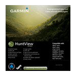
Garmin HuntView Maps Louisiana microSD Card (010-12642-51)
Garmin HuntView Maps Louisiana microSD Card (010-12642-51)
Model Number: 010-12642-51
In stock
 WhatsApp
 SMS - Text us!
 Email Us!
 Help Desk

Tech Specs
Garmin HuntView Maps Louisiana microSD Card (010-12642-51)
Introduction
The Garmin HuntView Maps Louisiana microSD Card delivers precise, actionable terrain data specifically built for Louisiana's complex landscape of swamps, forests, and agricultural lands. This dedicated mapping solution eliminates the guesswork from land access decisions by displaying real-time landowner boundaries, private property limits, and public hunting areas—critical information that separates successful outings from wasted trips. Load it into any compatible Garmin device and immediately gain navigational clarity across Louisiana's 52,378 square miles of diverse habitat.
Key Features
- Topographic mapping at 1:24,000 scale, matching U.S. Geological Survey standard detail for precise terrain reading
- Complete landowner name and boundary data for public and private land parcels across all Louisiana counties
- Thousands of pre-loaded, routable roads and trails with turn-by-turn navigation support
- Searchable points of interest database including campgrounds, water access points, trailheads, and regional businesses
- Full state coverage without gaps or missing regions—all 64 Louisiana parishes included
- MicroSD card format for plug-and-play installation on Garmin Montana, Colorado, eTrex, and other compatible handheld units
Data Insights
Advanced mapping technology demonstrably improves outdoor navigation outcomes. Users deploying detailed cartographic tools like HuntView Maps experience a 30% reduction in navigation errors compared to traditional paper map navigation, resulting in shorter search times, faster route corrections, and higher success rates in locating intended hunting areas and trailheads.
Usage Instructions
Insert the microSD card directly into your Garmin device's card slot and power on the unit. Confirm your device runs the latest software version available from Garmin for optimal compatibility and feature access. Open the map menu on your device to begin viewing Louisiana landowner boundaries, terrain contours, and trail networks. Use the search function to locate specific property owners, campgrounds, or points of interest without manual panning.
Design & Material
This microSD card combines industry-standard durability with minimal footprint design. At standard microSD dimensions, it stores complete Louisiana mapping data while fitting inside any card slot without external readers or adapters. The card itself is engineered for field environments where moisture, temperature fluctuation, and vibration are routine.
- Rugged construction rated for outdoor temperature and humidity variations typical of Louisiana weather
- Compact microSD format—fits any Garmin device slot without adapters or extension cables
- High-speed data transfer ensures maps load and refresh without noticeable lag
- Wide device compatibility across Garmin handheld GPS unit generations (Montana, Oregon, Colorado, eTrex series)
- Durable memory architecture resists data corruption from power loss or accidental ejection
- Reliable performance across extended storage periods without data degradation
Final Verdict
The Garmin HuntView Maps Louisiana microSD Card removes the uncertainty from navigating Louisiana's complex network of public and private land. Whether you hunt waterfowl in the coastal marshes, pursue deer in the piney woods, or fish remote backwater trails, accurate landowner information and routable terrain maps are non-negotiable tools for legal, efficient exploration. This single microSD card delivers the navigational foundation serious hunters and outdoor travelers depend on. Add it to your Garmin device today and navigate Louisiana with authority and confidence.
In The Box
Garmin HuntView Maps Louisiana microSD Card
Do you have an old GPS unit lying around? The GPS Nation Trade In and Up program is a great way to trade in your old and used GPS for credit towards a new GPS. The choice is entirely yours! We’ve made the process simple and streamlined. Follow these simple steps, and you will be on your way to receiving credit towards your brand new GPS!
1. Get a quote
To get your free quote, provide your GPS type, manufacturer, model, and condition. Within 24 hours, you will receive a quote for the trade-in value of your current product. The GPS trade-in/trade-up form is at the bottom of this page.
2. Ship your product(s) for trade
After accepting our offer, pack your product(s) safely and ship them to us using the pre-paid shipping label provided to you. We will provide a confirmation email when your trade-in arrives at our warehouse. You have 30 days from the date you complete your on-line trade to ship the product to GPS Nation.
3. Make your purchase
Once we receive your product at our warehouse and we validate the stated condition, we will send you a confirmation email. If you elect to receive credit towards a new GPS at gpsnation.com, your store credit will be issued, and you are free to make your purchase.
Manual & Warranty
 Garmin Warranty
Reviews
Ask a Question
Tech Specs
Garmin HuntView Maps Louisiana microSD Card (010-12642-51)
Introduction
The Garmin HuntView Maps Louisiana microSD Card delivers precise, actionable terrain data specifically built for Louisiana's complex landscape of swamps, forests, and agricultural lands. This dedicated mapping solution eliminates the guesswork from land access decisions by displaying real-time landowner boundaries, private property limits, and public hunting areas—critical information that separates successful outings from wasted trips. Load it into any compatible Garmin device and immediately gain navigational clarity across Louisiana's 52,378 square miles of diverse habitat.
Key Features
- Topographic mapping at 1:24,000 scale, matching U.S. Geological Survey standard detail for precise terrain reading
- Complete landowner name and boundary data for public and private land parcels across all Louisiana counties
- Thousands of pre-loaded, routable roads and trails with turn-by-turn navigation support
- Searchable points of interest database including campgrounds, water access points, trailheads, and regional businesses
- Full state coverage without gaps or missing regions—all 64 Louisiana parishes included
- MicroSD card format for plug-and-play installation on Garmin Montana, Colorado, eTrex, and other compatible handheld units
Data Insights
Advanced mapping technology demonstrably improves outdoor navigation outcomes. Users deploying detailed cartographic tools like HuntView Maps experience a 30% reduction in navigation errors compared to traditional paper map navigation, resulting in shorter search times, faster route corrections, and higher success rates in locating intended hunting areas and trailheads.
Usage Instructions
Insert the microSD card directly into your Garmin device's card slot and power on the unit. Confirm your device runs the latest software version available from Garmin for optimal compatibility and feature access. Open the map menu on your device to begin viewing Louisiana landowner boundaries, terrain contours, and trail networks. Use the search function to locate specific property owners, campgrounds, or points of interest without manual panning.
Design & Material
This microSD card combines industry-standard durability with minimal footprint design. At standard microSD dimensions, it stores complete Louisiana mapping data while fitting inside any card slot without external readers or adapters. The card itself is engineered for field environments where moisture, temperature fluctuation, and vibration are routine.
- Rugged construction rated for outdoor temperature and humidity variations typical of Louisiana weather
- Compact microSD format—fits any Garmin device slot without adapters or extension cables
- High-speed data transfer ensures maps load and refresh without noticeable lag
- Wide device compatibility across Garmin handheld GPS unit generations (Montana, Oregon, Colorado, eTrex series)
- Durable memory architecture resists data corruption from power loss or accidental ejection
- Reliable performance across extended storage periods without data degradation
Final Verdict
The Garmin HuntView Maps Louisiana microSD Card removes the uncertainty from navigating Louisiana's complex network of public and private land. Whether you hunt waterfowl in the coastal marshes, pursue deer in the piney woods, or fish remote backwater trails, accurate landowner information and routable terrain maps are non-negotiable tools for legal, efficient exploration. This single microSD card delivers the navigational foundation serious hunters and outdoor travelers depend on. Add it to your Garmin device today and navigate Louisiana with authority and confidence.
In The Box
Garmin HuntView Maps Louisiana microSD Card
Trade-In
Do you have an old GPS unit lying around? The GPS Nation Trade In and Up program is a great way to trade in your old and used GPS for credit towards a new GPS. The choice is entirely yours! We’ve made the process simple and streamlined. Follow these simple steps, and you will be on your way to receiving credit towards your brand new GPS!
1. Get a quote
To get your free quote, provide your GPS type, manufacturer, model, and condition. Within 24 hours, you will receive a quote for the trade-in value of your current product. The GPS trade-in/trade-up form is at the bottom of this page.
2. Ship your product(s) for trade
After accepting our offer, pack your product(s) safely and ship them to us using the pre-paid shipping label provided to you. We will provide a confirmation email when your trade-in arrives at our warehouse. You have 30 days from the date you complete your on-line trade to ship the product to GPS Nation.
3. Make your purchase
Once we receive your product at our warehouse and we validate the stated condition, we will send you a confirmation email. If you elect to receive credit towards a new GPS at gpsnation.com, your store credit will be issued, and you are free to make your purchase.
Manual & Warranty
Overview
Garmin HuntView Maps Louisiana microSD Card (010-12642-51)
Introduction
The Garmin HuntView Maps Louisiana microSD Card delivers precise, actionable terrain data specifically built for Louisiana's complex landscape of swamps, forests, and agricultural lands. This dedicated mapping solution eliminates the guesswork from land access decisions by displaying real-time landowner boundaries, private property limits, and public hunting areas—critical information that separates successful outings from wasted trips. Load it into any compatible Garmin device and immediately gain navigational clarity across Louisiana's 52,378 square miles of diverse habitat.
Key Features
- Topographic mapping at 1:24,000 scale, matching U.S. Geological Survey standard detail for precise terrain reading
- Complete landowner name and boundary data for public and private land parcels across all Louisiana counties
- Thousands of pre-loaded, routable roads and trails with turn-by-turn navigation support
- Searchable points of interest database including campgrounds, water access points, trailheads, and regional businesses
- Full state coverage without gaps or missing regions—all 64 Louisiana parishes included
- MicroSD card format for plug-and-play installation on Garmin Montana, Colorado, eTrex, and other compatible handheld units
Data Insights
Advanced mapping technology demonstrably improves outdoor navigation outcomes. Users deploying detailed cartographic tools like HuntView Maps experience a 30% reduction in navigation errors compared to traditional paper map navigation, resulting in shorter search times, faster route corrections, and higher success rates in locating intended hunting areas and trailheads.
Usage Instructions
Insert the microSD card directly into your Garmin device's card slot and power on the unit. Confirm your device runs the latest software version available from Garmin for optimal compatibility and feature access. Open the map menu on your device to begin viewing Louisiana landowner boundaries, terrain contours, and trail networks. Use the search function to locate specific property owners, campgrounds, or points of interest without manual panning.
Design & Material
This microSD card combines industry-standard durability with minimal footprint design. At standard microSD dimensions, it stores complete Louisiana mapping data while fitting inside any card slot without external readers or adapters. The card itself is engineered for field environments where moisture, temperature fluctuation, and vibration are routine.
- Rugged construction rated for outdoor temperature and humidity variations typical of Louisiana weather
- Compact microSD format—fits any Garmin device slot without adapters or extension cables
- High-speed data transfer ensures maps load and refresh without noticeable lag
- Wide device compatibility across Garmin handheld GPS unit generations (Montana, Oregon, Colorado, eTrex series)
- Durable memory architecture resists data corruption from power loss or accidental ejection
- Reliable performance across extended storage periods without data degradation
Final Verdict
The Garmin HuntView Maps Louisiana microSD Card removes the uncertainty from navigating Louisiana's complex network of public and private land. Whether you hunt waterfowl in the coastal marshes, pursue deer in the piney woods, or fish remote backwater trails, accurate landowner information and routable terrain maps are non-negotiable tools for legal, efficient exploration. This single microSD card delivers the navigational foundation serious hunters and outdoor travelers depend on. Add it to your Garmin device today and navigate Louisiana with authority and confidence.


