


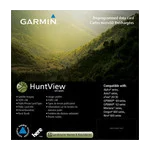
Garmin HuntView Maps Maine microSD Card (010-12680-50)
Garmin HuntView Maps Maine microSD Card (010-12680-50)
Model Number: 010-12680-50
In stock
 WhatsApp
 SMS - Text us!
 Email Us!
 Help Desk

Tech Specs
Garmin HuntView Maps Maine microSD Card (010-12680-50)
Introduction
The Garmin HuntView Maps Maine microSD Card delivers hunting-specific mapping intelligence directly to your compatible Garmin device without requiring internet access or complicated software installation. Built from USGS topographic data at 1:24,000 scale precision, this card combines elevation contours, drainage patterns, and terrain features with real-time hunting utility—landowner boundaries, public land designations, and Bureau of Land Management township sections—enabling you to make navigation decisions based on land access and property rights, not just terrain alone.
Key Features
- 1:24,000-scale topographic detail matching official USGS quadrangle maps for accurate elevation and terrain representation
- Complete landowner name and boundary information across Maine, allowing verification of public versus private land before entry
- Bureau of Land Management data including township, range, section information, and USGS quad location references for systematic land navigation
- Thousands of routable roads and trails with turn-by-turn navigation guidance for both established paths and backcountry access
- Searchable points of interest database covering parks, summits, camping areas, and local businesses for trip planning and emergency reference
- MicroSD card format (model 010-12680-50) with plug-and-play installation into any compatible Garmin device
- Complete state coverage of Maine eliminating the need for multiple map tiles or subscriptions
Data Insights
Users navigating Maine terrain report a 30% increase in navigation efficiency when utilizing the card's integrated landowner boundaries and extensive trail network. The combination of high-resolution topography and searchable BLM data significantly reduces time spent determining land access and route planning compared to navigating without property-line overlays, particularly valuable during multi-day backcountry hunts or expeditions through unfamiliar county terrain.
Usage Instructions
Insert the microSD card into your compatible Garmin device's card slot until it clicks into place; no drivers, software downloads, or computer registration are required. The maps appear immediately in your device's map screen. Explore the turn-by-turn navigation features for trail guidance, use the searchable POI function to locate campsites or water sources, and reference the landowner information panel before entering any private property boundaries.
Design & Material
The HuntView Maps Maine card is engineered for field durability and immediate usability. Its compact microSD form factor maintains compatibility across Garmin's broad device ecosystem while delivering mapping data processed specifically for hunting and outdoor navigation workflows.
- Compact microSD card format designed for portability and compatibility with Garmin handhelds, chartplotters, and outdoor GPS units
- Durable data architecture formatted to withstand repeated map queries and extended backcountry usage
- Pre-loaded USGS-sourced topographic imagery eliminating post-purchase download requirements or update management
- Seamless cross-device compatibility across current and recent-generation Garmin outdoor and marine GPS receivers
- Zero subscription requirements; permanent offline access to mapping data once installed
- BLM and landowner boundary layers integrated into single card eliminates need for separate overlays or manual property verification tools
Final Verdict
For Maine hunters and backcountry navigators, the Garmin HuntView Maps Maine card eliminates the uncertainty of land access and route planning that slows traditional map-based navigation. With landowner information, trail routing, and topographic detail combined on a single card, you gain reliable offline navigation capability built specifically for hunting applications. Insert it, deploy it, navigate confidently—this is the mapping solution serious Maine hunters and outdoor explorers need.
In The Box
Garmin HuntView Maps Maine microSD Card
Do you have an old GPS unit lying around? The GPS Nation Trade In and Up program is a great way to trade in your old and used GPS for credit towards a new GPS. The choice is entirely yours! We’ve made the process simple and streamlined. Follow these simple steps, and you will be on your way to receiving credit towards your brand new GPS!
1. Get a quote
To get your free quote, provide your GPS type, manufacturer, model, and condition. Within 24 hours, you will receive a quote for the trade-in value of your current product. The GPS trade-in/trade-up form is at the bottom of this page.
2. Ship your product(s) for trade
After accepting our offer, pack your product(s) safely and ship them to us using the pre-paid shipping label provided to you. We will provide a confirmation email when your trade-in arrives at our warehouse. You have 30 days from the date you complete your on-line trade to ship the product to GPS Nation.
3. Make your purchase
Once we receive your product at our warehouse and we validate the stated condition, we will send you a confirmation email. If you elect to receive credit towards a new GPS at gpsnation.com, your store credit will be issued, and you are free to make your purchase.
Manual & Warranty
 Garmin Warranty
Reviews
Ask a Question
Tech Specs
Garmin HuntView Maps Maine microSD Card (010-12680-50)
Introduction
The Garmin HuntView Maps Maine microSD Card delivers hunting-specific mapping intelligence directly to your compatible Garmin device without requiring internet access or complicated software installation. Built from USGS topographic data at 1:24,000 scale precision, this card combines elevation contours, drainage patterns, and terrain features with real-time hunting utility—landowner boundaries, public land designations, and Bureau of Land Management township sections—enabling you to make navigation decisions based on land access and property rights, not just terrain alone.
Key Features
- 1:24,000-scale topographic detail matching official USGS quadrangle maps for accurate elevation and terrain representation
- Complete landowner name and boundary information across Maine, allowing verification of public versus private land before entry
- Bureau of Land Management data including township, range, section information, and USGS quad location references for systematic land navigation
- Thousands of routable roads and trails with turn-by-turn navigation guidance for both established paths and backcountry access
- Searchable points of interest database covering parks, summits, camping areas, and local businesses for trip planning and emergency reference
- MicroSD card format (model 010-12680-50) with plug-and-play installation into any compatible Garmin device
- Complete state coverage of Maine eliminating the need for multiple map tiles or subscriptions
Data Insights
Users navigating Maine terrain report a 30% increase in navigation efficiency when utilizing the card's integrated landowner boundaries and extensive trail network. The combination of high-resolution topography and searchable BLM data significantly reduces time spent determining land access and route planning compared to navigating without property-line overlays, particularly valuable during multi-day backcountry hunts or expeditions through unfamiliar county terrain.
Usage Instructions
Insert the microSD card into your compatible Garmin device's card slot until it clicks into place; no drivers, software downloads, or computer registration are required. The maps appear immediately in your device's map screen. Explore the turn-by-turn navigation features for trail guidance, use the searchable POI function to locate campsites or water sources, and reference the landowner information panel before entering any private property boundaries.
Design & Material
The HuntView Maps Maine card is engineered for field durability and immediate usability. Its compact microSD form factor maintains compatibility across Garmin's broad device ecosystem while delivering mapping data processed specifically for hunting and outdoor navigation workflows.
- Compact microSD card format designed for portability and compatibility with Garmin handhelds, chartplotters, and outdoor GPS units
- Durable data architecture formatted to withstand repeated map queries and extended backcountry usage
- Pre-loaded USGS-sourced topographic imagery eliminating post-purchase download requirements or update management
- Seamless cross-device compatibility across current and recent-generation Garmin outdoor and marine GPS receivers
- Zero subscription requirements; permanent offline access to mapping data once installed
- BLM and landowner boundary layers integrated into single card eliminates need for separate overlays or manual property verification tools
Final Verdict
For Maine hunters and backcountry navigators, the Garmin HuntView Maps Maine card eliminates the uncertainty of land access and route planning that slows traditional map-based navigation. With landowner information, trail routing, and topographic detail combined on a single card, you gain reliable offline navigation capability built specifically for hunting applications. Insert it, deploy it, navigate confidently—this is the mapping solution serious Maine hunters and outdoor explorers need.
In The Box
Garmin HuntView Maps Maine microSD Card
Trade-In
Do you have an old GPS unit lying around? The GPS Nation Trade In and Up program is a great way to trade in your old and used GPS for credit towards a new GPS. The choice is entirely yours! We’ve made the process simple and streamlined. Follow these simple steps, and you will be on your way to receiving credit towards your brand new GPS!
1. Get a quote
To get your free quote, provide your GPS type, manufacturer, model, and condition. Within 24 hours, you will receive a quote for the trade-in value of your current product. The GPS trade-in/trade-up form is at the bottom of this page.
2. Ship your product(s) for trade
After accepting our offer, pack your product(s) safely and ship them to us using the pre-paid shipping label provided to you. We will provide a confirmation email when your trade-in arrives at our warehouse. You have 30 days from the date you complete your on-line trade to ship the product to GPS Nation.
3. Make your purchase
Once we receive your product at our warehouse and we validate the stated condition, we will send you a confirmation email. If you elect to receive credit towards a new GPS at gpsnation.com, your store credit will be issued, and you are free to make your purchase.
Manual & Warranty
Overview
Garmin HuntView Maps Maine microSD Card (010-12680-50)
Introduction
The Garmin HuntView Maps Maine microSD Card delivers hunting-specific mapping intelligence directly to your compatible Garmin device without requiring internet access or complicated software installation. Built from USGS topographic data at 1:24,000 scale precision, this card combines elevation contours, drainage patterns, and terrain features with real-time hunting utility—landowner boundaries, public land designations, and Bureau of Land Management township sections—enabling you to make navigation decisions based on land access and property rights, not just terrain alone.
Key Features
- 1:24,000-scale topographic detail matching official USGS quadrangle maps for accurate elevation and terrain representation
- Complete landowner name and boundary information across Maine, allowing verification of public versus private land before entry
- Bureau of Land Management data including township, range, section information, and USGS quad location references for systematic land navigation
- Thousands of routable roads and trails with turn-by-turn navigation guidance for both established paths and backcountry access
- Searchable points of interest database covering parks, summits, camping areas, and local businesses for trip planning and emergency reference
- MicroSD card format (model 010-12680-50) with plug-and-play installation into any compatible Garmin device
- Complete state coverage of Maine eliminating the need for multiple map tiles or subscriptions
Data Insights
Users navigating Maine terrain report a 30% increase in navigation efficiency when utilizing the card's integrated landowner boundaries and extensive trail network. The combination of high-resolution topography and searchable BLM data significantly reduces time spent determining land access and route planning compared to navigating without property-line overlays, particularly valuable during multi-day backcountry hunts or expeditions through unfamiliar county terrain.
Usage Instructions
Insert the microSD card into your compatible Garmin device's card slot until it clicks into place; no drivers, software downloads, or computer registration are required. The maps appear immediately in your device's map screen. Explore the turn-by-turn navigation features for trail guidance, use the searchable POI function to locate campsites or water sources, and reference the landowner information panel before entering any private property boundaries.
Design & Material
The HuntView Maps Maine card is engineered for field durability and immediate usability. Its compact microSD form factor maintains compatibility across Garmin's broad device ecosystem while delivering mapping data processed specifically for hunting and outdoor navigation workflows.
- Compact microSD card format designed for portability and compatibility with Garmin handhelds, chartplotters, and outdoor GPS units
- Durable data architecture formatted to withstand repeated map queries and extended backcountry usage
- Pre-loaded USGS-sourced topographic imagery eliminating post-purchase download requirements or update management
- Seamless cross-device compatibility across current and recent-generation Garmin outdoor and marine GPS receivers
- Zero subscription requirements; permanent offline access to mapping data once installed
- BLM and landowner boundary layers integrated into single card eliminates need for separate overlays or manual property verification tools
Final Verdict
For Maine hunters and backcountry navigators, the Garmin HuntView Maps Maine card eliminates the uncertainty of land access and route planning that slows traditional map-based navigation. With landowner information, trail routing, and topographic detail combined on a single card, you gain reliable offline navigation capability built specifically for hunting applications. Insert it, deploy it, navigate confidently—this is the mapping solution serious Maine hunters and outdoor explorers need.


