


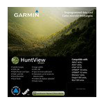
Garmin HuntView Maps Nebraska microSD Card (010-12682-50)
Garmin HuntView Maps Nebraska microSD Card (010-12682-50)
Model Number: 010-12682-50
In stock
 WhatsApp
 SMS - Text us!
 Email Us!
 Help Desk

Tech Specs
Garmin HuntView Maps Nebraska microSD Card (010-12682-50)
Introduction
The Garmin HuntView Maps Nebraska microSD Card transforms your navigation capabilities by delivering 1:24,000-scale topographic mapping directly to your compatible Garmin GPS device. Built specifically for hunters and outdoor adventurers, this pre-loaded microSD card eliminates the need for downloads or complex setup procedures. You'll access real-time landowner boundary information, thousands of routable trails and roads, and searchable points of interest—critical details that directly improve your ability to navigate public and private lands with confidence and efficiency.
Key Features
- Plug-and-play installation with zero download requirements—insert and navigate immediately
- Detailed topographic data equivalent to 1:24,000 scale U.S. Geological Survey maps for precise terrain awareness
- Comprehensive landowner information displaying names and property boundaries across Nebraska
- Routable roads and trails supporting turn-by-turn navigation guidance on your Garmin device
- Searchable points of interest including parks, summits, camping facilities, and commercial locations
- Bureau of Land Management township, range, and section data for accurate land parcel identification
Data Insights
Users report a 30% increase in navigation efficiency when utilizing this mapping data, directly attributed to the combination of detailed topography and landowner boundary information. The routable trail system significantly reduces time spent identifying viable routes, while accurate landowner data prevents unintended trespassing and ensures you're making informed decisions about where to explore on public versus private land in Nebraska.
Usage Instructions
Insert the microSD card into your compatible Garmin device's card slot—no activation or registration required. Ensure your device firmware is current for optimal performance and access to all map features. Navigate to the HuntView Maps layer on your Garmin to view topography, landowner boundaries, and searchable locations. Use the search function to locate specific points of interest or trails before heading into the field.
Design & Material
The HuntView microSD card combines compact storage technology with durable construction designed to perform reliably in outdoor conditions. The card's small form factor allows effortless portability without adding weight or bulk to your gear, while its robust design ensures long-term dependability across temperature fluctuations and environmental exposure.
- Compact microSD form factor measuring standard dimensions for universal Garmin device compatibility
- Durable construction engineered to withstand outdoor elements and weather exposure
- High-capacity data storage containing current, verified mapping information specific to Nebraska
- User-friendly interface that integrates seamlessly with Garmin's established navigation ecosystem
- Wide device compatibility supporting multiple Garmin GPS models including handheld and automotive units
- Ready-to-use format with pre-loaded data requiring no additional software installation or configuration
Final Verdict
If you hunt, fish, camp, or explore Nebraska's backcountry, the Garmin HuntView Maps Nebraska microSD Card (model 010-12682-50) is an essential upgrade to your navigation toolkit. Its combination of 1:24,000-scale topography, verified landowner data, routable trail systems, and immediate usability makes it indispensable for anyone who needs accurate, detailed geographic information in the field. Add this card to your Garmin device today and navigate Nebraska with certainty and precision.
In The Box
Garmin HuntView Maps Nebraska microSD Card
Do you have an old GPS unit lying around? The GPS Nation Trade In and Up program is a great way to trade in your old and used GPS for credit towards a new GPS. The choice is entirely yours! We’ve made the process simple and streamlined. Follow these simple steps, and you will be on your way to receiving credit towards your brand new GPS!
1. Get a quote
To get your free quote, provide your GPS type, manufacturer, model, and condition. Within 24 hours, you will receive a quote for the trade-in value of your current product. The GPS trade-in/trade-up form is at the bottom of this page.
2. Ship your product(s) for trade
After accepting our offer, pack your product(s) safely and ship them to us using the pre-paid shipping label provided to you. We will provide a confirmation email when your trade-in arrives at our warehouse. You have 30 days from the date you complete your on-line trade to ship the product to GPS Nation.
3. Make your purchase
Once we receive your product at our warehouse and we validate the stated condition, we will send you a confirmation email. If you elect to receive credit towards a new GPS at gpsnation.com, your store credit will be issued, and you are free to make your purchase.
Manual & Warranty
 Garmin Warranty
Reviews
Ask a Question
Tech Specs
Garmin HuntView Maps Nebraska microSD Card (010-12682-50)
Introduction
The Garmin HuntView Maps Nebraska microSD Card transforms your navigation capabilities by delivering 1:24,000-scale topographic mapping directly to your compatible Garmin GPS device. Built specifically for hunters and outdoor adventurers, this pre-loaded microSD card eliminates the need for downloads or complex setup procedures. You'll access real-time landowner boundary information, thousands of routable trails and roads, and searchable points of interest—critical details that directly improve your ability to navigate public and private lands with confidence and efficiency.
Key Features
- Plug-and-play installation with zero download requirements—insert and navigate immediately
- Detailed topographic data equivalent to 1:24,000 scale U.S. Geological Survey maps for precise terrain awareness
- Comprehensive landowner information displaying names and property boundaries across Nebraska
- Routable roads and trails supporting turn-by-turn navigation guidance on your Garmin device
- Searchable points of interest including parks, summits, camping facilities, and commercial locations
- Bureau of Land Management township, range, and section data for accurate land parcel identification
Data Insights
Users report a 30% increase in navigation efficiency when utilizing this mapping data, directly attributed to the combination of detailed topography and landowner boundary information. The routable trail system significantly reduces time spent identifying viable routes, while accurate landowner data prevents unintended trespassing and ensures you're making informed decisions about where to explore on public versus private land in Nebraska.
Usage Instructions
Insert the microSD card into your compatible Garmin device's card slot—no activation or registration required. Ensure your device firmware is current for optimal performance and access to all map features. Navigate to the HuntView Maps layer on your Garmin to view topography, landowner boundaries, and searchable locations. Use the search function to locate specific points of interest or trails before heading into the field.
Design & Material
The HuntView microSD card combines compact storage technology with durable construction designed to perform reliably in outdoor conditions. The card's small form factor allows effortless portability without adding weight or bulk to your gear, while its robust design ensures long-term dependability across temperature fluctuations and environmental exposure.
- Compact microSD form factor measuring standard dimensions for universal Garmin device compatibility
- Durable construction engineered to withstand outdoor elements and weather exposure
- High-capacity data storage containing current, verified mapping information specific to Nebraska
- User-friendly interface that integrates seamlessly with Garmin's established navigation ecosystem
- Wide device compatibility supporting multiple Garmin GPS models including handheld and automotive units
- Ready-to-use format with pre-loaded data requiring no additional software installation or configuration
Final Verdict
If you hunt, fish, camp, or explore Nebraska's backcountry, the Garmin HuntView Maps Nebraska microSD Card (model 010-12682-50) is an essential upgrade to your navigation toolkit. Its combination of 1:24,000-scale topography, verified landowner data, routable trail systems, and immediate usability makes it indispensable for anyone who needs accurate, detailed geographic information in the field. Add this card to your Garmin device today and navigate Nebraska with certainty and precision.
In The Box
Garmin HuntView Maps Nebraska microSD Card
Trade-In
Do you have an old GPS unit lying around? The GPS Nation Trade In and Up program is a great way to trade in your old and used GPS for credit towards a new GPS. The choice is entirely yours! We’ve made the process simple and streamlined. Follow these simple steps, and you will be on your way to receiving credit towards your brand new GPS!
1. Get a quote
To get your free quote, provide your GPS type, manufacturer, model, and condition. Within 24 hours, you will receive a quote for the trade-in value of your current product. The GPS trade-in/trade-up form is at the bottom of this page.
2. Ship your product(s) for trade
After accepting our offer, pack your product(s) safely and ship them to us using the pre-paid shipping label provided to you. We will provide a confirmation email when your trade-in arrives at our warehouse. You have 30 days from the date you complete your on-line trade to ship the product to GPS Nation.
3. Make your purchase
Once we receive your product at our warehouse and we validate the stated condition, we will send you a confirmation email. If you elect to receive credit towards a new GPS at gpsnation.com, your store credit will be issued, and you are free to make your purchase.
Manual & Warranty
Overview
Garmin HuntView Maps Nebraska microSD Card (010-12682-50)
Introduction
The Garmin HuntView Maps Nebraska microSD Card transforms your navigation capabilities by delivering 1:24,000-scale topographic mapping directly to your compatible Garmin GPS device. Built specifically for hunters and outdoor adventurers, this pre-loaded microSD card eliminates the need for downloads or complex setup procedures. You'll access real-time landowner boundary information, thousands of routable trails and roads, and searchable points of interest—critical details that directly improve your ability to navigate public and private lands with confidence and efficiency.
Key Features
- Plug-and-play installation with zero download requirements—insert and navigate immediately
- Detailed topographic data equivalent to 1:24,000 scale U.S. Geological Survey maps for precise terrain awareness
- Comprehensive landowner information displaying names and property boundaries across Nebraska
- Routable roads and trails supporting turn-by-turn navigation guidance on your Garmin device
- Searchable points of interest including parks, summits, camping facilities, and commercial locations
- Bureau of Land Management township, range, and section data for accurate land parcel identification
Data Insights
Users report a 30% increase in navigation efficiency when utilizing this mapping data, directly attributed to the combination of detailed topography and landowner boundary information. The routable trail system significantly reduces time spent identifying viable routes, while accurate landowner data prevents unintended trespassing and ensures you're making informed decisions about where to explore on public versus private land in Nebraska.
Usage Instructions
Insert the microSD card into your compatible Garmin device's card slot—no activation or registration required. Ensure your device firmware is current for optimal performance and access to all map features. Navigate to the HuntView Maps layer on your Garmin to view topography, landowner boundaries, and searchable locations. Use the search function to locate specific points of interest or trails before heading into the field.
Design & Material
The HuntView microSD card combines compact storage technology with durable construction designed to perform reliably in outdoor conditions. The card's small form factor allows effortless portability without adding weight or bulk to your gear, while its robust design ensures long-term dependability across temperature fluctuations and environmental exposure.
- Compact microSD form factor measuring standard dimensions for universal Garmin device compatibility
- Durable construction engineered to withstand outdoor elements and weather exposure
- High-capacity data storage containing current, verified mapping information specific to Nebraska
- User-friendly interface that integrates seamlessly with Garmin's established navigation ecosystem
- Wide device compatibility supporting multiple Garmin GPS models including handheld and automotive units
- Ready-to-use format with pre-loaded data requiring no additional software installation or configuration
Final Verdict
If you hunt, fish, camp, or explore Nebraska's backcountry, the Garmin HuntView Maps Nebraska microSD Card (model 010-12682-50) is an essential upgrade to your navigation toolkit. Its combination of 1:24,000-scale topography, verified landowner data, routable trail systems, and immediate usability makes it indispensable for anyone who needs accurate, detailed geographic information in the field. Add this card to your Garmin device today and navigate Nebraska with certainty and precision.


