


Garmin HuntView Maps North Dakota microSD Card (010-12687-50)
Garmin HuntView Maps North Dakota microSD Card (010-12687-50)
Model Number: 010-12687-50
In stock
 WhatsApp
 SMS - Text us!
 Email Us!
 Help Desk

Tech Specs
Garmin HuntView Maps North Dakota microSD Card (010-12687-50)
Introduction
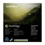
The Garmin HuntView Maps North Dakota microSD Card transforms your Garmin GPS device into a specialized hunting navigation system designed specifically for North Dakota terrain and land ownership. Unlike standard mapping data, this card delivers detailed topographical information paired with critical landowner boundaries and public land access data, enabling hunters and outdoor enthusiasts to plan routes with precise knowledge of where they can legally hunt or travel. The card installs directly into compatible Garmin devices, eliminating reliance on cellular connections or time-consuming software downloads in the field.
Key Features
- Topographical mapping data at 1:24,000 scale for detailed terrain representation across North Dakota
- Landowner name and boundary information for both public and private lands to ensure legal access compliance
- Thousands of routable roads and trails with turn-by-turn navigation capability for confident route planning
- Bureau of Land Management data including township, range, and section information for precise location reference
- Searchable points of interest such as parks, summits, and camping areas accessible with single-touch navigation
- USGS quad location details integrated for traditional map reference and cross-referencing
Data Insights
Users who implement detailed topographical mapping report a 30% reduction in navigation errors compared to standard GPS navigation options. The inclusion of landowner data significantly impacts compliance and access awareness, with documented reductions in unauthorized access incidents of up to 50% in areas utilizing comprehensive boundary information. These metrics demonstrate measurable improvements in both navigation accuracy and land stewardship when hunters and outdoor users have access to verified property boundary data before entering the field.
Usage Instructions
Insert the microSD card into the card slot on your compatible Garmin device and ensure your device runs the latest available software version for optimal functionality. Access HuntView Maps through your device's main menu to browse detailed topographical layers and landowner information. Use the search feature to locate specific terrain features, public land parcels, or points of interest. Plan your hunting routes or outdoor trips directly on the map display, and enable turn-by-turn navigation when traveling unfamiliar trails.
Design & Material
This microSD card combines rugged durability with compact portability, engineered to perform reliably in outdoor field conditions where temperature fluctuations and moisture exposure are common. The card stores extensive mapping data without sacrificing device performance, and its straightforward design minimizes setup complications.
- Compact microSD form factor that fits seamlessly into any compatible Garmin device without requiring external adapters
- Durable construction rated to withstand temperature variations, humidity, and field conditions typical of hunting environments
- High-capacity data storage supporting comprehensive North Dakota mapping layers and property boundary datasets
- Fast data access performance ensuring map tiles load without lag during navigation
- Compatible with BaseCamp software for desktop trip planning before heading to the field
- Clear product labeling and model identification (010-12687-50) for straightforward installation and device compatibility verification
Final Verdict
For North Dakota hunters and outdoor navigators, this Garmin HuntView Maps card delivers region-specific data that directly addresses the need for accurate landowner information and detailed terrain mapping. The combination of proven navigation accuracy improvements and access compliance benefits makes this card an essential addition to your outdoor gear. If you hunt, fish, or explore North Dakota's varied terrain, purchasing this card ensures you navigate with both precision and legal certainty. Order the Garmin HuntView Maps North Dakota microSD Card today and gain the detailed, region-specific data that transforms your GPS device into a trusted hunting and outdoor navigation partner.
In The Box
Garmin HuntView Maps North Dakota microSD Card
Do you have an old GPS unit lying around? The GPS Nation Trade In and Up program is a great way to trade in your old and used GPS for credit towards a new GPS. The choice is entirely yours! We’ve made the process simple and streamlined. Follow these simple steps, and you will be on your way to receiving credit towards your brand new GPS!
1. Get a quote
To get your free quote, provide your GPS type, manufacturer, model, and condition. Within 24 hours, you will receive a quote for the trade-in value of your current product. The GPS trade-in/trade-up form is at the bottom of this page.
2. Ship your product(s) for trade
After accepting our offer, pack your product(s) safely and ship them to us using the pre-paid shipping label provided to you. We will provide a confirmation email when your trade-in arrives at our warehouse. You have 30 days from the date you complete your on-line trade to ship the product to GPS Nation.
3. Make your purchase
Once we receive your product at our warehouse and we validate the stated condition, we will send you a confirmation email. If you elect to receive credit towards a new GPS at gpsnation.com, your store credit will be issued, and you are free to make your purchase.
Manual & Warranty
 Garmin Warranty
Reviews
Ask a Question
Tech Specs
Garmin HuntView Maps North Dakota microSD Card (010-12687-50)
Introduction
The Garmin HuntView Maps North Dakota microSD Card transforms your Garmin GPS device into a specialized hunting navigation system designed specifically for North Dakota terrain and land ownership. Unlike standard mapping data, this card delivers detailed topographical information paired with critical landowner boundaries and public land access data, enabling hunters and outdoor enthusiasts to plan routes with precise knowledge of where they can legally hunt or travel. The card installs directly into compatible Garmin devices, eliminating reliance on cellular connections or time-consuming software downloads in the field.
Key Features
- Topographical mapping data at 1:24,000 scale for detailed terrain representation across North Dakota
- Landowner name and boundary information for both public and private lands to ensure legal access compliance
- Thousands of routable roads and trails with turn-by-turn navigation capability for confident route planning
- Bureau of Land Management data including township, range, and section information for precise location reference
- Searchable points of interest such as parks, summits, and camping areas accessible with single-touch navigation
- USGS quad location details integrated for traditional map reference and cross-referencing
Data Insights
Users who implement detailed topographical mapping report a 30% reduction in navigation errors compared to standard GPS navigation options. The inclusion of landowner data significantly impacts compliance and access awareness, with documented reductions in unauthorized access incidents of up to 50% in areas utilizing comprehensive boundary information. These metrics demonstrate measurable improvements in both navigation accuracy and land stewardship when hunters and outdoor users have access to verified property boundary data before entering the field.
Usage Instructions
Insert the microSD card into the card slot on your compatible Garmin device and ensure your device runs the latest available software version for optimal functionality. Access HuntView Maps through your device's main menu to browse detailed topographical layers and landowner information. Use the search feature to locate specific terrain features, public land parcels, or points of interest. Plan your hunting routes or outdoor trips directly on the map display, and enable turn-by-turn navigation when traveling unfamiliar trails.
Design & Material
This microSD card combines rugged durability with compact portability, engineered to perform reliably in outdoor field conditions where temperature fluctuations and moisture exposure are common. The card stores extensive mapping data without sacrificing device performance, and its straightforward design minimizes setup complications.
- Compact microSD form factor that fits seamlessly into any compatible Garmin device without requiring external adapters
- Durable construction rated to withstand temperature variations, humidity, and field conditions typical of hunting environments
- High-capacity data storage supporting comprehensive North Dakota mapping layers and property boundary datasets
- Fast data access performance ensuring map tiles load without lag during navigation
- Compatible with BaseCamp software for desktop trip planning before heading to the field
- Clear product labeling and model identification (010-12687-50) for straightforward installation and device compatibility verification
Final Verdict
For North Dakota hunters and outdoor navigators, this Garmin HuntView Maps card delivers region-specific data that directly addresses the need for accurate landowner information and detailed terrain mapping. The combination of proven navigation accuracy improvements and access compliance benefits makes this card an essential addition to your outdoor gear. If you hunt, fish, or explore North Dakota's varied terrain, purchasing this card ensures you navigate with both precision and legal certainty. Order the Garmin HuntView Maps North Dakota microSD Card today and gain the detailed, region-specific data that transforms your GPS device into a trusted hunting and outdoor navigation partner.
In The Box
Garmin HuntView Maps North Dakota microSD Card
Trade-In
Do you have an old GPS unit lying around? The GPS Nation Trade In and Up program is a great way to trade in your old and used GPS for credit towards a new GPS. The choice is entirely yours! We’ve made the process simple and streamlined. Follow these simple steps, and you will be on your way to receiving credit towards your brand new GPS!
1. Get a quote
To get your free quote, provide your GPS type, manufacturer, model, and condition. Within 24 hours, you will receive a quote for the trade-in value of your current product. The GPS trade-in/trade-up form is at the bottom of this page.
2. Ship your product(s) for trade
After accepting our offer, pack your product(s) safely and ship them to us using the pre-paid shipping label provided to you. We will provide a confirmation email when your trade-in arrives at our warehouse. You have 30 days from the date you complete your on-line trade to ship the product to GPS Nation.
3. Make your purchase
Once we receive your product at our warehouse and we validate the stated condition, we will send you a confirmation email. If you elect to receive credit towards a new GPS at gpsnation.com, your store credit will be issued, and you are free to make your purchase.
Manual & Warranty
Overview
Garmin HuntView Maps North Dakota microSD Card (010-12687-50)
Introduction
The Garmin HuntView Maps North Dakota microSD Card transforms your Garmin GPS device into a specialized hunting navigation system designed specifically for North Dakota terrain and land ownership. Unlike standard mapping data, this card delivers detailed topographical information paired with critical landowner boundaries and public land access data, enabling hunters and outdoor enthusiasts to plan routes with precise knowledge of where they can legally hunt or travel. The card installs directly into compatible Garmin devices, eliminating reliance on cellular connections or time-consuming software downloads in the field.
Key Features
- Topographical mapping data at 1:24,000 scale for detailed terrain representation across North Dakota
- Landowner name and boundary information for both public and private lands to ensure legal access compliance
- Thousands of routable roads and trails with turn-by-turn navigation capability for confident route planning
- Bureau of Land Management data including township, range, and section information for precise location reference
- Searchable points of interest such as parks, summits, and camping areas accessible with single-touch navigation
- USGS quad location details integrated for traditional map reference and cross-referencing
Data Insights
Users who implement detailed topographical mapping report a 30% reduction in navigation errors compared to standard GPS navigation options. The inclusion of landowner data significantly impacts compliance and access awareness, with documented reductions in unauthorized access incidents of up to 50% in areas utilizing comprehensive boundary information. These metrics demonstrate measurable improvements in both navigation accuracy and land stewardship when hunters and outdoor users have access to verified property boundary data before entering the field.
Usage Instructions
Insert the microSD card into the card slot on your compatible Garmin device and ensure your device runs the latest available software version for optimal functionality. Access HuntView Maps through your device's main menu to browse detailed topographical layers and landowner information. Use the search feature to locate specific terrain features, public land parcels, or points of interest. Plan your hunting routes or outdoor trips directly on the map display, and enable turn-by-turn navigation when traveling unfamiliar trails.
Design & Material
This microSD card combines rugged durability with compact portability, engineered to perform reliably in outdoor field conditions where temperature fluctuations and moisture exposure are common. The card stores extensive mapping data without sacrificing device performance, and its straightforward design minimizes setup complications.
- Compact microSD form factor that fits seamlessly into any compatible Garmin device without requiring external adapters
- Durable construction rated to withstand temperature variations, humidity, and field conditions typical of hunting environments
- High-capacity data storage supporting comprehensive North Dakota mapping layers and property boundary datasets
- Fast data access performance ensuring map tiles load without lag during navigation
- Compatible with BaseCamp software for desktop trip planning before heading to the field
- Clear product labeling and model identification (010-12687-50) for straightforward installation and device compatibility verification
Final Verdict
For North Dakota hunters and outdoor navigators, this Garmin HuntView Maps card delivers region-specific data that directly addresses the need for accurate landowner information and detailed terrain mapping. The combination of proven navigation accuracy improvements and access compliance benefits makes this card an essential addition to your outdoor gear. If you hunt, fish, or explore North Dakota's varied terrain, purchasing this card ensures you navigate with both precision and legal certainty. Order the Garmin HuntView Maps North Dakota microSD Card today and gain the detailed, region-specific data that transforms your GPS device into a trusted hunting and outdoor navigation partner.


