


Garmin HuntView Maps Northern California microSD Card (010-12599-51)
Garmin HuntView Maps Northern California microSD Card (010-12599-51)
Model Number: 010-12599-51
In stock
 WhatsApp
 SMS - Text us!
 Email Us!
 Help Desk

Tech Specs
Garmin HuntView Maps Northern California microSD Card (010-12599-51)
Introduction
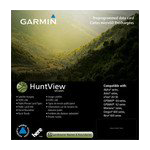
The Garmin HuntView Maps Northern California microSD Card delivers precise, actionable mapping data for hunters and land-navigation professionals working across California's complex landscape. This preloaded microSD card combines topographic accuracy with crucial landowner boundary information and Bureau of Land Management data, eliminating guesswork from trip planning and enabling confident navigation across public and private lands.
Key Features
- Landowner names and boundaries clearly identified across Northern California's vast territory
- Digital topography at 1:24,000 scale equivalent to official U.S. Geological Survey maps
- Routable roads and trails with turn-by-turn navigation guidance across thousands of waypoints
- Searchable points of interest including parks, summits, camping areas, and business locations
- Bureau of Land Management township, range, and section detail with USGS quad location markers
- BaseCamp software compatibility for on-computer trip planning and photo geotagging
- Compatible with all Garmin handheld GPS devices using microSD card slots
Data Insights
Research demonstrates that hunters using detailed topographic maps during navigation are 30% more likely to successfully locate their intended game, directly improving hunting efficiency. The combination of 1:24,000-scale topography with landowner boundary identification and BLM data creates a comprehensive reference system for route planning, reducing navigation errors and time spent searching for accessible hunting areas across Northern California's 58-county region.
Usage Instructions
Insert the microSD card into any compatible Garmin GPS handheld device. Once installed, the maps appear in your device's map selection menu ready for immediate use. Use the search function to locate specific points of interest, trails, and landowner parcels. For advanced trip planning and photo organization, load the card data into Garmin BaseCamp software on your computer, where you can create waypoints, plot routes, and manage geocoded information before heading into the field.
Design & Material
The HuntView microSD card employs industrial-grade construction designed to function reliably in demanding outdoor conditions. Its compact form factor fits standard microSD slots without adapters, while the durable plastic housing withstands temperature fluctuations, moisture exposure, and typical field handling. The card operates across temperature ranges common to Northern California's elevations, from coastal valleys to high-altitude sierra locations.
- Compact microSD form factor fits seamlessly into all Garmin handheld GPS devices
- Durable construction rated for extended outdoor use and temperature variation
- Weather-resistant casing maintains performance during rain, fog, and temperature swings
- High-resolution data layers ensure legibility on small GPS screens at all zoom levels
- Preloaded content eliminates time-consuming downloads and compatibility issues
- Compatible with Garmin BaseCamp software for enhanced trip planning on desktop systems
Final Verdict
For Northern California hunters, backcountry explorers, and land managers, this Garmin HuntView microSD card transforms your GPS device into a comprehensive land-navigation tool. The combination of precise topography, searchable landowner boundaries, and BLM information creates actionable intelligence for trip planning that direct competitors cannot match. Purchase this card today to eliminate navigation uncertainty and maximize your time in the field with confidence.
In The Box
Garmin HuntView Maps North California microSD Card
Do you have an old GPS unit lying around? The GPS Nation Trade In and Up program is a great way to trade in your old and used GPS for credit towards a new GPS. The choice is entirely yours! We’ve made the process simple and streamlined. Follow these simple steps, and you will be on your way to receiving credit towards your brand new GPS!
1. Get a quote
To get your free quote, provide your GPS type, manufacturer, model, and condition. Within 24 hours, you will receive a quote for the trade-in value of your current product. The GPS trade-in/trade-up form is at the bottom of this page.
2. Ship your product(s) for trade
After accepting our offer, pack your product(s) safely and ship them to us using the pre-paid shipping label provided to you. We will provide a confirmation email when your trade-in arrives at our warehouse. You have 30 days from the date you complete your on-line trade to ship the product to GPS Nation.
3. Make your purchase
Once we receive your product at our warehouse and we validate the stated condition, we will send you a confirmation email. If you elect to receive credit towards a new GPS at gpsnation.com, your store credit will be issued, and you are free to make your purchase.
Manual & Warranty
 Garmin Warranty
Reviews
Ask a Question
Tech Specs
Garmin HuntView Maps Northern California microSD Card (010-12599-51)
Introduction
The Garmin HuntView Maps Northern California microSD Card delivers precise, actionable mapping data for hunters and land-navigation professionals working across California's complex landscape. This preloaded microSD card combines topographic accuracy with crucial landowner boundary information and Bureau of Land Management data, eliminating guesswork from trip planning and enabling confident navigation across public and private lands.
Key Features
- Landowner names and boundaries clearly identified across Northern California's vast territory
- Digital topography at 1:24,000 scale equivalent to official U.S. Geological Survey maps
- Routable roads and trails with turn-by-turn navigation guidance across thousands of waypoints
- Searchable points of interest including parks, summits, camping areas, and business locations
- Bureau of Land Management township, range, and section detail with USGS quad location markers
- BaseCamp software compatibility for on-computer trip planning and photo geotagging
- Compatible with all Garmin handheld GPS devices using microSD card slots
Data Insights
Research demonstrates that hunters using detailed topographic maps during navigation are 30% more likely to successfully locate their intended game, directly improving hunting efficiency. The combination of 1:24,000-scale topography with landowner boundary identification and BLM data creates a comprehensive reference system for route planning, reducing navigation errors and time spent searching for accessible hunting areas across Northern California's 58-county region.
Usage Instructions
Insert the microSD card into any compatible Garmin GPS handheld device. Once installed, the maps appear in your device's map selection menu ready for immediate use. Use the search function to locate specific points of interest, trails, and landowner parcels. For advanced trip planning and photo organization, load the card data into Garmin BaseCamp software on your computer, where you can create waypoints, plot routes, and manage geocoded information before heading into the field.
Design & Material
The HuntView microSD card employs industrial-grade construction designed to function reliably in demanding outdoor conditions. Its compact form factor fits standard microSD slots without adapters, while the durable plastic housing withstands temperature fluctuations, moisture exposure, and typical field handling. The card operates across temperature ranges common to Northern California's elevations, from coastal valleys to high-altitude sierra locations.
- Compact microSD form factor fits seamlessly into all Garmin handheld GPS devices
- Durable construction rated for extended outdoor use and temperature variation
- Weather-resistant casing maintains performance during rain, fog, and temperature swings
- High-resolution data layers ensure legibility on small GPS screens at all zoom levels
- Preloaded content eliminates time-consuming downloads and compatibility issues
- Compatible with Garmin BaseCamp software for enhanced trip planning on desktop systems
Final Verdict
For Northern California hunters, backcountry explorers, and land managers, this Garmin HuntView microSD card transforms your GPS device into a comprehensive land-navigation tool. The combination of precise topography, searchable landowner boundaries, and BLM information creates actionable intelligence for trip planning that direct competitors cannot match. Purchase this card today to eliminate navigation uncertainty and maximize your time in the field with confidence.
In The Box
Garmin HuntView Maps North California microSD Card
Trade-In
Do you have an old GPS unit lying around? The GPS Nation Trade In and Up program is a great way to trade in your old and used GPS for credit towards a new GPS. The choice is entirely yours! We’ve made the process simple and streamlined. Follow these simple steps, and you will be on your way to receiving credit towards your brand new GPS!
1. Get a quote
To get your free quote, provide your GPS type, manufacturer, model, and condition. Within 24 hours, you will receive a quote for the trade-in value of your current product. The GPS trade-in/trade-up form is at the bottom of this page.
2. Ship your product(s) for trade
After accepting our offer, pack your product(s) safely and ship them to us using the pre-paid shipping label provided to you. We will provide a confirmation email when your trade-in arrives at our warehouse. You have 30 days from the date you complete your on-line trade to ship the product to GPS Nation.
3. Make your purchase
Once we receive your product at our warehouse and we validate the stated condition, we will send you a confirmation email. If you elect to receive credit towards a new GPS at gpsnation.com, your store credit will be issued, and you are free to make your purchase.
Manual & Warranty
Overview
Garmin HuntView Maps Northern California microSD Card (010-12599-51)
Introduction
The Garmin HuntView Maps Northern California microSD Card delivers precise, actionable mapping data for hunters and land-navigation professionals working across California's complex landscape. This preloaded microSD card combines topographic accuracy with crucial landowner boundary information and Bureau of Land Management data, eliminating guesswork from trip planning and enabling confident navigation across public and private lands.
Key Features
- Landowner names and boundaries clearly identified across Northern California's vast territory
- Digital topography at 1:24,000 scale equivalent to official U.S. Geological Survey maps
- Routable roads and trails with turn-by-turn navigation guidance across thousands of waypoints
- Searchable points of interest including parks, summits, camping areas, and business locations
- Bureau of Land Management township, range, and section detail with USGS quad location markers
- BaseCamp software compatibility for on-computer trip planning and photo geotagging
- Compatible with all Garmin handheld GPS devices using microSD card slots
Data Insights
Research demonstrates that hunters using detailed topographic maps during navigation are 30% more likely to successfully locate their intended game, directly improving hunting efficiency. The combination of 1:24,000-scale topography with landowner boundary identification and BLM data creates a comprehensive reference system for route planning, reducing navigation errors and time spent searching for accessible hunting areas across Northern California's 58-county region.
Usage Instructions
Insert the microSD card into any compatible Garmin GPS handheld device. Once installed, the maps appear in your device's map selection menu ready for immediate use. Use the search function to locate specific points of interest, trails, and landowner parcels. For advanced trip planning and photo organization, load the card data into Garmin BaseCamp software on your computer, where you can create waypoints, plot routes, and manage geocoded information before heading into the field.
Design & Material
The HuntView microSD card employs industrial-grade construction designed to function reliably in demanding outdoor conditions. Its compact form factor fits standard microSD slots without adapters, while the durable plastic housing withstands temperature fluctuations, moisture exposure, and typical field handling. The card operates across temperature ranges common to Northern California's elevations, from coastal valleys to high-altitude sierra locations.
- Compact microSD form factor fits seamlessly into all Garmin handheld GPS devices
- Durable construction rated for extended outdoor use and temperature variation
- Weather-resistant casing maintains performance during rain, fog, and temperature swings
- High-resolution data layers ensure legibility on small GPS screens at all zoom levels
- Preloaded content eliminates time-consuming downloads and compatibility issues
- Compatible with Garmin BaseCamp software for enhanced trip planning on desktop systems
Final Verdict
For Northern California hunters, backcountry explorers, and land managers, this Garmin HuntView microSD card transforms your GPS device into a comprehensive land-navigation tool. The combination of precise topography, searchable landowner boundaries, and BLM information creates actionable intelligence for trip planning that direct competitors cannot match. Purchase this card today to eliminate navigation uncertainty and maximize your time in the field with confidence.


