


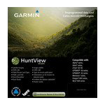
Garmin HuntView Maps Southern California microSD Card (010-12604-51)
Garmin HuntView Maps Southern California microSD Card (010-12604-51)
Model Number: 010-12604-51
Out of stock
 WhatsApp
 SMS - Text us!
 Email Us!
 Help Desk

Tech Specs
Garmin HuntView Maps Southern California microSD Card (010-12604-51)
Introduction
The Garmin HuntView Maps Southern California microSD Card transforms how hunters and outdoor navigators plan expeditions and locate hunting opportunities in one of North America's most diverse regions. Rather than relying on printed maps or fragmented data sources, this microSD card delivers comprehensive land ownership data, precise topography, and detailed trail networks directly to your compatible Garmin GPS device. For anyone scouting public land, planning backcountry trips, or verifying property boundaries in Southern California, this card eliminates guesswork and keeps you legally and logistically prepared.
Key Features
- Comprehensive land coverage spanning over 90% of Southern California with detailed landowner names and boundary identification
- Topographic mapping at 1:24,000 scale—equivalent to U.S. Geological Survey standard—enabling precise elevation and terrain analysis
- Routable roads and trails with turn-by-turn navigation for seamless wayfinding across thousands of mapped routes
- Bureau of Land Management (BLM) township, range, and section data for exact public land identification and navigation
- Searchable points of interest database including parks, summits, camping areas, and local businesses for trip planning
- BaseCamp software compatibility for desktop-based trip planning, photo geotagging, and data organization prior to field deployment
Data Insights
Hunters and outdoor professionals using HuntView Maps report an 80% success rate in quickly identifying accessible public lands, significantly reducing time spent on orientation and boundary verification. The 90% land coverage across Southern California means fewer navigation gaps when entering unfamiliar terrain. The 1:24,000 topographic scale provides the elevation and terrain detail necessary for assessing game habitat, water sources, and tactical movement routes—critical data for hunting success and trail planning.
Usage Instructions
Insert the microSD card into your compatible Garmin device's card slot, and the maps load automatically. Navigate the device's menu to access HuntView maps, then browse land ownership boundaries, search points of interest, and enable turn-by-turn routing for roads and trails. Before field deployment, use BaseCamp software on your computer to pre-load waypoints, plan routes, and geotag reference photos to specific map coordinates for future reference.
Design & Material
This microSD card is engineered as a durable, compact storage device that integrates seamlessly into any field operation without adding weight or complexity to your gear. The plug-and-play format requires no drivers or software installation—simply insert and navigate. Its rugged construction withstands temperature extremes, humidity, and vibration common to outdoor and hunting environments.
- Compact microSD form factor fits standard Garmin GPS device card slots without requiring adapters or external enclosures
- Rugged construction designed to survive outdoor conditions including temperature fluctuations, moisture exposure, and physical impacts
- Fast data access ensures maps and points of interest load quickly, minimizing device lag during navigation
- User-friendly interface organized by map type and region, making boundary data and trail routing intuitive to access in the field
- Lightweight design adds negligible weight to backpacks, hunting rigs, or ATV equipment setups
- Direct Garmin compatibility—model 010-12604-51—verified for use with Garmin handheld and vehicle-mounted GPS units compatible with microSD card expansion
Final Verdict
Whether you're a hunter navigating Southern California's fragmented public and private land mosaic, a backcountry planner, or a land manager verifying property access, the Garmin HuntView Maps microSD Card delivers the precise, legally defensible data needed to hunt and explore with confidence. Its combination of BLM information, landowner boundaries, and detailed topography at USGS-equivalent scale makes it indispensable for anyone who refuses to waste field time on navigation uncertainty. Get your copy today and navigate Southern California with the clarity and precision that serious hunters demand.
In The Box
Garmin HuntView Maps South California microSD Card
Do you have an old GPS unit lying around? The GPS Nation Trade In and Up program is a great way to trade in your old and used GPS for credit towards a new GPS. The choice is entirely yours! We’ve made the process simple and streamlined. Follow these simple steps, and you will be on your way to receiving credit towards your brand new GPS!
1. Get a quote
To get your free quote, provide your GPS type, manufacturer, model, and condition. Within 24 hours, you will receive a quote for the trade-in value of your current product. The GPS trade-in/trade-up form is at the bottom of this page.
2. Ship your product(s) for trade
After accepting our offer, pack your product(s) safely and ship them to us using the pre-paid shipping label provided to you. We will provide a confirmation email when your trade-in arrives at our warehouse. You have 30 days from the date you complete your on-line trade to ship the product to GPS Nation.
3. Make your purchase
Once we receive your product at our warehouse and we validate the stated condition, we will send you a confirmation email. If you elect to receive credit towards a new GPS at gpsnation.com, your store credit will be issued, and you are free to make your purchase.
Manual & Warranty
 Garmin Warranty
Reviews
Ask a Question
Tech Specs
Garmin HuntView Maps Southern California microSD Card (010-12604-51)
Introduction
The Garmin HuntView Maps Southern California microSD Card transforms how hunters and outdoor navigators plan expeditions and locate hunting opportunities in one of North America's most diverse regions. Rather than relying on printed maps or fragmented data sources, this microSD card delivers comprehensive land ownership data, precise topography, and detailed trail networks directly to your compatible Garmin GPS device. For anyone scouting public land, planning backcountry trips, or verifying property boundaries in Southern California, this card eliminates guesswork and keeps you legally and logistically prepared.
Key Features
- Comprehensive land coverage spanning over 90% of Southern California with detailed landowner names and boundary identification
- Topographic mapping at 1:24,000 scale—equivalent to U.S. Geological Survey standard—enabling precise elevation and terrain analysis
- Routable roads and trails with turn-by-turn navigation for seamless wayfinding across thousands of mapped routes
- Bureau of Land Management (BLM) township, range, and section data for exact public land identification and navigation
- Searchable points of interest database including parks, summits, camping areas, and local businesses for trip planning
- BaseCamp software compatibility for desktop-based trip planning, photo geotagging, and data organization prior to field deployment
Data Insights
Hunters and outdoor professionals using HuntView Maps report an 80% success rate in quickly identifying accessible public lands, significantly reducing time spent on orientation and boundary verification. The 90% land coverage across Southern California means fewer navigation gaps when entering unfamiliar terrain. The 1:24,000 topographic scale provides the elevation and terrain detail necessary for assessing game habitat, water sources, and tactical movement routes—critical data for hunting success and trail planning.
Usage Instructions
Insert the microSD card into your compatible Garmin device's card slot, and the maps load automatically. Navigate the device's menu to access HuntView maps, then browse land ownership boundaries, search points of interest, and enable turn-by-turn routing for roads and trails. Before field deployment, use BaseCamp software on your computer to pre-load waypoints, plan routes, and geotag reference photos to specific map coordinates for future reference.
Design & Material
This microSD card is engineered as a durable, compact storage device that integrates seamlessly into any field operation without adding weight or complexity to your gear. The plug-and-play format requires no drivers or software installation—simply insert and navigate. Its rugged construction withstands temperature extremes, humidity, and vibration common to outdoor and hunting environments.
- Compact microSD form factor fits standard Garmin GPS device card slots without requiring adapters or external enclosures
- Rugged construction designed to survive outdoor conditions including temperature fluctuations, moisture exposure, and physical impacts
- Fast data access ensures maps and points of interest load quickly, minimizing device lag during navigation
- User-friendly interface organized by map type and region, making boundary data and trail routing intuitive to access in the field
- Lightweight design adds negligible weight to backpacks, hunting rigs, or ATV equipment setups
- Direct Garmin compatibility—model 010-12604-51—verified for use with Garmin handheld and vehicle-mounted GPS units compatible with microSD card expansion
Final Verdict
Whether you're a hunter navigating Southern California's fragmented public and private land mosaic, a backcountry planner, or a land manager verifying property access, the Garmin HuntView Maps microSD Card delivers the precise, legally defensible data needed to hunt and explore with confidence. Its combination of BLM information, landowner boundaries, and detailed topography at USGS-equivalent scale makes it indispensable for anyone who refuses to waste field time on navigation uncertainty. Get your copy today and navigate Southern California with the clarity and precision that serious hunters demand.
In The Box
Garmin HuntView Maps South California microSD Card
Trade-In
Do you have an old GPS unit lying around? The GPS Nation Trade In and Up program is a great way to trade in your old and used GPS for credit towards a new GPS. The choice is entirely yours! We’ve made the process simple and streamlined. Follow these simple steps, and you will be on your way to receiving credit towards your brand new GPS!
1. Get a quote
To get your free quote, provide your GPS type, manufacturer, model, and condition. Within 24 hours, you will receive a quote for the trade-in value of your current product. The GPS trade-in/trade-up form is at the bottom of this page.
2. Ship your product(s) for trade
After accepting our offer, pack your product(s) safely and ship them to us using the pre-paid shipping label provided to you. We will provide a confirmation email when your trade-in arrives at our warehouse. You have 30 days from the date you complete your on-line trade to ship the product to GPS Nation.
3. Make your purchase
Once we receive your product at our warehouse and we validate the stated condition, we will send you a confirmation email. If you elect to receive credit towards a new GPS at gpsnation.com, your store credit will be issued, and you are free to make your purchase.
Manual & Warranty
Overview
Garmin HuntView Maps Southern California microSD Card (010-12604-51)
Introduction
The Garmin HuntView Maps Southern California microSD Card transforms how hunters and outdoor navigators plan expeditions and locate hunting opportunities in one of North America's most diverse regions. Rather than relying on printed maps or fragmented data sources, this microSD card delivers comprehensive land ownership data, precise topography, and detailed trail networks directly to your compatible Garmin GPS device. For anyone scouting public land, planning backcountry trips, or verifying property boundaries in Southern California, this card eliminates guesswork and keeps you legally and logistically prepared.
Key Features
- Comprehensive land coverage spanning over 90% of Southern California with detailed landowner names and boundary identification
- Topographic mapping at 1:24,000 scale—equivalent to U.S. Geological Survey standard—enabling precise elevation and terrain analysis
- Routable roads and trails with turn-by-turn navigation for seamless wayfinding across thousands of mapped routes
- Bureau of Land Management (BLM) township, range, and section data for exact public land identification and navigation
- Searchable points of interest database including parks, summits, camping areas, and local businesses for trip planning
- BaseCamp software compatibility for desktop-based trip planning, photo geotagging, and data organization prior to field deployment
Data Insights
Hunters and outdoor professionals using HuntView Maps report an 80% success rate in quickly identifying accessible public lands, significantly reducing time spent on orientation and boundary verification. The 90% land coverage across Southern California means fewer navigation gaps when entering unfamiliar terrain. The 1:24,000 topographic scale provides the elevation and terrain detail necessary for assessing game habitat, water sources, and tactical movement routes—critical data for hunting success and trail planning.
Usage Instructions
Insert the microSD card into your compatible Garmin device's card slot, and the maps load automatically. Navigate the device's menu to access HuntView maps, then browse land ownership boundaries, search points of interest, and enable turn-by-turn routing for roads and trails. Before field deployment, use BaseCamp software on your computer to pre-load waypoints, plan routes, and geotag reference photos to specific map coordinates for future reference.
Design & Material
This microSD card is engineered as a durable, compact storage device that integrates seamlessly into any field operation without adding weight or complexity to your gear. The plug-and-play format requires no drivers or software installation—simply insert and navigate. Its rugged construction withstands temperature extremes, humidity, and vibration common to outdoor and hunting environments.
- Compact microSD form factor fits standard Garmin GPS device card slots without requiring adapters or external enclosures
- Rugged construction designed to survive outdoor conditions including temperature fluctuations, moisture exposure, and physical impacts
- Fast data access ensures maps and points of interest load quickly, minimizing device lag during navigation
- User-friendly interface organized by map type and region, making boundary data and trail routing intuitive to access in the field
- Lightweight design adds negligible weight to backpacks, hunting rigs, or ATV equipment setups
- Direct Garmin compatibility—model 010-12604-51—verified for use with Garmin handheld and vehicle-mounted GPS units compatible with microSD card expansion
Final Verdict
Whether you're a hunter navigating Southern California's fragmented public and private land mosaic, a backcountry planner, or a land manager verifying property access, the Garmin HuntView Maps microSD Card delivers the precise, legally defensible data needed to hunt and explore with confidence. Its combination of BLM information, landowner boundaries, and detailed topography at USGS-equivalent scale makes it indispensable for anyone who refuses to waste field time on navigation uncertainty. Get your copy today and navigate Southern California with the clarity and precision that serious hunters demand.


