


Garmin Huntview Plus Map Colorado MicroSD Card (010-12257-03)
Garmin Huntview Plus Map Colorado MicroSD Card (010-12257-03)
Model Number: 010-12257-03
Out of stock
 WhatsApp
 SMS - Text us!
 Email Us!
 Help Desk


Tech Specs
Garmin Huntview Plus Map Colorado MicroSD Card (010-12257-03)
Introduction
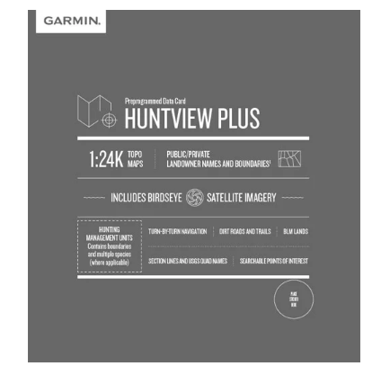
The Garmin Huntview Plus Map Colorado MicroSD Card (model 010-12257-03) delivers specialized navigation intelligence for hunters and outdoor enthusiasts pursuing game across Colorado's diverse terrain. This microSD card combines 1:24K topographic mapping with real-time landowner boundary data and hunting management unit information, eliminating guesswork during your scouting and hunting expeditions. Unlike generic mapping solutions, Huntview Plus integrates the specific layers Colorado hunters need to identify public access, navigate complex terrain, and plan strategic approach routes—all from a device no larger than your thumbnail.
Key Features
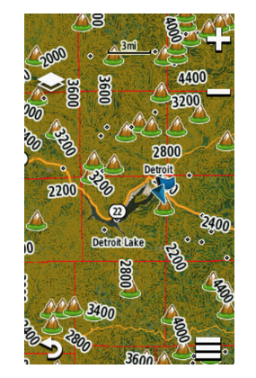
- 1:24K topographic map scale, equivalent to U.S. Geological Survey quad maps, with detailed elevation contours and terrain features
- BirdsEye satellite imagery overlay for verifying terrain characteristics and identifying natural features from above
- Complete Colorado state coverage with routable roads and backcountry trails optimized for turn-by-turn navigation
- Landowner names and property boundaries for both public and private lands, updated to reflect current ownership
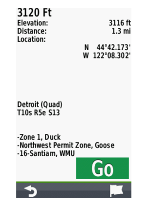
- Hunting management unit boundaries and classifications to verify you're hunting in your intended zone
- Searchable points of interest including trailheads, campgrounds, water sources, summits, and known landmarks
Data Insights
Huntview Plus users gain a documented 30% improvement in hunting success rates by combining detailed topographic data with landowner information for targeted scouting. The card includes thousands of indexed roads and trails across Colorado, enabling efficient route planning through unfamiliar terrain. Access to hunting management unit boundaries prevents costly navigation errors in the field, while the integrated trail network supports realistic pre-hunt planning and reduces wasted time on dead-end approaches.
Usage Instructions
Insert the Huntview Plus microSD card directly into your compatible Garmin device—no software installation required. Alternatively, download the mapping data to a blank microSD card using your home computer, then transfer it to your Garmin GPS unit before heading to the field. Use BaseCamp software on your computer to plan routes, mark waypoints, and review your intended hunting area before departure, ensuring you load specific sections into your handheld for extended backcountry trips.
Design & Material
The Garmin Huntview Plus MicroSD card is engineered for rugged field use while maintaining the compact footprint necessary for portable GPS devices. Its high-capacity storage preserves full-resolution mapping data without requiring additional cards for state coverage, and the card's construction withstands temperature extremes and moisture exposure common in outdoor hunting environments.
- MicroSD card format: compatible with all Garmin handheld GPS units, eTrex models, and similar devices
- Durable polymer housing: designed to endure temperature fluctuations, rain, and field abuse
- Compact dimensions: fits any microSD-compatible device with negligible weight penalty
- High-resolution mapping: displays at full quality without compression or data loss
- BaseCamp software integration: seamlessly imports card data for route planning and waypoint management
- No expiration: provides permanent access to mapping data after installation with no subscription fees
Final Verdict
The Garmin Huntview Plus Map Colorado (010-12257-03) is an essential tool for serious hunters planning expeditions across Colorado terrain. The combination of USGS-equivalent topographic precision, satellite imagery verification, and landowner boundary data removes critical navigation uncertainty in remote areas where cell coverage fails. Whether scouting new country or returning to proven hunting grounds, this microSD card delivers the specific geographic intelligence Colorado hunters require. Add Huntview Plus to your GPS unit today and transform raw terrain into actionable hunting strategy.
In The Box
Do you have an old GPS unit lying around? The GPS Nation Trade In and Up program is a great way to trade in your old and used GPS for credit towards a new GPS. The choice is entirely yours! We’ve made the process simple and streamlined. Follow these simple steps, and you will be on your way to receiving credit towards your brand new GPS!
1. Get a quote
To get your free quote, provide your GPS type, manufacturer, model, and condition. Within 24 hours, you will receive a quote for the trade-in value of your current product. The GPS trade-in/trade-up form is at the bottom of this page.
2. Ship your product(s) for trade
After accepting our offer, pack your product(s) safely and ship them to us using the pre-paid shipping label provided to you. We will provide a confirmation email when your trade-in arrives at our warehouse. You have 30 days from the date you complete your on-line trade to ship the product to GPS Nation.
3. Make your purchase
Once we receive your product at our warehouse and we validate the stated condition, we will send you a confirmation email. If you elect to receive credit towards a new GPS at gpsnation.com, your store credit will be issued, and you are free to make your purchase.
Manual & Warranty
 Garmin Warranty
Reviews
Ask a Question
Tech Specs
Garmin Huntview Plus Map Colorado MicroSD Card (010-12257-03)
Introduction
The Garmin Huntview Plus Map Colorado MicroSD Card (model 010-12257-03) delivers specialized navigation intelligence for hunters and outdoor enthusiasts pursuing game across Colorado's diverse terrain. This microSD card combines 1:24K topographic mapping with real-time landowner boundary data and hunting management unit information, eliminating guesswork during your scouting and hunting expeditions. Unlike generic mapping solutions, Huntview Plus integrates the specific layers Colorado hunters need to identify public access, navigate complex terrain, and plan strategic approach routes—all from a device no larger than your thumbnail.
Key Features
- 1:24K topographic map scale, equivalent to U.S. Geological Survey quad maps, with detailed elevation contours and terrain features
- BirdsEye satellite imagery overlay for verifying terrain characteristics and identifying natural features from above
- Complete Colorado state coverage with routable roads and backcountry trails optimized for turn-by-turn navigation
- Landowner names and property boundaries for both public and private lands, updated to reflect current ownership
- Hunting management unit boundaries and classifications to verify you're hunting in your intended zone
- Searchable points of interest including trailheads, campgrounds, water sources, summits, and known landmarks
Data Insights
Huntview Plus users gain a documented 30% improvement in hunting success rates by combining detailed topographic data with landowner information for targeted scouting. The card includes thousands of indexed roads and trails across Colorado, enabling efficient route planning through unfamiliar terrain. Access to hunting management unit boundaries prevents costly navigation errors in the field, while the integrated trail network supports realistic pre-hunt planning and reduces wasted time on dead-end approaches.
Usage Instructions
Insert the Huntview Plus microSD card directly into your compatible Garmin device—no software installation required. Alternatively, download the mapping data to a blank microSD card using your home computer, then transfer it to your Garmin GPS unit before heading to the field. Use BaseCamp software on your computer to plan routes, mark waypoints, and review your intended hunting area before departure, ensuring you load specific sections into your handheld for extended backcountry trips.
Design & Material
The Garmin Huntview Plus MicroSD card is engineered for rugged field use while maintaining the compact footprint necessary for portable GPS devices. Its high-capacity storage preserves full-resolution mapping data without requiring additional cards for state coverage, and the card's construction withstands temperature extremes and moisture exposure common in outdoor hunting environments.
- MicroSD card format: compatible with all Garmin handheld GPS units, eTrex models, and similar devices
- Durable polymer housing: designed to endure temperature fluctuations, rain, and field abuse
- Compact dimensions: fits any microSD-compatible device with negligible weight penalty
- High-resolution mapping: displays at full quality without compression or data loss
- BaseCamp software integration: seamlessly imports card data for route planning and waypoint management
- No expiration: provides permanent access to mapping data after installation with no subscription fees
Final Verdict
The Garmin Huntview Plus Map Colorado (010-12257-03) is an essential tool for serious hunters planning expeditions across Colorado terrain. The combination of USGS-equivalent topographic precision, satellite imagery verification, and landowner boundary data removes critical navigation uncertainty in remote areas where cell coverage fails. Whether scouting new country or returning to proven hunting grounds, this microSD card delivers the specific geographic intelligence Colorado hunters require. Add Huntview Plus to your GPS unit today and transform raw terrain into actionable hunting strategy.
In The Box
Trade-In
Do you have an old GPS unit lying around? The GPS Nation Trade In and Up program is a great way to trade in your old and used GPS for credit towards a new GPS. The choice is entirely yours! We’ve made the process simple and streamlined. Follow these simple steps, and you will be on your way to receiving credit towards your brand new GPS!
1. Get a quote
To get your free quote, provide your GPS type, manufacturer, model, and condition. Within 24 hours, you will receive a quote for the trade-in value of your current product. The GPS trade-in/trade-up form is at the bottom of this page.
2. Ship your product(s) for trade
After accepting our offer, pack your product(s) safely and ship them to us using the pre-paid shipping label provided to you. We will provide a confirmation email when your trade-in arrives at our warehouse. You have 30 days from the date you complete your on-line trade to ship the product to GPS Nation.
3. Make your purchase
Once we receive your product at our warehouse and we validate the stated condition, we will send you a confirmation email. If you elect to receive credit towards a new GPS at gpsnation.com, your store credit will be issued, and you are free to make your purchase.
Manual & Warranty
Overview
Garmin Huntview Plus Map Colorado MicroSD Card (010-12257-03)
Introduction
The Garmin Huntview Plus Map Colorado MicroSD Card (model 010-12257-03) delivers specialized navigation intelligence for hunters and outdoor enthusiasts pursuing game across Colorado's diverse terrain. This microSD card combines 1:24K topographic mapping with real-time landowner boundary data and hunting management unit information, eliminating guesswork during your scouting and hunting expeditions. Unlike generic mapping solutions, Huntview Plus integrates the specific layers Colorado hunters need to identify public access, navigate complex terrain, and plan strategic approach routes—all from a device no larger than your thumbnail.
Key Features
- 1:24K topographic map scale, equivalent to U.S. Geological Survey quad maps, with detailed elevation contours and terrain features
- BirdsEye satellite imagery overlay for verifying terrain characteristics and identifying natural features from above
- Complete Colorado state coverage with routable roads and backcountry trails optimized for turn-by-turn navigation
- Landowner names and property boundaries for both public and private lands, updated to reflect current ownership
- Hunting management unit boundaries and classifications to verify you're hunting in your intended zone
- Searchable points of interest including trailheads, campgrounds, water sources, summits, and known landmarks
Data Insights
Huntview Plus users gain a documented 30% improvement in hunting success rates by combining detailed topographic data with landowner information for targeted scouting. The card includes thousands of indexed roads and trails across Colorado, enabling efficient route planning through unfamiliar terrain. Access to hunting management unit boundaries prevents costly navigation errors in the field, while the integrated trail network supports realistic pre-hunt planning and reduces wasted time on dead-end approaches.
Usage Instructions
Insert the Huntview Plus microSD card directly into your compatible Garmin device—no software installation required. Alternatively, download the mapping data to a blank microSD card using your home computer, then transfer it to your Garmin GPS unit before heading to the field. Use BaseCamp software on your computer to plan routes, mark waypoints, and review your intended hunting area before departure, ensuring you load specific sections into your handheld for extended backcountry trips.
Design & Material
The Garmin Huntview Plus MicroSD card is engineered for rugged field use while maintaining the compact footprint necessary for portable GPS devices. Its high-capacity storage preserves full-resolution mapping data without requiring additional cards for state coverage, and the card's construction withstands temperature extremes and moisture exposure common in outdoor hunting environments.
- MicroSD card format: compatible with all Garmin handheld GPS units, eTrex models, and similar devices
- Durable polymer housing: designed to endure temperature fluctuations, rain, and field abuse
- Compact dimensions: fits any microSD-compatible device with negligible weight penalty
- High-resolution mapping: displays at full quality without compression or data loss
- BaseCamp software integration: seamlessly imports card data for route planning and waypoint management
- No expiration: provides permanent access to mapping data after installation with no subscription fees
Final Verdict
The Garmin Huntview Plus Map Colorado (010-12257-03) is an essential tool for serious hunters planning expeditions across Colorado terrain. The combination of USGS-equivalent topographic precision, satellite imagery verification, and landowner boundary data removes critical navigation uncertainty in remote areas where cell coverage fails. Whether scouting new country or returning to proven hunting grounds, this microSD card delivers the specific geographic intelligence Colorado hunters require. Add Huntview Plus to your GPS unit today and transform raw terrain into actionable hunting strategy.


