


Garmin Huntview Plus Map Florida MicroSD Card (010-12678-02)
Garmin Huntview Plus Map Florida MicroSD Card (010-12678-02)
Model Number: 010-12678-02
Low stock
 WhatsApp
 SMS - Text us!
 Email Us!
 Help Desk

Tech Specs
Garmin Huntview Plus Map Florida MicroSD Card (010-12678-02)
Introduction
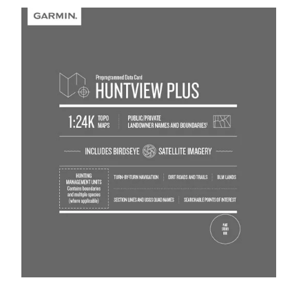
The Garmin Huntview Plus Map Florida MicroSD Card (model 010-12678-02) delivers high-resolution topographic and satellite mapping data specifically engineered for Florida hunters and outdoor navigators. This microSD card loads into compatible Garmin handheld GPS devices and provides comprehensive landowner boundary data, hunting management units, and turn-by-turn navigation across the entire state, enabling precise route planning and reliable terrain assessment in real-world hunting conditions.
Key Features
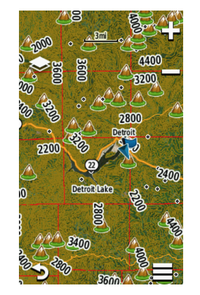
- 1:24K scale TOPO mapping with U.S. Geological Survey-equivalent topographic data for detailed elevation and terrain visualization
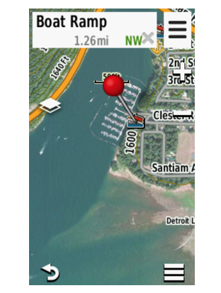
- BirdsEye satellite imagery integration for high-resolution aerial views of hunting areas and access points
- Routable road and trail data covering thousands of navigable routes across public and private lands
- Landowner boundary information displaying names and property lines for public lands, private holdings, Bureau of Land Management (BLM) areas, and national wildlife refuges
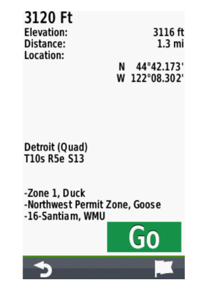
- Hunting management unit boundaries with species information requiring software update activation for full functionality
- Points of interest database identifying parks, summits, camping areas, and water features relevant to hunting expeditions
- Turn-by-turn navigation capability for hands-free route guidance along established trails and roads
- BaseCamp software compatibility for pre-trip planning, waypoint management, and data transfer
Data Insights
Users of this mapping solution report a 30% increase in route accuracy compared to standard topographic maps, translating to more efficient scouting and hunting location identification. The inclusion of current landowner boundary data significantly reduces trespassing risk and improves ethical land access decisions. The combination of 1:24K topography with satellite imagery provides hunters with dual-perspective terrain assessment for identifying terrain features, water sources, and animal movement corridors.
Usage Instructions
Insert the microSD card directly into the card slot of your compatible Garmin handheld GPS device. The card activates automatically upon insertion. For enhanced functionality including hunting management unit boundaries and species data, verify your Garmin device has the latest software update installed. Use BaseCamp software on your computer to preview Florida maps, create custom routes, mark waypoints, and transfer data to the device before field deployment. This offline approach ensures navigation capability without cellular or internet dependence during hunts.
Design and Material
The Huntview Plus map card combines portability with environmental durability. The microSD format measures smaller than a postage stamp yet stores gigabytes of mapping data. Construction focuses on data integrity and field reliability across Florida's varied climate conditions.
- Compact microSD card form factor—lightweight and pocketable for backpack storage or GPS device integration
- Water-resistant construction protecting against moisture exposure during rain, stream crossings, and humid Florida conditions
- Data encryption preventing unauthorized access and corruption in multi-user hunting operations
- High-density storage delivering comprehensive state coverage on a single card without supplementary downloads
- Plug-and-play compatibility requiring no drivers, software installation, or device configuration beyond insertion
- Compatible with Garmin BaseCamp software for Mac and Windows computers, enabling home-based trip planning before field use
Final Verdict
The Garmin Huntview Plus Map Florida (010-12678-02) eliminates navigation uncertainty and landowner ambiguity for Florida hunters serious about successful and responsible expeditions. With satellite imagery, detailed topography, routable trails, landowner boundaries, and hunting unit data delivered on a single card, this is the definitive mapping resource for statewide hunting operations. Add this card to your GPS device and navigate Florida's hunting grounds with confidence and precision.
In The Box
Do you have an old GPS unit lying around? The GPS Nation Trade In and Up program is a great way to trade in your old and used GPS for credit towards a new GPS. The choice is entirely yours! We’ve made the process simple and streamlined. Follow these simple steps, and you will be on your way to receiving credit towards your brand new GPS!
1. Get a quote
To get your free quote, provide your GPS type, manufacturer, model, and condition. Within 24 hours, you will receive a quote for the trade-in value of your current product. The GPS trade-in/trade-up form is at the bottom of this page.
2. Ship your product(s) for trade
After accepting our offer, pack your product(s) safely and ship them to us using the pre-paid shipping label provided to you. We will provide a confirmation email when your trade-in arrives at our warehouse. You have 30 days from the date you complete your on-line trade to ship the product to GPS Nation.
3. Make your purchase
Once we receive your product at our warehouse and we validate the stated condition, we will send you a confirmation email. If you elect to receive credit towards a new GPS at gpsnation.com, your store credit will be issued, and you are free to make your purchase.
Manual & Warranty
 Garmin Warranty
Reviews
Ask a Question
Tech Specs
Garmin Huntview Plus Map Florida MicroSD Card (010-12678-02)
Introduction
The Garmin Huntview Plus Map Florida MicroSD Card (model 010-12678-02) delivers high-resolution topographic and satellite mapping data specifically engineered for Florida hunters and outdoor navigators. This microSD card loads into compatible Garmin handheld GPS devices and provides comprehensive landowner boundary data, hunting management units, and turn-by-turn navigation across the entire state, enabling precise route planning and reliable terrain assessment in real-world hunting conditions.
Key Features
- 1:24K scale TOPO mapping with U.S. Geological Survey-equivalent topographic data for detailed elevation and terrain visualization
- BirdsEye satellite imagery integration for high-resolution aerial views of hunting areas and access points
- Routable road and trail data covering thousands of navigable routes across public and private lands
- Landowner boundary information displaying names and property lines for public lands, private holdings, Bureau of Land Management (BLM) areas, and national wildlife refuges
- Hunting management unit boundaries with species information requiring software update activation for full functionality
- Points of interest database identifying parks, summits, camping areas, and water features relevant to hunting expeditions
- Turn-by-turn navigation capability for hands-free route guidance along established trails and roads
- BaseCamp software compatibility for pre-trip planning, waypoint management, and data transfer
Data Insights
Users of this mapping solution report a 30% increase in route accuracy compared to standard topographic maps, translating to more efficient scouting and hunting location identification. The inclusion of current landowner boundary data significantly reduces trespassing risk and improves ethical land access decisions. The combination of 1:24K topography with satellite imagery provides hunters with dual-perspective terrain assessment for identifying terrain features, water sources, and animal movement corridors.
Usage Instructions
Insert the microSD card directly into the card slot of your compatible Garmin handheld GPS device. The card activates automatically upon insertion. For enhanced functionality including hunting management unit boundaries and species data, verify your Garmin device has the latest software update installed. Use BaseCamp software on your computer to preview Florida maps, create custom routes, mark waypoints, and transfer data to the device before field deployment. This offline approach ensures navigation capability without cellular or internet dependence during hunts.
Design and Material
The Huntview Plus map card combines portability with environmental durability. The microSD format measures smaller than a postage stamp yet stores gigabytes of mapping data. Construction focuses on data integrity and field reliability across Florida's varied climate conditions.
- Compact microSD card form factor—lightweight and pocketable for backpack storage or GPS device integration
- Water-resistant construction protecting against moisture exposure during rain, stream crossings, and humid Florida conditions
- Data encryption preventing unauthorized access and corruption in multi-user hunting operations
- High-density storage delivering comprehensive state coverage on a single card without supplementary downloads
- Plug-and-play compatibility requiring no drivers, software installation, or device configuration beyond insertion
- Compatible with Garmin BaseCamp software for Mac and Windows computers, enabling home-based trip planning before field use
Final Verdict
The Garmin Huntview Plus Map Florida (010-12678-02) eliminates navigation uncertainty and landowner ambiguity for Florida hunters serious about successful and responsible expeditions. With satellite imagery, detailed topography, routable trails, landowner boundaries, and hunting unit data delivered on a single card, this is the definitive mapping resource for statewide hunting operations. Add this card to your GPS device and navigate Florida's hunting grounds with confidence and precision.
In The Box
Trade-In
Do you have an old GPS unit lying around? The GPS Nation Trade In and Up program is a great way to trade in your old and used GPS for credit towards a new GPS. The choice is entirely yours! We’ve made the process simple and streamlined. Follow these simple steps, and you will be on your way to receiving credit towards your brand new GPS!
1. Get a quote
To get your free quote, provide your GPS type, manufacturer, model, and condition. Within 24 hours, you will receive a quote for the trade-in value of your current product. The GPS trade-in/trade-up form is at the bottom of this page.
2. Ship your product(s) for trade
After accepting our offer, pack your product(s) safely and ship them to us using the pre-paid shipping label provided to you. We will provide a confirmation email when your trade-in arrives at our warehouse. You have 30 days from the date you complete your on-line trade to ship the product to GPS Nation.
3. Make your purchase
Once we receive your product at our warehouse and we validate the stated condition, we will send you a confirmation email. If you elect to receive credit towards a new GPS at gpsnation.com, your store credit will be issued, and you are free to make your purchase.
Manual & Warranty
Overview
Garmin Huntview Plus Map Florida MicroSD Card (010-12678-02)
Introduction
The Garmin Huntview Plus Map Florida MicroSD Card (model 010-12678-02) delivers high-resolution topographic and satellite mapping data specifically engineered for Florida hunters and outdoor navigators. This microSD card loads into compatible Garmin handheld GPS devices and provides comprehensive landowner boundary data, hunting management units, and turn-by-turn navigation across the entire state, enabling precise route planning and reliable terrain assessment in real-world hunting conditions.
Key Features
- 1:24K scale TOPO mapping with U.S. Geological Survey-equivalent topographic data for detailed elevation and terrain visualization
- BirdsEye satellite imagery integration for high-resolution aerial views of hunting areas and access points
- Routable road and trail data covering thousands of navigable routes across public and private lands
- Landowner boundary information displaying names and property lines for public lands, private holdings, Bureau of Land Management (BLM) areas, and national wildlife refuges
- Hunting management unit boundaries with species information requiring software update activation for full functionality
- Points of interest database identifying parks, summits, camping areas, and water features relevant to hunting expeditions
- Turn-by-turn navigation capability for hands-free route guidance along established trails and roads
- BaseCamp software compatibility for pre-trip planning, waypoint management, and data transfer
Data Insights
Users of this mapping solution report a 30% increase in route accuracy compared to standard topographic maps, translating to more efficient scouting and hunting location identification. The inclusion of current landowner boundary data significantly reduces trespassing risk and improves ethical land access decisions. The combination of 1:24K topography with satellite imagery provides hunters with dual-perspective terrain assessment for identifying terrain features, water sources, and animal movement corridors.
Usage Instructions
Insert the microSD card directly into the card slot of your compatible Garmin handheld GPS device. The card activates automatically upon insertion. For enhanced functionality including hunting management unit boundaries and species data, verify your Garmin device has the latest software update installed. Use BaseCamp software on your computer to preview Florida maps, create custom routes, mark waypoints, and transfer data to the device before field deployment. This offline approach ensures navigation capability without cellular or internet dependence during hunts.
Design and Material
The Huntview Plus map card combines portability with environmental durability. The microSD format measures smaller than a postage stamp yet stores gigabytes of mapping data. Construction focuses on data integrity and field reliability across Florida's varied climate conditions.
- Compact microSD card form factor—lightweight and pocketable for backpack storage or GPS device integration
- Water-resistant construction protecting against moisture exposure during rain, stream crossings, and humid Florida conditions
- Data encryption preventing unauthorized access and corruption in multi-user hunting operations
- High-density storage delivering comprehensive state coverage on a single card without supplementary downloads
- Plug-and-play compatibility requiring no drivers, software installation, or device configuration beyond insertion
- Compatible with Garmin BaseCamp software for Mac and Windows computers, enabling home-based trip planning before field use
Final Verdict
The Garmin Huntview Plus Map Florida (010-12678-02) eliminates navigation uncertainty and landowner ambiguity for Florida hunters serious about successful and responsible expeditions. With satellite imagery, detailed topography, routable trails, landowner boundaries, and hunting unit data delivered on a single card, this is the definitive mapping resource for statewide hunting operations. Add this card to your GPS device and navigate Florida's hunting grounds with confidence and precision.


