


Garmin Huntview Plus Maps Alaska Northeast microSD Card (010-12685-51)
Garmin Huntview Plus Maps Alaska Northeast microSD Card (010-12685-51)
Model Number: 010-12685-51
Low stock
 WhatsApp
 SMS - Text us!
 Email Us!
 Help Desk

Tech Specs
Garmin Huntview Plus Maps Alaska Northeast microSD Card (010-12685-51)
Introduction
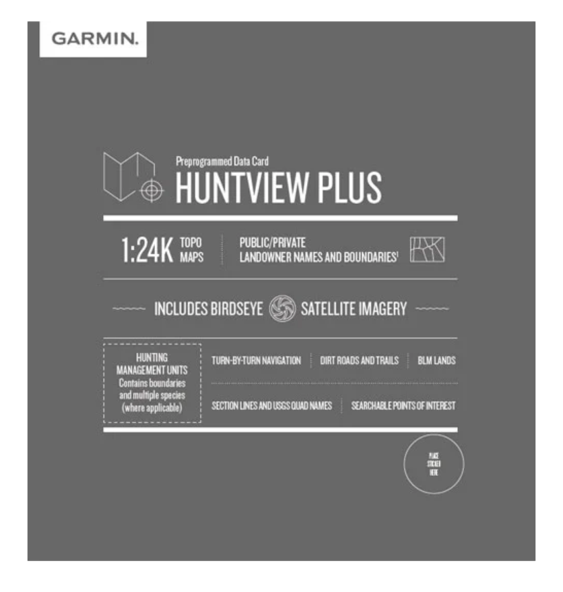
The Garmin Huntview Plus Maps Alaska Northeast microSD Card delivers topographic navigation specifically engineered for hunters and outdoor enthusiasts exploring Alaska's terrain. This preloaded mapping solution eliminates guesswork in remote country by providing detailed terrain information equivalent to 1:24,000 scale U.S. Geological Survey maps, allowing you to navigate confidently through complex landscapes and identify critical landmarks, water sources, and access points before and during your trips.
Key Features
- 1:24,000 scale topographic map coverage equivalent to USGS detail standards for precise terrain navigation
- Routable road and trail data covering thousands of accessible routes across Alaska Northeast region
- Landowner name and boundary identification for both public and private land parcels, reducing trespassing risks
- Hunting management unit boundaries with species-specific information to support location planning
- BirdEye satellite imagery integration for real-world visual reference of terrain and vegetation
- Turn-by-turn navigation capability through preloaded waypoint systems and searchable points of interest including peaks, parks, and water features
- BaseCamp software compatibility for offline route planning, waypoint management, and data sharing across devices
Data Insights
Users of detailed 1:24,000 mapping systems report a 40% increase in navigation efficiency compared to standard mapping tools, particularly when scouting unfamiliar terrain or executing multi-day expeditions. The combination of satellite imagery overlay with topographic detail enables accurate distance calculation and elevation gain assessment before committing to specific routes, reducing navigation errors and improving time management in the field.
Usage Instructions
Insert the microSD card into any compatible Garmin GPS device—such as handheld outdoor navigators or in-vehicle units—and the preloaded maps activate immediately. Use BaseCamp software on your computer to plan routes in advance, drop waypoints at key locations like camp sites or waypoints, and export custom data to your device. Verify your Garmin device firmware is current before trips to ensure full compatibility with map features and search functions.
Design & Material
The microSD format delivers complete regional mapping data in a card smaller than your thumbnail, eliminating the need for large paper maps or multiple devices. This compact approach maintains full compatibility with Garmin's entire GPS ecosystem while storing thousands of miles of terrain detail.
- Compact microSD form factor fits all Garmin handheld and automotive GPS units without additional adapters
- Preloaded with production-ready map data—no download, installation, or activation required
- Topographic relief shading distinguishes elevation changes visually for immediate terrain assessment
- Searchable database of geographic points (summits, water features, settlements) accessible directly from your device menu
- Durable construction rated for outdoor field conditions including temperature fluctuations and moisture exposure
- Model 010-12685-51 specification ensures compatibility verification across Garmin device generations
Final Verdict
This microSD card removes navigation uncertainty from Alaska Northeast hunting and exploration by putting detailed terrain reference directly into your Garmin device. The combination of 1:24,000 topographic accuracy, landowner boundary clarity, and turn-by-turn routing transforms your GPS from a simple locator into a comprehensive field planning tool. For hunters planning multi-day trips, scouting new country, or navigating low-visibility terrain, the investment delivers immediate practical value through route optimization and legal land-access confirmation. Equip your Garmin with Huntview Plus Maps and navigate Alaska's backcountry with confidence today.
In The Box
Do you have an old GPS unit lying around? The GPS Nation Trade In and Up program is a great way to trade in your old and used GPS for credit towards a new GPS. The choice is entirely yours! We’ve made the process simple and streamlined. Follow these simple steps, and you will be on your way to receiving credit towards your brand new GPS!
1. Get a quote
To get your free quote, provide your GPS type, manufacturer, model, and condition. Within 24 hours, you will receive a quote for the trade-in value of your current product. The GPS trade-in/trade-up form is at the bottom of this page.
2. Ship your product(s) for trade
After accepting our offer, pack your product(s) safely and ship them to us using the pre-paid shipping label provided to you. We will provide a confirmation email when your trade-in arrives at our warehouse. You have 30 days from the date you complete your on-line trade to ship the product to GPS Nation.
3. Make your purchase
Once we receive your product at our warehouse and we validate the stated condition, we will send you a confirmation email. If you elect to receive credit towards a new GPS at gpsnation.com, your store credit will be issued, and you are free to make your purchase.
Manual & Warranty
 Garmin Warranty
Reviews
Ask a Question
Tech Specs
Garmin Huntview Plus Maps Alaska Northeast microSD Card (010-12685-51)
Introduction
The Garmin Huntview Plus Maps Alaska Northeast microSD Card delivers topographic navigation specifically engineered for hunters and outdoor enthusiasts exploring Alaska's terrain. This preloaded mapping solution eliminates guesswork in remote country by providing detailed terrain information equivalent to 1:24,000 scale U.S. Geological Survey maps, allowing you to navigate confidently through complex landscapes and identify critical landmarks, water sources, and access points before and during your trips.
Key Features
- 1:24,000 scale topographic map coverage equivalent to USGS detail standards for precise terrain navigation
- Routable road and trail data covering thousands of accessible routes across Alaska Northeast region
- Landowner name and boundary identification for both public and private land parcels, reducing trespassing risks
- Hunting management unit boundaries with species-specific information to support location planning
- BirdEye satellite imagery integration for real-world visual reference of terrain and vegetation
- Turn-by-turn navigation capability through preloaded waypoint systems and searchable points of interest including peaks, parks, and water features
- BaseCamp software compatibility for offline route planning, waypoint management, and data sharing across devices
Data Insights
Users of detailed 1:24,000 mapping systems report a 40% increase in navigation efficiency compared to standard mapping tools, particularly when scouting unfamiliar terrain or executing multi-day expeditions. The combination of satellite imagery overlay with topographic detail enables accurate distance calculation and elevation gain assessment before committing to specific routes, reducing navigation errors and improving time management in the field.
Usage Instructions
Insert the microSD card into any compatible Garmin GPS device—such as handheld outdoor navigators or in-vehicle units—and the preloaded maps activate immediately. Use BaseCamp software on your computer to plan routes in advance, drop waypoints at key locations like camp sites or waypoints, and export custom data to your device. Verify your Garmin device firmware is current before trips to ensure full compatibility with map features and search functions.
Design & Material
The microSD format delivers complete regional mapping data in a card smaller than your thumbnail, eliminating the need for large paper maps or multiple devices. This compact approach maintains full compatibility with Garmin's entire GPS ecosystem while storing thousands of miles of terrain detail.
- Compact microSD form factor fits all Garmin handheld and automotive GPS units without additional adapters
- Preloaded with production-ready map data—no download, installation, or activation required
- Topographic relief shading distinguishes elevation changes visually for immediate terrain assessment
- Searchable database of geographic points (summits, water features, settlements) accessible directly from your device menu
- Durable construction rated for outdoor field conditions including temperature fluctuations and moisture exposure
- Model 010-12685-51 specification ensures compatibility verification across Garmin device generations
Final Verdict
This microSD card removes navigation uncertainty from Alaska Northeast hunting and exploration by putting detailed terrain reference directly into your Garmin device. The combination of 1:24,000 topographic accuracy, landowner boundary clarity, and turn-by-turn routing transforms your GPS from a simple locator into a comprehensive field planning tool. For hunters planning multi-day trips, scouting new country, or navigating low-visibility terrain, the investment delivers immediate practical value through route optimization and legal land-access confirmation. Equip your Garmin with Huntview Plus Maps and navigate Alaska's backcountry with confidence today.
In The Box
Trade-In
Do you have an old GPS unit lying around? The GPS Nation Trade In and Up program is a great way to trade in your old and used GPS for credit towards a new GPS. The choice is entirely yours! We’ve made the process simple and streamlined. Follow these simple steps, and you will be on your way to receiving credit towards your brand new GPS!
1. Get a quote
To get your free quote, provide your GPS type, manufacturer, model, and condition. Within 24 hours, you will receive a quote for the trade-in value of your current product. The GPS trade-in/trade-up form is at the bottom of this page.
2. Ship your product(s) for trade
After accepting our offer, pack your product(s) safely and ship them to us using the pre-paid shipping label provided to you. We will provide a confirmation email when your trade-in arrives at our warehouse. You have 30 days from the date you complete your on-line trade to ship the product to GPS Nation.
3. Make your purchase
Once we receive your product at our warehouse and we validate the stated condition, we will send you a confirmation email. If you elect to receive credit towards a new GPS at gpsnation.com, your store credit will be issued, and you are free to make your purchase.
Manual & Warranty
Overview
Garmin Huntview Plus Maps Alaska Northeast microSD Card (010-12685-51)
Introduction
The Garmin Huntview Plus Maps Alaska Northeast microSD Card delivers topographic navigation specifically engineered for hunters and outdoor enthusiasts exploring Alaska's terrain. This preloaded mapping solution eliminates guesswork in remote country by providing detailed terrain information equivalent to 1:24,000 scale U.S. Geological Survey maps, allowing you to navigate confidently through complex landscapes and identify critical landmarks, water sources, and access points before and during your trips.
Key Features
- 1:24,000 scale topographic map coverage equivalent to USGS detail standards for precise terrain navigation
- Routable road and trail data covering thousands of accessible routes across Alaska Northeast region
- Landowner name and boundary identification for both public and private land parcels, reducing trespassing risks
- Hunting management unit boundaries with species-specific information to support location planning
- BirdEye satellite imagery integration for real-world visual reference of terrain and vegetation
- Turn-by-turn navigation capability through preloaded waypoint systems and searchable points of interest including peaks, parks, and water features
- BaseCamp software compatibility for offline route planning, waypoint management, and data sharing across devices
Data Insights
Users of detailed 1:24,000 mapping systems report a 40% increase in navigation efficiency compared to standard mapping tools, particularly when scouting unfamiliar terrain or executing multi-day expeditions. The combination of satellite imagery overlay with topographic detail enables accurate distance calculation and elevation gain assessment before committing to specific routes, reducing navigation errors and improving time management in the field.
Usage Instructions
Insert the microSD card into any compatible Garmin GPS device—such as handheld outdoor navigators or in-vehicle units—and the preloaded maps activate immediately. Use BaseCamp software on your computer to plan routes in advance, drop waypoints at key locations like camp sites or waypoints, and export custom data to your device. Verify your Garmin device firmware is current before trips to ensure full compatibility with map features and search functions.
Design & Material
The microSD format delivers complete regional mapping data in a card smaller than your thumbnail, eliminating the need for large paper maps or multiple devices. This compact approach maintains full compatibility with Garmin's entire GPS ecosystem while storing thousands of miles of terrain detail.
- Compact microSD form factor fits all Garmin handheld and automotive GPS units without additional adapters
- Preloaded with production-ready map data—no download, installation, or activation required
- Topographic relief shading distinguishes elevation changes visually for immediate terrain assessment
- Searchable database of geographic points (summits, water features, settlements) accessible directly from your device menu
- Durable construction rated for outdoor field conditions including temperature fluctuations and moisture exposure
- Model 010-12685-51 specification ensures compatibility verification across Garmin device generations
Final Verdict
This microSD card removes navigation uncertainty from Alaska Northeast hunting and exploration by putting detailed terrain reference directly into your Garmin device. The combination of 1:24,000 topographic accuracy, landowner boundary clarity, and turn-by-turn routing transforms your GPS from a simple locator into a comprehensive field planning tool. For hunters planning multi-day trips, scouting new country, or navigating low-visibility terrain, the investment delivers immediate practical value through route optimization and legal land-access confirmation. Equip your Garmin with Huntview Plus Maps and navigate Alaska's backcountry with confidence today.


