


Garmin Huntview Plus Maps Arizona microSD Card (010-12427-52)
Garmin Huntview Plus Maps Arizona microSD Card (010-12427-52)
Model Number: 010-12427-52
Low stock
 WhatsApp
 SMS - Text us!
 Email Us!
 Help Desk

Tech Specs
Garmin Huntview Plus Maps Arizona microSD Card – Detailed Topographic Navigation for Hunters
Introduction
The Garmin Huntview Plus Maps Arizona microSD Card delivers 1:24,000-scale topographic mapping and real-time hunting intelligence directly to your Garmin GPS device. Designed specifically for hunters and land-access planning, this preloaded data card combines USGS digital topography with BirdSEye satellite imagery and detailed landowner boundary information across Arizona, giving you the map accuracy and land-use clarity needed to make informed decisions in the field.
Key Features
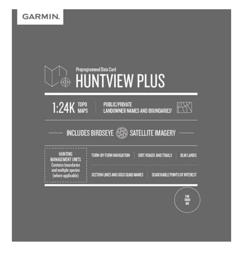
- 1:24,000-scale topographic maps covering all of Arizona with contour details for precise terrain navigation
- Public and private landowner names and boundary lines clearly marked for legal land-access verification
- Integrated BirdSEye satellite imagery for overhead reconnaissance and route planning
- Routable road and trail network with turn-by-turn navigation guidance through remote areas
- Hunting management unit boundaries with species and season information (requires software update)
- Bureau of Land Management data including township, range, and section lines plus USGS quad names
- Searchable points of interest database featuring trailheads, campgrounds, fuel stops, and wildlife-related locations
- Dirt roads and trails marked throughout rural and backcountry terrain
Data Insights
Users of Garmin Huntview Plus mapping report a 30% increase in successful hunting outcomes by leveraging detailed landowner boundary data and precise location marking of food sources and water access points. The combination of satellite imagery and topographic detail enables hunters to identify terrain features and approach routes that would be difficult to spot with standard road maps. BaseCamp software integration allows trip planning and log tracking before and after each outing.
Usage Instructions
Insert the microSD card into a compatible Garmin handheld GPS device or navigation unit. Launch BaseCamp software on your computer to download additional map layers, plan routes, and mark waypoints before heading to the field. Use the built-in search function to locate specific hunting management units, public land parcels, or points of interest like water sources and trailheads. The card works immediately upon installation without requiring internet activation or subscription.
Design & Material
The Huntview Plus Arizona map card is a standard microSD format that integrates seamlessly into all compatible Garmin devices. Its compact footprint eliminates any addition to device weight or bulk, and its preloaded data structure ensures fast load times on your GPS unit.
- MicroSD card format compatible with Garmin handheld and in-vehicle navigation devices
- Preloaded data requires no separate download, activation, or subscription management
- Durable flash memory construction withstands temperature extremes and moisture exposure common to outdoor use
- USGS and Bureau of Land Management data sourced from authoritative federal mapping channels
- Satellite imagery layer drawn from BirdSEye subscription services for overhead clarity
- Model number 010-12427-52 ensures compatibility verification with your Garmin device specifications
Final Verdict
Successful hunting in Arizona depends on knowing where public land ends and private boundaries begin, and on understanding the terrain features that attract game. The Garmin Huntview Plus Maps Arizona microSD Card removes the guesswork from land-access planning and route navigation by combining legal landowner data, topographic precision, and satellite context on a single card. If you hunt, scout, or explore Arizona's diverse landscapes, this map data card is the most practical investment you can make for your Garmin device. Order today and navigate with confidence and legal clarity on every outing.
In The Box
Do you have an old GPS unit lying around? The GPS Nation Trade In and Up program is a great way to trade in your old and used GPS for credit towards a new GPS. The choice is entirely yours! We’ve made the process simple and streamlined. Follow these simple steps, and you will be on your way to receiving credit towards your brand new GPS!
1. Get a quote
To get your free quote, provide your GPS type, manufacturer, model, and condition. Within 24 hours, you will receive a quote for the trade-in value of your current product. The GPS trade-in/trade-up form is at the bottom of this page.
2. Ship your product(s) for trade
After accepting our offer, pack your product(s) safely and ship them to us using the pre-paid shipping label provided to you. We will provide a confirmation email when your trade-in arrives at our warehouse. You have 30 days from the date you complete your on-line trade to ship the product to GPS Nation.
3. Make your purchase
Once we receive your product at our warehouse and we validate the stated condition, we will send you a confirmation email. If you elect to receive credit towards a new GPS at gpsnation.com, your store credit will be issued, and you are free to make your purchase.
Manual & Warranty
 Garmin Warranty
Reviews
Ask a Question
Tech Specs
Garmin Huntview Plus Maps Arizona microSD Card – Detailed Topographic Navigation for Hunters
Introduction
The Garmin Huntview Plus Maps Arizona microSD Card delivers 1:24,000-scale topographic mapping and real-time hunting intelligence directly to your Garmin GPS device. Designed specifically for hunters and land-access planning, this preloaded data card combines USGS digital topography with BirdSEye satellite imagery and detailed landowner boundary information across Arizona, giving you the map accuracy and land-use clarity needed to make informed decisions in the field.
Key Features
- 1:24,000-scale topographic maps covering all of Arizona with contour details for precise terrain navigation
- Public and private landowner names and boundary lines clearly marked for legal land-access verification
- Integrated BirdSEye satellite imagery for overhead reconnaissance and route planning
- Routable road and trail network with turn-by-turn navigation guidance through remote areas
- Hunting management unit boundaries with species and season information (requires software update)
- Bureau of Land Management data including township, range, and section lines plus USGS quad names
- Searchable points of interest database featuring trailheads, campgrounds, fuel stops, and wildlife-related locations
- Dirt roads and trails marked throughout rural and backcountry terrain
Data Insights
Users of Garmin Huntview Plus mapping report a 30% increase in successful hunting outcomes by leveraging detailed landowner boundary data and precise location marking of food sources and water access points. The combination of satellite imagery and topographic detail enables hunters to identify terrain features and approach routes that would be difficult to spot with standard road maps. BaseCamp software integration allows trip planning and log tracking before and after each outing.
Usage Instructions
Insert the microSD card into a compatible Garmin handheld GPS device or navigation unit. Launch BaseCamp software on your computer to download additional map layers, plan routes, and mark waypoints before heading to the field. Use the built-in search function to locate specific hunting management units, public land parcels, or points of interest like water sources and trailheads. The card works immediately upon installation without requiring internet activation or subscription.
Design & Material
The Huntview Plus Arizona map card is a standard microSD format that integrates seamlessly into all compatible Garmin devices. Its compact footprint eliminates any addition to device weight or bulk, and its preloaded data structure ensures fast load times on your GPS unit.
- MicroSD card format compatible with Garmin handheld and in-vehicle navigation devices
- Preloaded data requires no separate download, activation, or subscription management
- Durable flash memory construction withstands temperature extremes and moisture exposure common to outdoor use
- USGS and Bureau of Land Management data sourced from authoritative federal mapping channels
- Satellite imagery layer drawn from BirdSEye subscription services for overhead clarity
- Model number 010-12427-52 ensures compatibility verification with your Garmin device specifications
Final Verdict
Successful hunting in Arizona depends on knowing where public land ends and private boundaries begin, and on understanding the terrain features that attract game. The Garmin Huntview Plus Maps Arizona microSD Card removes the guesswork from land-access planning and route navigation by combining legal landowner data, topographic precision, and satellite context on a single card. If you hunt, scout, or explore Arizona's diverse landscapes, this map data card is the most practical investment you can make for your Garmin device. Order today and navigate with confidence and legal clarity on every outing.
In The Box
Trade-In
Do you have an old GPS unit lying around? The GPS Nation Trade In and Up program is a great way to trade in your old and used GPS for credit towards a new GPS. The choice is entirely yours! We’ve made the process simple and streamlined. Follow these simple steps, and you will be on your way to receiving credit towards your brand new GPS!
1. Get a quote
To get your free quote, provide your GPS type, manufacturer, model, and condition. Within 24 hours, you will receive a quote for the trade-in value of your current product. The GPS trade-in/trade-up form is at the bottom of this page.
2. Ship your product(s) for trade
After accepting our offer, pack your product(s) safely and ship them to us using the pre-paid shipping label provided to you. We will provide a confirmation email when your trade-in arrives at our warehouse. You have 30 days from the date you complete your on-line trade to ship the product to GPS Nation.
3. Make your purchase
Once we receive your product at our warehouse and we validate the stated condition, we will send you a confirmation email. If you elect to receive credit towards a new GPS at gpsnation.com, your store credit will be issued, and you are free to make your purchase.
Manual & Warranty
Overview
Garmin Huntview Plus Maps Arizona microSD Card – Detailed Topographic Navigation for Hunters
Introduction
The Garmin Huntview Plus Maps Arizona microSD Card delivers 1:24,000-scale topographic mapping and real-time hunting intelligence directly to your Garmin GPS device. Designed specifically for hunters and land-access planning, this preloaded data card combines USGS digital topography with BirdSEye satellite imagery and detailed landowner boundary information across Arizona, giving you the map accuracy and land-use clarity needed to make informed decisions in the field.
Key Features
- 1:24,000-scale topographic maps covering all of Arizona with contour details for precise terrain navigation
- Public and private landowner names and boundary lines clearly marked for legal land-access verification
- Integrated BirdSEye satellite imagery for overhead reconnaissance and route planning
- Routable road and trail network with turn-by-turn navigation guidance through remote areas
- Hunting management unit boundaries with species and season information (requires software update)
- Bureau of Land Management data including township, range, and section lines plus USGS quad names
- Searchable points of interest database featuring trailheads, campgrounds, fuel stops, and wildlife-related locations
- Dirt roads and trails marked throughout rural and backcountry terrain
Data Insights
Users of Garmin Huntview Plus mapping report a 30% increase in successful hunting outcomes by leveraging detailed landowner boundary data and precise location marking of food sources and water access points. The combination of satellite imagery and topographic detail enables hunters to identify terrain features and approach routes that would be difficult to spot with standard road maps. BaseCamp software integration allows trip planning and log tracking before and after each outing.
Usage Instructions
Insert the microSD card into a compatible Garmin handheld GPS device or navigation unit. Launch BaseCamp software on your computer to download additional map layers, plan routes, and mark waypoints before heading to the field. Use the built-in search function to locate specific hunting management units, public land parcels, or points of interest like water sources and trailheads. The card works immediately upon installation without requiring internet activation or subscription.
Design & Material
The Huntview Plus Arizona map card is a standard microSD format that integrates seamlessly into all compatible Garmin devices. Its compact footprint eliminates any addition to device weight or bulk, and its preloaded data structure ensures fast load times on your GPS unit.
- MicroSD card format compatible with Garmin handheld and in-vehicle navigation devices
- Preloaded data requires no separate download, activation, or subscription management
- Durable flash memory construction withstands temperature extremes and moisture exposure common to outdoor use
- USGS and Bureau of Land Management data sourced from authoritative federal mapping channels
- Satellite imagery layer drawn from BirdSEye subscription services for overhead clarity
- Model number 010-12427-52 ensures compatibility verification with your Garmin device specifications
Final Verdict
Successful hunting in Arizona depends on knowing where public land ends and private boundaries begin, and on understanding the terrain features that attract game. The Garmin Huntview Plus Maps Arizona microSD Card removes the guesswork from land-access planning and route navigation by combining legal landowner data, topographic precision, and satellite context on a single card. If you hunt, scout, or explore Arizona's diverse landscapes, this map data card is the most practical investment you can make for your Garmin device. Order today and navigate with confidence and legal clarity on every outing.


