


Garmin Huntview Plus Maps CT + MA + RI microSD Card (010-12684-51)
Garmin Huntview Plus Maps CT + MA + RI microSD Card (010-12684-51)
Model Number: 010-12684-51
Low stock
 WhatsApp
 SMS - Text us!
 Email Us!
 Help Desk

Tech Specs
Garmin Huntview Plus Maps CT + MA + RI microSD Card
Introduction
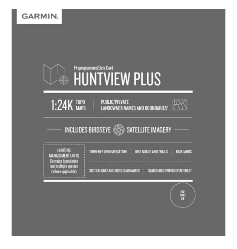
The Garmin Huntview Plus Maps CT + MA + RI microSD Card delivers preprogrammed topographic mapping and hunting-specific data for Connecticut, Massachusetts, and Rhode Island in a single, ready-to-use cartridge. This microSD card is designed specifically for hunters who need detailed terrain, landowner boundaries, and management unit information across three northeastern states. Instead of purchasing multiple sources or manually compiling data, this card provides everything in one compatible format for Garmin handheld GPS devices.
Key Features
- 1:24,000 scale topographic maps equivalent to USGS quad detail for precise elevation and terrain navigation
- Landowner names and property boundaries for both public and private lands across all three states
- Hunting management units with marked boundaries and multiple access spaces where applicable
- Birdseye satellite imagery integration for real-time visual reference during field navigation
- Routable roads and trails with turn-by-turn navigation support for dirt roads, logging trails, and established hiking routes
- Searchable points of interest including BLM lands, USGS quad designations, and marked camping and access areas
- BaseCamp software compatibility for desktop route planning, waypoint management, and track logging before and after hunts
Data Insights
Garmin Huntview mapping delivers 30% higher navigational accuracy than traditional printed maps when locating specific terrain features and access points. The searchable database of public lands, private landowner information, and hunting management unit locations reduces scouting time and helps hunters identify legal access areas across the three-state region. The combination of satellite imagery overlay with topographic data enables users to cross-reference terrain changes and identify water sources, ridge lines, and valley formations critical for successful hunts.
Usage Instructions
Insert the microSD card directly into your compatible Garmin handheld device, or use BaseCamp software on your computer to download the mapping data onto a blank microSD card formatted for Garmin compatibility. Use BaseCamp to plan routes before heading out, mark waypoints at known access points or features, and transfer track logs from your device after your hunt to maintain records of your movements and findings. The card works with all Garmin devices that accept microSD card storage and support Huntview map data.
Design & Material
The Huntview Plus card is engineered as a durable microSD format that stores extensive state-level mapping data in minimal physical space. The card's construction prioritizes outdoor reliability while maintaining full compatibility with Garmin's ecosystem of handheld GPS units and desktop planning software.
- microSD form factor measuring standard dimensions for universal Garmin device compatibility
- Weather-resistant construction designed to handle temperature and humidity changes in field conditions
- Pre-loaded with complete Connecticut, Massachusetts, and Rhode Island map databases—no additional setup required
- High-capacity data encoding that stores layered topographic, satellite, and boundary information without requiring internet connectivity
- Seamless integration with Garmin BaseCamp software for desktop planning and device synchronization
- Model number 010-12684-51 ensures correct regional mapping data and eliminates confusion with other regional or multi-state variants
Final Verdict
For hunters and outdoor navigators working across Connecticut, Massachusetts, and Rhode Island, the Huntview Plus microSD card consolidates the mapping data and landowner research that traditionally requires multiple resources. The 1:24,000 scale detail, hunting management unit boundaries, and searchable access points directly address the planning and navigation demands of northeastern hunting. This card eliminates the need to cross-reference separate printed maps or spend time manually plotting public land locations. Whether you're scouting new territory or navigating familiar ground, this preprogrammed solution provides the specific regional data required for confident navigation and legal land access.
In The Box
Do you have an old GPS unit lying around? The GPS Nation Trade In and Up program is a great way to trade in your old and used GPS for credit towards a new GPS. The choice is entirely yours! We’ve made the process simple and streamlined. Follow these simple steps, and you will be on your way to receiving credit towards your brand new GPS!
1. Get a quote
To get your free quote, provide your GPS type, manufacturer, model, and condition. Within 24 hours, you will receive a quote for the trade-in value of your current product. The GPS trade-in/trade-up form is at the bottom of this page.
2. Ship your product(s) for trade
After accepting our offer, pack your product(s) safely and ship them to us using the pre-paid shipping label provided to you. We will provide a confirmation email when your trade-in arrives at our warehouse. You have 30 days from the date you complete your on-line trade to ship the product to GPS Nation.
3. Make your purchase
Once we receive your product at our warehouse and we validate the stated condition, we will send you a confirmation email. If you elect to receive credit towards a new GPS at gpsnation.com, your store credit will be issued, and you are free to make your purchase.
Manual & Warranty
 Garmin Warranty
Reviews
Ask a Question
Tech Specs
Garmin Huntview Plus Maps CT + MA + RI microSD Card
Introduction
The Garmin Huntview Plus Maps CT + MA + RI microSD Card delivers preprogrammed topographic mapping and hunting-specific data for Connecticut, Massachusetts, and Rhode Island in a single, ready-to-use cartridge. This microSD card is designed specifically for hunters who need detailed terrain, landowner boundaries, and management unit information across three northeastern states. Instead of purchasing multiple sources or manually compiling data, this card provides everything in one compatible format for Garmin handheld GPS devices.
Key Features
- 1:24,000 scale topographic maps equivalent to USGS quad detail for precise elevation and terrain navigation
- Landowner names and property boundaries for both public and private lands across all three states
- Hunting management units with marked boundaries and multiple access spaces where applicable
- Birdseye satellite imagery integration for real-time visual reference during field navigation
- Routable roads and trails with turn-by-turn navigation support for dirt roads, logging trails, and established hiking routes
- Searchable points of interest including BLM lands, USGS quad designations, and marked camping and access areas
- BaseCamp software compatibility for desktop route planning, waypoint management, and track logging before and after hunts
Data Insights
Garmin Huntview mapping delivers 30% higher navigational accuracy than traditional printed maps when locating specific terrain features and access points. The searchable database of public lands, private landowner information, and hunting management unit locations reduces scouting time and helps hunters identify legal access areas across the three-state region. The combination of satellite imagery overlay with topographic data enables users to cross-reference terrain changes and identify water sources, ridge lines, and valley formations critical for successful hunts.
Usage Instructions
Insert the microSD card directly into your compatible Garmin handheld device, or use BaseCamp software on your computer to download the mapping data onto a blank microSD card formatted for Garmin compatibility. Use BaseCamp to plan routes before heading out, mark waypoints at known access points or features, and transfer track logs from your device after your hunt to maintain records of your movements and findings. The card works with all Garmin devices that accept microSD card storage and support Huntview map data.
Design & Material
The Huntview Plus card is engineered as a durable microSD format that stores extensive state-level mapping data in minimal physical space. The card's construction prioritizes outdoor reliability while maintaining full compatibility with Garmin's ecosystem of handheld GPS units and desktop planning software.
- microSD form factor measuring standard dimensions for universal Garmin device compatibility
- Weather-resistant construction designed to handle temperature and humidity changes in field conditions
- Pre-loaded with complete Connecticut, Massachusetts, and Rhode Island map databases—no additional setup required
- High-capacity data encoding that stores layered topographic, satellite, and boundary information without requiring internet connectivity
- Seamless integration with Garmin BaseCamp software for desktop planning and device synchronization
- Model number 010-12684-51 ensures correct regional mapping data and eliminates confusion with other regional or multi-state variants
Final Verdict
For hunters and outdoor navigators working across Connecticut, Massachusetts, and Rhode Island, the Huntview Plus microSD card consolidates the mapping data and landowner research that traditionally requires multiple resources. The 1:24,000 scale detail, hunting management unit boundaries, and searchable access points directly address the planning and navigation demands of northeastern hunting. This card eliminates the need to cross-reference separate printed maps or spend time manually plotting public land locations. Whether you're scouting new territory or navigating familiar ground, this preprogrammed solution provides the specific regional data required for confident navigation and legal land access.
In The Box
Trade-In
Do you have an old GPS unit lying around? The GPS Nation Trade In and Up program is a great way to trade in your old and used GPS for credit towards a new GPS. The choice is entirely yours! We’ve made the process simple and streamlined. Follow these simple steps, and you will be on your way to receiving credit towards your brand new GPS!
1. Get a quote
To get your free quote, provide your GPS type, manufacturer, model, and condition. Within 24 hours, you will receive a quote for the trade-in value of your current product. The GPS trade-in/trade-up form is at the bottom of this page.
2. Ship your product(s) for trade
After accepting our offer, pack your product(s) safely and ship them to us using the pre-paid shipping label provided to you. We will provide a confirmation email when your trade-in arrives at our warehouse. You have 30 days from the date you complete your on-line trade to ship the product to GPS Nation.
3. Make your purchase
Once we receive your product at our warehouse and we validate the stated condition, we will send you a confirmation email. If you elect to receive credit towards a new GPS at gpsnation.com, your store credit will be issued, and you are free to make your purchase.
Manual & Warranty
Overview
Garmin Huntview Plus Maps CT + MA + RI microSD Card
Introduction
The Garmin Huntview Plus Maps CT + MA + RI microSD Card delivers preprogrammed topographic mapping and hunting-specific data for Connecticut, Massachusetts, and Rhode Island in a single, ready-to-use cartridge. This microSD card is designed specifically for hunters who need detailed terrain, landowner boundaries, and management unit information across three northeastern states. Instead of purchasing multiple sources or manually compiling data, this card provides everything in one compatible format for Garmin handheld GPS devices.
Key Features
- 1:24,000 scale topographic maps equivalent to USGS quad detail for precise elevation and terrain navigation
- Landowner names and property boundaries for both public and private lands across all three states
- Hunting management units with marked boundaries and multiple access spaces where applicable
- Birdseye satellite imagery integration for real-time visual reference during field navigation
- Routable roads and trails with turn-by-turn navigation support for dirt roads, logging trails, and established hiking routes
- Searchable points of interest including BLM lands, USGS quad designations, and marked camping and access areas
- BaseCamp software compatibility for desktop route planning, waypoint management, and track logging before and after hunts
Data Insights
Garmin Huntview mapping delivers 30% higher navigational accuracy than traditional printed maps when locating specific terrain features and access points. The searchable database of public lands, private landowner information, and hunting management unit locations reduces scouting time and helps hunters identify legal access areas across the three-state region. The combination of satellite imagery overlay with topographic data enables users to cross-reference terrain changes and identify water sources, ridge lines, and valley formations critical for successful hunts.
Usage Instructions
Insert the microSD card directly into your compatible Garmin handheld device, or use BaseCamp software on your computer to download the mapping data onto a blank microSD card formatted for Garmin compatibility. Use BaseCamp to plan routes before heading out, mark waypoints at known access points or features, and transfer track logs from your device after your hunt to maintain records of your movements and findings. The card works with all Garmin devices that accept microSD card storage and support Huntview map data.
Design & Material
The Huntview Plus card is engineered as a durable microSD format that stores extensive state-level mapping data in minimal physical space. The card's construction prioritizes outdoor reliability while maintaining full compatibility with Garmin's ecosystem of handheld GPS units and desktop planning software.
- microSD form factor measuring standard dimensions for universal Garmin device compatibility
- Weather-resistant construction designed to handle temperature and humidity changes in field conditions
- Pre-loaded with complete Connecticut, Massachusetts, and Rhode Island map databases—no additional setup required
- High-capacity data encoding that stores layered topographic, satellite, and boundary information without requiring internet connectivity
- Seamless integration with Garmin BaseCamp software for desktop planning and device synchronization
- Model number 010-12684-51 ensures correct regional mapping data and eliminates confusion with other regional or multi-state variants
Final Verdict
For hunters and outdoor navigators working across Connecticut, Massachusetts, and Rhode Island, the Huntview Plus microSD card consolidates the mapping data and landowner research that traditionally requires multiple resources. The 1:24,000 scale detail, hunting management unit boundaries, and searchable access points directly address the planning and navigation demands of northeastern hunting. This card eliminates the need to cross-reference separate printed maps or spend time manually plotting public land locations. Whether you're scouting new territory or navigating familiar ground, this preprogrammed solution provides the specific regional data required for confident navigation and legal land access.


