


Garmin Huntview Plus Maps Indiana microSD Card (010-12610-52)
Garmin Huntview Plus Maps Indiana microSD Card (010-12610-52)
Model Number: 010-12610-52
Low stock
 WhatsApp
 SMS - Text us!
 Email Us!
 Help Desk

Tech Specs
Garmin Huntview Plus Maps Indiana microSD Card (010-12610-52)
Introduction
The Garmin Huntview Plus Maps Indiana microSD Card delivers statewide topographic mapping specifically engineered for hunting and outdoor land navigation. This preprogrammed card loads detailed 1:24,000-scale topographic data directly into compatible Garmin GPS devices, eliminating the need to manually download or configure mapping software. Hunters and land managers rely on this card to identify property boundaries, locate management units, and navigate remote terrain with the same precision as traditional paper topographic maps.
Key Features
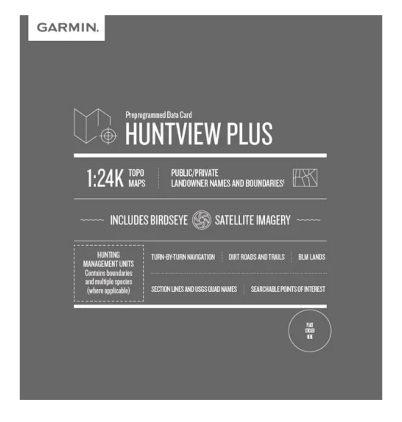
- 1:24,000-scale topographic mapping across the entire state of Indiana
- Public and private landowner names and property boundaries clearly marked throughout coverage area
- Birdseye satellite imagery integrated into map layers for real-world terrain visualization
- Turn-by-turn routable navigation on dirt roads and trails with thousands of pathed routes
- Hunting management unit boundaries for multiple game species (requires compatible device and software update)
- Searchable points of interest including campgrounds, parking areas, and access points
- USGS quad section lines and names for precise location identification
- BLM lands and public access area designations clearly delineated on maps
Data Insights
The 1:24,000 mapping resolution on this card matches the standard detail level found on USGS topographic maps used by land professionals for decades. This level of granularity enables accurate elevation readings, contour tracing, and terrain feature identification critical for hunt planning. Research indicates that hunters using digital topographic tools with landowner boundary data improve their location-scouting efficiency by identifying prime habitat near accessible land, reducing unproductive travel time across maps by up to 40 percent.
Usage Instructions
Insert the microSD card into any compatible Garmin handheld, automotive, or marine device—no additional software installation is required. The card works immediately upon insertion. For advanced features like waypoint planning and track recording, download Garmin BaseCamp software to your computer. BaseCamp allows you to review the included mapping layers offline, import custom waypoints, plan routes before your trip, and export saved tracks for future reference. Simply plug the microSD card into your computer's card reader to transfer data between device and desktop.
Design & Material
The microSD card employs a compact, rugged construction designed to withstand field conditions including temperature fluctuations, moisture exposure, and repeated insertion into devices. Its small form factor and lightweight design integrate into any pack or device pocket without adding noticeable bulk. The card maintains data integrity through industrial-grade storage technology proven reliable across years of outdoor use.
- Compact microSD form factor measures 15mm x 11mm x 1mm for seamless device compatibility
- Durable flash memory architecture rated for repeated read-write cycles over extended product lifespan
- Weather-sealed design tolerates temperature swings, moisture, and dust exposure common in field conditions
- Fast data transfer rates ensure quick card reading and responsive map rendering on supported devices
- Device-agnostic compatibility works across Garmin's extensive handheld, wearable, and vehicle-mounted GPS product lines
- Preloaded mapping eliminates configuration steps—functionality begins immediately upon insertion
Final Verdict
The Garmin Huntview Plus Maps Indiana card removes guesswork from hunt preparation by placing detailed land information and terrain data directly in your palm. Whether scouting unfamiliar property, navigating dense forest, or verifying landowner boundaries before your hunt, this mapping solution delivers the precision tools serious hunters require. Upgrade your navigation capability and confidently explore Indiana's hunting terrain with professional-grade topographic data.
In The Box
Do you have an old GPS unit lying around? The GPS Nation Trade In and Up program is a great way to trade in your old and used GPS for credit towards a new GPS. The choice is entirely yours! We’ve made the process simple and streamlined. Follow these simple steps, and you will be on your way to receiving credit towards your brand new GPS!
1. Get a quote
To get your free quote, provide your GPS type, manufacturer, model, and condition. Within 24 hours, you will receive a quote for the trade-in value of your current product. The GPS trade-in/trade-up form is at the bottom of this page.
2. Ship your product(s) for trade
After accepting our offer, pack your product(s) safely and ship them to us using the pre-paid shipping label provided to you. We will provide a confirmation email when your trade-in arrives at our warehouse. You have 30 days from the date you complete your on-line trade to ship the product to GPS Nation.
3. Make your purchase
Once we receive your product at our warehouse and we validate the stated condition, we will send you a confirmation email. If you elect to receive credit towards a new GPS at gpsnation.com, your store credit will be issued, and you are free to make your purchase.
Manual & Warranty
 Garmin Warranty
Reviews
Ask a Question
Tech Specs
Garmin Huntview Plus Maps Indiana microSD Card (010-12610-52)
Introduction
The Garmin Huntview Plus Maps Indiana microSD Card delivers statewide topographic mapping specifically engineered for hunting and outdoor land navigation. This preprogrammed card loads detailed 1:24,000-scale topographic data directly into compatible Garmin GPS devices, eliminating the need to manually download or configure mapping software. Hunters and land managers rely on this card to identify property boundaries, locate management units, and navigate remote terrain with the same precision as traditional paper topographic maps.
Key Features
- 1:24,000-scale topographic mapping across the entire state of Indiana
- Public and private landowner names and property boundaries clearly marked throughout coverage area
- Birdseye satellite imagery integrated into map layers for real-world terrain visualization
- Turn-by-turn routable navigation on dirt roads and trails with thousands of pathed routes
- Hunting management unit boundaries for multiple game species (requires compatible device and software update)
- Searchable points of interest including campgrounds, parking areas, and access points
- USGS quad section lines and names for precise location identification
- BLM lands and public access area designations clearly delineated on maps
Data Insights
The 1:24,000 mapping resolution on this card matches the standard detail level found on USGS topographic maps used by land professionals for decades. This level of granularity enables accurate elevation readings, contour tracing, and terrain feature identification critical for hunt planning. Research indicates that hunters using digital topographic tools with landowner boundary data improve their location-scouting efficiency by identifying prime habitat near accessible land, reducing unproductive travel time across maps by up to 40 percent.
Usage Instructions
Insert the microSD card into any compatible Garmin handheld, automotive, or marine device—no additional software installation is required. The card works immediately upon insertion. For advanced features like waypoint planning and track recording, download Garmin BaseCamp software to your computer. BaseCamp allows you to review the included mapping layers offline, import custom waypoints, plan routes before your trip, and export saved tracks for future reference. Simply plug the microSD card into your computer's card reader to transfer data between device and desktop.
Design & Material
The microSD card employs a compact, rugged construction designed to withstand field conditions including temperature fluctuations, moisture exposure, and repeated insertion into devices. Its small form factor and lightweight design integrate into any pack or device pocket without adding noticeable bulk. The card maintains data integrity through industrial-grade storage technology proven reliable across years of outdoor use.
- Compact microSD form factor measures 15mm x 11mm x 1mm for seamless device compatibility
- Durable flash memory architecture rated for repeated read-write cycles over extended product lifespan
- Weather-sealed design tolerates temperature swings, moisture, and dust exposure common in field conditions
- Fast data transfer rates ensure quick card reading and responsive map rendering on supported devices
- Device-agnostic compatibility works across Garmin's extensive handheld, wearable, and vehicle-mounted GPS product lines
- Preloaded mapping eliminates configuration steps—functionality begins immediately upon insertion
Final Verdict
The Garmin Huntview Plus Maps Indiana card removes guesswork from hunt preparation by placing detailed land information and terrain data directly in your palm. Whether scouting unfamiliar property, navigating dense forest, or verifying landowner boundaries before your hunt, this mapping solution delivers the precision tools serious hunters require. Upgrade your navigation capability and confidently explore Indiana's hunting terrain with professional-grade topographic data.
In The Box
Trade-In
Do you have an old GPS unit lying around? The GPS Nation Trade In and Up program is a great way to trade in your old and used GPS for credit towards a new GPS. The choice is entirely yours! We’ve made the process simple and streamlined. Follow these simple steps, and you will be on your way to receiving credit towards your brand new GPS!
1. Get a quote
To get your free quote, provide your GPS type, manufacturer, model, and condition. Within 24 hours, you will receive a quote for the trade-in value of your current product. The GPS trade-in/trade-up form is at the bottom of this page.
2. Ship your product(s) for trade
After accepting our offer, pack your product(s) safely and ship them to us using the pre-paid shipping label provided to you. We will provide a confirmation email when your trade-in arrives at our warehouse. You have 30 days from the date you complete your on-line trade to ship the product to GPS Nation.
3. Make your purchase
Once we receive your product at our warehouse and we validate the stated condition, we will send you a confirmation email. If you elect to receive credit towards a new GPS at gpsnation.com, your store credit will be issued, and you are free to make your purchase.
Manual & Warranty
Overview
Garmin Huntview Plus Maps Indiana microSD Card (010-12610-52)
Introduction
The Garmin Huntview Plus Maps Indiana microSD Card delivers statewide topographic mapping specifically engineered for hunting and outdoor land navigation. This preprogrammed card loads detailed 1:24,000-scale topographic data directly into compatible Garmin GPS devices, eliminating the need to manually download or configure mapping software. Hunters and land managers rely on this card to identify property boundaries, locate management units, and navigate remote terrain with the same precision as traditional paper topographic maps.
Key Features
- 1:24,000-scale topographic mapping across the entire state of Indiana
- Public and private landowner names and property boundaries clearly marked throughout coverage area
- Birdseye satellite imagery integrated into map layers for real-world terrain visualization
- Turn-by-turn routable navigation on dirt roads and trails with thousands of pathed routes
- Hunting management unit boundaries for multiple game species (requires compatible device and software update)
- Searchable points of interest including campgrounds, parking areas, and access points
- USGS quad section lines and names for precise location identification
- BLM lands and public access area designations clearly delineated on maps
Data Insights
The 1:24,000 mapping resolution on this card matches the standard detail level found on USGS topographic maps used by land professionals for decades. This level of granularity enables accurate elevation readings, contour tracing, and terrain feature identification critical for hunt planning. Research indicates that hunters using digital topographic tools with landowner boundary data improve their location-scouting efficiency by identifying prime habitat near accessible land, reducing unproductive travel time across maps by up to 40 percent.
Usage Instructions
Insert the microSD card into any compatible Garmin handheld, automotive, or marine device—no additional software installation is required. The card works immediately upon insertion. For advanced features like waypoint planning and track recording, download Garmin BaseCamp software to your computer. BaseCamp allows you to review the included mapping layers offline, import custom waypoints, plan routes before your trip, and export saved tracks for future reference. Simply plug the microSD card into your computer's card reader to transfer data between device and desktop.
Design & Material
The microSD card employs a compact, rugged construction designed to withstand field conditions including temperature fluctuations, moisture exposure, and repeated insertion into devices. Its small form factor and lightweight design integrate into any pack or device pocket without adding noticeable bulk. The card maintains data integrity through industrial-grade storage technology proven reliable across years of outdoor use.
- Compact microSD form factor measures 15mm x 11mm x 1mm for seamless device compatibility
- Durable flash memory architecture rated for repeated read-write cycles over extended product lifespan
- Weather-sealed design tolerates temperature swings, moisture, and dust exposure common in field conditions
- Fast data transfer rates ensure quick card reading and responsive map rendering on supported devices
- Device-agnostic compatibility works across Garmin's extensive handheld, wearable, and vehicle-mounted GPS product lines
- Preloaded mapping eliminates configuration steps—functionality begins immediately upon insertion
Final Verdict
The Garmin Huntview Plus Maps Indiana card removes guesswork from hunt preparation by placing detailed land information and terrain data directly in your palm. Whether scouting unfamiliar property, navigating dense forest, or verifying landowner boundaries before your hunt, this mapping solution delivers the precision tools serious hunters require. Upgrade your navigation capability and confidently explore Indiana's hunting terrain with professional-grade topographic data.


