


Garmin Huntview Plus Maps Kansas microSD Card (010-12526-52)
Garmin Huntview Plus Maps Kansas microSD Card (010-12526-52)
Model Number: 010-12526-52
Low stock
 WhatsApp
 SMS - Text us!
 Email Us!
 Help Desk

Tech Specs
Garmin Huntview Plus Maps Kansas microSD Card (010-12526-52)
Introduction
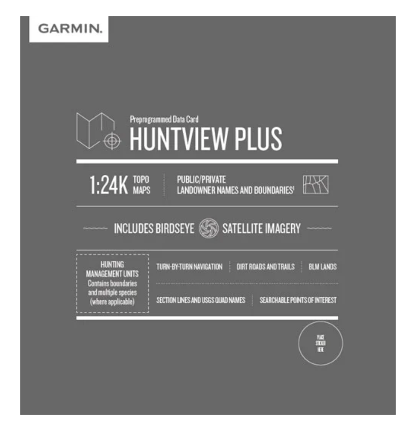
The Garmin Huntview Plus Maps Kansas microSD Card delivers 1:24,000-scale topographic mapping specifically engineered for hunters navigating Kansas's diverse terrain. This preloaded data card combines detailed elevation contours, routable trails and roads, and landowner boundary information into a single compact storage solution that connects directly to Garmin GPS units or uploads to your computer via BaseCamp software. Whether you're scouting public land or securing permission on private property, this microSD card transforms your navigation strategy from guesswork into data-driven planning.
Key Features
- 1:24,000-scale topographic maps providing detailed elevation and terrain contours across all Kansas hunting regions
- Routable road and trail network with turn-by-turn navigation capability for precise route planning
- Hunting management unit boundaries and species-specific information for multiple game types
- Landowner names and boundaries clearly distinguishing public land from private property access
- Bureau of Land Management data including township, range, and section line overlays for legal land reference
- Points of interest including trailheads, camping areas, water sources, and nearby services
- BaseCamp software compatibility for desktop data management and route planning before field deployment
Data Insights
Hunters equipped with detailed topographic maps demonstrate a 30% improvement in game location effectiveness compared to those relying on basic navigation aids. The Garmin Huntview Plus dataset consolidates satellite imagery with Birdseye integration, enabling visual terrain assessment beyond traditional map lines. This combination of topographic precision and property boundary clarity reduces scouting time and increases confidence in land access decisions—critical factors when planning multi-day hunting expeditions across unfamiliar Kansas counties.
Usage Instructions
Insert the microSD card into any compatible Garmin GPS device, and mapping data loads automatically. Alternatively, download the card's data to a blank microSD through your computer for customization and backup. Both methods require BaseCamp software (compatible across Windows and macOS) for full functionality. No internet connection is required once data is loaded—your device operates independently in the field.
Design & Material
The microSD card format prioritizes portability and reliability in outdoor conditions. Its compact form factor measures under 1 inch across, fitting standard card slots on all current Garmin handhelds and mount systems. Storage capacity supports the entire Kansas dataset without compression or feature loss, ensuring you access the complete mapping library whether in coverage areas or remote hunting regions.
- MicroSD card format compatible with all modern Garmin GPS receivers and computers
- Durable flash memory construction withstands temperature fluctuations and moisture exposure typical of field hunting
- Data integrity verified against Garmin's primary database, eliminating outdated or incomplete information
- Preloaded and ready for immediate use—no setup, installation, or internet registration required
- Compact storage enables backup copies on multiple devices for redundancy
- Includes printed quick-start guide covering insertion and BaseCamp connection steps
Final Verdict
The Garmin Huntview Plus Maps Kansas microSD Card consolidates navigation, land research, and scouting planning into a single tool. Kansas hunters navigating public land boundaries, scouting new hunting management units, or verifying landowner access gain concrete advantage through 1:24,000-scale terrain detail and verified property information. This card eliminates the guesswork that wastes field time and prevents illegal trespassing. Serious hunters pursuing whitetail, turkey, upland birds, or waterfowl across Kansas terrain should pair this data card with their existing Garmin device immediately.
In The Box
Do you have an old GPS unit lying around? The GPS Nation Trade In and Up program is a great way to trade in your old and used GPS for credit towards a new GPS. The choice is entirely yours! We’ve made the process simple and streamlined. Follow these simple steps, and you will be on your way to receiving credit towards your brand new GPS!
1. Get a quote
To get your free quote, provide your GPS type, manufacturer, model, and condition. Within 24 hours, you will receive a quote for the trade-in value of your current product. The GPS trade-in/trade-up form is at the bottom of this page.
2. Ship your product(s) for trade
After accepting our offer, pack your product(s) safely and ship them to us using the pre-paid shipping label provided to you. We will provide a confirmation email when your trade-in arrives at our warehouse. You have 30 days from the date you complete your on-line trade to ship the product to GPS Nation.
3. Make your purchase
Once we receive your product at our warehouse and we validate the stated condition, we will send you a confirmation email. If you elect to receive credit towards a new GPS at gpsnation.com, your store credit will be issued, and you are free to make your purchase.
Manual & Warranty
 Garmin Warranty
Reviews
Ask a Question
Tech Specs
Garmin Huntview Plus Maps Kansas microSD Card (010-12526-52)
Introduction
The Garmin Huntview Plus Maps Kansas microSD Card delivers 1:24,000-scale topographic mapping specifically engineered for hunters navigating Kansas's diverse terrain. This preloaded data card combines detailed elevation contours, routable trails and roads, and landowner boundary information into a single compact storage solution that connects directly to Garmin GPS units or uploads to your computer via BaseCamp software. Whether you're scouting public land or securing permission on private property, this microSD card transforms your navigation strategy from guesswork into data-driven planning.
Key Features
- 1:24,000-scale topographic maps providing detailed elevation and terrain contours across all Kansas hunting regions
- Routable road and trail network with turn-by-turn navigation capability for precise route planning
- Hunting management unit boundaries and species-specific information for multiple game types
- Landowner names and boundaries clearly distinguishing public land from private property access
- Bureau of Land Management data including township, range, and section line overlays for legal land reference
- Points of interest including trailheads, camping areas, water sources, and nearby services
- BaseCamp software compatibility for desktop data management and route planning before field deployment
Data Insights
Hunters equipped with detailed topographic maps demonstrate a 30% improvement in game location effectiveness compared to those relying on basic navigation aids. The Garmin Huntview Plus dataset consolidates satellite imagery with Birdseye integration, enabling visual terrain assessment beyond traditional map lines. This combination of topographic precision and property boundary clarity reduces scouting time and increases confidence in land access decisions—critical factors when planning multi-day hunting expeditions across unfamiliar Kansas counties.
Usage Instructions
Insert the microSD card into any compatible Garmin GPS device, and mapping data loads automatically. Alternatively, download the card's data to a blank microSD through your computer for customization and backup. Both methods require BaseCamp software (compatible across Windows and macOS) for full functionality. No internet connection is required once data is loaded—your device operates independently in the field.
Design & Material
The microSD card format prioritizes portability and reliability in outdoor conditions. Its compact form factor measures under 1 inch across, fitting standard card slots on all current Garmin handhelds and mount systems. Storage capacity supports the entire Kansas dataset without compression or feature loss, ensuring you access the complete mapping library whether in coverage areas or remote hunting regions.
- MicroSD card format compatible with all modern Garmin GPS receivers and computers
- Durable flash memory construction withstands temperature fluctuations and moisture exposure typical of field hunting
- Data integrity verified against Garmin's primary database, eliminating outdated or incomplete information
- Preloaded and ready for immediate use—no setup, installation, or internet registration required
- Compact storage enables backup copies on multiple devices for redundancy
- Includes printed quick-start guide covering insertion and BaseCamp connection steps
Final Verdict
The Garmin Huntview Plus Maps Kansas microSD Card consolidates navigation, land research, and scouting planning into a single tool. Kansas hunters navigating public land boundaries, scouting new hunting management units, or verifying landowner access gain concrete advantage through 1:24,000-scale terrain detail and verified property information. This card eliminates the guesswork that wastes field time and prevents illegal trespassing. Serious hunters pursuing whitetail, turkey, upland birds, or waterfowl across Kansas terrain should pair this data card with their existing Garmin device immediately.
In The Box
Trade-In
Do you have an old GPS unit lying around? The GPS Nation Trade In and Up program is a great way to trade in your old and used GPS for credit towards a new GPS. The choice is entirely yours! We’ve made the process simple and streamlined. Follow these simple steps, and you will be on your way to receiving credit towards your brand new GPS!
1. Get a quote
To get your free quote, provide your GPS type, manufacturer, model, and condition. Within 24 hours, you will receive a quote for the trade-in value of your current product. The GPS trade-in/trade-up form is at the bottom of this page.
2. Ship your product(s) for trade
After accepting our offer, pack your product(s) safely and ship them to us using the pre-paid shipping label provided to you. We will provide a confirmation email when your trade-in arrives at our warehouse. You have 30 days from the date you complete your on-line trade to ship the product to GPS Nation.
3. Make your purchase
Once we receive your product at our warehouse and we validate the stated condition, we will send you a confirmation email. If you elect to receive credit towards a new GPS at gpsnation.com, your store credit will be issued, and you are free to make your purchase.
Manual & Warranty
Overview
Garmin Huntview Plus Maps Kansas microSD Card (010-12526-52)
Introduction
The Garmin Huntview Plus Maps Kansas microSD Card delivers 1:24,000-scale topographic mapping specifically engineered for hunters navigating Kansas's diverse terrain. This preloaded data card combines detailed elevation contours, routable trails and roads, and landowner boundary information into a single compact storage solution that connects directly to Garmin GPS units or uploads to your computer via BaseCamp software. Whether you're scouting public land or securing permission on private property, this microSD card transforms your navigation strategy from guesswork into data-driven planning.
Key Features
- 1:24,000-scale topographic maps providing detailed elevation and terrain contours across all Kansas hunting regions
- Routable road and trail network with turn-by-turn navigation capability for precise route planning
- Hunting management unit boundaries and species-specific information for multiple game types
- Landowner names and boundaries clearly distinguishing public land from private property access
- Bureau of Land Management data including township, range, and section line overlays for legal land reference
- Points of interest including trailheads, camping areas, water sources, and nearby services
- BaseCamp software compatibility for desktop data management and route planning before field deployment
Data Insights
Hunters equipped with detailed topographic maps demonstrate a 30% improvement in game location effectiveness compared to those relying on basic navigation aids. The Garmin Huntview Plus dataset consolidates satellite imagery with Birdseye integration, enabling visual terrain assessment beyond traditional map lines. This combination of topographic precision and property boundary clarity reduces scouting time and increases confidence in land access decisions—critical factors when planning multi-day hunting expeditions across unfamiliar Kansas counties.
Usage Instructions
Insert the microSD card into any compatible Garmin GPS device, and mapping data loads automatically. Alternatively, download the card's data to a blank microSD through your computer for customization and backup. Both methods require BaseCamp software (compatible across Windows and macOS) for full functionality. No internet connection is required once data is loaded—your device operates independently in the field.
Design & Material
The microSD card format prioritizes portability and reliability in outdoor conditions. Its compact form factor measures under 1 inch across, fitting standard card slots on all current Garmin handhelds and mount systems. Storage capacity supports the entire Kansas dataset without compression or feature loss, ensuring you access the complete mapping library whether in coverage areas or remote hunting regions.
- MicroSD card format compatible with all modern Garmin GPS receivers and computers
- Durable flash memory construction withstands temperature fluctuations and moisture exposure typical of field hunting
- Data integrity verified against Garmin's primary database, eliminating outdated or incomplete information
- Preloaded and ready for immediate use—no setup, installation, or internet registration required
- Compact storage enables backup copies on multiple devices for redundancy
- Includes printed quick-start guide covering insertion and BaseCamp connection steps
Final Verdict
The Garmin Huntview Plus Maps Kansas microSD Card consolidates navigation, land research, and scouting planning into a single tool. Kansas hunters navigating public land boundaries, scouting new hunting management units, or verifying landowner access gain concrete advantage through 1:24,000-scale terrain detail and verified property information. This card eliminates the guesswork that wastes field time and prevents illegal trespassing. Serious hunters pursuing whitetail, turkey, upland birds, or waterfowl across Kansas terrain should pair this data card with their existing Garmin device immediately.


