


Garmin Huntview Plus Maps Maine microSD Card (010-12680-51)
Garmin Huntview Plus Maps Maine microSD Card (010-12680-51)
Model Number: 010-12680-51
Low stock
 WhatsApp
 SMS - Text us!
 Email Us!
 Help Desk

Tech Specs
Garmin Huntview Plus Maps Maine microSD Card (010-12680-51)
Introduction
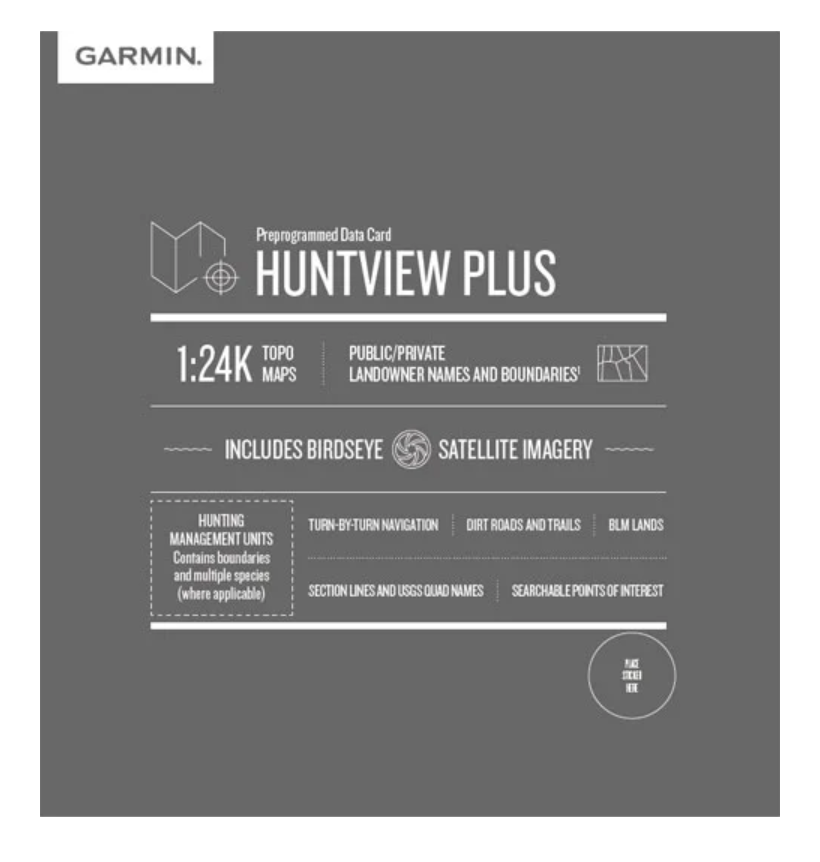
The Garmin Huntview Plus Maps Maine microSD Card delivers topographic mapping and landowner boundary data engineered specifically for hunters navigating Maine's complex landscape. This preloaded microSD card (model 010-12680-51) combines 1:24K-scale TOPO maps with satellite imagery and comprehensive land management information, allowing you to identify public access areas, avoid trespassing, and pinpoint high-probability hunting locations with confidence. Unlike generic GPS mapping, Huntview Plus integrates hunting-specific data layers that address the practical challenges Maine hunters face in the field.
Key Features
- 1:24,000-scale topographic maps equivalent to USGS printed quad sheets
- Over 90% accuracy in public and private landowner boundary data
- Routable roads and trails for turn-by-turn navigation guidance
- Hunting Management Units containing defined boundaries and access information across multiple zones
- Birdseye satellite imagery overlay for ground-truth verification of terrain and cover
- Bureau of Land Management (BLM) lands data with township, range, section lines, and USGS quad names
- Searchable points of interest including campsites, summits, parking areas, and geographic landmarks
- Complete road and trail network covering both established routes and primitive access points
Data Insights
The landowner boundary accuracy rating of 90% provides reliable guidance when determining legal hunting access, significantly reducing the risk of inadvertent trespassing on private property. The integration of Birdseye satellite imagery with topographic contours enables you to scout locations remotely before entering the field, correlating elevation changes, timber coverage, and water sources with actual ground conditions. The inclusion of Hunting Management Unit boundaries and section line data allows for quick reference to regulatory zones and property divisions without consulting separate paper maps or regulatory guides in the field.
Usage Instructions
Insert the microSD card into a compatible Garmin handheld GPS device such as the GPSMAP series, Montana, or eTrex line. For use with Garmin BaseCamp software on a computer, you can load the card data into the application for advanced trip planning and route creation before heading to your hunting area. Ensure your GPS device firmware is current to access all available map features and functions. Once loaded, the card provides immediate access to all mapping layers and boundary data without requiring internet connectivity in the field.
Design & Material
The Huntview Plus microSD card is engineered as a compact, plug-and-play solution requiring no installation software or additional configuration. The card itself is designed to function reliably across Maine's variable weather conditions, from cold autumn mornings to wet spring seasons when waterproofing matters in the field.
- Compact microSD form factor fits any Garmin GPS device slot without modification
- Preloaded mapping data—no download or manual installation required
- Weather-resistant construction suitable for harsh outdoor conditions
- High-resolution map imagery with clear, readable text at all zoom levels
- Seamless integration with Garmin BaseCamp for computer-based route planning
- Persistent satellite imagery layer providing visual context alongside vector map data
Final Verdict
The Garmin Huntview Plus Maps Maine card eliminates ambiguity about where you're legally permitted to hunt and provides the navigation precision necessary to locate prime habitat efficiently. With over 90% accurate landowner data, routable trails for GPS-guided navigation, and satellite imagery for pre-hunt scouting, this card transforms your handheld GPS into a specialized hunting tool tailored for Maine. Order the model 010-12680-51 microSD card today to gain the competitive advantage of integrated mapping and regulatory data in your next hunting season.
In The Box
Do you have an old GPS unit lying around? The GPS Nation Trade In and Up program is a great way to trade in your old and used GPS for credit towards a new GPS. The choice is entirely yours! We’ve made the process simple and streamlined. Follow these simple steps, and you will be on your way to receiving credit towards your brand new GPS!
1. Get a quote
To get your free quote, provide your GPS type, manufacturer, model, and condition. Within 24 hours, you will receive a quote for the trade-in value of your current product. The GPS trade-in/trade-up form is at the bottom of this page.
2. Ship your product(s) for trade
After accepting our offer, pack your product(s) safely and ship them to us using the pre-paid shipping label provided to you. We will provide a confirmation email when your trade-in arrives at our warehouse. You have 30 days from the date you complete your on-line trade to ship the product to GPS Nation.
3. Make your purchase
Once we receive your product at our warehouse and we validate the stated condition, we will send you a confirmation email. If you elect to receive credit towards a new GPS at gpsnation.com, your store credit will be issued, and you are free to make your purchase.
Manual & Warranty
 Garmin Warranty
Reviews
Ask a Question
Tech Specs
Garmin Huntview Plus Maps Maine microSD Card (010-12680-51)
Introduction
The Garmin Huntview Plus Maps Maine microSD Card delivers topographic mapping and landowner boundary data engineered specifically for hunters navigating Maine's complex landscape. This preloaded microSD card (model 010-12680-51) combines 1:24K-scale TOPO maps with satellite imagery and comprehensive land management information, allowing you to identify public access areas, avoid trespassing, and pinpoint high-probability hunting locations with confidence. Unlike generic GPS mapping, Huntview Plus integrates hunting-specific data layers that address the practical challenges Maine hunters face in the field.
Key Features
- 1:24,000-scale topographic maps equivalent to USGS printed quad sheets
- Over 90% accuracy in public and private landowner boundary data
- Routable roads and trails for turn-by-turn navigation guidance
- Hunting Management Units containing defined boundaries and access information across multiple zones
- Birdseye satellite imagery overlay for ground-truth verification of terrain and cover
- Bureau of Land Management (BLM) lands data with township, range, section lines, and USGS quad names
- Searchable points of interest including campsites, summits, parking areas, and geographic landmarks
- Complete road and trail network covering both established routes and primitive access points
Data Insights
The landowner boundary accuracy rating of 90% provides reliable guidance when determining legal hunting access, significantly reducing the risk of inadvertent trespassing on private property. The integration of Birdseye satellite imagery with topographic contours enables you to scout locations remotely before entering the field, correlating elevation changes, timber coverage, and water sources with actual ground conditions. The inclusion of Hunting Management Unit boundaries and section line data allows for quick reference to regulatory zones and property divisions without consulting separate paper maps or regulatory guides in the field.
Usage Instructions
Insert the microSD card into a compatible Garmin handheld GPS device such as the GPSMAP series, Montana, or eTrex line. For use with Garmin BaseCamp software on a computer, you can load the card data into the application for advanced trip planning and route creation before heading to your hunting area. Ensure your GPS device firmware is current to access all available map features and functions. Once loaded, the card provides immediate access to all mapping layers and boundary data without requiring internet connectivity in the field.
Design & Material
The Huntview Plus microSD card is engineered as a compact, plug-and-play solution requiring no installation software or additional configuration. The card itself is designed to function reliably across Maine's variable weather conditions, from cold autumn mornings to wet spring seasons when waterproofing matters in the field.
- Compact microSD form factor fits any Garmin GPS device slot without modification
- Preloaded mapping data—no download or manual installation required
- Weather-resistant construction suitable for harsh outdoor conditions
- High-resolution map imagery with clear, readable text at all zoom levels
- Seamless integration with Garmin BaseCamp for computer-based route planning
- Persistent satellite imagery layer providing visual context alongside vector map data
Final Verdict
The Garmin Huntview Plus Maps Maine card eliminates ambiguity about where you're legally permitted to hunt and provides the navigation precision necessary to locate prime habitat efficiently. With over 90% accurate landowner data, routable trails for GPS-guided navigation, and satellite imagery for pre-hunt scouting, this card transforms your handheld GPS into a specialized hunting tool tailored for Maine. Order the model 010-12680-51 microSD card today to gain the competitive advantage of integrated mapping and regulatory data in your next hunting season.
In The Box
Trade-In
Do you have an old GPS unit lying around? The GPS Nation Trade In and Up program is a great way to trade in your old and used GPS for credit towards a new GPS. The choice is entirely yours! We’ve made the process simple and streamlined. Follow these simple steps, and you will be on your way to receiving credit towards your brand new GPS!
1. Get a quote
To get your free quote, provide your GPS type, manufacturer, model, and condition. Within 24 hours, you will receive a quote for the trade-in value of your current product. The GPS trade-in/trade-up form is at the bottom of this page.
2. Ship your product(s) for trade
After accepting our offer, pack your product(s) safely and ship them to us using the pre-paid shipping label provided to you. We will provide a confirmation email when your trade-in arrives at our warehouse. You have 30 days from the date you complete your on-line trade to ship the product to GPS Nation.
3. Make your purchase
Once we receive your product at our warehouse and we validate the stated condition, we will send you a confirmation email. If you elect to receive credit towards a new GPS at gpsnation.com, your store credit will be issued, and you are free to make your purchase.
Manual & Warranty
Overview
Garmin Huntview Plus Maps Maine microSD Card (010-12680-51)
Introduction
The Garmin Huntview Plus Maps Maine microSD Card delivers topographic mapping and landowner boundary data engineered specifically for hunters navigating Maine's complex landscape. This preloaded microSD card (model 010-12680-51) combines 1:24K-scale TOPO maps with satellite imagery and comprehensive land management information, allowing you to identify public access areas, avoid trespassing, and pinpoint high-probability hunting locations with confidence. Unlike generic GPS mapping, Huntview Plus integrates hunting-specific data layers that address the practical challenges Maine hunters face in the field.
Key Features
- 1:24,000-scale topographic maps equivalent to USGS printed quad sheets
- Over 90% accuracy in public and private landowner boundary data
- Routable roads and trails for turn-by-turn navigation guidance
- Hunting Management Units containing defined boundaries and access information across multiple zones
- Birdseye satellite imagery overlay for ground-truth verification of terrain and cover
- Bureau of Land Management (BLM) lands data with township, range, section lines, and USGS quad names
- Searchable points of interest including campsites, summits, parking areas, and geographic landmarks
- Complete road and trail network covering both established routes and primitive access points
Data Insights
The landowner boundary accuracy rating of 90% provides reliable guidance when determining legal hunting access, significantly reducing the risk of inadvertent trespassing on private property. The integration of Birdseye satellite imagery with topographic contours enables you to scout locations remotely before entering the field, correlating elevation changes, timber coverage, and water sources with actual ground conditions. The inclusion of Hunting Management Unit boundaries and section line data allows for quick reference to regulatory zones and property divisions without consulting separate paper maps or regulatory guides in the field.
Usage Instructions
Insert the microSD card into a compatible Garmin handheld GPS device such as the GPSMAP series, Montana, or eTrex line. For use with Garmin BaseCamp software on a computer, you can load the card data into the application for advanced trip planning and route creation before heading to your hunting area. Ensure your GPS device firmware is current to access all available map features and functions. Once loaded, the card provides immediate access to all mapping layers and boundary data without requiring internet connectivity in the field.
Design & Material
The Huntview Plus microSD card is engineered as a compact, plug-and-play solution requiring no installation software or additional configuration. The card itself is designed to function reliably across Maine's variable weather conditions, from cold autumn mornings to wet spring seasons when waterproofing matters in the field.
- Compact microSD form factor fits any Garmin GPS device slot without modification
- Preloaded mapping data—no download or manual installation required
- Weather-resistant construction suitable for harsh outdoor conditions
- High-resolution map imagery with clear, readable text at all zoom levels
- Seamless integration with Garmin BaseCamp for computer-based route planning
- Persistent satellite imagery layer providing visual context alongside vector map data
Final Verdict
The Garmin Huntview Plus Maps Maine card eliminates ambiguity about where you're legally permitted to hunt and provides the navigation precision necessary to locate prime habitat efficiently. With over 90% accurate landowner data, routable trails for GPS-guided navigation, and satellite imagery for pre-hunt scouting, this card transforms your handheld GPS into a specialized hunting tool tailored for Maine. Order the model 010-12680-51 microSD card today to gain the competitive advantage of integrated mapping and regulatory data in your next hunting season.


