


Garmin Huntview Plus Maps Nebraska microSD Card (010-12682-51)
Garmin Huntview Plus Maps Nebraska microSD Card (010-12682-51)
Model Number: 010-12682-51
Low stock
 WhatsApp
 SMS - Text us!
 Email Us!
 Help Desk

Tech Specs
Garmin Huntview Plus Maps Nebraska microSD Card (010-12682-51)
Introduction
The Garmin Huntview Plus Maps Nebraska microSD Card delivers precision topographic mapping and routable trail data specifically designed for hunters and backcountry explorers. This microSD card (model 010-12682-51) plugs directly into compatible Garmin handheld GPS devices to provide detailed terrain visualization, landowner boundary identification, and hunting management unit data in a format that eliminates guesswork in the field. Unlike basic road maps, Huntview Plus combines 1:24,000 scale topographic detail with on-the-ground navigation features that enable you to access remote locations with confidence and stay within legal boundaries.
Key Features
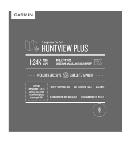
- 1:24,000 scale topographic mapping equivalent to USGS standard detail
- Over 500,000 miles of routable roads and trails with turn-by-turn navigation guidance
- Landowner names and property boundaries for public lands, private parcels, BLM areas, and National Parks across Nebraska
- Hunting management units with species and boundary information for strategic planning
- Points of interest including parks, summits, campgrounds, and nearby commercial services
- BirdSEye satellite imagery overlay for visual terrain context
Data Insights
The Huntview Plus mapping database encompasses comprehensive coverage of Nebraska's terrain, incorporating over 500,000 miles of roads and trails. This dataset reflects USGS-standard topographic precision at 1:24,000 scale, ensuring contour lines and elevation details match professional surveying standards. The integration of hunting management unit boundaries with species-specific information gives outdoor enthusiasts immediate access to regulatory data that traditionally required separate resources, streamlining trip planning and reducing navigation errors in unfamiliar terrain.
Usage Instructions
Insert the microSD card directly into your compatible Garmin device's card slot to activate the maps instantly. Alternatively, transfer the map data to a blank microSD card using Garmin's BaseCamp software or Garmin WebUpdater on your home computer, allowing offline map access without requiring an active data connection in the field. Once loaded, navigate using the device's touchscreen or buttons to access routable turn-by-turn directions, search specific map features, or toggle landowner and management unit overlays as needed.
Design & Material
The microSD card format provides a small, rugged data storage solution that integrates into Garmin's portable handheld ecosystem. Its compact form factor minimizes weight and bulk while maintaining robust data integrity under field conditions. The card's durability supports the temperature and moisture exposure typical of outdoor use without requiring additional protective casing.
- MicroSD card format fits standard Garmin device slots with no adapters required
- Durable flash memory construction withstands extended outdoor exposure and temperature fluctuations
- Plug-and-play installation with immediate map availability
- High-resolution topographic and satellite data layers eliminate resolution degradation during zoom
- Seamless compatibility with Garmin handheld models supporting microSD card expansion
- Supports offline navigation—no subscription or cellular service required for map access
Final Verdict
For Nebraska hunters and backcountry adventurers, the Garmin Huntview Plus Maps microSD Card eliminates critical navigation gaps by combining precise topography, legal boundary clarity, and on-the-ground trail routing in a single, compact data source. The 1:24,000 detail standard ensures terrain accuracy that translates directly to safer route planning and more efficient field navigation. Whether you're scouting new territory, respecting private land boundaries, or navigating to remote hunting areas, this card provides the authoritative reference data serious outdoor users demand. Purchase the Garmin Huntview Plus Maps Nebraska microSD Card today and navigate Nebraska's terrain with confidence and legal accuracy.
In The Box
Do you have an old GPS unit lying around? The GPS Nation Trade In and Up program is a great way to trade in your old and used GPS for credit towards a new GPS. The choice is entirely yours! We’ve made the process simple and streamlined. Follow these simple steps, and you will be on your way to receiving credit towards your brand new GPS!
1. Get a quote
To get your free quote, provide your GPS type, manufacturer, model, and condition. Within 24 hours, you will receive a quote for the trade-in value of your current product. The GPS trade-in/trade-up form is at the bottom of this page.
2. Ship your product(s) for trade
After accepting our offer, pack your product(s) safely and ship them to us using the pre-paid shipping label provided to you. We will provide a confirmation email when your trade-in arrives at our warehouse. You have 30 days from the date you complete your on-line trade to ship the product to GPS Nation.
3. Make your purchase
Once we receive your product at our warehouse and we validate the stated condition, we will send you a confirmation email. If you elect to receive credit towards a new GPS at gpsnation.com, your store credit will be issued, and you are free to make your purchase.
Manual & Warranty
 Garmin Warranty
Reviews
Ask a Question
Tech Specs
Garmin Huntview Plus Maps Nebraska microSD Card (010-12682-51)
Introduction
The Garmin Huntview Plus Maps Nebraska microSD Card delivers precision topographic mapping and routable trail data specifically designed for hunters and backcountry explorers. This microSD card (model 010-12682-51) plugs directly into compatible Garmin handheld GPS devices to provide detailed terrain visualization, landowner boundary identification, and hunting management unit data in a format that eliminates guesswork in the field. Unlike basic road maps, Huntview Plus combines 1:24,000 scale topographic detail with on-the-ground navigation features that enable you to access remote locations with confidence and stay within legal boundaries.
Key Features
- 1:24,000 scale topographic mapping equivalent to USGS standard detail
- Over 500,000 miles of routable roads and trails with turn-by-turn navigation guidance
- Landowner names and property boundaries for public lands, private parcels, BLM areas, and National Parks across Nebraska
- Hunting management units with species and boundary information for strategic planning
- Points of interest including parks, summits, campgrounds, and nearby commercial services
- BirdSEye satellite imagery overlay for visual terrain context
Data Insights
The Huntview Plus mapping database encompasses comprehensive coverage of Nebraska's terrain, incorporating over 500,000 miles of roads and trails. This dataset reflects USGS-standard topographic precision at 1:24,000 scale, ensuring contour lines and elevation details match professional surveying standards. The integration of hunting management unit boundaries with species-specific information gives outdoor enthusiasts immediate access to regulatory data that traditionally required separate resources, streamlining trip planning and reducing navigation errors in unfamiliar terrain.
Usage Instructions
Insert the microSD card directly into your compatible Garmin device's card slot to activate the maps instantly. Alternatively, transfer the map data to a blank microSD card using Garmin's BaseCamp software or Garmin WebUpdater on your home computer, allowing offline map access without requiring an active data connection in the field. Once loaded, navigate using the device's touchscreen or buttons to access routable turn-by-turn directions, search specific map features, or toggle landowner and management unit overlays as needed.
Design & Material
The microSD card format provides a small, rugged data storage solution that integrates into Garmin's portable handheld ecosystem. Its compact form factor minimizes weight and bulk while maintaining robust data integrity under field conditions. The card's durability supports the temperature and moisture exposure typical of outdoor use without requiring additional protective casing.
- MicroSD card format fits standard Garmin device slots with no adapters required
- Durable flash memory construction withstands extended outdoor exposure and temperature fluctuations
- Plug-and-play installation with immediate map availability
- High-resolution topographic and satellite data layers eliminate resolution degradation during zoom
- Seamless compatibility with Garmin handheld models supporting microSD card expansion
- Supports offline navigation—no subscription or cellular service required for map access
Final Verdict
For Nebraska hunters and backcountry adventurers, the Garmin Huntview Plus Maps microSD Card eliminates critical navigation gaps by combining precise topography, legal boundary clarity, and on-the-ground trail routing in a single, compact data source. The 1:24,000 detail standard ensures terrain accuracy that translates directly to safer route planning and more efficient field navigation. Whether you're scouting new territory, respecting private land boundaries, or navigating to remote hunting areas, this card provides the authoritative reference data serious outdoor users demand. Purchase the Garmin Huntview Plus Maps Nebraska microSD Card today and navigate Nebraska's terrain with confidence and legal accuracy.
In The Box
Trade-In
Do you have an old GPS unit lying around? The GPS Nation Trade In and Up program is a great way to trade in your old and used GPS for credit towards a new GPS. The choice is entirely yours! We’ve made the process simple and streamlined. Follow these simple steps, and you will be on your way to receiving credit towards your brand new GPS!
1. Get a quote
To get your free quote, provide your GPS type, manufacturer, model, and condition. Within 24 hours, you will receive a quote for the trade-in value of your current product. The GPS trade-in/trade-up form is at the bottom of this page.
2. Ship your product(s) for trade
After accepting our offer, pack your product(s) safely and ship them to us using the pre-paid shipping label provided to you. We will provide a confirmation email when your trade-in arrives at our warehouse. You have 30 days from the date you complete your on-line trade to ship the product to GPS Nation.
3. Make your purchase
Once we receive your product at our warehouse and we validate the stated condition, we will send you a confirmation email. If you elect to receive credit towards a new GPS at gpsnation.com, your store credit will be issued, and you are free to make your purchase.
Manual & Warranty
Overview
Garmin Huntview Plus Maps Nebraska microSD Card (010-12682-51)
Introduction
The Garmin Huntview Plus Maps Nebraska microSD Card delivers precision topographic mapping and routable trail data specifically designed for hunters and backcountry explorers. This microSD card (model 010-12682-51) plugs directly into compatible Garmin handheld GPS devices to provide detailed terrain visualization, landowner boundary identification, and hunting management unit data in a format that eliminates guesswork in the field. Unlike basic road maps, Huntview Plus combines 1:24,000 scale topographic detail with on-the-ground navigation features that enable you to access remote locations with confidence and stay within legal boundaries.
Key Features
- 1:24,000 scale topographic mapping equivalent to USGS standard detail
- Over 500,000 miles of routable roads and trails with turn-by-turn navigation guidance
- Landowner names and property boundaries for public lands, private parcels, BLM areas, and National Parks across Nebraska
- Hunting management units with species and boundary information for strategic planning
- Points of interest including parks, summits, campgrounds, and nearby commercial services
- BirdSEye satellite imagery overlay for visual terrain context
Data Insights
The Huntview Plus mapping database encompasses comprehensive coverage of Nebraska's terrain, incorporating over 500,000 miles of roads and trails. This dataset reflects USGS-standard topographic precision at 1:24,000 scale, ensuring contour lines and elevation details match professional surveying standards. The integration of hunting management unit boundaries with species-specific information gives outdoor enthusiasts immediate access to regulatory data that traditionally required separate resources, streamlining trip planning and reducing navigation errors in unfamiliar terrain.
Usage Instructions
Insert the microSD card directly into your compatible Garmin device's card slot to activate the maps instantly. Alternatively, transfer the map data to a blank microSD card using Garmin's BaseCamp software or Garmin WebUpdater on your home computer, allowing offline map access without requiring an active data connection in the field. Once loaded, navigate using the device's touchscreen or buttons to access routable turn-by-turn directions, search specific map features, or toggle landowner and management unit overlays as needed.
Design & Material
The microSD card format provides a small, rugged data storage solution that integrates into Garmin's portable handheld ecosystem. Its compact form factor minimizes weight and bulk while maintaining robust data integrity under field conditions. The card's durability supports the temperature and moisture exposure typical of outdoor use without requiring additional protective casing.
- MicroSD card format fits standard Garmin device slots with no adapters required
- Durable flash memory construction withstands extended outdoor exposure and temperature fluctuations
- Plug-and-play installation with immediate map availability
- High-resolution topographic and satellite data layers eliminate resolution degradation during zoom
- Seamless compatibility with Garmin handheld models supporting microSD card expansion
- Supports offline navigation—no subscription or cellular service required for map access
Final Verdict
For Nebraska hunters and backcountry adventurers, the Garmin Huntview Plus Maps microSD Card eliminates critical navigation gaps by combining precise topography, legal boundary clarity, and on-the-ground trail routing in a single, compact data source. The 1:24,000 detail standard ensures terrain accuracy that translates directly to safer route planning and more efficient field navigation. Whether you're scouting new territory, respecting private land boundaries, or navigating to remote hunting areas, this card provides the authoritative reference data serious outdoor users demand. Purchase the Garmin Huntview Plus Maps Nebraska microSD Card today and navigate Nebraska's terrain with confidence and legal accuracy.


