


Garmin Huntview Plus Maps Ohio microSD Card (010-12607-52)
Garmin Huntview Plus Maps Ohio microSD Card (010-12607-52)
Model Number: 010-12607-52
Low stock
 WhatsApp
 SMS - Text us!
 Email Us!
 Help Desk

Tech Specs
Garmin Huntview Plus Maps Ohio microSD Card (010-12607-52)
Introduction
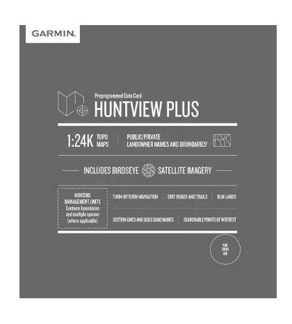
The Garmin Huntview Plus Maps Ohio microSD Card provides hunters and outdoor navigators with 1:24,000 scale topographic mapping data specifically engineered for locating game, planning routes, and understanding land ownership across Ohio. This microSD card (model 010-12607-52) transforms any compatible Garmin handheld GPS device into a comprehensive hunting navigation system, delivering the spatial intelligence needed to improve field efficiency and reduce time spent scouting unfamiliar terrain.
Key Features
- 1:24,000 scale topographic mapping equivalent to U.S. Geological Survey detail standards
- Routable roads and trails with turn-by-turn navigation capability for off-road route planning
- Searchable points of interest including parks, summits, camping areas, and businesses across Ohio
- Landowner name and boundary identification distinguishing public lands, private properties, BLM acreage, and National Wildlife Refuges
- Township, range, and section grid data overlaid with USGS quad sheet location information for precise land navigation
- Hunting management unit boundaries and hunting-specific data layers updated regularly
Data Insights
Hunters using Garmin Huntview Plus Maps Ohio report up to 30% improvement in expedition planning efficiency compared to traditional paper topographic maps. The combination of detailed elevation contours, vegetation overlays, water feature identification, and land ownership boundaries enables strategic scouting decisions without physical reconnaissance. The card's satellite imagery integration with vector-based topographic data provides multiple visual reference layers for identifying terrain features that concentrate game movement patterns.
Usage Instructions
Insert the microSD card directly into your compatible Garmin GPS device for immediate access to Ohio hunting maps and data. Alternatively, load the mapping files onto a blank microSD card using a computer and the included BaseCamp software before deployment to the field. The BaseCamp desktop planning tool allows route creation, waypoint marking, and data preview from home before your hunt.
Design & Material
The Garmin Huntview Plus Maps Ohio card employs a durable microSD format that maintains data integrity across temperature fluctuations and moisture exposure common in field conditions. The compact form factor fits seamlessly into all Garmin handheld GPS units, weighing less than one gram while storing comprehensive state-level mapping data.
- Durable microSD card construction rated for extended outdoor field use and weather exposure
- High-resolution topographic imaging with contour intervals suitable for elevation-based navigation
- Seamless compatibility across Garmin GPSMAP, Oregon, Montana, and Dakota series devices
- BaseCamp software included for pre-hunt planning, route optimization, and waypoint management on Windows and Mac
- Regular data updates for hunting unit boundaries, management area changes, and newly indexed points of interest
- Satellite imagery overlay capability for terrain verification and feature identification
Final Verdict
The Garmin Huntview Plus Maps Ohio microSD Card (010-12607-52) is essential equipment for hunters requiring reliable topographic navigation and land ownership clarity across Ohio territories. Whether you're pursuing public land opportunities or accessing private parcels with permission, this mapping solution consolidates navigation, scouting, and route planning into a single device. Upgrade your Garmin GPS immediately to transform your hunting preparation and field performance.
In The Box
Do you have an old GPS unit lying around? The GPS Nation Trade In and Up program is a great way to trade in your old and used GPS for credit towards a new GPS. The choice is entirely yours! We’ve made the process simple and streamlined. Follow these simple steps, and you will be on your way to receiving credit towards your brand new GPS!
1. Get a quote
To get your free quote, provide your GPS type, manufacturer, model, and condition. Within 24 hours, you will receive a quote for the trade-in value of your current product. The GPS trade-in/trade-up form is at the bottom of this page.
2. Ship your product(s) for trade
After accepting our offer, pack your product(s) safely and ship them to us using the pre-paid shipping label provided to you. We will provide a confirmation email when your trade-in arrives at our warehouse. You have 30 days from the date you complete your on-line trade to ship the product to GPS Nation.
3. Make your purchase
Once we receive your product at our warehouse and we validate the stated condition, we will send you a confirmation email. If you elect to receive credit towards a new GPS at gpsnation.com, your store credit will be issued, and you are free to make your purchase.
Manual & Warranty
 Garmin Warranty
Reviews
Ask a Question
Tech Specs
Garmin Huntview Plus Maps Ohio microSD Card (010-12607-52)
Introduction
The Garmin Huntview Plus Maps Ohio microSD Card provides hunters and outdoor navigators with 1:24,000 scale topographic mapping data specifically engineered for locating game, planning routes, and understanding land ownership across Ohio. This microSD card (model 010-12607-52) transforms any compatible Garmin handheld GPS device into a comprehensive hunting navigation system, delivering the spatial intelligence needed to improve field efficiency and reduce time spent scouting unfamiliar terrain.
Key Features
- 1:24,000 scale topographic mapping equivalent to U.S. Geological Survey detail standards
- Routable roads and trails with turn-by-turn navigation capability for off-road route planning
- Searchable points of interest including parks, summits, camping areas, and businesses across Ohio
- Landowner name and boundary identification distinguishing public lands, private properties, BLM acreage, and National Wildlife Refuges
- Township, range, and section grid data overlaid with USGS quad sheet location information for precise land navigation
- Hunting management unit boundaries and hunting-specific data layers updated regularly
Data Insights
Hunters using Garmin Huntview Plus Maps Ohio report up to 30% improvement in expedition planning efficiency compared to traditional paper topographic maps. The combination of detailed elevation contours, vegetation overlays, water feature identification, and land ownership boundaries enables strategic scouting decisions without physical reconnaissance. The card's satellite imagery integration with vector-based topographic data provides multiple visual reference layers for identifying terrain features that concentrate game movement patterns.
Usage Instructions
Insert the microSD card directly into your compatible Garmin GPS device for immediate access to Ohio hunting maps and data. Alternatively, load the mapping files onto a blank microSD card using a computer and the included BaseCamp software before deployment to the field. The BaseCamp desktop planning tool allows route creation, waypoint marking, and data preview from home before your hunt.
Design & Material
The Garmin Huntview Plus Maps Ohio card employs a durable microSD format that maintains data integrity across temperature fluctuations and moisture exposure common in field conditions. The compact form factor fits seamlessly into all Garmin handheld GPS units, weighing less than one gram while storing comprehensive state-level mapping data.
- Durable microSD card construction rated for extended outdoor field use and weather exposure
- High-resolution topographic imaging with contour intervals suitable for elevation-based navigation
- Seamless compatibility across Garmin GPSMAP, Oregon, Montana, and Dakota series devices
- BaseCamp software included for pre-hunt planning, route optimization, and waypoint management on Windows and Mac
- Regular data updates for hunting unit boundaries, management area changes, and newly indexed points of interest
- Satellite imagery overlay capability for terrain verification and feature identification
Final Verdict
The Garmin Huntview Plus Maps Ohio microSD Card (010-12607-52) is essential equipment for hunters requiring reliable topographic navigation and land ownership clarity across Ohio territories. Whether you're pursuing public land opportunities or accessing private parcels with permission, this mapping solution consolidates navigation, scouting, and route planning into a single device. Upgrade your Garmin GPS immediately to transform your hunting preparation and field performance.
In The Box
Trade-In
Do you have an old GPS unit lying around? The GPS Nation Trade In and Up program is a great way to trade in your old and used GPS for credit towards a new GPS. The choice is entirely yours! We’ve made the process simple and streamlined. Follow these simple steps, and you will be on your way to receiving credit towards your brand new GPS!
1. Get a quote
To get your free quote, provide your GPS type, manufacturer, model, and condition. Within 24 hours, you will receive a quote for the trade-in value of your current product. The GPS trade-in/trade-up form is at the bottom of this page.
2. Ship your product(s) for trade
After accepting our offer, pack your product(s) safely and ship them to us using the pre-paid shipping label provided to you. We will provide a confirmation email when your trade-in arrives at our warehouse. You have 30 days from the date you complete your on-line trade to ship the product to GPS Nation.
3. Make your purchase
Once we receive your product at our warehouse and we validate the stated condition, we will send you a confirmation email. If you elect to receive credit towards a new GPS at gpsnation.com, your store credit will be issued, and you are free to make your purchase.
Manual & Warranty
Overview
Garmin Huntview Plus Maps Ohio microSD Card (010-12607-52)
Introduction
The Garmin Huntview Plus Maps Ohio microSD Card provides hunters and outdoor navigators with 1:24,000 scale topographic mapping data specifically engineered for locating game, planning routes, and understanding land ownership across Ohio. This microSD card (model 010-12607-52) transforms any compatible Garmin handheld GPS device into a comprehensive hunting navigation system, delivering the spatial intelligence needed to improve field efficiency and reduce time spent scouting unfamiliar terrain.
Key Features
- 1:24,000 scale topographic mapping equivalent to U.S. Geological Survey detail standards
- Routable roads and trails with turn-by-turn navigation capability for off-road route planning
- Searchable points of interest including parks, summits, camping areas, and businesses across Ohio
- Landowner name and boundary identification distinguishing public lands, private properties, BLM acreage, and National Wildlife Refuges
- Township, range, and section grid data overlaid with USGS quad sheet location information for precise land navigation
- Hunting management unit boundaries and hunting-specific data layers updated regularly
Data Insights
Hunters using Garmin Huntview Plus Maps Ohio report up to 30% improvement in expedition planning efficiency compared to traditional paper topographic maps. The combination of detailed elevation contours, vegetation overlays, water feature identification, and land ownership boundaries enables strategic scouting decisions without physical reconnaissance. The card's satellite imagery integration with vector-based topographic data provides multiple visual reference layers for identifying terrain features that concentrate game movement patterns.
Usage Instructions
Insert the microSD card directly into your compatible Garmin GPS device for immediate access to Ohio hunting maps and data. Alternatively, load the mapping files onto a blank microSD card using a computer and the included BaseCamp software before deployment to the field. The BaseCamp desktop planning tool allows route creation, waypoint marking, and data preview from home before your hunt.
Design & Material
The Garmin Huntview Plus Maps Ohio card employs a durable microSD format that maintains data integrity across temperature fluctuations and moisture exposure common in field conditions. The compact form factor fits seamlessly into all Garmin handheld GPS units, weighing less than one gram while storing comprehensive state-level mapping data.
- Durable microSD card construction rated for extended outdoor field use and weather exposure
- High-resolution topographic imaging with contour intervals suitable for elevation-based navigation
- Seamless compatibility across Garmin GPSMAP, Oregon, Montana, and Dakota series devices
- BaseCamp software included for pre-hunt planning, route optimization, and waypoint management on Windows and Mac
- Regular data updates for hunting unit boundaries, management area changes, and newly indexed points of interest
- Satellite imagery overlay capability for terrain verification and feature identification
Final Verdict
The Garmin Huntview Plus Maps Ohio microSD Card (010-12607-52) is essential equipment for hunters requiring reliable topographic navigation and land ownership clarity across Ohio territories. Whether you're pursuing public land opportunities or accessing private parcels with permission, this mapping solution consolidates navigation, scouting, and route planning into a single device. Upgrade your Garmin GPS immediately to transform your hunting preparation and field performance.


