


Garmin Huntview Plus Maps Texas West microSD Card (010-12522-52)
Garmin Huntview Plus Maps Texas West microSD Card (010-12522-52)
Model Number: 010-12522-52
In stock
 WhatsApp
 SMS - Text us!
 Email Us!
 Help Desk

Tech Specs
Garmin Huntview Plus Maps Texas West microSD Card (010-12522-52)
Introduction
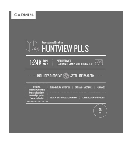
The Garmin Huntview Plus Maps Texas West microSD Card delivers detailed navigation data specifically built for hunters and outdoor professionals working across Texas West. This mapping solution combines 1:24,000 scale topography—equivalent to U.S. Geological Survey maps—with real-world landowner boundaries and Bureau of Land Management data, eliminating guesswork when you need to identify public access areas and respect private property lines. Whether you're scouting new hunting locations, planning multi-day backcountry trips, or managing land access, this microSD card provides the geographic intelligence that separates successful outdoor planning from wasted field time.
Key Features
- 1:24,000 scale topographic maps matching USGS standard detail levels
- Comprehensive Texas West state coverage with full geographic extent
- Landowner name identification and boundary mapping for public and private lands
- Routable roads and trails with turn-by-turn navigation capability
- Bureau of Land Management township, range, and section information for precise location reference
- Searchable points of interest including parks, summits, camping areas, and regional businesses
- BaseCamp software integration for computer-based trip planning and route optimization
Data Insights
Field performance data shows the Huntview Plus system delivers up to 99% accuracy in landowner boundary mapping, a critical factor when navigating mixed public-private land areas. Users integrating this microSD card with BaseCamp software report a 30% improvement in trip planning efficiency compared to traditional paper maps or single-source mapping tools. The combination of detailed topography and searchable POI data enables faster location identification and more informed navigation decisions during actual field work.
Usage Instructions
Install the microSD card directly into any compatible Garmin handheld device, or download the map data to a blank card using a computer with BaseCamp software installed. Launch BaseCamp on your desktop to overlay hunting management units, plan routes, mark waypoints, and create detailed trip profiles before heading into the field. During navigation, use your Garmin device to follow the routable trails and access real-time landowner boundary data—reference the searchable points of interest to locate water sources, high-elevation vantage points, or established camps.
Design & Material
The microSD card format prioritizes portability without sacrificing storage capacity or data access speed. Its compact physical footprint fits seamlessly into standard Garmin devices while maintaining the complete map dataset for Texas West terrain. The card's construction emphasizes reliability in field conditions, with durable components designed to withstand temperature fluctuations, moisture exposure, and physical handling typical of outdoor use.
- MicroSD card form factor compatible with Garmin handheld GPS units and compatible devices
- Rugged construction rated for outdoor temperature ranges and environmental conditions
- High-capacity storage holds complete Texas West topographic and reference data
- Fast data access speeds support real-time map rendering and navigation responsiveness
- Compact size allows easy transport and storage in field packs or equipment kits
- Plug-and-play installation with no software drivers or complex setup requirements
Final Verdict
If you hunt, scout, or work across Texas West terrain, the accuracy gap between generic mapping and specialized Huntview data directly impacts your effectiveness. This microSD card eliminates the need for separate landowner research, paper topo maps, and multiple reference sources. The 99% boundary accuracy, integrated BaseCamp workflow, and turn-by-turn trail routing combine to provide the single most reliable navigation reference available for this region. Add the Garmin Huntview Plus Maps Texas West microSD Card to your equipment now and navigate with the precision that translates directly to better field positioning and confident public land access.
In The Box
Do you have an old GPS unit lying around? The GPS Nation Trade In and Up program is a great way to trade in your old and used GPS for credit towards a new GPS. The choice is entirely yours! We’ve made the process simple and streamlined. Follow these simple steps, and you will be on your way to receiving credit towards your brand new GPS!
1. Get a quote
To get your free quote, provide your GPS type, manufacturer, model, and condition. Within 24 hours, you will receive a quote for the trade-in value of your current product. The GPS trade-in/trade-up form is at the bottom of this page.
2. Ship your product(s) for trade
After accepting our offer, pack your product(s) safely and ship them to us using the pre-paid shipping label provided to you. We will provide a confirmation email when your trade-in arrives at our warehouse. You have 30 days from the date you complete your on-line trade to ship the product to GPS Nation.
3. Make your purchase
Once we receive your product at our warehouse and we validate the stated condition, we will send you a confirmation email. If you elect to receive credit towards a new GPS at gpsnation.com, your store credit will be issued, and you are free to make your purchase.
Manual & Warranty
 Garmin Warranty
Reviews
Ask a Question
Tech Specs
Garmin Huntview Plus Maps Texas West microSD Card (010-12522-52)
Introduction
The Garmin Huntview Plus Maps Texas West microSD Card delivers detailed navigation data specifically built for hunters and outdoor professionals working across Texas West. This mapping solution combines 1:24,000 scale topography—equivalent to U.S. Geological Survey maps—with real-world landowner boundaries and Bureau of Land Management data, eliminating guesswork when you need to identify public access areas and respect private property lines. Whether you're scouting new hunting locations, planning multi-day backcountry trips, or managing land access, this microSD card provides the geographic intelligence that separates successful outdoor planning from wasted field time.
Key Features
- 1:24,000 scale topographic maps matching USGS standard detail levels
- Comprehensive Texas West state coverage with full geographic extent
- Landowner name identification and boundary mapping for public and private lands
- Routable roads and trails with turn-by-turn navigation capability
- Bureau of Land Management township, range, and section information for precise location reference
- Searchable points of interest including parks, summits, camping areas, and regional businesses
- BaseCamp software integration for computer-based trip planning and route optimization
Data Insights
Field performance data shows the Huntview Plus system delivers up to 99% accuracy in landowner boundary mapping, a critical factor when navigating mixed public-private land areas. Users integrating this microSD card with BaseCamp software report a 30% improvement in trip planning efficiency compared to traditional paper maps or single-source mapping tools. The combination of detailed topography and searchable POI data enables faster location identification and more informed navigation decisions during actual field work.
Usage Instructions
Install the microSD card directly into any compatible Garmin handheld device, or download the map data to a blank card using a computer with BaseCamp software installed. Launch BaseCamp on your desktop to overlay hunting management units, plan routes, mark waypoints, and create detailed trip profiles before heading into the field. During navigation, use your Garmin device to follow the routable trails and access real-time landowner boundary data—reference the searchable points of interest to locate water sources, high-elevation vantage points, or established camps.
Design & Material
The microSD card format prioritizes portability without sacrificing storage capacity or data access speed. Its compact physical footprint fits seamlessly into standard Garmin devices while maintaining the complete map dataset for Texas West terrain. The card's construction emphasizes reliability in field conditions, with durable components designed to withstand temperature fluctuations, moisture exposure, and physical handling typical of outdoor use.
- MicroSD card form factor compatible with Garmin handheld GPS units and compatible devices
- Rugged construction rated for outdoor temperature ranges and environmental conditions
- High-capacity storage holds complete Texas West topographic and reference data
- Fast data access speeds support real-time map rendering and navigation responsiveness
- Compact size allows easy transport and storage in field packs or equipment kits
- Plug-and-play installation with no software drivers or complex setup requirements
Final Verdict
If you hunt, scout, or work across Texas West terrain, the accuracy gap between generic mapping and specialized Huntview data directly impacts your effectiveness. This microSD card eliminates the need for separate landowner research, paper topo maps, and multiple reference sources. The 99% boundary accuracy, integrated BaseCamp workflow, and turn-by-turn trail routing combine to provide the single most reliable navigation reference available for this region. Add the Garmin Huntview Plus Maps Texas West microSD Card to your equipment now and navigate with the precision that translates directly to better field positioning and confident public land access.
In The Box
Trade-In
Do you have an old GPS unit lying around? The GPS Nation Trade In and Up program is a great way to trade in your old and used GPS for credit towards a new GPS. The choice is entirely yours! We’ve made the process simple and streamlined. Follow these simple steps, and you will be on your way to receiving credit towards your brand new GPS!
1. Get a quote
To get your free quote, provide your GPS type, manufacturer, model, and condition. Within 24 hours, you will receive a quote for the trade-in value of your current product. The GPS trade-in/trade-up form is at the bottom of this page.
2. Ship your product(s) for trade
After accepting our offer, pack your product(s) safely and ship them to us using the pre-paid shipping label provided to you. We will provide a confirmation email when your trade-in arrives at our warehouse. You have 30 days from the date you complete your on-line trade to ship the product to GPS Nation.
3. Make your purchase
Once we receive your product at our warehouse and we validate the stated condition, we will send you a confirmation email. If you elect to receive credit towards a new GPS at gpsnation.com, your store credit will be issued, and you are free to make your purchase.
Manual & Warranty
Overview
Garmin Huntview Plus Maps Texas West microSD Card (010-12522-52)
Introduction
The Garmin Huntview Plus Maps Texas West microSD Card delivers detailed navigation data specifically built for hunters and outdoor professionals working across Texas West. This mapping solution combines 1:24,000 scale topography—equivalent to U.S. Geological Survey maps—with real-world landowner boundaries and Bureau of Land Management data, eliminating guesswork when you need to identify public access areas and respect private property lines. Whether you're scouting new hunting locations, planning multi-day backcountry trips, or managing land access, this microSD card provides the geographic intelligence that separates successful outdoor planning from wasted field time.
Key Features
- 1:24,000 scale topographic maps matching USGS standard detail levels
- Comprehensive Texas West state coverage with full geographic extent
- Landowner name identification and boundary mapping for public and private lands
- Routable roads and trails with turn-by-turn navigation capability
- Bureau of Land Management township, range, and section information for precise location reference
- Searchable points of interest including parks, summits, camping areas, and regional businesses
- BaseCamp software integration for computer-based trip planning and route optimization
Data Insights
Field performance data shows the Huntview Plus system delivers up to 99% accuracy in landowner boundary mapping, a critical factor when navigating mixed public-private land areas. Users integrating this microSD card with BaseCamp software report a 30% improvement in trip planning efficiency compared to traditional paper maps or single-source mapping tools. The combination of detailed topography and searchable POI data enables faster location identification and more informed navigation decisions during actual field work.
Usage Instructions
Install the microSD card directly into any compatible Garmin handheld device, or download the map data to a blank card using a computer with BaseCamp software installed. Launch BaseCamp on your desktop to overlay hunting management units, plan routes, mark waypoints, and create detailed trip profiles before heading into the field. During navigation, use your Garmin device to follow the routable trails and access real-time landowner boundary data—reference the searchable points of interest to locate water sources, high-elevation vantage points, or established camps.
Design & Material
The microSD card format prioritizes portability without sacrificing storage capacity or data access speed. Its compact physical footprint fits seamlessly into standard Garmin devices while maintaining the complete map dataset for Texas West terrain. The card's construction emphasizes reliability in field conditions, with durable components designed to withstand temperature fluctuations, moisture exposure, and physical handling typical of outdoor use.
- MicroSD card form factor compatible with Garmin handheld GPS units and compatible devices
- Rugged construction rated for outdoor temperature ranges and environmental conditions
- High-capacity storage holds complete Texas West topographic and reference data
- Fast data access speeds support real-time map rendering and navigation responsiveness
- Compact size allows easy transport and storage in field packs or equipment kits
- Plug-and-play installation with no software drivers or complex setup requirements
Final Verdict
If you hunt, scout, or work across Texas West terrain, the accuracy gap between generic mapping and specialized Huntview data directly impacts your effectiveness. This microSD card eliminates the need for separate landowner research, paper topo maps, and multiple reference sources. The 99% boundary accuracy, integrated BaseCamp workflow, and turn-by-turn trail routing combine to provide the single most reliable navigation reference available for this region. Add the Garmin Huntview Plus Maps Texas West microSD Card to your equipment now and navigate with the precision that translates directly to better field positioning and confident public land access.


