


Garmin Madeira and Canary Islands Charts BlueChart g3 Vision | VAF450S | microSD/SD
Garmin Madeira and Canary Islands Charts BlueChart g3 Vision | VAF450S | microSD/SD
Model Number: 010-C0750-00
In stock
 WhatsApp
 SMS - Text us!
 Email Us!
 Help Desk

Tech Specs
In The Box
Do you have an old GPS unit lying around? The GPS Nation Trade In and Up program is a great way to trade in your old and used GPS for credit towards a new GPS. The choice is entirely yours! We’ve made the process simple and streamlined. Follow these simple steps, and you will be on your way to receiving credit towards your brand new GPS!
1. Get a quote
To get your free quote, provide your GPS type, manufacturer, model, and condition. Within 24 hours, you will receive a quote for the trade-in value of your current product. The GPS trade-in/trade-up form is at the bottom of this page.
2. Ship your product(s) for trade
After accepting our offer, pack your product(s) safely and ship them to us using the pre-paid shipping label provided to you. We will provide a confirmation email when your trade-in arrives at our warehouse. You have 30 days from the date you complete your on-line trade to ship the product to GPS Nation.
3. Make your purchase
Once we receive your product at our warehouse and we validate the stated condition, we will send you a confirmation email. If you elect to receive credit towards a new GPS at gpsnation.com, your store credit will be issued, and you are free to make your purchase.
Manual & Warranty
 Garmin Warranty
Reviews
Ask a Question
Tech Specs
In The Box
Trade-In
Do you have an old GPS unit lying around? The GPS Nation Trade In and Up program is a great way to trade in your old and used GPS for credit towards a new GPS. The choice is entirely yours! We’ve made the process simple and streamlined. Follow these simple steps, and you will be on your way to receiving credit towards your brand new GPS!
1. Get a quote
To get your free quote, provide your GPS type, manufacturer, model, and condition. Within 24 hours, you will receive a quote for the trade-in value of your current product. The GPS trade-in/trade-up form is at the bottom of this page.
2. Ship your product(s) for trade
After accepting our offer, pack your product(s) safely and ship them to us using the pre-paid shipping label provided to you. We will provide a confirmation email when your trade-in arrives at our warehouse. You have 30 days from the date you complete your on-line trade to ship the product to GPS Nation.
3. Make your purchase
Once we receive your product at our warehouse and we validate the stated condition, we will send you a confirmation email. If you elect to receive credit towards a new GPS at gpsnation.com, your store credit will be issued, and you are free to make your purchase.
Manual & Warranty
Overview
Garmin Madeira and Canary Islands Charts BlueChart g3 Vision (VAF450S) microSD/SD Navigation Card
Introduction
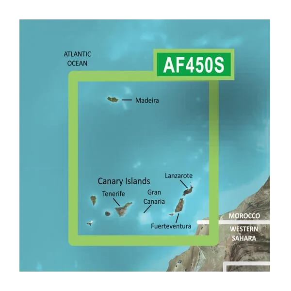
The Garmin Madeira and Canary Islands Charts BlueChart g3 Vision (model 010-C0750-00) delivers comprehensive marine navigation coverage for the Arquipélago da Madeira and the Canary Islands through a pre-loaded microSD/SD card format. Compiled from official charts and private hydrographic sources, this navigation product combines high-resolution satellite imagery with detailed bathymetric data, enabling sailors and recreational fishermen to navigate confidently in Atlantic waters where precision mapping significantly impacts both safety and fishing success.
Key Features
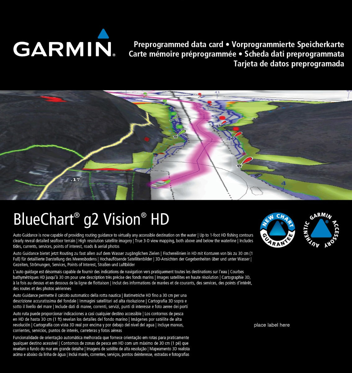
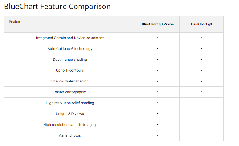
- Auto Guidance Technology: Automatically calculates optimal routes based on your vessel's hull dimensions and navigational preferences
- Depth Range Shading: Display up to 10 customizable depth ranges simultaneously for quick interpretation of underwater structure
- 1-Foot Contour Lines: Provides bottom-structure detail specifically enhanced for fishing location identification
- Shallow Water Shading: User-adjustable depth threshold highlighting to match your vessel's draft and operational requirements
- MarinerEye and FishEye 3D Perspectives: Dual rendering modes reveal ocean floor topography and surrounding coastal landscapes from multiple viewing angles
- High-Resolution Satellite Imagery: Photo-realistic port and landmark visualization for confident visual navigation confirmation
- Detailed Port Plans: Comprehensive charting for Arrecife, Puerto del Rosario, and additional regional harbor approaches
Data Insights
Coverage encompasses the entire Madeira archipelago and Canary Islands region with specialized attention to fishing grounds and harbor approaches. The chart includes a New Chart Guarantee program paired with a discount card update mechanism, ensuring navigation data remains current without requiring a complete card replacement. This systematic update approach extends the chart's practical utility across multiple seasons and changing maritime conditions in the Atlantic coastal zone.
Usage Instructions
Insert the microSD/SD card into any compatible Garmin GPS chartplotter or multifunction display. The card initializes with all charts pre-loaded and ready for immediate use. Access Auto Guidance to input your vessel specifications once, then allow the system to generate safe, dimensionally-appropriate routing. Engage depth shading overlays while underway to identify transition zones, and switch between 3D viewing modes for comprehensive spatial awareness during approach to unfamiliar anchorages or fishing marks.
Design & Material
The BlueChart g3 Vision card delivers a compact, weather-resistant storage solution engineered for the marine environment. The physical microSD/SD format measures approximately 32mm x 24mm, fitting standard card slots across Garmin's plotters and integrated navigation systems without requiring external adapters or docking stations.
- Weather-resistant construction rated for saltwater spray and marine humidity exposure
- Pre-programmed charts require zero configuration before first use
- High-definition graphics rendering with multi-layer transparency for visual clarity in variable lighting conditions
- Compact card form factor allows transport in a pocket, chart bag, or spare equipment kit
- Fast data initialization: charts load within seconds of device boot sequence
- Compatible across Garmin's GPSMAP and echoMAP series plotters manufactured within the past 10+ years
Final Verdict
The Garmin Madeira and Canary Islands Charts BlueChart g3 Vision is an essential reference for anyone navigating these Atlantic waters regularly. Whether plotting ocean passages between the islands, targeting coastal fishing grounds, or entering regional ports, the combination of detailed bathymetry, 3D visualization, and Auto Guidance routing eliminates guesswork from passage planning. The update guarantee ensures your chart data ages gracefully rather than becoming obsolete. Purchase this card today to navigate the Madeira and Canary Islands with confidence grounded in professional-grade marine data.


