


Garmin Mediterranean Southeast Charts BlueChart g3 | HXEU016R | microSD/SD
Garmin Mediterranean Southeast Charts BlueChart g3 | HXEU016R | microSD/SD
Model Number: 010-C0774-20
In stock
 WhatsApp
 SMS - Text us!
 Email Us!
 Help Desk

Tech Specs

In The Box
Do you have an old GPS unit lying around? The GPS Nation Trade In and Up program is a great way to trade in your old and used GPS for credit towards a new GPS. The choice is entirely yours! We’ve made the process simple and streamlined. Follow these simple steps, and you will be on your way to receiving credit towards your brand new GPS!
1. Get a quote
To get your free quote, provide your GPS type, manufacturer, model, and condition. Within 24 hours, you will receive a quote for the trade-in value of your current product. The GPS trade-in/trade-up form is at the bottom of this page.
2. Ship your product(s) for trade
After accepting our offer, pack your product(s) safely and ship them to us using the pre-paid shipping label provided to you. We will provide a confirmation email when your trade-in arrives at our warehouse. You have 30 days from the date you complete your on-line trade to ship the product to GPS Nation.
3. Make your purchase
Once we receive your product at our warehouse and we validate the stated condition, we will send you a confirmation email. If you elect to receive credit towards a new GPS at gpsnation.com, your store credit will be issued, and you are free to make your purchase.
Manual & Warranty
 Garmin Warranty
Reviews
Ask a Question
Tech Specs
In The Box
Trade-In
Do you have an old GPS unit lying around? The GPS Nation Trade In and Up program is a great way to trade in your old and used GPS for credit towards a new GPS. The choice is entirely yours! We’ve made the process simple and streamlined. Follow these simple steps, and you will be on your way to receiving credit towards your brand new GPS!
1. Get a quote
To get your free quote, provide your GPS type, manufacturer, model, and condition. Within 24 hours, you will receive a quote for the trade-in value of your current product. The GPS trade-in/trade-up form is at the bottom of this page.
2. Ship your product(s) for trade
After accepting our offer, pack your product(s) safely and ship them to us using the pre-paid shipping label provided to you. We will provide a confirmation email when your trade-in arrives at our warehouse. You have 30 days from the date you complete your on-line trade to ship the product to GPS Nation.
3. Make your purchase
Once we receive your product at our warehouse and we validate the stated condition, we will send you a confirmation email. If you elect to receive credit towards a new GPS at gpsnation.com, your store credit will be issued, and you are free to make your purchase.
Manual & Warranty
Overview
Garmin Mediterranean Southeast Charts BlueChart g3 Navigation System
Introduction
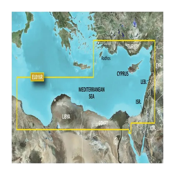
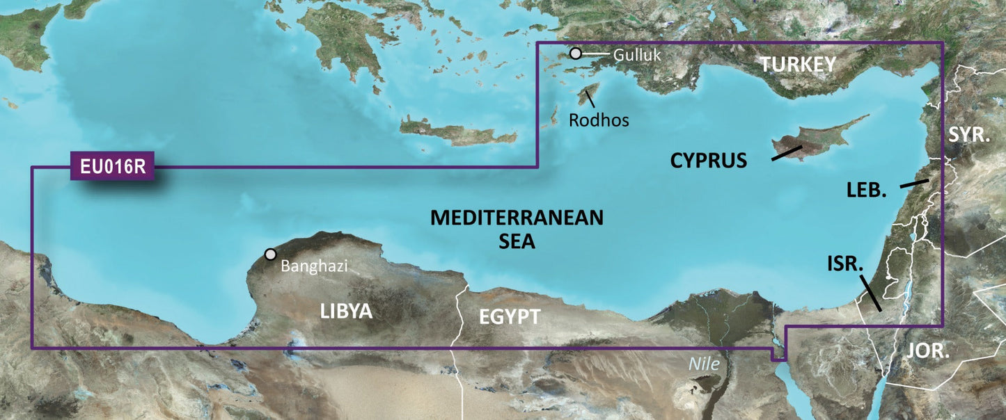
The Garmin Mediterranean Southeast Charts BlueChart g3 delivers precision coastal navigation for cruisers and anglers operating across the eastern Mediterranean basin. This microSD/SD card-based charting system combines Garmin's navigation expertise with Navionics-sourced data to provide detailed, actionable information for safe passage and effective route planning in waters from Turkey through the Levantine coast and westward to Libya.
Key Features
- Coastal chart coverage spanning from Güllük, Turkey eastward to Cyprus, Syria, Lebanon, and Israel, then west to Misratah, Libya
- Over 95% coverage of Mediterranean waters with high-resolution detail across the southeastern region
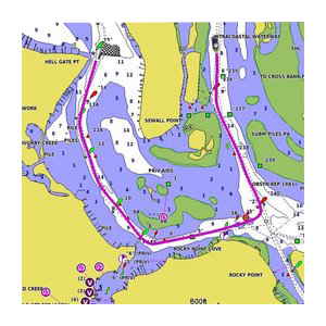
- Depth range shading with up to 10 customizable depth layers for visual target depth identification
- 1-foot contour intervals for accurate underwater structure representation essential to fishing and navigation planning
- Auto Guidance Technology that calculates optimal routes while flagging obstructions and minimum safe depths automatically
- High-resolution satellite imagery overlay for realistic harbor and coastal landmark visualization when entering unfamiliar anchorages
- Customizable shallow water shading at user-defined depths to reduce grounding risk in coastal transitions
Data Insights
This charting solution provides comprehensive coverage across one of Europe's most complex maritime regions. The 95% coverage threshold ensures minimal chart gaps across the southeastern Mediterranean, a critical advantage for vessels operating in areas where paper chart availability or real-time weather routing may be limited. The combination of 1-foot bottom contours and 10-layer depth shading allows both recreational and commercial operators to interpret underwater topography with significantly greater precision than standard 5- or 10-foot contour systems.
Usage Instructions
Insert the microSD/SD card into your compatible Garmin marine device. Once loaded, activate Auto Guidance to receive suggested routes to any destination, with automatic hazard and depth warnings displayed. Customize depth range shading according to your vessel's draft and target depths. Update charts regularly through Garmin's update service to access the latest navigation corrections and chart refinements.
Design & Material
The BlueChart g3 system employs a compact microSD/SD format that integrates directly into Garmin's lineup of chartplotters, fish finders, and multifunction displays without requiring external hardware or complex installation procedures. The card-based architecture preserves chart data integrity across temperature fluctuations and salt-air exposure common in maritime environments.
- MicroSD/SD card format ensures compatibility with all current-generation Garmin marine devices
- Durable construction withstands repeated insertion cycles and marine storage conditions
- Integrated content from both Garmin proprietary data and Navionics charting sources for comprehensive accuracy
- Regularly updated content delivered through Garmin's chart update subscription service
- Seamless integration with Auto Guidance, 3D underwater views, and satellite imagery overlays
- User-friendly interface requiring minimal configuration beyond depth shading customization and chart updates
Final Verdict
For mariners navigating the Mediterranean Southeast, this chart system eliminates the need for multiple paper charts, outdated digital sources, or incomplete regional coverage. The model HXEU016R represents a direct investment in passage safety and operational confidence. Secure your BlueChart g3 card today to ensure your Garmin device has the exact detail and coverage this strategically important region demands.


