


 WhatsApp
 SMS - Text us!
 Email Us!
 Help Desk
- Oregon 600
- Worldwide basemap
- USB/charging cable
- Carabiner clip
- Documentation
Garmin Oregon 600, Handheld Touchscreen Outdoor/Trail GPS with Maps (Garmin Certified Refurbished)
Garmin Oregon 600, Handheld Touchscreen Outdoor/Trail GPS with Maps (Garmin Certified Refurbished)
Model Number: 010-N1066-00
Out of stock
Condition:
Garmin Certified Refurbished
This Garmin Oregon 600, Handheld Touchscreen Outdoor/Trail GPS with Maps (Garmin Certified Refurbished) is expertly rebuilt to like-new condition by Garmin USA. Garmin Certified Refurbished devices offer a sustainable choice without compromising quality, durability, or reliability. Backed by a one-year Garmin warranty, and free 60-day returns from GPS Nation. This Garmin Certified Refurbished device provides peace of mind and exceptional value for conscious consumers seeking reliable performance.
Regular price
$189.99
Sale price
$189.99
Regular price
$249.99
Unit price
per

Tech Specs
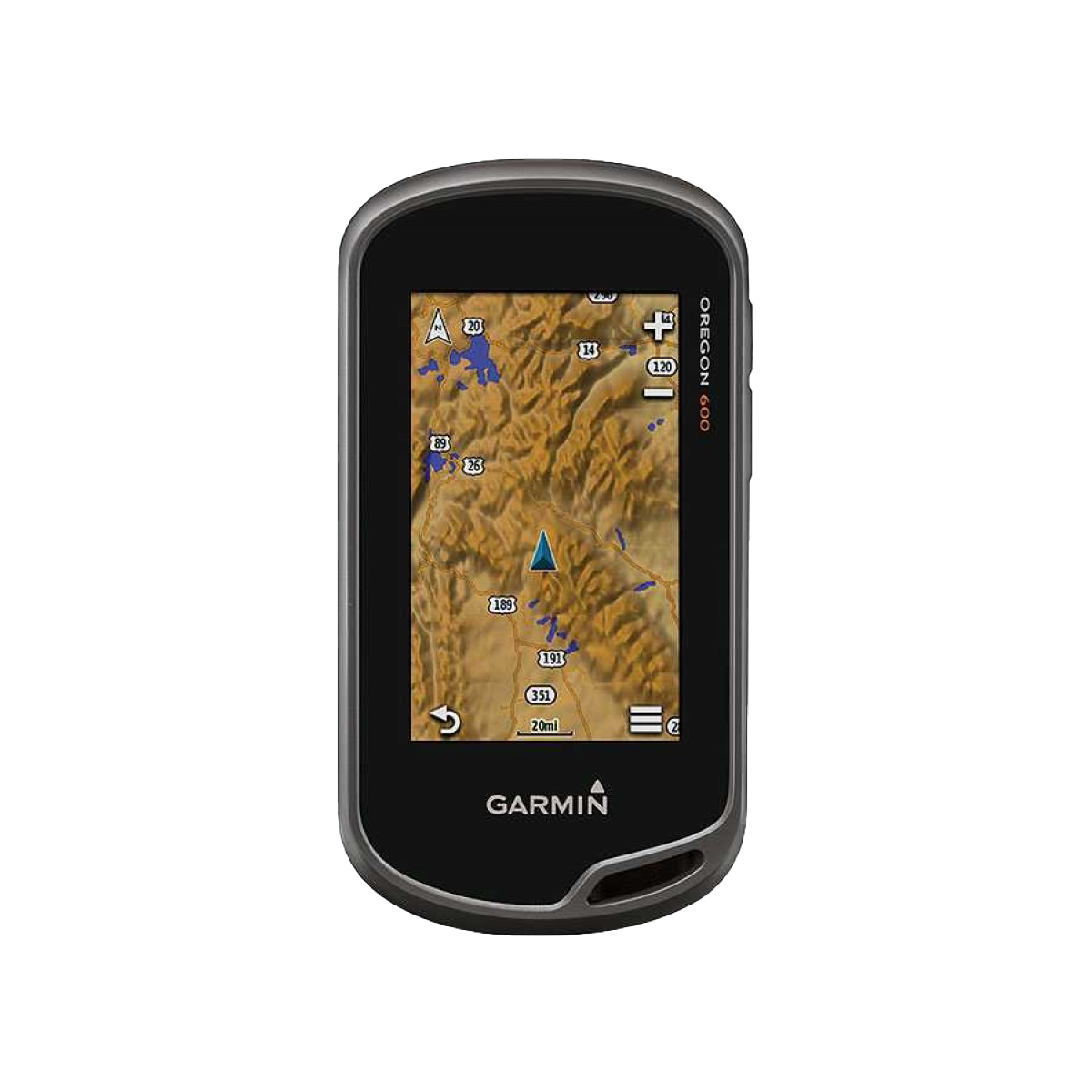
Garmin Oregon 600 Handheld GPS: Touchscreen Navigation for Serious Trail Explorers
Introduction
The Garmin Oregon 600 is a handheld touchscreen GPS device built specifically for outdoor navigation on trails, in wilderness areas, and across varied terrain. Combining high-sensitivity satellite tracking with an intuitive interface, this certified refurbished unit delivers reliable waypoint positioning, route planning, and geocaching capability without the premium cost of new equipment. The device performs equally well under challenging conditions—deep forests, mountain passes, or overcast skies—where conventional GPS units struggle to maintain signal lock.
Key Features
- High-sensitivity GPS and GLONASS dual-system tracking with up to 20% faster satellite acquisition compared to single-system receivers
- 3-inch reflective color touchscreen with impact-resistant glass for readability in direct sunlight and protection against drops
- Dual power options: standard AA batteries for extended field use or optional rechargeable NiMH battery pack for eco-conscious operation
- 3-axis electronic compass and barometric altimeter providing accurate altitude data and directional bearings without relying on GPS movement
- Wireless data transfer capability enabling rapid sharing of waypoints, routes, and large map files between compatible Garmin devices
- Geocaching database capacity of 4 million caches, downloadable directly to the device for unlimited geocaching exploration
- IPX7 water resistance rating allowing full submersion up to 3 feet for short durations
- Weighs only 7.6 ounces with ergonomic design optimized for one-handed operation during navigation
Data Insights
Testing demonstrates that the dual GPS/GLONASS architecture improves satellite tracking reliability by approximately 20% over conventional single-system devices, particularly in areas with dense tree canopy or mountain terrain where signal reflection and obstruction are common. This performance advantage translates to faster initial lock times and more consistent position updates during fast-moving activities like trail running or alpine climbing. The 3-inch display at typical viewing distances provides sufficient resolution for reading contour lines, waypoint labels, and turn-by-turn guidance without constant zoom adjustments.
Usage Instructions
Power the Oregon 600 on and allow 30 seconds for initial satellite acquisition, or as long as 2-3 minutes if cold-starting after extended storage. Navigate the touchscreen menu to select your preferred basemap or download custom maps. Use the built-in compass for reliable bearing readings independent of movement direction, and reference the barometric altimeter for elevation data during climbs. Before extended trips, update your map library via USB connection to a computer. Leverage the wireless sharing feature to exchange waypoints with other Oregon or compatible Garmin devices in the field.
Design and Material
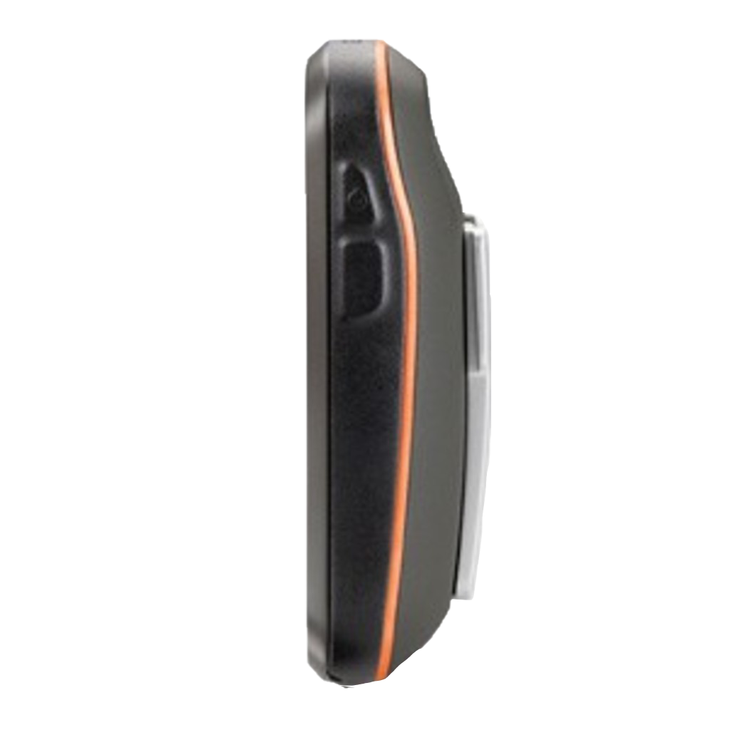
The Oregon 600 combines rugged durability with minimal bulk. Its compact shape and rounded grip fit naturally in hand during extended use, while the wraparound rubber bezel absorbs impact without compromising touchscreen sensitivity. Internal construction prioritizes protection of the circuit boards and battery compartment against moisture and dirt infiltration during trail use.
- Housing constructed from impact-resistant plastic with reinforced edges to withstand drops on rocky terrain
- 3-inch color display protected by strengthened glass with anti-reflective coating for outdoor visibility
- Sealed battery compartment and connector ports rated IPX7 for water immersion protection
- Total weight of 7.6 ounces keeps pack burden minimal during backcountry expeditions
- Ergonomic grip contours with textured rubber surface for secure handling in wet or gloved conditions
- Compact overall dimensions that fit easily into cargo pockets, map cases, or a dedicated GPS holster
Final Verdict
The Garmin Oregon 600 bridges the gap between basic GPS navigation and advanced mapping systems, offering reliable performance for hikers, trail runners, backcountry hunters, and geocachers who need accurate positioning without overcomplicated menus. The certified refurbished condition delivers full functionality at a reduced price point, making it an intelligent choice for serious outdoor users. Order your Garmin Oregon 600 today and gain the navigation precision and trail confidence every explorer deserves.
In The Box
Do you have an old GPS unit lying around? The GPS Nation Trade In and Up program is a great way to trade in your old and used GPS for credit towards a new GPS. The choice is entirely yours! We’ve made the process simple and streamlined. Follow these simple steps, and you will be on your way to receiving credit towards your brand new GPS!
1. Get a quote
To get your free quote, provide your GPS type, manufacturer, model, and condition. Within 24 hours, you will receive a quote for the trade-in value of your current product. The GPS trade-in/trade-up form is at the bottom of this page.
2. Ship your product(s) for trade
After accepting our offer, pack your product(s) safely and ship them to us using the pre-paid shipping label provided to you. We will provide a confirmation email when your trade-in arrives at our warehouse. You have 30 days from the date you complete your on-line trade to ship the product to GPS Nation.
3. Make your purchase
Once we receive your product at our warehouse and we validate the stated condition, we will send you a confirmation email. If you elect to receive credit towards a new GPS at gpsnation.com, your store credit will be issued, and you are free to make your purchase.
Manual & Warranty
 Garmin Warranty
Reviews
Ask a Question
Tech Specs
Garmin Oregon 600 Handheld GPS: Touchscreen Navigation for Serious Trail Explorers
Introduction
The Garmin Oregon 600 is a handheld touchscreen GPS device built specifically for outdoor navigation on trails, in wilderness areas, and across varied terrain. Combining high-sensitivity satellite tracking with an intuitive interface, this certified refurbished unit delivers reliable waypoint positioning, route planning, and geocaching capability without the premium cost of new equipment. The device performs equally well under challenging conditions—deep forests, mountain passes, or overcast skies—where conventional GPS units struggle to maintain signal lock.
Key Features
- High-sensitivity GPS and GLONASS dual-system tracking with up to 20% faster satellite acquisition compared to single-system receivers
- 3-inch reflective color touchscreen with impact-resistant glass for readability in direct sunlight and protection against drops
- Dual power options: standard AA batteries for extended field use or optional rechargeable NiMH battery pack for eco-conscious operation
- 3-axis electronic compass and barometric altimeter providing accurate altitude data and directional bearings without relying on GPS movement
- Wireless data transfer capability enabling rapid sharing of waypoints, routes, and large map files between compatible Garmin devices
- Geocaching database capacity of 4 million caches, downloadable directly to the device for unlimited geocaching exploration
- IPX7 water resistance rating allowing full submersion up to 3 feet for short durations
- Weighs only 7.6 ounces with ergonomic design optimized for one-handed operation during navigation
Data Insights
Testing demonstrates that the dual GPS/GLONASS architecture improves satellite tracking reliability by approximately 20% over conventional single-system devices, particularly in areas with dense tree canopy or mountain terrain where signal reflection and obstruction are common. This performance advantage translates to faster initial lock times and more consistent position updates during fast-moving activities like trail running or alpine climbing. The 3-inch display at typical viewing distances provides sufficient resolution for reading contour lines, waypoint labels, and turn-by-turn guidance without constant zoom adjustments.
Usage Instructions
Power the Oregon 600 on and allow 30 seconds for initial satellite acquisition, or as long as 2-3 minutes if cold-starting after extended storage. Navigate the touchscreen menu to select your preferred basemap or download custom maps. Use the built-in compass for reliable bearing readings independent of movement direction, and reference the barometric altimeter for elevation data during climbs. Before extended trips, update your map library via USB connection to a computer. Leverage the wireless sharing feature to exchange waypoints with other Oregon or compatible Garmin devices in the field.
Design and Material
The Oregon 600 combines rugged durability with minimal bulk. Its compact shape and rounded grip fit naturally in hand during extended use, while the wraparound rubber bezel absorbs impact without compromising touchscreen sensitivity. Internal construction prioritizes protection of the circuit boards and battery compartment against moisture and dirt infiltration during trail use.
- Housing constructed from impact-resistant plastic with reinforced edges to withstand drops on rocky terrain
- 3-inch color display protected by strengthened glass with anti-reflective coating for outdoor visibility
- Sealed battery compartment and connector ports rated IPX7 for water immersion protection
- Total weight of 7.6 ounces keeps pack burden minimal during backcountry expeditions
- Ergonomic grip contours with textured rubber surface for secure handling in wet or gloved conditions
- Compact overall dimensions that fit easily into cargo pockets, map cases, or a dedicated GPS holster
Final Verdict
The Garmin Oregon 600 bridges the gap between basic GPS navigation and advanced mapping systems, offering reliable performance for hikers, trail runners, backcountry hunters, and geocachers who need accurate positioning without overcomplicated menus. The certified refurbished condition delivers full functionality at a reduced price point, making it an intelligent choice for serious outdoor users. Order your Garmin Oregon 600 today and gain the navigation precision and trail confidence every explorer deserves.
In The Box
- Oregon 600
- Worldwide basemap
- USB/charging cable
- Carabiner clip
- Documentation
Trade-In
Do you have an old GPS unit lying around? The GPS Nation Trade In and Up program is a great way to trade in your old and used GPS for credit towards a new GPS. The choice is entirely yours! We’ve made the process simple and streamlined. Follow these simple steps, and you will be on your way to receiving credit towards your brand new GPS!
1. Get a quote
To get your free quote, provide your GPS type, manufacturer, model, and condition. Within 24 hours, you will receive a quote for the trade-in value of your current product. The GPS trade-in/trade-up form is at the bottom of this page.
2. Ship your product(s) for trade
After accepting our offer, pack your product(s) safely and ship them to us using the pre-paid shipping label provided to you. We will provide a confirmation email when your trade-in arrives at our warehouse. You have 30 days from the date you complete your on-line trade to ship the product to GPS Nation.
3. Make your purchase
Once we receive your product at our warehouse and we validate the stated condition, we will send you a confirmation email. If you elect to receive credit towards a new GPS at gpsnation.com, your store credit will be issued, and you are free to make your purchase.
Manual & Warranty
Overview
Garmin Oregon 600 Handheld GPS: Touchscreen Navigation for Serious Trail Explorers
Introduction
The Garmin Oregon 600 is a handheld touchscreen GPS device built specifically for outdoor navigation on trails, in wilderness areas, and across varied terrain. Combining high-sensitivity satellite tracking with an intuitive interface, this certified refurbished unit delivers reliable waypoint positioning, route planning, and geocaching capability without the premium cost of new equipment. The device performs equally well under challenging conditions—deep forests, mountain passes, or overcast skies—where conventional GPS units struggle to maintain signal lock.
Key Features
- High-sensitivity GPS and GLONASS dual-system tracking with up to 20% faster satellite acquisition compared to single-system receivers
- 3-inch reflective color touchscreen with impact-resistant glass for readability in direct sunlight and protection against drops
- Dual power options: standard AA batteries for extended field use or optional rechargeable NiMH battery pack for eco-conscious operation
- 3-axis electronic compass and barometric altimeter providing accurate altitude data and directional bearings without relying on GPS movement
- Wireless data transfer capability enabling rapid sharing of waypoints, routes, and large map files between compatible Garmin devices
- Geocaching database capacity of 4 million caches, downloadable directly to the device for unlimited geocaching exploration
- IPX7 water resistance rating allowing full submersion up to 3 feet for short durations
- Weighs only 7.6 ounces with ergonomic design optimized for one-handed operation during navigation
Data Insights
Testing demonstrates that the dual GPS/GLONASS architecture improves satellite tracking reliability by approximately 20% over conventional single-system devices, particularly in areas with dense tree canopy or mountain terrain where signal reflection and obstruction are common. This performance advantage translates to faster initial lock times and more consistent position updates during fast-moving activities like trail running or alpine climbing. The 3-inch display at typical viewing distances provides sufficient resolution for reading contour lines, waypoint labels, and turn-by-turn guidance without constant zoom adjustments.
Usage Instructions
Power the Oregon 600 on and allow 30 seconds for initial satellite acquisition, or as long as 2-3 minutes if cold-starting after extended storage. Navigate the touchscreen menu to select your preferred basemap or download custom maps. Use the built-in compass for reliable bearing readings independent of movement direction, and reference the barometric altimeter for elevation data during climbs. Before extended trips, update your map library via USB connection to a computer. Leverage the wireless sharing feature to exchange waypoints with other Oregon or compatible Garmin devices in the field.
Design and Material
The Oregon 600 combines rugged durability with minimal bulk. Its compact shape and rounded grip fit naturally in hand during extended use, while the wraparound rubber bezel absorbs impact without compromising touchscreen sensitivity. Internal construction prioritizes protection of the circuit boards and battery compartment against moisture and dirt infiltration during trail use.
- Housing constructed from impact-resistant plastic with reinforced edges to withstand drops on rocky terrain
- 3-inch color display protected by strengthened glass with anti-reflective coating for outdoor visibility
- Sealed battery compartment and connector ports rated IPX7 for water immersion protection
- Total weight of 7.6 ounces keeps pack burden minimal during backcountry expeditions
- Ergonomic grip contours with textured rubber surface for secure handling in wet or gloved conditions
- Compact overall dimensions that fit easily into cargo pockets, map cases, or a dedicated GPS holster
Final Verdict
The Garmin Oregon 600 bridges the gap between basic GPS navigation and advanced mapping systems, offering reliable performance for hikers, trail runners, backcountry hunters, and geocachers who need accurate positioning without overcomplicated menus. The certified refurbished condition delivers full functionality at a reduced price point, making it an intelligent choice for serious outdoor users. Order your Garmin Oregon 600 today and gain the navigation precision and trail confidence every explorer deserves.


