


Garmin Portugal Coastal Charts BlueChart g3 Vision | VEU479S | microSD/SD
Garmin Portugal Coastal Charts BlueChart g3 Vision | VEU479S | microSD/SD
Model Number: 010-C0823-00
In stock
 WhatsApp
 SMS - Text us!
 Email Us!
 Help Desk

Tech Specs

In The Box
Do you have an old GPS unit lying around? The GPS Nation Trade In and Up program is a great way to trade in your old and used GPS for credit towards a new GPS. The choice is entirely yours! We’ve made the process simple and streamlined. Follow these simple steps, and you will be on your way to receiving credit towards your brand new GPS!
1. Get a quote
To get your free quote, provide your GPS type, manufacturer, model, and condition. Within 24 hours, you will receive a quote for the trade-in value of your current product. The GPS trade-in/trade-up form is at the bottom of this page.
2. Ship your product(s) for trade
After accepting our offer, pack your product(s) safely and ship them to us using the pre-paid shipping label provided to you. We will provide a confirmation email when your trade-in arrives at our warehouse. You have 30 days from the date you complete your on-line trade to ship the product to GPS Nation.
3. Make your purchase
Once we receive your product at our warehouse and we validate the stated condition, we will send you a confirmation email. If you elect to receive credit towards a new GPS at gpsnation.com, your store credit will be issued, and you are free to make your purchase.
Manual & Warranty
 Garmin Warranty
Reviews
Ask a Question
Tech Specs
In The Box
Trade-In
Do you have an old GPS unit lying around? The GPS Nation Trade In and Up program is a great way to trade in your old and used GPS for credit towards a new GPS. The choice is entirely yours! We’ve made the process simple and streamlined. Follow these simple steps, and you will be on your way to receiving credit towards your brand new GPS!
1. Get a quote
To get your free quote, provide your GPS type, manufacturer, model, and condition. Within 24 hours, you will receive a quote for the trade-in value of your current product. The GPS trade-in/trade-up form is at the bottom of this page.
2. Ship your product(s) for trade
After accepting our offer, pack your product(s) safely and ship them to us using the pre-paid shipping label provided to you. We will provide a confirmation email when your trade-in arrives at our warehouse. You have 30 days from the date you complete your on-line trade to ship the product to GPS Nation.
3. Make your purchase
Once we receive your product at our warehouse and we validate the stated condition, we will send you a confirmation email. If you elect to receive credit towards a new GPS at gpsnation.com, your store credit will be issued, and you are free to make your purchase.
Manual & Warranty
Overview
Garmin Portugal Coastal Charts BlueChart g3 Vision | VEU479S | microSD/SD Card
Introduction
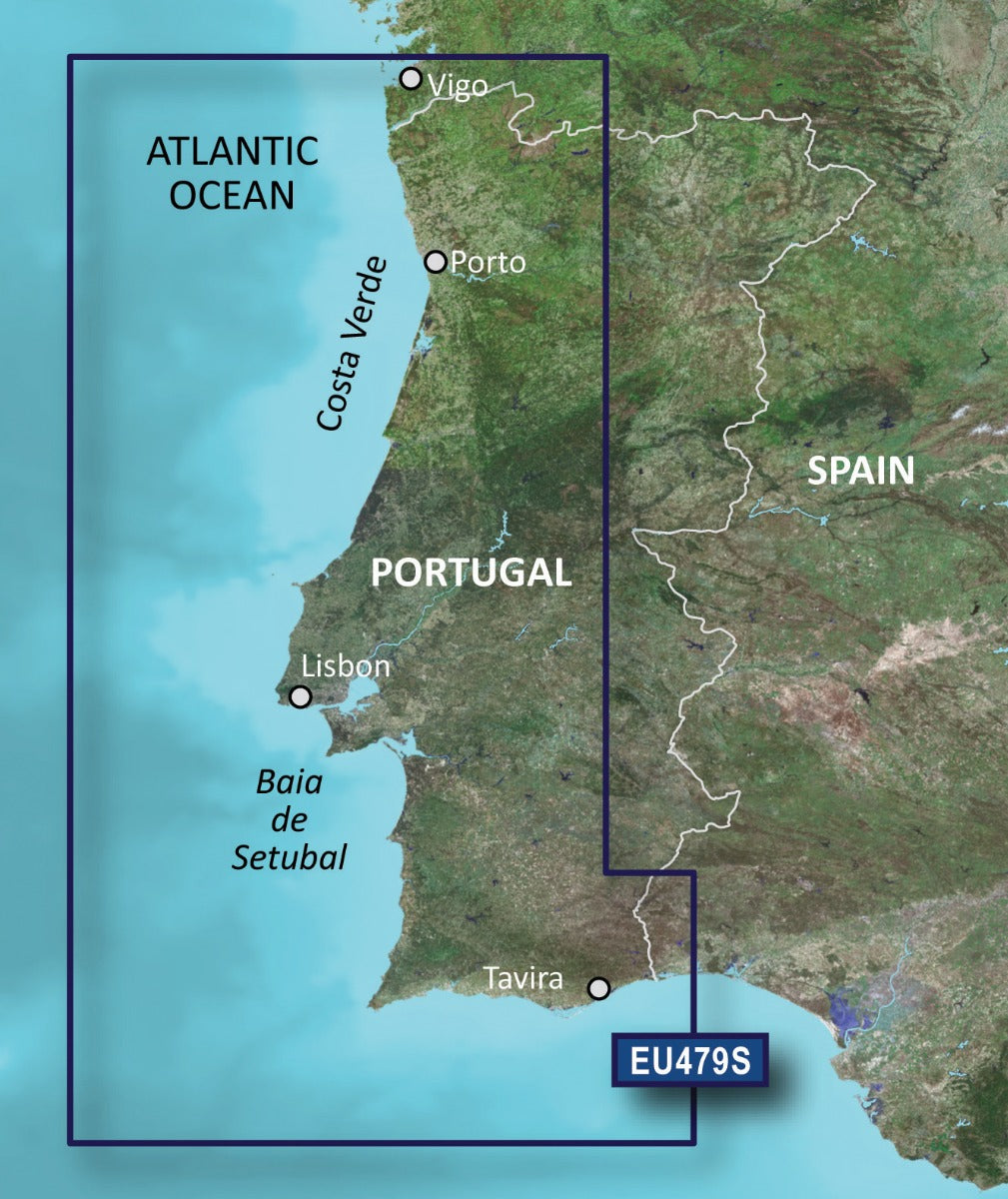
The Garmin Portugal Coastal Charts BlueChart g3 Vision delivers professional-grade marine navigation for Portugal's Atlantic coastline, from Costa Verde in the north to Baia de Setubal in the south. This microSD/SD card-based charting solution combines Garmin and Navionics data to provide mariners, commercial fishermen, and recreational boaters with the precision, detail, and safety features needed to navigate complex Portuguese waters confidently. The integrated technology improves underwater situational awareness and route planning accuracy, directly reducing navigation hazards and increasing time efficiency on the water.
Key Features
- Integrated Garmin and Navionics data providing comprehensive coastal coverage of Portuguese waters including Porto, Lisbon, and Tavira regions
- 20% increase in mapping accuracy compared to previous BlueChart generations, delivering more precise navigational details
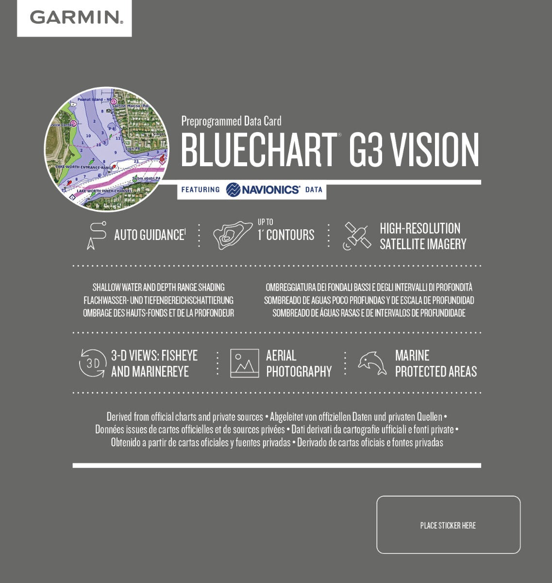
- Depth range shading across up to 10 distinct depth intervals for rapid visual interpretation
- Contour mapping down to 1-foot resolution for precise underwater structure and seafloor topology
- Auto Guidance Technology that calculates safe routes based on user-defined depth clearance and vessel specifications
- High-resolution satellite imagery overlay synchronized with nautical charts for visual reference at unfamiliar ports and anchorages
- Shallow water shading alerts highlighting low-water zones to prevent grounding hazards
- 3-D viewing capability for enhanced situational awareness of underwater terrain and navigational obstacles
Data Insights
Garmin's BlueChart g3 Vision platform delivers measurable performance improvements for Portuguese coastal navigation. The 20% accuracy increase over prior charting versions translates to more precise depth readings, clearer seabed structure detail, and improved Auto Guidance route recommendations. Users fishing in complex offshore grounds near Lisbon and Porto benefit from the 1-foot contour resolution, which reveals subtle bathymetric features that concentrate fish populations. The 10-tiered depth shading system accelerates decision-making in variable-depth approaches, reducing navigation errors in challenging tidal zones and shallow passages typical of Portugal's Baia de Setubal and northern Costa Verde waters.
Usage Instructions
Insert the VEU479S microSD/SD card into your compatible Garmin chartplotter, fishfinder, or integrated marine GPS device. Update your Garmin device to the latest software version before first use to ensure full feature compatibility and access to all charting layers. Once loaded, activate Auto Guidance in your device settings and configure your vessel's draft and desired depth clearance. Use the depth range shading and 3-D view functions to survey bottom structure before entering unfamiliar anchorages, and reference the satellite imagery overlay for visual confirmation of coastal landmarks and port approaches.
Design & Material
The Garmin Portugal Coastal Charts BlueChart g3 Vision is engineered for durability and seamless Garmin device integration. The chart data is preloaded and compressed onto a robust microSD/SD card, eliminating the need for external subscriptions or internet connectivity while on the water. The user interface is intuitive, designed for rapid chart panning, layer toggling, and route visualization—critical for situations where boaters need quick access to safety information.
- Durable microSD/SD card construction with industrial-grade data storage designed for marine environments
- Preloaded with extensive Portuguese coastal data covering all major ports, anchorages, and fishing grounds
- Seamless compatibility with Garmin chartplotters, GPS units, and multifunction displays across generations
- Lightweight and portable format for quick installation and device portability
- Advanced satellite imagery overlay synchronized with vector nautical charts for dual-reference navigation
- 3-D terrain visualization and interactive depth range layer system for enhanced underwater awareness
Final Verdict
Whether you navigate Portuguese waters for commercial fishing, recreational cruising, or coastal exploration, the Garmin Portugal Coastal Charts BlueChart g3 Vision is an essential tool for safety and efficiency. The combination of 1-foot contour precision, Auto Guidance routing, and 20% improved mapping accuracy directly supports better catch rates, safer navigation, and reduced grounding risk. Invest in these premium charts today to unlock the full potential of your Garmin marine navigation system and tackle Portugal's challenging coastal waters with confidence.


