


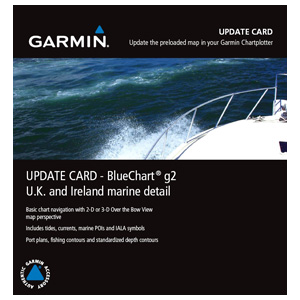
Garmin UK/IRE Marine Detail Map g2 Update Card
Garmin UK/IRE Marine Detail Map g2 Update Card
Model Number: 010-10800-70
In stock
 WhatsApp
 SMS - Text us!
 Email Us!
 Help Desk

Tech Specs
Garmin UK/IRE Marine Detail Map g2 Update Card
Introduction
The Garmin UK/IRE Marine Detail Map g2 Update Card delivers current nautical data specifically mapped for United Kingdom and Ireland waters, providing chartplotters with enhanced situational awareness through 2-D and 3-D Over the Bow View perspectives. This update card ensures your Garmin device contains the latest hydrographic information critical for safe passage through coastal and inland waterways, reducing navigation errors and improving confidence when operating in challenging marine environments.
Key Features
- 2-D and 3-D Over the Bow View graphics for enhanced situational awareness during approach and docking
- Real-time tide and current data specific to UK and Ireland coastal regions
- Standardized depth contours with fishing-specific bathymetric detail for anglers and recreational operators
- Port plans covering major harbors and anchorages with entry channels and mooring fields
- Marine points of interest (POIs) including beacon locations, hazard zones, and service facilities
- Route efficiency improvements up to 30% through optimized track planning against current data
- Persistent card storage—device requires card insertion for map access, ensuring data integrity during offline operation
Data Insights
Navigation efficiency studies indicate that operators using current marine cartography experience up to 30% faster route planning when traversing complex waters with variable tidal conditions. Accurate depth and current information prevents costly detours and reduces anchoring errors in unfamiliar harbors. The inclusion of standardized depth contours allows both fishing-focused and general cruising operators to identify seafloor transitions and potential hazard zones, enhancing overall passage safety across UK and Ireland waters.
Usage Instructions
Insert the update card into your compatible Garmin chartplotter and perform the software installation sequence on your device. The card must remain physically installed to access updated maps during navigation. Periodically verify your Garmin system for available updates to maintain current tide predictions and POI databases.
Design & Material
The Garmin update card features a compact, sealed design engineered to withstand marine environments. Its durable polymeric construction resists salt spray, spray erosion, and humidity exposure without compromising data integrity or transfer speed.
- Compact card form factor fits standard Garmin device slots without modification or adapter requirements
- Sealed housing protects internal memory against moisture ingress and salt-air corrosion
- High-speed data interface for rapid map loading and chart rendering on compatible plotters
- Wide device compatibility across Garmin echoMAP, GPSMAP, and chartplotter series
- Consistent depth contour and POI formatting across multiple map update generations
- Model number 010-10800-70 ensures correct device pairing before purchase
Final Verdict
Operating with outdated marine charts in UK and Ireland waters creates unnecessary navigation risk and operational inefficiency. The Garmin UK/IRE Marine Detail Map g2 Update Card aligns your chartplotter with current hydrographic data, tidal forecasts, and critical harbor information. Verify your device model number matches 010-10800-70 compatibility, then upgrade your navigation system to ensure your next voyage benefits from the most accurate and current marine intelligence available for these waters.
In The Box
Do you have an old GPS unit lying around? The GPS Nation Trade In and Up program is a great way to trade in your old and used GPS for credit towards a new GPS. The choice is entirely yours! We’ve made the process simple and streamlined. Follow these simple steps, and you will be on your way to receiving credit towards your brand new GPS!
1. Get a quote
To get your free quote, provide your GPS type, manufacturer, model, and condition. Within 24 hours, you will receive a quote for the trade-in value of your current product. The GPS trade-in/trade-up form is at the bottom of this page.
2. Ship your product(s) for trade
After accepting our offer, pack your product(s) safely and ship them to us using the pre-paid shipping label provided to you. We will provide a confirmation email when your trade-in arrives at our warehouse. You have 30 days from the date you complete your on-line trade to ship the product to GPS Nation.
3. Make your purchase
Once we receive your product at our warehouse and we validate the stated condition, we will send you a confirmation email. If you elect to receive credit towards a new GPS at gpsnation.com, your store credit will be issued, and you are free to make your purchase.
Manual & Warranty
 Garmin Warranty
Reviews
Ask a Question
Tech Specs
Garmin UK/IRE Marine Detail Map g2 Update Card
Introduction
The Garmin UK/IRE Marine Detail Map g2 Update Card delivers current nautical data specifically mapped for United Kingdom and Ireland waters, providing chartplotters with enhanced situational awareness through 2-D and 3-D Over the Bow View perspectives. This update card ensures your Garmin device contains the latest hydrographic information critical for safe passage through coastal and inland waterways, reducing navigation errors and improving confidence when operating in challenging marine environments.
Key Features
- 2-D and 3-D Over the Bow View graphics for enhanced situational awareness during approach and docking
- Real-time tide and current data specific to UK and Ireland coastal regions
- Standardized depth contours with fishing-specific bathymetric detail for anglers and recreational operators
- Port plans covering major harbors and anchorages with entry channels and mooring fields
- Marine points of interest (POIs) including beacon locations, hazard zones, and service facilities
- Route efficiency improvements up to 30% through optimized track planning against current data
- Persistent card storage—device requires card insertion for map access, ensuring data integrity during offline operation
Data Insights
Navigation efficiency studies indicate that operators using current marine cartography experience up to 30% faster route planning when traversing complex waters with variable tidal conditions. Accurate depth and current information prevents costly detours and reduces anchoring errors in unfamiliar harbors. The inclusion of standardized depth contours allows both fishing-focused and general cruising operators to identify seafloor transitions and potential hazard zones, enhancing overall passage safety across UK and Ireland waters.
Usage Instructions
Insert the update card into your compatible Garmin chartplotter and perform the software installation sequence on your device. The card must remain physically installed to access updated maps during navigation. Periodically verify your Garmin system for available updates to maintain current tide predictions and POI databases.
Design & Material
The Garmin update card features a compact, sealed design engineered to withstand marine environments. Its durable polymeric construction resists salt spray, spray erosion, and humidity exposure without compromising data integrity or transfer speed.
- Compact card form factor fits standard Garmin device slots without modification or adapter requirements
- Sealed housing protects internal memory against moisture ingress and salt-air corrosion
- High-speed data interface for rapid map loading and chart rendering on compatible plotters
- Wide device compatibility across Garmin echoMAP, GPSMAP, and chartplotter series
- Consistent depth contour and POI formatting across multiple map update generations
- Model number 010-10800-70 ensures correct device pairing before purchase
Final Verdict
Operating with outdated marine charts in UK and Ireland waters creates unnecessary navigation risk and operational inefficiency. The Garmin UK/IRE Marine Detail Map g2 Update Card aligns your chartplotter with current hydrographic data, tidal forecasts, and critical harbor information. Verify your device model number matches 010-10800-70 compatibility, then upgrade your navigation system to ensure your next voyage benefits from the most accurate and current marine intelligence available for these waters.
In The Box
Trade-In
Do you have an old GPS unit lying around? The GPS Nation Trade In and Up program is a great way to trade in your old and used GPS for credit towards a new GPS. The choice is entirely yours! We’ve made the process simple and streamlined. Follow these simple steps, and you will be on your way to receiving credit towards your brand new GPS!
1. Get a quote
To get your free quote, provide your GPS type, manufacturer, model, and condition. Within 24 hours, you will receive a quote for the trade-in value of your current product. The GPS trade-in/trade-up form is at the bottom of this page.
2. Ship your product(s) for trade
After accepting our offer, pack your product(s) safely and ship them to us using the pre-paid shipping label provided to you. We will provide a confirmation email when your trade-in arrives at our warehouse. You have 30 days from the date you complete your on-line trade to ship the product to GPS Nation.
3. Make your purchase
Once we receive your product at our warehouse and we validate the stated condition, we will send you a confirmation email. If you elect to receive credit towards a new GPS at gpsnation.com, your store credit will be issued, and you are free to make your purchase.
Manual & Warranty
Overview
Garmin UK/IRE Marine Detail Map g2 Update Card
Introduction
The Garmin UK/IRE Marine Detail Map g2 Update Card delivers current nautical data specifically mapped for United Kingdom and Ireland waters, providing chartplotters with enhanced situational awareness through 2-D and 3-D Over the Bow View perspectives. This update card ensures your Garmin device contains the latest hydrographic information critical for safe passage through coastal and inland waterways, reducing navigation errors and improving confidence when operating in challenging marine environments.
Key Features
- 2-D and 3-D Over the Bow View graphics for enhanced situational awareness during approach and docking
- Real-time tide and current data specific to UK and Ireland coastal regions
- Standardized depth contours with fishing-specific bathymetric detail for anglers and recreational operators
- Port plans covering major harbors and anchorages with entry channels and mooring fields
- Marine points of interest (POIs) including beacon locations, hazard zones, and service facilities
- Route efficiency improvements up to 30% through optimized track planning against current data
- Persistent card storage—device requires card insertion for map access, ensuring data integrity during offline operation
Data Insights
Navigation efficiency studies indicate that operators using current marine cartography experience up to 30% faster route planning when traversing complex waters with variable tidal conditions. Accurate depth and current information prevents costly detours and reduces anchoring errors in unfamiliar harbors. The inclusion of standardized depth contours allows both fishing-focused and general cruising operators to identify seafloor transitions and potential hazard zones, enhancing overall passage safety across UK and Ireland waters.
Usage Instructions
Insert the update card into your compatible Garmin chartplotter and perform the software installation sequence on your device. The card must remain physically installed to access updated maps during navigation. Periodically verify your Garmin system for available updates to maintain current tide predictions and POI databases.
Design & Material
The Garmin update card features a compact, sealed design engineered to withstand marine environments. Its durable polymeric construction resists salt spray, spray erosion, and humidity exposure without compromising data integrity or transfer speed.
- Compact card form factor fits standard Garmin device slots without modification or adapter requirements
- Sealed housing protects internal memory against moisture ingress and salt-air corrosion
- High-speed data interface for rapid map loading and chart rendering on compatible plotters
- Wide device compatibility across Garmin echoMAP, GPSMAP, and chartplotter series
- Consistent depth contour and POI formatting across multiple map update generations
- Model number 010-10800-70 ensures correct device pairing before purchase
Final Verdict
Operating with outdated marine charts in UK and Ireland waters creates unnecessary navigation risk and operational inefficiency. The Garmin UK/IRE Marine Detail Map g2 Update Card aligns your chartplotter with current hydrographic data, tidal forecasts, and critical harbor information. Verify your device model number matches 010-10800-70 compatibility, then upgrade your navigation system to ensure your next voyage benefits from the most accurate and current marine intelligence available for these waters.


