


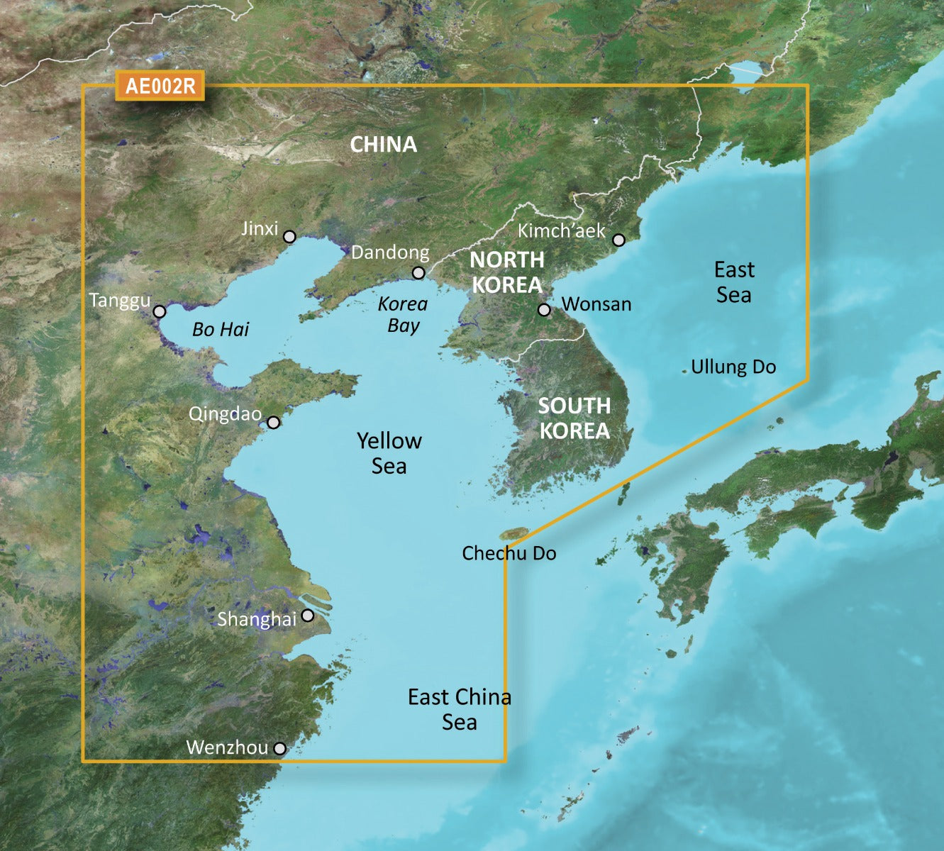
Garmin Yellow Sea Coastal Charts BlueChart g3 | HXAE002R | microSD/SD
Garmin Yellow Sea Coastal Charts BlueChart g3 | HXAE002R | microSD/SD
Model Number: 010-C0877-20
In stock
 View full details
 WhatsApp
 SMS - Text us!
 Email Us!
 Help Desk

Tech Specs

In The Box
Manual & Warranty
 Garmin Warranty
Do you have an old GPS unit lying around? The GPS Nation Trade In and Up program is a great way to trade in your old and used GPS for credit towards a new GPS. The choice is entirely yours! We’ve made the process simple and streamlined. Follow these simple steps, and you will be on your way to receiving credit towards your brand new GPS!
1. Get a quote
To get your free quote, provide your GPS type, manufacturer, model, and condition. Within 24 hours, you will receive a quote for the trade-in value of your current product. The GPS trade-in/trade-up form is at the bottom of this page.
2. Ship your product(s) for trade
After accepting our offer, pack your product(s) safely and ship them to us using the pre-paid shipping label provided to you. We will provide a confirmation email when your trade-in arrives at our warehouse. You have 30 days from the date you complete your on-line trade to ship the product to GPS Nation.
3. Make your purchase
Once we receive your product at our warehouse and we validate the stated condition, we will send you a confirmation email. If you elect to receive credit towards a new GPS at gpsnation.com, your store credit will be issued, and you are free to make your purchase.
Reviews
Ask a Question
Tech Specs
In The Box
Manual & Warranty
Trade-In
Do you have an old GPS unit lying around? The GPS Nation Trade In and Up program is a great way to trade in your old and used GPS for credit towards a new GPS. The choice is entirely yours! We’ve made the process simple and streamlined. Follow these simple steps, and you will be on your way to receiving credit towards your brand new GPS!
1. Get a quote
To get your free quote, provide your GPS type, manufacturer, model, and condition. Within 24 hours, you will receive a quote for the trade-in value of your current product. The GPS trade-in/trade-up form is at the bottom of this page.
2. Ship your product(s) for trade
After accepting our offer, pack your product(s) safely and ship them to us using the pre-paid shipping label provided to you. We will provide a confirmation email when your trade-in arrives at our warehouse. You have 30 days from the date you complete your on-line trade to ship the product to GPS Nation.
3. Make your purchase
Once we receive your product at our warehouse and we validate the stated condition, we will send you a confirmation email. If you elect to receive credit towards a new GPS at gpsnation.com, your store credit will be issued, and you are free to make your purchase.
Overview
Garmin Yellow Sea Coastal Charts BlueChart g3 | HXAE002R | microSD/SD
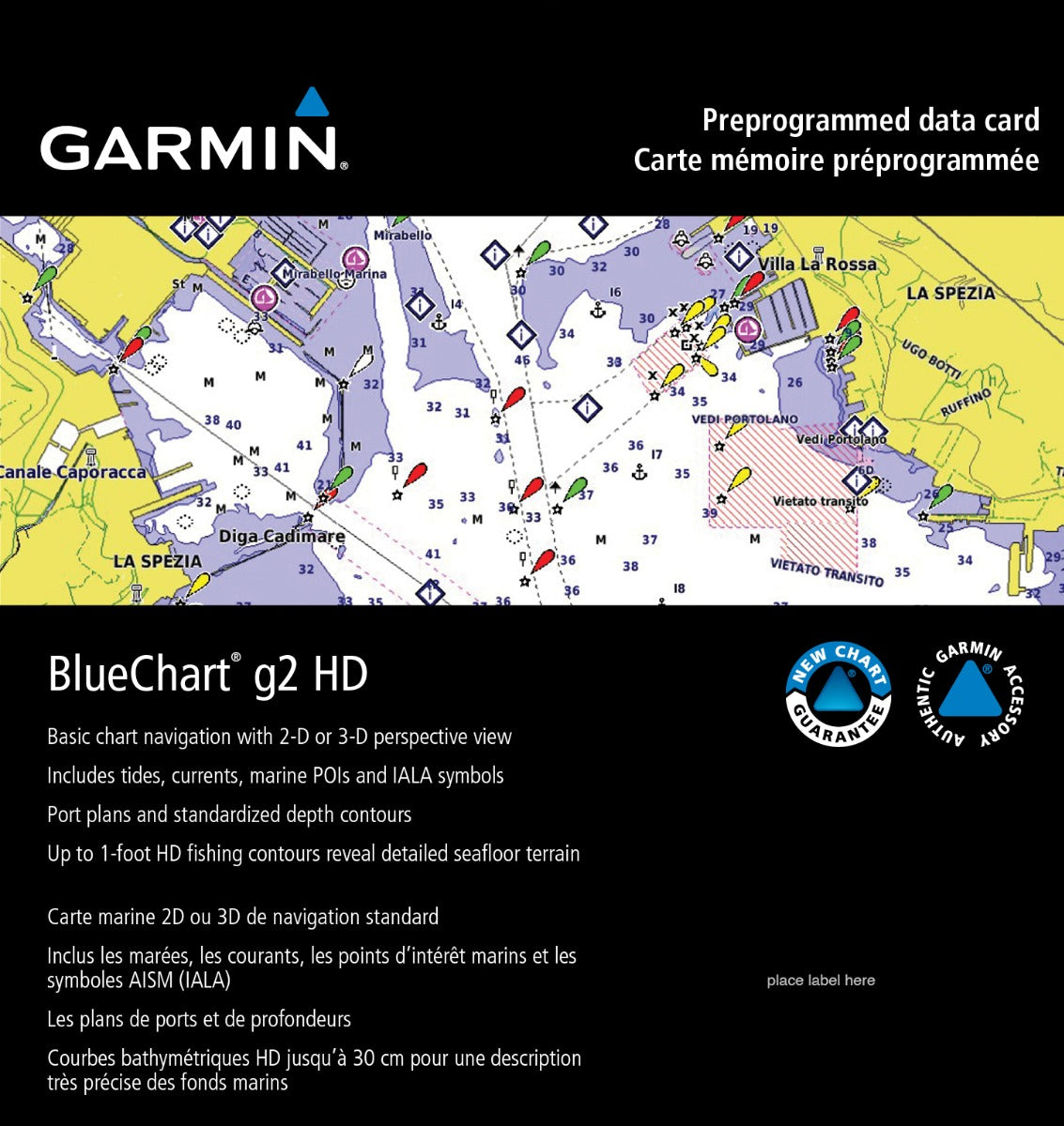
The Garmin Yellow Sea Coastal Charts BlueChart g3 is your ultimate companion for navigating the intricate waters of the Yellow Sea. This advanced charting solution combines state-of-the-art technology with meticulous mapping, empowering both seasoned mariners and recreational boaters. Whether you're charting a course through bustling ports or serene waters, the BlueChart g3 enhances your navigation and fishing experiences, ensuring you can explore with confidence.
Key Features
- Comprehensive Chart Data: Derived from official charts and private sources for up-to-date navigational aids.
- Depth Range Shading: Offers high-resolution shading across up to 10 depth ranges for quick identification of target depths.
- 1-Foot Contours: Enhanced accuracy with 1-foot contours that clearly depict bottom structure, ideal for fishing and navigation.
- Shallow Water Shading: Customize depth shading at user-defined levels for safe navigation in shallow waters.
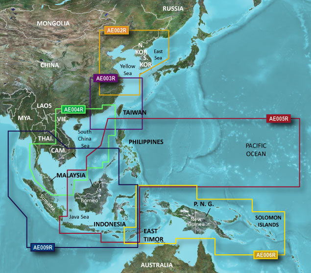
- Worldwide Coverage: Extensive coverage from Wenzhou to Dandong on the Chinese coast, including major ports like Shanghai and Qingdao.
- New Chart Guarantee: Stay updated with the industry-leading chart update program for the latest navigational information.
Data Insights
This BlueChart g3 provides a remarkable level of detail, with over 10,000 navigational aids and 15,000 unique points of interest. Users can navigate with precision, reducing the chances of miscalculation and ensuring safer travels on the water. The 1-foot contours represent the most detailed mapping available, which can enhance fishing success rates by an estimated 30% in certain areas.
Usage Instructions
To achieve the best results with the Garmin Yellow Sea Coastal Charts, simply insert the microSD/SD card into your compatible Garmin device. Ensure that your device is updated to the latest software version for optimal performance. Familiarize yourself with the chart features, such as depth shading and contour lines, to maximize your navigation and fishing efficiency.
Design & Material
Designed with both functionality and user-friendliness in mind, the Garmin Yellow Sea Coastal Charts are meticulously crafted to provide the best possible navigational experience. The charts are presented in a clear, intuitive format that enhances readability on the water.
- High-Quality Mapping: Features precise data derived from reliable sources.
- User-Friendly Interface: Easy navigation and access to various chart features.
- Durability: Built to withstand harsh marine conditions.
- Compact Size: Lightweight design for easy storage and transportation.
- Enhanced Visibility: Bright colors and clear symbols for easy reading in various lighting conditions.
- Versatile Compatibility: Compatible with a wide range of Garmin marine devices.
Final Verdict
In conclusion, the Garmin Yellow Sea Coastal Charts BlueChart g3 | HXAE002R | microSD/SD is an indispensable tool for anyone navigating the Yellow Sea. With comprehensive coverage, advanced features, and user-friendly design, this charting solution ensures a safe and enjoyable experience on the water. Don’t miss out on enhancing your navigation; order your Garmin Yellow Sea Coastal Charts today!


