Swedish coast from Hoganas to Karlskrona, including Malmö. Danish, German, and Polish coasts from Århus to Koszalin including Sjælland, Fyn, Møn, Falster, Lolland, Langeland and Fehmarn. Also includes select lake coverage in Denmark.

 ($3.00
) $174.99 ($3.00
)
($3.00
) $174.99 ($3.00
) Order now and your Garmin Arhus to Kiel and Koszalin Charts BlueChart g3 Vision | VEU459S | Download will ship on Monday, Jul 29 with Free Shipping
![]() Place your order by 4:00 PM PST and your order will ship the same day, weekends and holidays excluded. Orders placed after 4:00 PM PST will ship the following business day. All orders are subject to verification. International orders subject to shipping charges. For further details see delivery estimates in cart.
Place your order by 4:00 PM PST and your order will ship the same day, weekends and holidays excluded. Orders placed after 4:00 PM PST will ship the following business day. All orders are subject to verification. International orders subject to shipping charges. For further details see delivery estimates in cart.
Condition: New  A brand-new, unused, unopened item in its original retail packaging, with all original packaging materials included. Original manufacturer's warranty is included.

* Required Fields
Do you have an old GPS unit lying around? The GPS Nation Trade In and Up program is a great way to trade in your old and used GPS for credit towards a new GPS. The choice is entirely yours! We’ve made the process simple and streamlined. Follow these simple steps, and you will be on your way to receiving credit towards your brand new GPS!
To get your free quote, provide your GPS type, manufacturer, model, and condition. Within 24 hours, you will receive a quote for the trade-in value of your current product. The GPS trade-in/trade-up form is at the bottom of this page.
After accepting our offer, pack your product(s) safely and ship them to us using the pre-paid shipping label provided to you. We will provide a confirmation email when your trade-in arrives at our warehouse. You have 30 days from the date you complete your on-line trade to ship the product to GPS Nation.
Once we receive your product at our warehouse and we validate the stated condition, we will send you a confirmation email. If you elect to receive credit towards a new GPS at gpsnation.com, your store credit will be issued, and you are free to make your purchase.
Experience unparalleled coverage and brilliant detail when you’re on the water. BlueChart g3 Vision coastal charts provide industry-leading coverage, clarity and detail with integrated Garmin and Navionics content.
Whether you are fishing or cruising, select a spot, and get a route showing you the general path and nearby obstructions at a safe depth1.
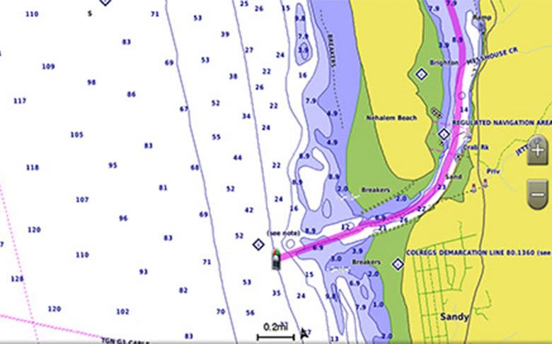
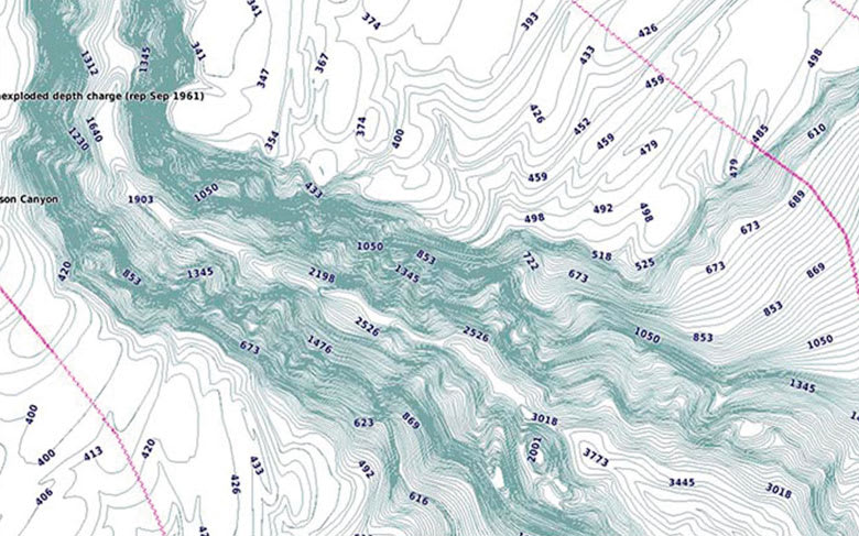
This feature displays high-resolution Depth Range Shading for up to 10 depth ranges so you can view your designated target depth.
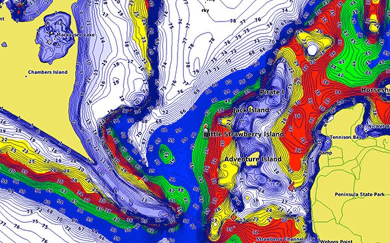
To give a clear picture of shallow waters to avoid, this feature allows for shading at a user-defined depth.
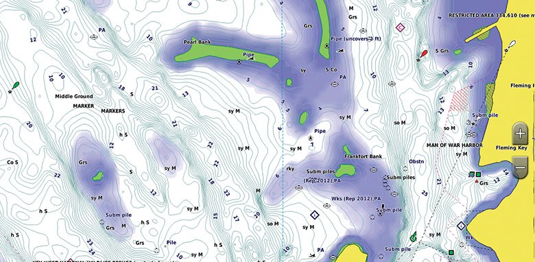
BlueChart g3 Vision charts feature 1’ contours that provide a more accurate depiction of bottom structure for improved fishing charts and enhanced detail in swamps, canals and port plans.
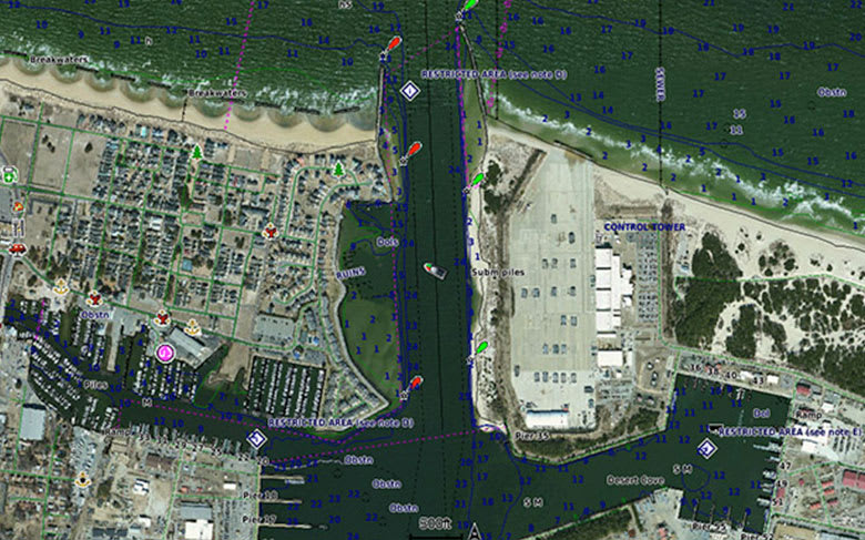
High-resolution satellite imagery with navigational charts overlaid gives you a realistic view of your surroundings. It’s our most realistic charting display in a chartplotter — ideal for entering unfamiliar harbors or ports.
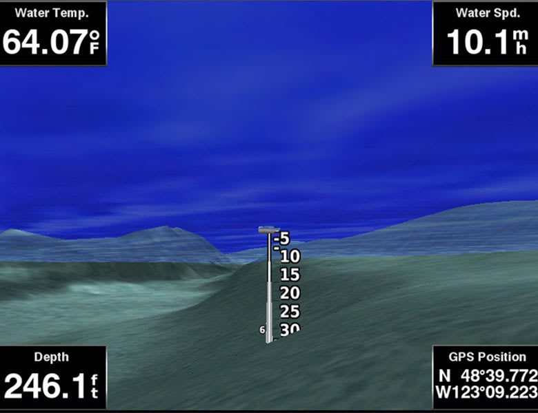
This underwater perspective shows 3-D representation of bottom and contours as seen from below the waterline. Interface with sonar data for a customized view.
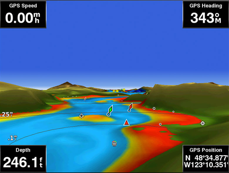
This view provides a 3-D representation of the surrounding area both above and below the waterline.
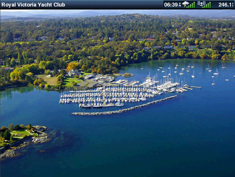
Crystal-clear aerial photography shows exceptional detail of many ports, harbors and marinas and is ideal when entering unfamiliar ports.
Swedish coast from Hoganas to Karlskrona, including Malmö. Danish, German, and Polish coasts from Århus to Koszalin including Sjælland, Fyn, Møn, Falster, Lolland, Langeland and Fehmarn. Also includes select lake coverage in Denmark.
 ($1.00
) $69.99 ($1.00
)
($1.00
) $69.99 ($1.00
) 
ABOUT SSL CERTIFICATES |