


Garmin GPSMAP 66st, Handheld Outdoor/Trail GPS with TOPO Maps (Garmin Certified Refurbished)
Garmin GPSMAP 66st, Handheld Outdoor/Trail GPS with TOPO Maps (Garmin Certified Refurbished)
Model Number: 010-N1918-10
Out of stock

 WhatsApp
 SMS - Text us!
 Email Us!
 Help Desk


Tech Specs
Garmin GPSMAP 66st Handheld GPS with TOPO Maps — Refurbished
Introduction
The Garmin GPSMAP 66st delivers the precision and durability serious outdoor enthusiasts need when navigating remote terrain. This handheld GPS unit combines multi-satellite tracking with preloaded topographic maps and rugged construction to keep you oriented on hiking trails, backcountry routes, and off-road explorations. Whether you're crossing unfamiliar ridgelines or tracking a winding river valley, the GPSMAP 66st provides reliable positioning without relying on cellular coverage or internet connectivity.
Key Features
- Multi-GNSS positioning with GPS, GLONASS, and Galileo satellite systems for up to 20% improved accuracy in challenging terrain and dense tree cover
- 16-hour battery life in standard GPS mode or up to 7 days in expedition mode using two AA batteries
- ABC sensors including barometric altimeter, electronic barometer for weather prediction, and 3-axis compass for reliable heading without magnetic variation drift
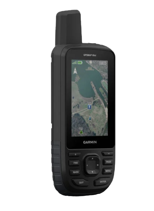
- Preloaded TOPO maps covering the United States and Canada with 1:24,000 and 1:250,000 scale terrain contours and elevation data
- Birdseye satellite imagery download capability at no annual cost—store high-resolution aerial photos directly on the device
- Active weather integration when paired with a compatible smartphone, displaying real-time forecasts and radar overlays on your map
Data Insights
Multi-GNSS receivers outperform single-system GPS by delivering significantly stronger signal acquisition in canyon and forest environments where traditional GPS alone struggles. The GPSMAP 66st's dual-frequency positioning capability reduces signal degradation by 20% compared to single-frequency units, translating to more accurate waypoint placement and trail tracking in obstructed terrain. The integrated barometric altimeter cross-references satellite elevation data, providing real-time vertical accuracy critical for high-altitude route planning and avalanche zone assessment.
Usage Instructions
Power on the device and allow 1–2 minutes for initial satellite acquisition. Use the ABC sensors to verify altitude and compass calibration before setting out. Download necessary TOPO maps and Birdseye imagery to your device's internal storage via a USB connection before venturing into areas without cellular service. Mark waypoints, track your route, and pair with a smartphone when in range to access active weather updates and send SOS signals if needed.
Design & Material
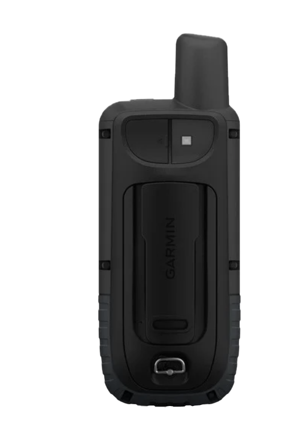
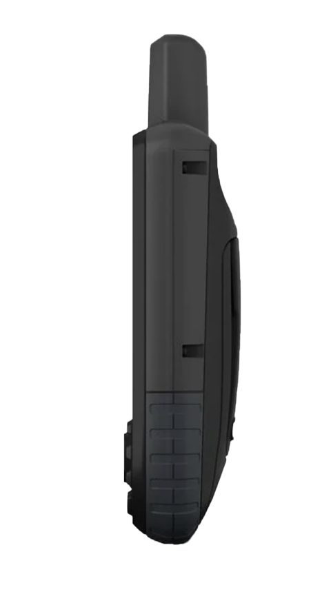
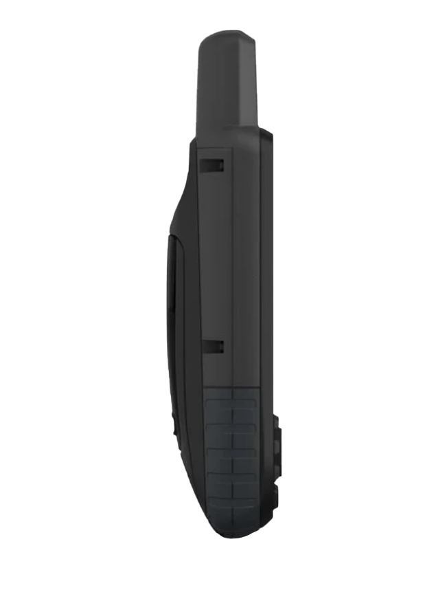
Built to survive remote conditions, the GPSMAP 66st balances rugged protection with everyday usability. Its compact form factor fits a jacket pocket while its raised bezel protects the 2.6-inch color touchscreen from drops and brush contact.
- Meets MIL-STD-810 military standards for thermal shock, vibration, and drop resistance
- Fully waterproof design rated IPX7—submerged to 1 meter for up to 30 minutes without damage
- Durable rubberized outer housing with textured grip for reliable one-handed operation in wet or gloved conditions
- Integrated LED flashlight with red mode for emergency signaling and night navigation without disrupting night vision
- High-resolution color display remains readable in direct sunlight and operates normally down to −22°F
- Compatible with aftermarket mounting hardware and night vision goggles for specialized outdoor applications
Final Verdict
The GPSMAP 66st is the dependable choice for explorers who cannot afford navigation failures. Its proven satellite accuracy, multi-day battery endurance, and ruggedized construction solve the core problem every backcountry traveler faces—staying found. Choose the GPSMAP 66st and venture into uncharted terrain with confidence that your location data will remain accurate when it matters most.
In The Box
- GPSMAP 66st
- Access to Birdseye Satellite Imagery
- USB cable
- Carabiner clip
- Documentation
Do you have an old GPS unit lying around? The GPS Nation Trade In and Up program is a great way to trade in your old and used GPS for credit towards a new GPS. The choice is entirely yours! We’ve made the process simple and streamlined. Follow these simple steps, and you will be on your way to receiving credit towards your brand new GPS!
1. Get a quote
To get your free quote, provide your GPS type, manufacturer, model, and condition. Within 24 hours, you will receive a quote for the trade-in value of your current product. The GPS trade-in/trade-up form is at the bottom of this page.
2. Ship your product(s) for trade
After accepting our offer, pack your product(s) safely and ship them to us using the pre-paid shipping label provided to you. We will provide a confirmation email when your trade-in arrives at our warehouse. You have 30 days from the date you complete your on-line trade to ship the product to GPS Nation.
3. Make your purchase
Once we receive your product at our warehouse and we validate the stated condition, we will send you a confirmation email. If you elect to receive credit towards a new GPS at gpsnation.com, your store credit will be issued, and you are free to make your purchase.
Manual & Warranty
 Garmin Warranty
Reviews
Ask a Question
Tech Specs
Garmin GPSMAP 66st Handheld GPS with TOPO Maps — Refurbished
Introduction
The Garmin GPSMAP 66st delivers the precision and durability serious outdoor enthusiasts need when navigating remote terrain. This handheld GPS unit combines multi-satellite tracking with preloaded topographic maps and rugged construction to keep you oriented on hiking trails, backcountry routes, and off-road explorations. Whether you're crossing unfamiliar ridgelines or tracking a winding river valley, the GPSMAP 66st provides reliable positioning without relying on cellular coverage or internet connectivity.
Key Features
- Multi-GNSS positioning with GPS, GLONASS, and Galileo satellite systems for up to 20% improved accuracy in challenging terrain and dense tree cover
- 16-hour battery life in standard GPS mode or up to 7 days in expedition mode using two AA batteries
- ABC sensors including barometric altimeter, electronic barometer for weather prediction, and 3-axis compass for reliable heading without magnetic variation drift
- Preloaded TOPO maps covering the United States and Canada with 1:24,000 and 1:250,000 scale terrain contours and elevation data
- Birdseye satellite imagery download capability at no annual cost—store high-resolution aerial photos directly on the device
- Active weather integration when paired with a compatible smartphone, displaying real-time forecasts and radar overlays on your map
Data Insights
Multi-GNSS receivers outperform single-system GPS by delivering significantly stronger signal acquisition in canyon and forest environments where traditional GPS alone struggles. The GPSMAP 66st's dual-frequency positioning capability reduces signal degradation by 20% compared to single-frequency units, translating to more accurate waypoint placement and trail tracking in obstructed terrain. The integrated barometric altimeter cross-references satellite elevation data, providing real-time vertical accuracy critical for high-altitude route planning and avalanche zone assessment.
Usage Instructions
Power on the device and allow 1–2 minutes for initial satellite acquisition. Use the ABC sensors to verify altitude and compass calibration before setting out. Download necessary TOPO maps and Birdseye imagery to your device's internal storage via a USB connection before venturing into areas without cellular service. Mark waypoints, track your route, and pair with a smartphone when in range to access active weather updates and send SOS signals if needed.
Design & Material
Built to survive remote conditions, the GPSMAP 66st balances rugged protection with everyday usability. Its compact form factor fits a jacket pocket while its raised bezel protects the 2.6-inch color touchscreen from drops and brush contact.
- Meets MIL-STD-810 military standards for thermal shock, vibration, and drop resistance
- Fully waterproof design rated IPX7—submerged to 1 meter for up to 30 minutes without damage
- Durable rubberized outer housing with textured grip for reliable one-handed operation in wet or gloved conditions
- Integrated LED flashlight with red mode for emergency signaling and night navigation without disrupting night vision
- High-resolution color display remains readable in direct sunlight and operates normally down to −22°F
- Compatible with aftermarket mounting hardware and night vision goggles for specialized outdoor applications
Final Verdict
The GPSMAP 66st is the dependable choice for explorers who cannot afford navigation failures. Its proven satellite accuracy, multi-day battery endurance, and ruggedized construction solve the core problem every backcountry traveler faces—staying found. Choose the GPSMAP 66st and venture into uncharted terrain with confidence that your location data will remain accurate when it matters most.
In The Box
- GPSMAP 66st
- Access to Birdseye Satellite Imagery
- USB cable
- Carabiner clip
- Documentation
Trade-In
Do you have an old GPS unit lying around? The GPS Nation Trade In and Up program is a great way to trade in your old and used GPS for credit towards a new GPS. The choice is entirely yours! We’ve made the process simple and streamlined. Follow these simple steps, and you will be on your way to receiving credit towards your brand new GPS!
1. Get a quote
To get your free quote, provide your GPS type, manufacturer, model, and condition. Within 24 hours, you will receive a quote for the trade-in value of your current product. The GPS trade-in/trade-up form is at the bottom of this page.
2. Ship your product(s) for trade
After accepting our offer, pack your product(s) safely and ship them to us using the pre-paid shipping label provided to you. We will provide a confirmation email when your trade-in arrives at our warehouse. You have 30 days from the date you complete your on-line trade to ship the product to GPS Nation.
3. Make your purchase
Once we receive your product at our warehouse and we validate the stated condition, we will send you a confirmation email. If you elect to receive credit towards a new GPS at gpsnation.com, your store credit will be issued, and you are free to make your purchase.
Manual & Warranty
Overview
Garmin GPSMAP 66st Handheld GPS with TOPO Maps — Refurbished
Introduction
The Garmin GPSMAP 66st delivers the precision and durability serious outdoor enthusiasts need when navigating remote terrain. This handheld GPS unit combines multi-satellite tracking with preloaded topographic maps and rugged construction to keep you oriented on hiking trails, backcountry routes, and off-road explorations. Whether you're crossing unfamiliar ridgelines or tracking a winding river valley, the GPSMAP 66st provides reliable positioning without relying on cellular coverage or internet connectivity.
Key Features
- Multi-GNSS positioning with GPS, GLONASS, and Galileo satellite systems for up to 20% improved accuracy in challenging terrain and dense tree cover
- 16-hour battery life in standard GPS mode or up to 7 days in expedition mode using two AA batteries
- ABC sensors including barometric altimeter, electronic barometer for weather prediction, and 3-axis compass for reliable heading without magnetic variation drift
- Preloaded TOPO maps covering the United States and Canada with 1:24,000 and 1:250,000 scale terrain contours and elevation data
- Birdseye satellite imagery download capability at no annual cost—store high-resolution aerial photos directly on the device
- Active weather integration when paired with a compatible smartphone, displaying real-time forecasts and radar overlays on your map
Data Insights
Multi-GNSS receivers outperform single-system GPS by delivering significantly stronger signal acquisition in canyon and forest environments where traditional GPS alone struggles. The GPSMAP 66st's dual-frequency positioning capability reduces signal degradation by 20% compared to single-frequency units, translating to more accurate waypoint placement and trail tracking in obstructed terrain. The integrated barometric altimeter cross-references satellite elevation data, providing real-time vertical accuracy critical for high-altitude route planning and avalanche zone assessment.
Usage Instructions
Power on the device and allow 1–2 minutes for initial satellite acquisition. Use the ABC sensors to verify altitude and compass calibration before setting out. Download necessary TOPO maps and Birdseye imagery to your device's internal storage via a USB connection before venturing into areas without cellular service. Mark waypoints, track your route, and pair with a smartphone when in range to access active weather updates and send SOS signals if needed.
Design & Material
Built to survive remote conditions, the GPSMAP 66st balances rugged protection with everyday usability. Its compact form factor fits a jacket pocket while its raised bezel protects the 2.6-inch color touchscreen from drops and brush contact.
- Meets MIL-STD-810 military standards for thermal shock, vibration, and drop resistance
- Fully waterproof design rated IPX7—submerged to 1 meter for up to 30 minutes without damage
- Durable rubberized outer housing with textured grip for reliable one-handed operation in wet or gloved conditions
- Integrated LED flashlight with red mode for emergency signaling and night navigation without disrupting night vision
- High-resolution color display remains readable in direct sunlight and operates normally down to −22°F
- Compatible with aftermarket mounting hardware and night vision goggles for specialized outdoor applications
Final Verdict
The GPSMAP 66st is the dependable choice for explorers who cannot afford navigation failures. Its proven satellite accuracy, multi-day battery endurance, and ruggedized construction solve the core problem every backcountry traveler faces—staying found. Choose the GPSMAP 66st and venture into uncharted terrain with confidence that your location data will remain accurate when it matters most.


